
American city breaks can change character within a few blocks, even when a private car never enters the plan. Philadelphia lets history, markets, parks, and central neighborhoods unfold through long chains of useful walking. Chicago stretches that pattern along a downtown river-and-lake spine, while New York depends on subway resets between huge walking districts. Boston compresses classic sightseeing into a tighter historic fabric. San Francisco and Seattle trade strong central walking for real elevation. Farther down the list, San Diego, Miami, Austin, Atlanta, and Los Angeles demand stricter daily geography. A good hotel base can matter as much as comfortable sidewalks.
Fifteen U.S. Cities, Side by Side
The order is close at the top, but the weekends behind those scores feel very different. Start with the table, then use the grouped comparisons below to choose the right city for your travel style.
| Rank | City | Overall score | Strongest advantage | Main limitation |
|---|---|---|---|---|
| 1 | Philadelphia | 94/100 | Exceptional balance across consecutive central walking, transit backup and car-free arrival | Old City-to-Parkway mileage and selected uneven historic surfaces |
| 2 (tie) | Chicago | 93/100 | Long Loop–Riverwalk–lakefront sightseeing spine with exceptional transit backup | Farther neighborhoods require transit; Navy Pier and Museum Campus add mileage |
| 2 (tie) | New York City | 93/100 | Outstanding neighborhood walking joined by an exceptional subway network | Huge scale and greater airport-transfer burden |
| 4 | Boston | 92/100 | Exceptionally compact historic sightseeing across adjoining central neighborhoods | Beacon Hill slopes, historic surfaces and outer Cambridge or Fenway extensions |
| 5 | Washington, DC | 91/100 | Flat central network around the Mall, Penn Quarter, Downtown and the White House | Monumental walking distances and no Metrorail station in Georgetown |
| 6 | Portland | 89/100 | Manageable westside visitor geography plus very easy airport rail | West Hills terrain and separate eastside neighborhood clusters |
| 7 | San Francisco | 88/100 | Dense central neighborhood walking with exceptional transit across larger gaps | Severe hills and separated Mission, Golden Gate Park and Presidio areas |
| 8 | Seattle | 86/100 | Strong Pike Place–waterfront–Pioneer Square–Seattle Center corridor | Eastbound climbs and wider gaps to farther neighborhoods |
| 9 | New Orleans | 85/100 | Compact French Quarter–CBD–riverfront–Marigny core with flat terrain | Uneven historic surfaces and shallower transit for outer extensions |
| 10 | Denver | 84/100 | Straightforward central walking and one of the easiest airport-rail arrivals | Wider gaps to RiNo, City Park and Cherry Creek; regional sights sit outside the core |
| 11 | San Diego | 79/100 | Strong downtown, waterfront and Little Italy walking with useful transit | Balboa Park, Coronado, beaches and La Jolla form separate zones |
| 12 | Miami | 74/100 | South Beach and Downtown/Brickell each work well locally on forgiving terrain | Beach-mainland separation and several additional neighborhood gaps |
| 13 | Austin | 72/100 | Useful Downtown–Capitol–university walking with bus and Rapid support | South Congress, East Austin and Zilker need more deliberate linking |
| 14 | Atlanta | 71/100 | Excellent airport rail plus worthwhile Downtown, Midtown and BeltLine districts | Fragmented inter-district pedestrian continuity and rolling terrain |
| 15 | Los Angeles | 69/100 | Rewarding individual districts with an improving rail network | The widest visitor spread in the comparison and costly cross-town combinations |
Chicago and New York City share second because their totals are identical. The list moves directly from rank 2 to rank 4; page order is not a tiebreaker.
The Top Five Solve a Car-Free Weekend in Different Ways
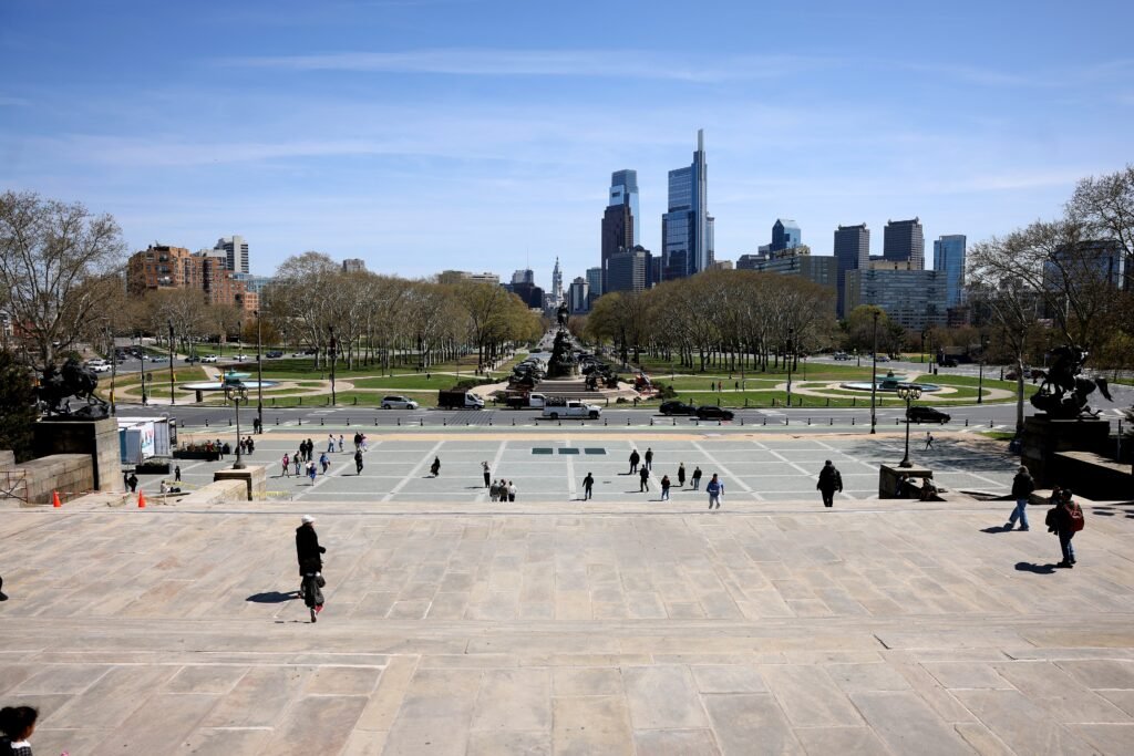
Philadelphia’s walking pattern explains why it leads without needing one tiny tourist core. Old City and Washington Square West flow into the City Hall area, then Rittenhouse and the Parkway extend the same central weekend westward. That creates long stretches where each mile still adds sightseeing value. SEPTA becomes useful near the edges rather than acting as the glue between every major stop. Direct airport rail and central Amtrak access strengthen the first and last hours, but neither is used to pretend the Parkway sits beside Independence Hall.
Chicago and New York: Same Score, Different Scale
Chicago’s full walking guide shows a central spine that is unusually easy to read. The Loop, Millennium Park, Grant Park, the Riverwalk, River North and Streeterville can fill a dense day before transit becomes essential. CTA then resets the trip toward Lincoln Park, Wicker Park, Wrigleyville or Hyde Park. New York’s car-free guide works at a much larger scale. Lower Manhattan, Midtown, Central Park and the Brooklyn waterfront can each support exceptional walking, but the subway links those separate worlds. Both cities offer the comparison’s strongest transit backup. That strength does not mean their attractions are all geographically close.

Boston and Washington: Compact History Versus Monumental Distance
Boston’s weekend walking guide represents the strongest compact historic-sightseeing pattern among the largest East Coast destinations here. Downtown, Beacon Hill, the Common, North End, Back Bay and nearby waterfront areas connect with relatively little transit repositioning. Cambridge and farther Fenway-area extensions are where the T starts saving meaningful time. By contrast, Washington’s visitor walking guide looks compact on a monument map but feels much larger underfoot. The Mall concentrates museums and memorials, yet its long sightlines hide substantial distances. Penn Quarter, Downtown and the White House area join the central network well, while Metro becomes more valuable beyond it.
Portland, San Francisco and Seattle Are Three Different West Coast Walks
Portland’s car-free weekend guide has the most manageable central geography of this West Coast trio. Downtown, the Pearl District, Old Town Chinatown and Northwest fit together well, while the MAX Red Line makes PDX arrival unusually simple. Washington Park and the West Hills introduce the clearest physical break, and eastside neighborhoods are better treated as transit-assisted extensions.
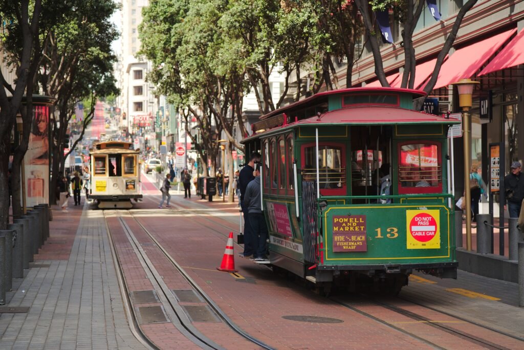
San Francisco’s two-day walking guide reaches a high position despite a very different physical problem. Union Square, Chinatown, North Beach and the Embarcadero can be excellent on foot, yet steep grades punish careless route choices. Muni and BART make the Mission, Golden Gate Park and the Presidio practical without turning those areas into one compact core. A short-looking line on the map can still be a serious climb.
Seattle’s central walking guide is strongest along the Pike Place–waterfront–Pioneer Square–Belltown–Seattle Center corridor. The experience changes quickly when a route turns east toward First Hill or Capitol Hill. Link and buses remove some of that climbing and carry visitors toward the University District and other farther areas. Ballard and Fremont remain separate destinations, not extensions of one downtown walk.
New Orleans and Denver Reach the 80s by Opposite Routes
New Orleans’ car-free weekend guide succeeds because so much of a first visit sits inside adjoining central districts. The French Quarter, CBD, Warehouse/Arts District, riverfront and Marigny support long, flat walking days. The limitation is underfoot and beyond the core: historic paving can be uneven, while Garden District and Uptown trips benefit from transit. Streetcars extend the weekend without changing the fact that those areas sit farther away.
Denver’s downtown walking guide offers almost the opposite formula. Union Station, LoDo and central downtown are straightforward, and airport rail delivers visitors to an excellent starting point. The city spreads sooner once RiNo, City Park or Cherry Creek enter the plan. Red Rocks, foothill stops and mountain excursions belong outside Denver’s city walking geography, however easy they may be by car.
When a Good Hotel Base Matters More Than a Citywide Map
The lower five are not places where walking disappears. They are places where a first-time visitor pays a larger penalty for choosing the wrong base. Each contains useful pedestrian districts, but the distance between those districts shapes the weekend more aggressively.
San Diego and Miami: Strong Zones, Real Water-and-Distance Gaps
San Diego’s downtown-and-coast guide starts strongest around Downtown, Little Italy and the Embarcadero. Balboa Park is close enough to add easily by bus, yet it still behaves as a separate visitor area. Coronado, La Jolla, beach communities and Point Loma push the map farther apart. Trying to stitch every district into one continuous walk wastes time that transit or ferry can save.
Miami’s neighborhood walkability guide makes the beach-mainland split even clearer. Downtown and Brickell form one strong walking-and-transit geography, while South Beach is another major pedestrian destination across the bay. Wynwood, Little Havana and Coconut Grove add further separation. Flat terrain makes individual walks easier, but it does not shrink the distances between the places many first-time visitors want to see.
Austin and Atlanta: Central Weekends Need Deliberate Connections
Austin’s central walking guide supports a useful Downtown–Capitol–university weekend before the map begins to pull apart. South Congress is attractive on foot after arrival, but crossing and distance make it a deliberate extension rather than the same compact core. East Austin and Zilker add further choices. Rapid and local buses improve the car-free trip without merging those areas into one pedestrian district.
Atlanta’s BeltLine and MARTA guide demonstrates how excellent gateway access can coexist with fragmented local geography. MARTA takes visitors directly from ATL toward Downtown and Midtown, while both districts work well on foot. The BeltLine Eastside corridor adds another excellent walking environment. Moving among those clusters exposes the wider roads, rolling terrain and inconsistent pedestrian continuity that keep Atlanta lower.
Los Angeles: The Clearest Cluster-Based Weekend
Los Angeles’ walkable-pockets guide is the strongest example of why good neighborhoods do not automatically create one walkable city break. Downtown, Hollywood, the Wilshire corridor and Santa Monica can each produce rewarding walks. Metro rail and buses make a car-free trip realistic, while the D Line extension improves Mid-Wilshire access. The defining limitation remains the distance between those clusters. Better transit reduces transfer pain; it does not turn the region into one continuous pedestrian landscape.
Pick the City That Fits Your Walking Style
The ranking gives the overall order. These traveler priorities show which cities become especially attractive once your own preferences matter.
| Traveler priority | Best fits | Why |
|---|---|---|
| Most walk-first sightseeing | Philadelphia, Boston | Large shares of a first visit can unfold through consecutive walking before transit becomes necessary. |
| Strongest transit backup | Chicago, New York City, San Francisco | Deep rail and bus networks make distinct visitor districts practical without making them geographically close. |
| Easiest car-free arrival | Philadelphia, Portland, Denver | Airport-to-core public transport is direct, frequent and especially straightforward for a short trip. |
| Easiest central terrain | Philadelphia, Chicago, New York City, Washington, DC, New Orleans, Denver, Miami | Core walking is generally flat or forgiving, although weather and distance still affect comfort. |
| Compact historic walking | Boston, Philadelphia, New Orleans | Historic sights and adjoining visitor neighborhoods can be joined with relatively little repositioning. |
| Big-city neighborhood walking | New York City, Chicago, San Francisco | Each offers excellent walking inside major districts, with transit carrying the longer citywide jumps. |
| Waterfront-focused walking | Chicago, Seattle, San Francisco, San Diego, New Orleans, Miami | Waterfront routes form a meaningful part of the visitor experience, though the wider city may still require transit. |
| Hill-sensitive trips | San Francisco, Seattle; Boston locally | San Francisco and Seattle need the most elevation planning, while Beacon Hill creates Boston’s main localized climb. |
| Base choice matters most | San Diego, Miami, Austin, Atlanta, Los Angeles | A well-placed hotel and geographically focused days prevent the weekend from becoming a chain of long transfers. |
Where a Car Starts to Make Sense
In the highest-ranked cities, a rental car usually becomes useful when the trip stops being an urban weekend. Denver mountain outings, San Francisco regional trips, Seattle trailheads and national parks, and farther San Diego coastal plans can change the calculation. Los Angeles also becomes easier by car when one day combines several awkward outer destinations. Keeping a car for an otherwise central Philadelphia, Chicago, New York, Boston or Washington weekend usually adds more parking friction than access.
The cluster-based cities require more judgment. Miami, Austin and Atlanta can all work well without a private car when each day stays geographically focused. A one-day rental or occasional ride may become sensible when the itinerary deliberately combines far-apart areas. That is different from treating the entire city as unwalkable.
Bottom Line
Philadelphia leads because its strengths reinforce one another: productive central walking, strong transit at the edges and exceptionally easy car-free arrival. Chicago and New York City remain tied immediately behind it, yet their trips feel fundamentally different. Boston favors consecutive historic walking, while Washington asks visitors to respect monumental distance. Portland, San Francisco, Seattle, New Orleans and Denver remain strong no-car weekends through different combinations of compactness, terrain and transit.
Farther down the table, planning matters more than willingness to walk. San Diego, Miami, Austin, Atlanta and Los Angeles reward a strong base and days built around nearby attractions. Their lower positions describe fragmented visitor geography, not an absence of worthwhile walking. Choose the city whose spatial pattern matches the way you actually like to travel.