
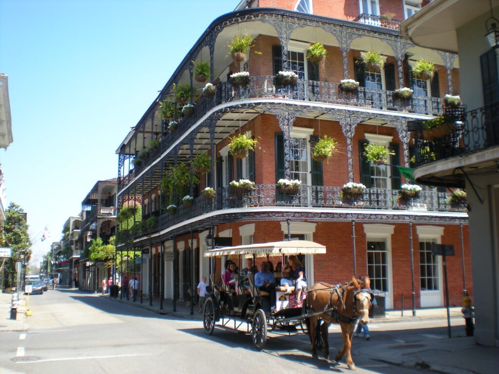
New Orleans concentrates much of its first-time sightseeing into a compact band along the riverfront. The French Quarter connects naturally with the Central Business District, Warehouse/Arts District, riverfront, and the Marigny edge. That density lets walking carry most of a central weekend without turning every transfer into a transit trip. The Garden District breaks that pattern because it sits farther from the historic core. Instead of stretching the walking day unnecessarily, the St. Charles streetcar links the two areas efficiently. The result is a city shaped by one dense walking core and one important car-free extension.
A car is usually more burden than benefit in the central visitor areas. Parking, one-way streets, event closures, and short attraction-to-attraction distances favor walking. The important caveat is that New Orleans’ historic surfaces are not uniformly smooth: old paving, uneven sidewalks, drainage features, and inconsistent curb treatments can make a nominally short route feel more demanding for travelers with mobility limitations.
Why New Orleans Works Well on Foot
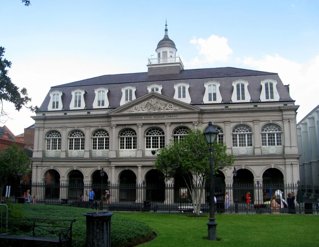
The strongest reason is attraction density. New Orleans & Company describes the French Quarter as roughly 85 square blocks bounded by Canal Street, Esplanade Avenue, Rampart Street, and the Mississippi River, with the whole neighborhood crossable in about 20 minutes. Jackson Square, St. Louis Cathedral, the Cabildo, the Presbytère, Royal Street, the French Market, and dozens of restaurants and music venues sit within a compact street grid. That means a visitor can spend an entire morning or afternoon sightseeing without arranging transportation between every stop.
The next layer of the city also connects reasonably well. Cross Canal Street and the CBD opens into the Warehouse/Arts District, where museums and galleries cluster around Julia Street and nearby blocks. Walk downriver from Jackson Square and the lower French Quarter blends into the Marigny and Frenchmen Street. These are not isolated tourist pods: they are adjoining districts where walking remains a practical default.
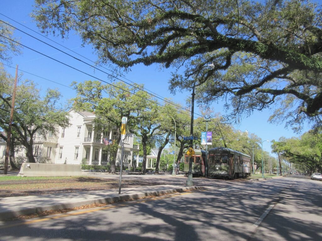
The Garden District is the major exception to the compact-core pattern. It is too far from the French Quarter to make the round trip on foot efficient for most weekend visitors, especially in warm weather. That is precisely where New Orleans’ transit adds value. The St. Charles streetcar runs from downtown through the Garden District and Uptown, letting travelers save their walking energy for the oak-lined residential streets, Prytania Street, and Magazine Street.
Where to Stay for the Most Walkable Weekend
For pure walking convenience, the French Quarter is the simplest base. It minimizes travel time to the city’s densest concentration of first-visit sights and gives easy evening access to the riverfront and Frenchmen Street. The tradeoff is that the Quarter can be busy and noisy, so not every traveler will want to sleep in the middle of it.
The Central Business District and Warehouse/Arts District are often the best all-around compromise. They remain walkable to the French Quarter, put major museums within easy reach, offer a large hotel inventory, and sit close to multiple streetcar and bus corridors. A visitor staying near Canal Street, Poydras Street, or the Warehouse District can walk most of Day 1 and use transit efficiently for Day 2.
The Lower Garden District works well for travelers who prefer a quieter neighborhood feel and do not mind using the St. Charles streetcar more often. The Marigny near Frenchmen Street is strong for music-focused evenings and lower-French-Quarter walks, but it is less centrally placed for the CBD and Garden District.
Representative Walking Times
These are practical planning estimates rather than guaranteed walking times. Heat, crowds, street closures and individual pace can change the actual time.
Jackson Square to the French Market is about 5 minutes; crossing the French Quarter from the Canal Street side toward Esplanade is roughly 20 minutes; Jackson Square to Frenchmen Street is about 12–15 minutes; and Jackson Square to the Warehouse/Arts District museum cluster is roughly 25–30 minutes. In the Garden District, St. Charles Avenue at Washington Avenue to Magazine Street is about 10–15 minutes. Heat, crowds, street closures, and the temptation to stop every block can all stretch these times.
A 2-Day Walking Route
The most efficient weekend does not try to force every neighborhood into one continuous walk. Day 1 stays in the dense historic core. On the second day, take the St. Charles streetcar to a separate walkable cluster, then work back through the Garden and Lower Garden districts.
Day 1: French Quarter to Frenchmen Street
Walking route
French Quarter to Frenchmen Street
- Jackson Square
- The Historic New Orleans Collection
- Preservation Hall
- French Market
- New Orleans Jazz Museum
- Frenchmen Street
Start at Jackson Square, the natural orientation point for a first visit. The cathedral, Cabildo, Presbytère, riverfront, and historic streets all sit within a few minutes. From the square, walk to The Historic New Orleans Collection on Royal Street for a compact dose of neighborhood history, then continue through the central Quarter toward Preservation Hall.
Continue downriver toward the French Market. The route naturally passes the lower Quarter’s shops, courtyards, and architectural details, so the value is as much in the blocks between stops as in the destinations themselves. From the market, continue to the New Orleans Jazz Museum at the Old U.S. Mint. Finish around Frenchmen Street, where the French Quarter gives way to the Marigny and the evening music corridor begins. The mapped route is intentionally compact; the day becomes longer through museum visits, food stops, and detours rather than through transportation.
Day 2: Garden District and Lower Garden District
Walking route
Garden District to Lower Garden District
- St. Charles Avenue at Washington Avenue
- The Garden District Book Shop
- Commander's Palace
- Magazine Street at Washington Avenue
- Buckner Mansion
- Coliseum Square Park
Take the St. Charles streetcar from downtown and begin the walking portion around St. Charles and Washington avenues. This is the key strategy that keeps Day 2 pleasant: use transit for the long connector, then walk once the architecture becomes the attraction. Head into the Garden District via Prytania Street, passing the Garden District Book Shop area and the blocks around Washington Avenue.
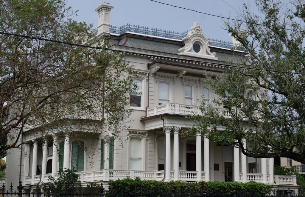
Continue toward Magazine Street, then work back toward Jackson Avenue and the Lower Garden District. The route passes well-known exterior architecture such as Buckner Mansion; respect private property and view residential landmarks only from public sidewalks. Finish at Coliseum Square Park, where the street pattern and 19th-century housing make the walk itself the experience. From this side of the Lower Garden District, either continue downtown if the weather is comfortable or use transit for the return.
Getting Around New Orleans Without a Car
New Orleans’ transit system is most useful when treated as a connector between walkable clusters. RTA operates buses, ferries, and five streetcar lines. For visitors, the St. Charles line is the standout because it connects downtown with the Garden District and Uptown. The Rampart/Loyola line connects Union Passenger Terminal with the edge of the French Quarter, while Canal and Riverfront services cover other common visitor movements.
RTA buses, streetcars and ferries use an integrated fare system, with visitor passes and digital payment options available. Fares and pass prices can change, so check current RTA information before travel rather than relying on fixed prices in the guide.
The main weakness is reliability around special events and construction. Parades, festivals, and roadwork can alter routes or force streetcar-to-bus substitutions. That is a temporary operating issue rather than a permanent walkability flaw, but it matters on the day of travel. Check RTA service alerts before relying on a specific line or connection.
Arriving Without a Car
Louis Armstrong New Orleans International Airport is outside the walkable core, but arriving without a car is realistic. Public buses connect the airport with central New Orleans, including the CBD and areas near Union Passenger Terminal. Service patterns vary, so check current airport and RTA information before travel.
Depending on your arrival time and hotel location, another public bus, taxi or rideshare can also be practical. For a central stay, none of these options requires turning the rest of the weekend into a car-dependent trip.
Train travelers arrive even more centrally. Amtrak’s Union Passenger Terminal is at 1001 Loyola Avenue, close to the CBD and connected to the Rampart/Loyola streetcar corridor. From there, many downtown hotels are a short ride or walk away.
When a Car Becomes Useful
A car starts to make sense when the trip extends beyond the central city rather than when the walking day becomes long. Regional swamp tours, plantation-area excursions, and destinations well outside the RTA visitor network may be easier with a rental car or organized transfer. For a classic two- or three-day first visit focused on the French Quarter, Warehouse District, Marigny, and Garden District, keeping a car parked usually adds cost and friction without adding much access.
Practical Walking Tips
Wear shoes that handle uneven pavement rather than choosing footwear only for distance. Historic blocks can include broken or tilted sidewalk sections, brick, stone, utility covers, and drainage transitions. New Orleans has continued adding ADA curb ramps and pedestrian-safety improvements, but surface quality is not consistent enough to assume every route will feel smooth.
Use the river and major streets as orientation tools. Canal Street is the clearest divider between the French Quarter and CBD, Esplanade Avenue marks the lower edge of the Quarter, and St. Charles Avenue is the main transit spine toward the Garden District. The visitor core is generally easy to understand once those anchors are clear.
During large events, build extra time into every transit-assisted walk. Street closures can be beneficial for pedestrians but may move the nearest bus or streetcar stop several blocks. The best plan is to keep the route flexible rather than treating a normal-day timetable as fixed during a parade or festival.
Seasonal Walking Note
New Orleans is flat, so hills never become the problem. Summer heat is the real walking limiter. National Weather Service climate normals for MSY put average June through August highs around 90–91°F, with frequent rainfall. In summer, schedule the longest outdoor sections in the morning, break the day with air-conditioned museums or restaurants, carry water, and use the streetcar for exposed connector trips.
Atlantic hurricane season runs from June 1 through November 30. That does not make the city unwalkable for half the year, but visitors in late summer and early fall should monitor official forecasts and any resulting transit, attraction, or event changes close to departure.
Bottom Line
New Orleans is one of the easier major U.S. destinations to enjoy without a car when the itinerary is built around its visitor core. The French Quarter is compact enough to explore almost entirely on foot, adjoining downtown districts extend that walkable zone, and inexpensive streetcars solve the biggest distance problem by connecting the center with the Garden District. The city’s limitations are real—uneven historic surfaces, event-day disruptions, and summer heat—but they change how you walk, not whether a car is required. For a first two- or three-day weekend, walking plus RTA is the stronger default.