
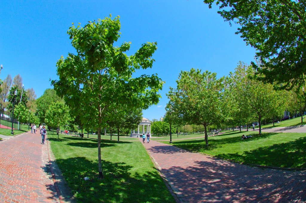
Few major U.S. city breaks connect historic sights, central neighborhoods, rail arrival and airport transit as naturally as Boston. The strongest chain runs from the North End and waterfront through Downtown, Boston Common, Beacon Hill and the Public Garden. Back Bay continues that sequence west, while Fenway remains close enough for either a longer walk or short MBTA ride. Most difficulties come from Beacon Hill slopes, historic surfaces, winter weather and occasional transit maintenance. For a first weekend, walking should handle most sightseeing, with the MBTA mainly covering longer gaps and bad-weather shortcuts.
Why Boston Works So Well on Foot

Boston’s biggest advantage is visitor density. The official Freedom Trail is a 2.5-mile red-lined route connecting 16 historic sites through Downtown, the North End and Charlestown. For visitors, that is more than an attraction: it is a built-in wayfinding system. Boston Common, the State House, Old South Meeting House, Old State House, Faneuil Hall, the Paul Revere House and Old North Church can be linked without repeatedly opening a map.
The city also has several compact neighborhoods that connect naturally. Beacon Hill sits immediately beside Boston Common. The Public Garden leads into Back Bay, where Newbury Street, Commonwealth Avenue and Copley Square reward slow walking rather than point-to-point transit. From Copley, even Fenway Park is only about a 22-minute representative walk, so transit is a convenience rather than a requirement for many travelers.
Pedestrian infrastructure is generally strong in the visitor core. Boston’s Complete Streets program explicitly gives pedestrians, cyclists and transit riders equal standing with drivers, and city guidance notes that most intersections have marked crosswalks at each approach. The historic fabric still creates exceptions: the National Park Service warns of sharp inclines, uneven sidewalks and narrow passages on parts of Beacon Hill, and selected Freedom Trail sites require stair detours for step-free access.
Where to Stay for the Most Walkable Boston Weekend
For most first-time visitors, Downtown/Boston Common and Back Bay are the two strongest bases. Downtown minimizes historic-sight walking; Back Bay gives you a more balanced mix of hotels, restaurants, parks, shopping and transit while remaining close enough to reach the Common on foot.
| Neighborhood | Best for | Walking advantage | Main trade-off |
|---|---|---|---|
| Downtown / Boston Common | First-time historic sightseeing | Immediate access to the Freedom Trail, Beacon Hill, Public Garden and several subway lines | Some blocks feel more business-district than neighborhood after work hours |
| Back Bay | Best all-around car-free base | Copley, Newbury Street, Public Garden, hotels and multiple transit choices are tightly grouped | Longer walk to the North End and Charlestown end of the Freedom Trail |
| Beacon Hill | Historic atmosphere | Beside Boston Common and the State House; compact enough to cross quickly | Hills, brick/cobblestone surfaces and fewer large hotels |
| North End / Waterfront | Food and evening atmosphere | Freedom Trail sights, dining, Faneuil Hall and the harbor are close together | Crowds and narrow streets; less central for Back Bay and Fenway |
| Fenway / Kenmore | Baseball and west-side sights | Excellent for Fenway Park and still walkable to Copley | Too far west for the most efficient first-time historic-core weekend |
Useful Walking Times in Boston
These are practical planning estimates rather than guaranteed walking times. Signals, crowds, exact entrances, construction and individual pace can change the actual time.
| Walk | Typical time |
|---|---|
| Boston Common → Faneuil Hall | 13 min |
| Boston Public Garden → Copley Square | 10 min |
| Copley Square → Fenway Park | 22 min |
| Boston Common → South Station | 15 min |
| North Station → Faneuil Hall | 9 min |
| Back Bay Station → Boston Common | 17 min |
| Faneuil Hall → Paul Revere House | about 10 min |
| Boston Common → Newbury Street at Arlington Street | about 10–15 min |
A 2-Day Walking Route for Boston
The routes below are designed around geography rather than a checklist of every attraction. Day 1 keeps the historic core and North End together. Day 2 shifts west through parks, Beacon Hill and Back Bay before ending at Fenway. That avoids unnecessary cross-city backtracking and makes the MBTA an optional fallback instead of the backbone of the weekend.
Day 1: Historic Core, Freedom Trail and North End
Walking route
Historic Core, Freedom Trail & North End
- Boston Common Visitor Information Center
- Massachusetts State House
- Granary Burying Ground
- Old South Meeting House
- Old State House
- Faneuil Hall
- Paul Revere House
- Old North Church
- Copp's Hill Burying Ground
Start at the Boston Common Visitor Information Center and follow the Freedom Trail toward the Massachusetts State House, Granary Burying Ground, Old South Meeting House and Old State House. The marked red line removes much of the navigation friction that visitors normally face in an irregular old street network. Allow extra time for whichever interiors matter most to you rather than trying to enter every building.
Continue to Faneuil Hall, which works well as a lunch, restroom and transit reset point. From there, walk into the North End for the Paul Revere House, Old North Church and Copp’s Hill Burying Ground. This part of the route shifts from civic landmarks to narrower residential and restaurant streets, so it is a good place to slow down and finish with dinner rather than rushing back across town.
If your group is tired, the route has several clean exit points near Government Center, State, Haymarket and North Station. Travelers with mobility concerns should check the National Park Service accessibility notes before committing to every historic-site entrance, because selected stops include stairs and some North End/Beacon Hill surfaces are uneven.
Day 2: Public Garden, Beacon Hill, Back Bay and Fenway
Walking route
Public Garden, Beacon Hill, Back Bay & Fenway
- Boston Public Garden
- Acorn Street
- Hatch Memorial Shell
- Commonwealth Avenue Mall
- Newbury Street at Dartmouth Street
- Copley Square
- Boston Public Library - Central Library
- Fenway Park
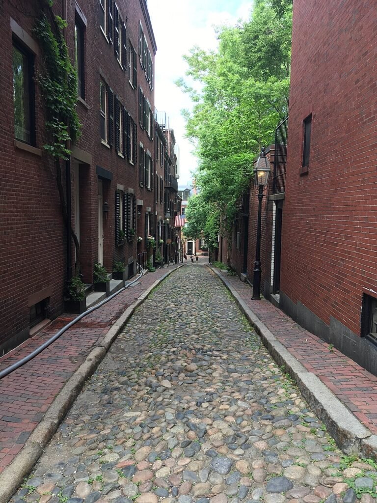
Begin in the Boston Public Garden, then make a short detour into Beacon Hill for Acorn Street before dropping toward the Charles River Esplanade and Hatch Shell. Beacon Hill is the most physically demanding portion of this day because of grade changes and historic paving, but the distances are short.
From the Esplanade, move through Commonwealth Avenue Mall and Newbury Street into Copley Square. This is Boston’s easiest stretch for mixing walking with spontaneous stops: cafes, shops, hotels, the Boston Public Library and transit are all close together. Finish by walking from Copley toward Fenway Park. The walk is about 22 minutes, but the Green Line provides a straightforward fallback if the weather turns or your legs are done.
Getting Around Boston Without a Car
Boston’s subway network is unusually useful for a walking-focused trip because the main lines intersect the neighborhoods visitors already want to explore. The Red, Green, Orange and Blue lines make it easy to skip a repetitive return walk, cross the core in bad weather, or reach areas beyond the two-day routes. Contactless Tap to Ride lets visitors pay with a compatible card, phone or wearable on subway and bus services, while traditional Charlie fare products and passes remain available.
Treat transit as a flexible backup and check MBTA service before departure. Weekend construction and maintenance can temporarily change the best route, but the central walking network usually leaves several practical alternatives.
Arriving in Boston Without a Car
Logan Airport is one of Boston’s strongest car-free advantages. The Silver Line SL1 connects airport terminals directly with South Station, while the Blue Line provides another useful option via the airport shuttle connection. Check current MBTA and Massport information before travel for service and fare details.
Rail arrival is equally convenient. South Station is roughly a 15-minute representative walk from Boston Common and directly connects with the Red Line and Silver Line. Back Bay Station is about a 17-minute walk from the Common and sits much closer to Copley Square and the heart of Back Bay. For Northeast Corridor travelers, that makes Boston a city where the car-free weekend can begin almost immediately after stepping off the train.
When a Car Becomes Useful
A car is rarely useful for the Boston portion of a weekend. Parking cost, traffic, one-way streets and the compact attraction pattern work against it. Even several common regional extensions can be done by train, ferry or bus. A rental car starts to make more sense when the itinerary shifts away from the transit network—for example, a flexible loop through rural New England, small coastal towns not well served by rail, hiking trailheads or multiple suburban stops in one day.
Practical Walking Tips
Wear shoes that handle more than smooth pavement. Much of central Boston is easy underfoot, but Beacon Hill and historic-site approaches can include brick, cobblestone, uneven concrete and steep grades. If accessibility is a priority, use the National Park Service accessibility guidance rather than assuming every segment of a historic route is step-free.
Build the day around clusters, not around repeatedly crossing the city. Keep Downtown and the North End together; keep the Public Garden, Back Bay and Fenway together. This simple geographic rule saves more time than trying to optimize every individual transit connection.
Check MBTA service alerts on the morning of travel, especially on weekends. Planned maintenance is common enough to affect the best fallback route, but Boston’s dense network usually leaves another practical option: another subway line, a short bus ride, or simply walking the remaining distance.
Seasonal Walking in Boston
Boston’s core remains walkable in every season, but the experience changes substantially. May through October is the main peak visitor period and offers the longest windows for outdoor sightseeing. Summer heat and thunderstorms can make shade and transit breaks valuable. Winter cold, snow and ice can turn short slopes and historic paving into the real challenge, so allow extra time and use the T more aggressively. Spring and fall are often the easiest seasons for long walking days, although rapidly changing New England weather still rewards a flexible plan.
Bottom Line: Is Boston Walkable?
Boston is one of the strongest major U.S. cities for a walk-first weekend. Its dense historic core, connected visitor neighborhoods, central lodging, useful transit and unusually straightforward car-free arrival make a short visit easy to organize without driving. You will use the MBTA, but mostly to save time or energy—not because Boston’s main visitor experience depends on it. For a two-day trip centered on Downtown, the North End, Beacon Hill, Back Bay and Fenway, leave the car out of the plan.