
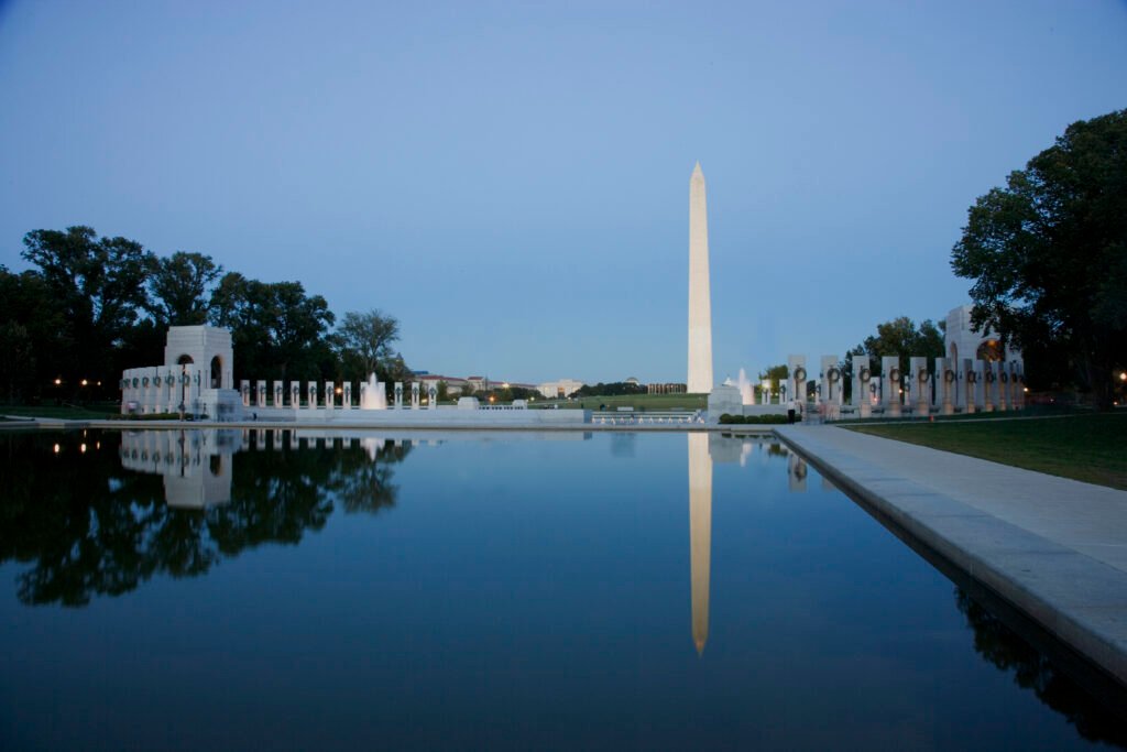
From Capitol Hill to Foggy Bottom, Washington, DC’s major visitor areas spread across a broad east-west sightseeing corridor. The National Mall ties Smithsonian museums and monuments together, while Penn Quarter and Downtown extend the usable center northward. Dupont Circle and Foggy Bottom widen that footprint further, yet remain practical additions to a walking-focused weekend. The Mall’s length and western memorials make cumulative distance the central challenge. That layout favors several connected sightseeing zones instead of one tightly compressed attraction district. This distinction explains why the city remains highly usable on foot despite its broad visitor footprint.

Why Washington Works So Well on Foot
Washington’s visitor geography is unusually favorable. Capitol Hill anchors the east, the Smithsonian museums line the central Mall, the major memorials continue west, and Downtown, Penn Quarter, Dupont Circle and Foggy Bottom sit close enough to connect by walking or a short Metro ride. Destination DC explicitly recommends walking for the National Mall and neighborhoods, while Metrorail handles the longer gaps.
The pedestrian environment is also strong where most short-stay visitors spend their time. The Mall has broad paths, major crossings and a dedicated wayfinding system, while the central street grid gives you frequent route choices north of the Mall. Terrain is rarely the problem: most of the visitor core is flat to gently rolling. The harder part is simply the cumulative distance of a monument-heavy day.
That distinction matters. Washington is not walkable because every sight is packed into a tiny historic center. It is walkable because multiple high-value clusters connect cleanly, pedestrian conditions are generally good, and public transit is useful enough that you can stop walking before fatigue becomes the defining part of the weekend.
Best Areas to Stay for a Car-Free Weekend
Penn Quarter and Downtown are the most balanced bases for a first trip. You can walk south toward the Mall, east toward Capitol Hill, west toward the White House and north toward neighborhood restaurants, while Metro Center and Gallery Place-Chinatown provide strong rail connections. This is the easiest choice when sightseeing efficiency matters more than having the most residential neighborhood atmosphere.
Dupont Circle is better if you want restaurants, cafés and a stronger neighborhood feel after museum hours. It has Red Line service and sits about a 17-20 minute walk from the White House area. Capitol Hill or Union Station works especially well for travelers arriving by Amtrak and for anyone prioritizing the Capitol, Library of Congress and Eastern Market.
Foggy Bottom is strategically useful for the western Mall, Kennedy Center and access toward Georgetown. Georgetown is beautiful and very walkable once you are there, but it is the one famous central visitor district that lacks a Metrorail station. That does not make a car necessary; it simply means Metrobus or a walk to Foggy Bottom-GWU or Rosslyn becomes part of the plan.
Useful Walking Times
These are practical planning estimates rather than guaranteed walking times. Crossings, crowds, weather and exact entrances can change the actual time. Washington Monument to Lincoln Memorial: about 16-20 minutes. Lincoln Memorial to the White House: about 23-25 minutes. White House to Dupont Circle: about 17-20 minutes. Dupont Circle to Georgetown Waterfront: about 30 minutes. Georgetown to Foggy Bottom-GWU Metro: roughly 15 minutes from the eastern part of the neighborhood.
The key number is not any single leg; it is the total. A visitor who crosses the Smithsonian museum zone, continues through the western memorials and then walks to dinner can easily turn an apparently simple sightseeing day into several miles. Comfortable shoes and route discipline matter more here than hill-climbing ability.
A Practical 2-Day Washington Walking Route
These routes are designed for a first weekend rather than for checking every landmark off a list. Museum time is deliberately flexible: choose the interiors that matter most to you and keep the geographic direction of travel intact.
Day 1: Capitol Hill to the Lincoln Memorial
Walking route
Capitol Hill to the Lincoln Memorial via the National Mall
- U.S. Capitol Visitor Center
- Library of Congress - Thomas Jefferson Building
- United States Botanic Garden Conservatory
- National Gallery of Art - West Building
- Smithsonian National Museum of Natural History
- Washington Monument
- World War II Memorial
- Lincoln Memorial
Start at the U.S. Capitol Visitor Center, then make the short move to the Library of Congress Thomas Jefferson Building. From there, walk around the Capitol grounds to the U.S. Botanic Garden. This compact opening cluster gives you three major stops before the long westbound portion of the day begins.
Continue along the Mall to the National Gallery of Art and then the National Museum of Natural History. Do not try to cover every museum. The route works because you keep moving west rather than repeatedly crossing the Mall. After your chosen museum time, continue to the Washington Monument, then the World War II Memorial and finally the Lincoln Memorial.
The final monument stretch is visually simple but physically longer than it looks. If your energy is fading, this is where you should shorten the route rather than forcing another neighborhood walk. The goal is to finish the day still enjoying the city, not to maximize step count.
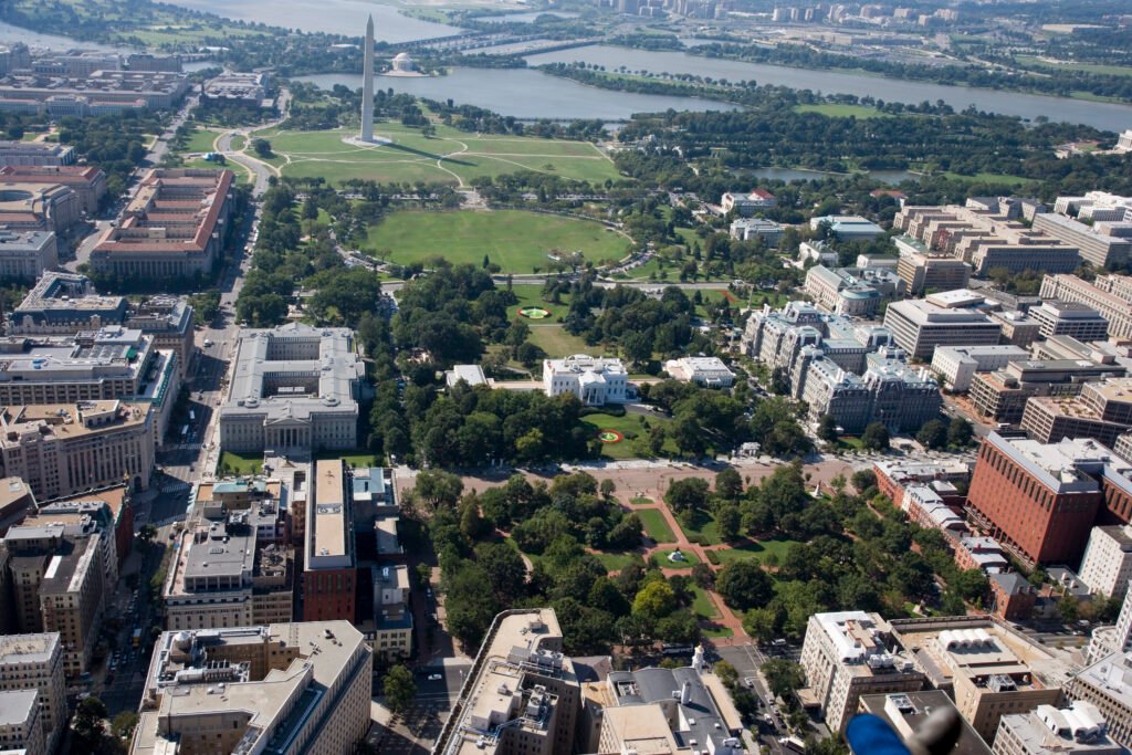
Day 2: Penn Quarter, the White House, Dupont and Georgetown
Walking route
Penn Quarter, the White House, Dupont Circle and Georgetown
- Smithsonian National Portrait Gallery
- Ford's Theatre
- White House Visitor Center
- Lafayette Square
- Dupont Circle
- The Phillips Collection
- M Street and Wisconsin Avenue NW
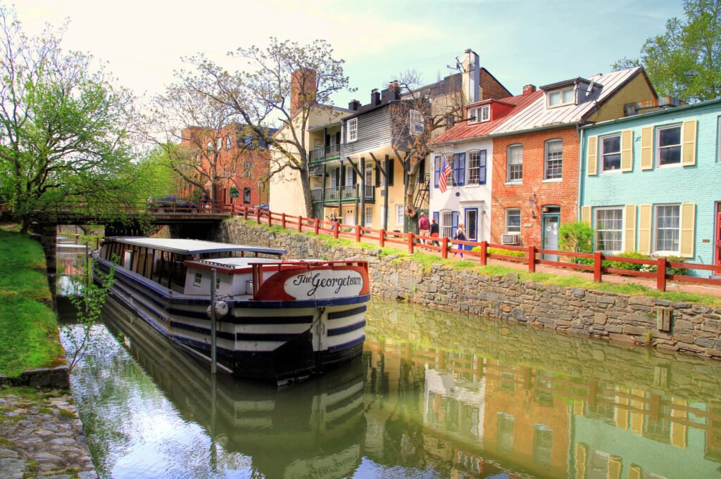
- C&O Canal - Georgetown
- Georgetown Waterfront Park
Begin at the National Portrait Gallery in Penn Quarter and walk to Ford’s Theatre. Continue toward the White House Visitor Center and Lafayette Square, then head north toward Dupont Circle. This section replaces the monumental scale of Day 1 with a more typical city walk through active downtown streets.
From Dupont, the Phillips Collection is an optional cultural stop before the longer walk west to Georgetown. Enter the neighborhood around M Street and Wisconsin Avenue, then drop to the C&O Canal and finish at Georgetown Waterfront Park. The ending is intentional: Georgetown shows both Washington’s strengths and its main transit limitation in one place. It is excellent on foot, but there is no Metrorail station inside the neighborhood.
If the final Dupont-to-Georgetown leg feels like too much, use Metrobus instead. For the return, Metrobus is again useful, or walk toward Foggy Bottom-GWU; Georgetown’s business district describes that station as roughly a 15-minute walk from the neighborhood.
Getting Around Washington Without a Car
Metrorail is the natural backup to walking. It connects the central visitor districts with Capitol Hill, Dupont Circle, Foggy Bottom, The Wharf area and both Reagan National and Dulles airports. Weekend service extends through much of the day and evening, but exact operating hours and train frequencies vary by line and can change during maintenance.
Core routes are frequent enough for spontaneous sightseeing, particularly through central segments served by multiple lines. Check current WMATA schedules and weekend service notices before relying on a particular train or connection.
Payment is unusually easy for occasional visitors. You can tap a contactless credit or debit card, or a mobile wallet, directly at Metrorail faregates and Metrobus fareboxes. Use the same card or device when entering and exiting rail. If multiple people are traveling together, each rider needs a separate payment method or device.
The former DC Circulator and DC Streetcar are no longer operating, so use current WMATA rail and bus information rather than older travel guides that still reference those services.
Arriving in Washington Without a Car
Ronald Reagan Washington National Airport (DCA) is the easiest air arrival for a car-free weekend. Its Metrorail station is connected to Terminal 2 by enclosed pedestrian bridges and is served by the Blue and Yellow lines. For a central hotel, the airport-to-city transfer is a normal transit trip rather than a special airport shuttle operation.
Washington Dulles International Airport (IAD) is farther away, but the arrival is still straightforward. The Silver Line station is connected to the main terminal by an indoor pedestrian tunnel with moving sidewalks, giving visitors a one-seat rail option toward central Washington. The tradeoff is time, not complexity.
BWI Marshall Airport requires an additional transfer. A free airport shuttle connects the terminals with the MARC/Amtrak rail station, where trains continue to Washington Union Station. Check current MARC and Amtrak schedules before travel. Intercity travelers arriving directly at Union Station are already beside Capitol Hill and connected to the Red Line.
When a Car Becomes Useful
For the city break described in this guide, a rental car usually makes Washington harder rather than easier. Parking, traffic and security-related street restrictions add friction while the core sights already work well by foot and transit. A car becomes more useful when the trip changes from a Washington weekend into a regional road trip: multiple suburban stops, rural destinations, or day trips well beyond the practical reach of Metro and regional rail.
Practical Walking Tips
Plan the Mall in one direction instead of zig-zagging between museums. Treat each museum interior as a separate energy cost, because several hours on gallery floors can make a later two-mile monument walk feel very different. Keep water with you in warm months, and use Metro before you are exhausted rather than after.
Also leave some slack in the itinerary. Federal security measures, demonstrations, major events and temporary street closures can change the most direct pedestrian path around the White House, Capitol and Mall. These disruptions are not a reason to rent a car; they are a reason to keep the route flexible and check current official notices.
Seasonal Walking Note
Summer heat can make the open sections of the Mall considerably more tiring, so shade, water and strategic Metro use become more important. Winter brings shorter days and colder conditions, while spring and fall usually support the longest walking days.
Bottom Line
A first-time visitor can build an excellent 2-3 day trip around walking, Metrorail and occasional Metrobus use without needing a private car. The city is not compact in the sense of having every landmark within a few blocks, but its major visitor clusters connect logically, the terrain is forgiving, transit fills the important gaps, and even both major Washington airports feed directly into the rail network. The winning strategy is simple: walk by cluster, use Metro for distance, and save the car for trips beyond Washington.