
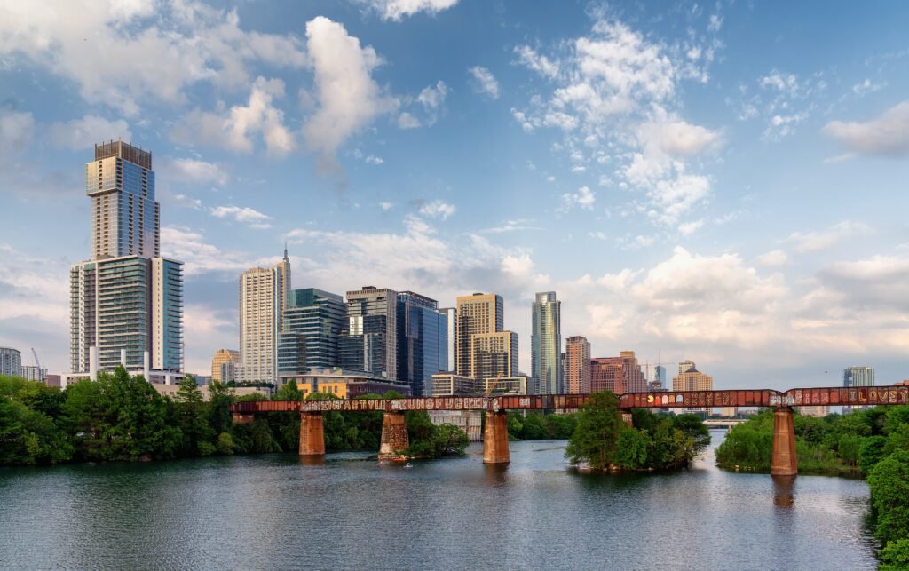
Downtown provides Austin’s clearest pedestrian anchor, with most downtown districts within a 15–20 minute walk of one another. South Congress adds another pedestrian-friendly corridor, but Austin still breaks into distinct walking zones. UT’s museum area and East Austin extend the experience into separate clusters rather than one continuous center. That pattern is the city’s defining walking constraint: each area works better internally than the spaces between them. The result is a weekend shaped by short local walks and selective connections, not an uninterrupted sightseeing route across Austin.
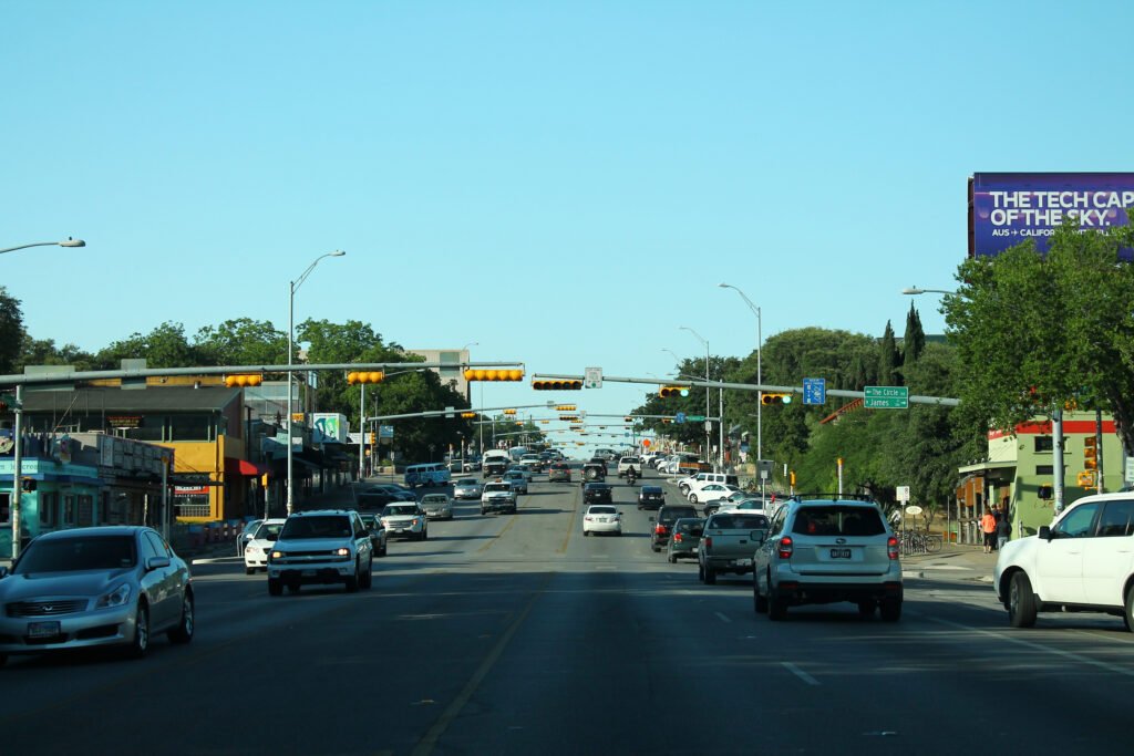
Why Austin Works Better on Foot Than Its Size Suggests
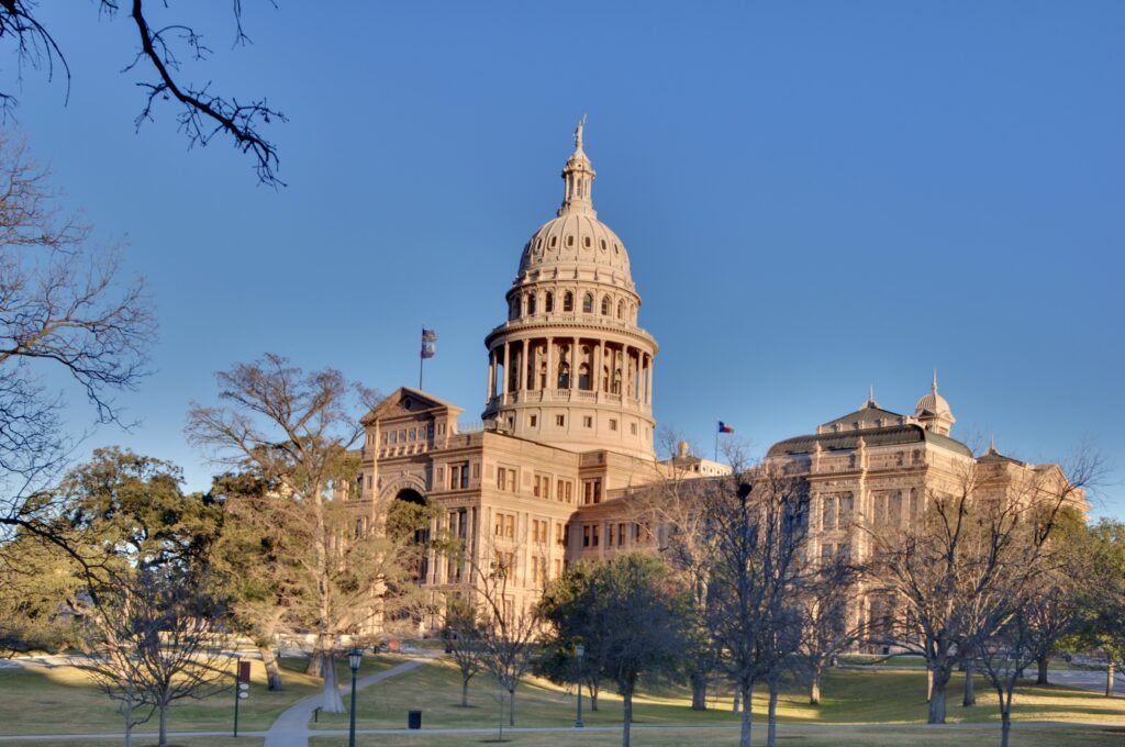
The downtown core does most of the heavy lifting. Congress Avenue forms a clear north-south spine from the Texas State Capitol toward Lady Bird Lake, while east-west streets connect the major downtown entertainment districts. For a first visit, that means you can spend much of a full day walking rather than waiting for transportation. Staying downtown is especially efficient because the same area also has the city’s densest concentration of visitor accommodation and everyday amenities.
South Congress is the second major strength. It is not just a street with attractions scattered along it; it functions as a pedestrian-oriented commercial district where shops, restaurants, hotels and music venues sit close enough together to reward slow walking. The bridge over Lady Bird Lake is the key connector. Once across, the most visitor-oriented SoCo stretch is straightforward to explore on foot.
Where Austin Stops Feeling Walkable
The problem is not that Austin lacks good walking districts. The problem is the distance between them. UT sits north of the main downtown entertainment core, East Austin sits across I-35, and Zilker Park and Barton Springs pull visitors southwest of downtown. These are not impossible walks, but stacking several of them into one day creates unnecessary mileage—especially when a bus can remove the least interesting segment.
Austin’s citywide pedestrian network also remains incomplete. The City’s 2023 Sidewalks, Crossings and Shared Streets Plan lists roughly 2,800 miles of existing sidewalk but about 1,500 miles of absent sidewalk, with significant crossing gaps outside the center. A visitor who stays downtown or on South Congress will experience a much better pedestrian environment than that citywide statistic suggests, but it is an important reason not to describe Austin as universally walkable.
Best Areas to Stay in Austin Without a Car
Downtown / 2nd Street: the best all-around choice for a first visit. It minimizes walking to the Capitol, Sixth Street, Lady Bird Lake and several entertainment districts, while keeping the best transit connections close. South Congress: better for travelers who value neighborhood atmosphere over maximum centrality; the avenue itself is excellent on foot and Rapid 801 helps with the downtown connection. East Austin / Plaza Saltillo: a strong base for East Sixth restaurants and nightlife, with a less seamless walk into downtown because of I-35. UT / West Campus edge: useful for a museum- or campus-heavy trip, but less balanced if South Congress and downtown evenings are priorities.
Representative Austin Walking Times
Use these as planning ranges rather than promises: Capitol → East 6th at Congress: about 10–12 minutes. East 6th / Congress → Congress Avenue Bridge: about 12–15 minutes. Bridge → South Congress at West James: about 15–20 minutes. Blanton Museum → LBJ Library: about 15 minutes. LBJ Library → Waterloo Park: about 20–25 minutes. Waterloo Park → East Sixth at Comal: about 25–30 minutes. From the downtown core to central South Congress, allow roughly 25–40 minutes depending on your starting point; to Zilker or Barton Springs, many visitor routes become 35–45 minutes or more. Signals, active construction and summer conditions can add time.
A 2-Day Austin Walking Route
The most efficient weekend does not force every major sight into one continuous mega-walk. Day 1 uses Austin’s strongest pedestrian spine from the Capitol through downtown and across the river to South Congress. Day 2 treats UT, Red River and East Austin as a separate north-to-east sequence. In hot weather, start early and use transit to shorten the return legs.
Day 1: Capitol, Downtown and South Congress
Walking route
Day 1 — Capitol, Downtown and South Congress
- Texas State Capitol
- Historic Sixth Street at Congress Avenue
- Austin City Hall / 2nd Street District
- Ann W. Richards Congress Avenue Bridge
- South Congress Avenue at West James Street
- South Congress Avenue at West Mary Street
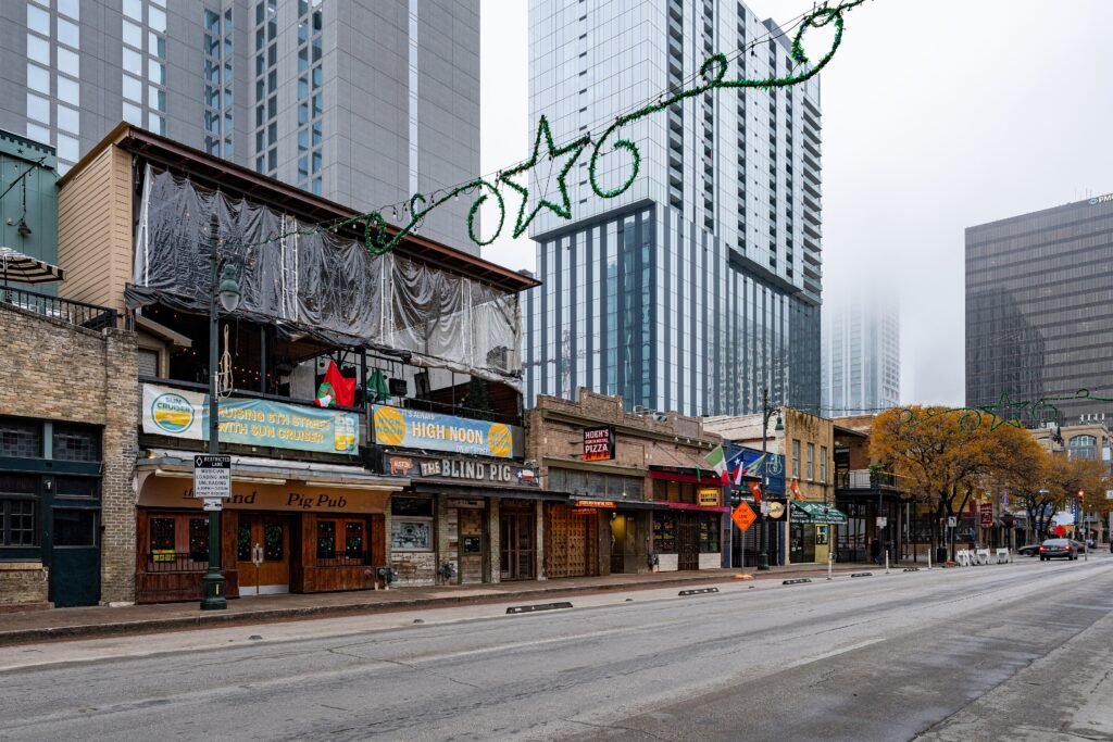
Start at the Texas State Capitol, then walk south on Congress Avenue toward Historic Sixth Street. Continue to the 2nd Street / City Hall area and the lakefront, then cross the Ann W. Richards Congress Avenue Bridge. The bridge is the transition point where Austin’s downtown walking day becomes a South Congress neighborhood walk. Continue to the West James and West Mary Street section of SoCo for shops, restaurants and the classic view back toward downtown. If you have already logged a full day of walking—or the heat is high—use Rapid 801 or a short ride for the return instead of retracing every step.
The route is intentionally linear and easy to understand. It avoids unnecessary detours and keeps most of the walking on Austin’s most visitor-friendly central streets. If you want an evening bat-viewing stop in season, the Congress Avenue Bridge is already on the route; check current sunset and viewing guidance rather than relying on a fixed time.
Day 2: UT Museums, Waterloo Park and East Austin
Walking route
Day 2 — UT Museums, Waterloo Park and East Austin
- Blanton Museum of Art
- LBJ Presidential Library
- Waterloo Park
- Red River Cultural District
- East Sixth Street at Comal Street
- Plaza Saltillo Station
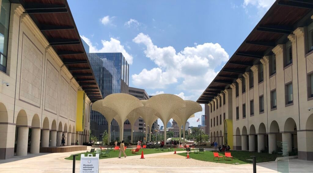
Begin at the Blanton Museum of Art and continue east across the UT area to the LBJ Presidential Library. From there, walk south toward Waterloo Park, then through the Red River Cultural District. Finish by crossing toward East Sixth Street and Plaza Saltillo. The final stop is deliberate: it gives you a transit node for the trip back rather than requiring another long walk after dinner or drinks.
If museums are the priority, allow enough indoor time at the Blanton and LBJ Library and shorten the East Austin portion. If neighborhood walking is the priority, treat the museum exteriors and campus as anchors and spend more time around Red River and East Sixth. The French Legation at 802 San Marcos Street is a worthwhile optional historic detour on days it is open, but its regular schedule is Tuesday through Saturday, so it should not be a required Sunday stop.
Getting Around Austin Without a Car
CapMetro works best as a bridge between walkable areas. Rapid 801 is especially useful because it connects the UT/downtown axis with South Congress. Another useful option, Rapid 803, serves UT and downtown before continuing through west and south Austin. Since June 2026, Rapid 837 has also operated at full frequency, linking downtown, Downtown Station and UT with destinations farther northeast. CapMetro’s Rapid local fare is $1.25 per ride or $2.50 per service day, and Tap to Pay, the Umo app and real-time arrival information make it relatively easy for short-stay visitors.
Do not plan the weekend around MetroRail alone. The Red Line is useful for specific destinations and Saturday/event trips, but its regular service is Monday through Saturday rather than a seven-day urban-rail pattern. For most visitors, buses and Rapid routes are the more dependable all-weekend gap-fillers.
Getting From Austin Airport Without a Car
Austin-Bergstrom International Airport has a genuinely useful no-car arrival option. CapMetro Route 20 runs from the airport to downtown and UT every 15–30 minutes, seven days a week. CapMetro publishes a roughly 35-minute ride to downtown and a local single fare of $1.25. The stop is on the lower level outside baggage claim. After midnight, Route 483 Night Owl Riverside provides another downtown-oriented option through about 4 a.m.; check the live planner for exact departures.
That direct airport bus keeps a car-free arrival straightforward even without an airport rail link. For a centrally located hotel, a rental car is unnecessary on arrival day unless you have mobility needs, a large group, substantial luggage or an itinerary that immediately leaves the central city.
When a Car Actually Becomes Useful
A car becomes useful when the trip expands beyond central Austin. Hill Country drives, Lake Travis, wineries, dispersed trailheads, some destination barbecue stops and other outer-city attractions are much easier with a vehicle. Within the core, the tradeoff is different: parking, traffic and the need to move the car between districts can erase the convenience. For a two-day city break focused on downtown, SoCo, UT and East Austin, walking plus transit is usually the cleaner strategy.
Practical Walking Tips for Austin
Cluster your days. Do not bounce between SoCo, UT, East Austin and Zilker on foot. Use transit for the boring miles. Rapid/local buses are most valuable between districts, not within them. Expect I-35 to slow east-west walking. The crossing is manageable, but less pleasant than downtown blocks. Carry water in hot months. Build indoor museum, café or lunch stops into the middle of the day. Check live construction. Central Austin has active streetscape work, so a mapped route may need a one-block detour even when the underlying pedestrian connection remains open.
Summer Heat Changes the Walking Equation
Austin’s summer climate is the biggest practical difference between “walkable on a map” and “comfortable to walk today.” City emergency-management guidance notes that temperatures can reach 100°F and higher and recommends staying hydrated, taking shade breaks and avoiding outdoor activity during peak temperatures. It absolutely changes how you should plan the itinerary. In summer, put the Capitol-to-SoCo or UT-to-East Austin outdoor segments in the morning or evening and use an air-conditioned bus or short ride for a midday transfer.
Temporary 2026–2027 Walking Disruption: Congress Avenue
Congress Avenue is undergoing a multi-phase public-space redesign, so visitors may encounter localized sidewalk shifts, construction fencing or short detours along the city’s main north-south walking spine. Check current project and street-closure information before travel.
Bottom Line: Can You Visit Austin Without a Car?
Yes. Austin is a good car-free weekend city when you stay central and accept that transit is part of the plan. Downtown and South Congress deliver the strongest pure walking experience; UT and East Austin add two more useful clusters. The weakness is the space between those areas, not the quality of every individual neighborhood. For a first-time 2–3 day visitor, the most realistic strategy is simple: walk heavily within each cluster, use CapMetro for the longer gaps, and save a car for Hill Country or other trips beyond central Austin.