
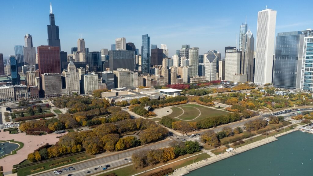
Millennium Park, the Art Institute, and the Riverwalk sit close enough to combine naturally during a downtown walking day. That central chain gives Chicago an unusually coherent sightseeing corridor on foot. Crossing the river extends it through River North, the Magnificent Mile, and Streeterville. South of the Loop, Grant Park and Museum Campus continue the visitor spine toward Lake Michigan. Farther neighborhoods sit beyond this central walking pattern, so CTA becomes the practical bridge between sightseeing clusters. Thiws keeps walking focused on the city’s richest central stretches instead of turning the weekend into a mileage test.
Why Chicago Works So Well on Foot
Chicago’s biggest advantage is the density of its central visitor attractions. Millennium Park, the Chicago Cultural Center, the Art Institute, Grant Park, the Riverwalk, and the southern end of the Magnificent Mile are all close enough to combine naturally on foot. North of the river, River North, Michigan Avenue, Streeterville, and Navy Pier continue the chain rather than forcing an immediate transit ride.
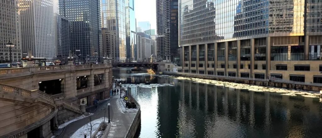
The pedestrian environment is also unusually legible for a major U.S. downtown. The street grid is generally direct, the terrain is very flat, and the river and lake provide clear orientation landmarks. The Chicago Riverwalk adds a dedicated pedestrian corridor through the center, while the Lakefront Trail creates a long separated route along Lake Michigan. The main navigation complication is the multi-level street system around Wacker Drive and the river, where the correct Riverwalk stair, ramp, or access point is not always obvious from street level.
The important limitation is distance. Museum Campus and Navy Pier are both walkable from the core, but each stretches the sightseeing footprint. A visitor can cover a lot on foot, yet trying to connect every major attraction in one uninterrupted walk quickly becomes inefficient. Chicago works best when walking is the default inside each cluster and CTA handles the longer transfers.
Where to Stay in Chicago Without a Car
Loop
For a first visit, the Loop is the strongest all-around base. It puts Millennium Park, the Art Institute, Grant Park, the Riverwalk, and multiple CTA rail lines close at hand. It also has a deep hotel supply, so it is easy to build a weekend around walking without sacrificing transit access when you need it.
River North
River North is an excellent alternative if you want to split your time between downtown architecture, restaurants, the Riverwalk, and the Magnificent Mile. It sits immediately north of the river, so the Loop remains walkable while CTA provides quick access to neighborhoods farther north and west.
Streeterville and the Magnificent Mile
Stay here if Navy Pier, North Michigan Avenue, and lakefront access are priorities. The area is still well connected to the Loop on foot, but Museum Campus and the South Loop are long enough away that transit is often the smarter choice.
South Loop
The South Loop works especially well for visitors focused on Museum Campus and Grant Park. It is less central to the northern sightseeing cluster, but downtown remains reachable by foot or CTA and the museum access is excellent.
Representative Walking Times
At a normal pace, plan on roughly 4 minutes from the Chicago Cultural Center to Millennium Park, 8 minutes from Millennium Park to the Art Institute, 10 minutes from the Art Institute to Buckingham Fountain, and about 20 minutes from Buckingham Fountain to the Field Museum. Millennium Park to the Riverwalk at Michigan Avenue is about 10 minutes. North of the river, the Wrigley Building to the Historic Water Tower is about 12 minutes, the Water Tower to 360 CHICAGO about 3 minutes, and 360 CHICAGO to Navy Pier roughly 22–25 minutes. These are practical planning estimates rather than guaranteed walking times. Crossings, park paths, Riverwalk access points, construction and individual pace can change the actual time.
A 2-Day Walking Route
These routes are designed around two coherent visitor clusters rather than an attempt to cross the whole city on foot. They assume a centrally located hotel and use walking as the default. Add CTA whenever weather, fatigue, luggage, or a neighborhood detour makes it the better option.
Day 1: Loop, Grant Park and Museum Campus
Walking route
Loop parks, art and Museum Campus
- Chicago Cultural Center
- Millennium Park
- Art Institute of Chicago
- Buckingham Fountain
- Field Museum
- Adler Planetarium
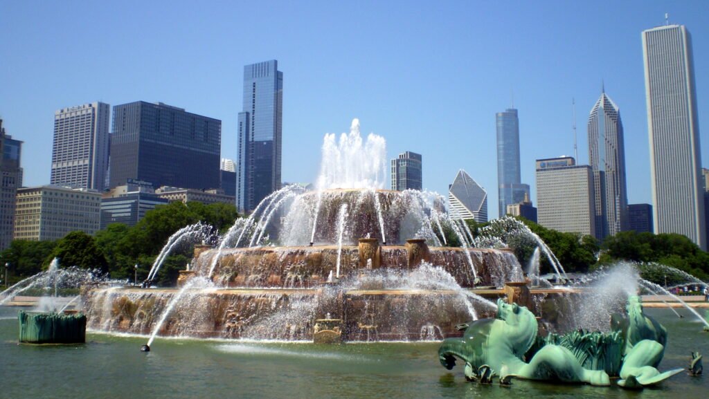
Start at the Chicago Cultural Center, then cross to Millennium Park. Continue south along Michigan Avenue to the Art Institute of Chicago, then enter Grant Park for Buckingham Fountain. From there, keep moving south toward Museum Campus, where the Field Museum and Adler Planetarium anchor the route.
The outdoor route is roughly 2.5–3 miles, depending on park paths and exactly where you enter and exit each site. Do not plan to tour every major museum in full on the same day. A more realistic weekend is to choose one main indoor museum, use the rest as route anchors, and finish near Adler for the broad lake-and-skyline setting before using CTA or a rideshare only if you no longer want to retrace the distance.
Day 2: Riverwalk, Magnificent Mile and Navy Pier
Walking route
Riverwalk, Magnificent Mile and Navy Pier
- Chicago Riverwalk at Michigan Avenue
- Wrigley Building
- Tribune Tower
- Historic Water Tower
- 360 CHICAGO
- Navy Pier
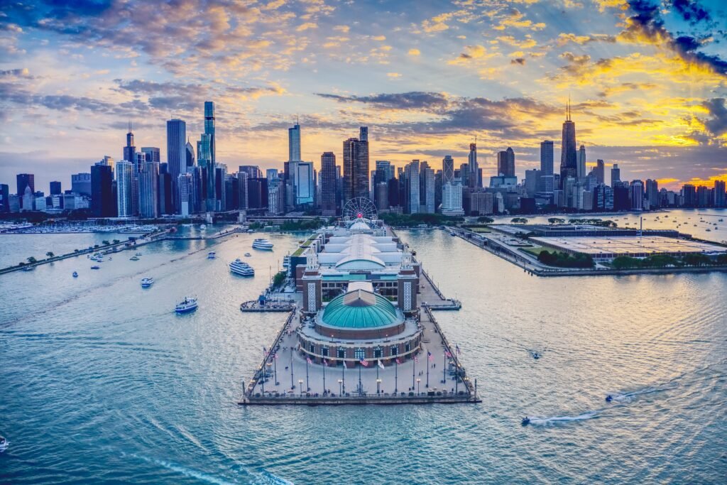
Begin on the Chicago Riverwalk near Michigan Avenue and spend time along the river before returning to street level at the Wrigley Building and Tribune Tower. Walk north along Michigan Avenue to the Historic Water Tower and 360 CHICAGO, then turn east through Streeterville and finish at Navy Pier.
The direct waypoint-to-waypoint route is roughly 1.75–2 miles, with additional distance if you explore a substantial section of the Riverwalk or wander through Navy Pier. This is a good day for an optional architecture cruise because it fits naturally into the same riverfront geography rather than creating a separate cross-city detour.
Getting Around Chicago Without a Car
CTA is what turns Chicago from a walkable downtown into a strong car-free weekend destination. The rail system and extensive bus network cover the gaps between central walking clusters and farther neighborhoods. The Red and Blue Lines operate 24 hours a day, while the Blue Line also provides the direct rail connection to O’Hare. Frequent bus corridors provide another useful option when a rail line does not match your route.
For occasional rides, visitors can use Ventra or tap a supported contactless bank card or mobile wallet at CTA readers. That lowers the friction of mixing walking and transit: you do not need to turn every two-mile gap into a walk simply because you have not bought a transit card.
For neighborhood trips, use CTA deliberately. Lincoln Park and Wrigleyville are natural north-side rail or bus trips; Wicker Park is better handled by the Blue Line or bus; Hyde Park is far enough south that transit is the practical choice for most weekend visitors.
Arriving in Chicago Without a Car
From O’Hare International Airport: the CTA Blue Line runs directly between O’Hare and downtown 24 hours a day. CTA lists a normal downtown trip at about 40–45 minutes. Terminals 1–3 connect directly to the rail station; passengers using Terminal 5 take the free Airport Transit System before following signs to CTA.
From Midway International Airport: the Orange Line reaches the Loop in roughly 20–25 minutes under normal conditions. The airport and rail station are linked by an enclosed connection. Orange Line trains run throughout the day and evening but not through the full overnight period.
From Chicago Union Station: intercity and commuter trains arrive on the west side of the Loop. Many downtown hotels and attractions are within walking range, though a CTA bus, nearby rail connection, or short taxi/rideshare can be sensible when you have luggage.
When a Car Becomes Useful
A car becomes useful mainly when your plans move beyond the central visitor areas covered in this guide: suburban destinations, regional road trips, or multiple stops that are poorly aligned with transit. For the Loop, Riverwalk, Magnificent Mile, Museum Campus, Navy Pier, and the major CTA-served neighborhoods, driving usually adds parking costs and downtown traffic without improving the trip enough to justify it.
Practical Walking Tips
Use the river and lake as orientation tools. Chicago’s grid is straightforward, but the Wacker Drive area is multi-level. If you are heading to the Riverwalk, look for signed stair, ramp, or elevator access rather than assuming every nearby intersection connects directly to the water level.
Build museum time into the mileage. Museum Campus looks compact on a map, but a long museum visit adds hours of standing and indoor walking. One major museum plus the outdoor route is usually more comfortable than trying to fully tour several institutions in one day.
Use transit before fatigue becomes the itinerary. A 20–25 minute walk can be pleasant once or twice, but stacking several of them can consume a weekend. CTA is useful precisely because it lets you preserve your walking energy for the areas where walking adds the most value.
Check CTA alerts before travel. Construction and temporary service changes can alter the best station or transfer on a particular weekend, so confirm the route when your itinerary depends on a specific line.
Seasonal Walking Note
Chicago remains navigable without a car in every season, but walking comfort varies sharply. Winter can bring strong wind, cold, snow, and ice, especially near the lake and river. Summer can be hot and humid. Spring and fall often provide the most forgiving conditions for long walking days. Seasonal weather can significantly change walking comfort and pace, especially along the exposed lakefront and river.
Bottom Line
Chicago is an excellent car-free weekend city. Stay in the Loop, River North, Streeterville/Magnificent Mile, or South Loop, walk the dense downtown clusters, and use CTA for the longer neighborhood jumps. The city is too large to experience entirely on foot, but that is not the practical test for a visitor. For a well-located first-time 2–3 day trip, Chicago combines strong attraction density, flat terrain, useful pedestrian corridors, excellent transit and direct rail access from both airports.