
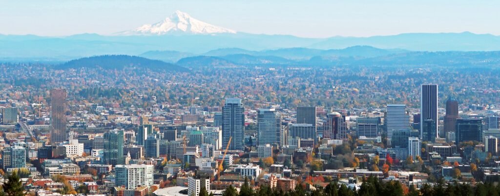
Unusually short blocks keep Portland’s westside visitor core tighter than its neighborhood list suggests. Downtown, the Pearl District, Old Town Chinatown, and Northwest/Nob Hill connect naturally on foot. The compact grid handles much of a first visit before Portland’s terrain and wider neighborhood spread become more important. Washington Park rises into the West Hills, adding real effort to a city break that otherwise favors walking. Farther out, the most interesting eastside neighborhoods sit beyond one practical all-day walking loop. The result is a compact central experience without pretending every major Portland neighborhood belongs to one continuous pedestrian circuit.
Why Portland Works Well on Foot
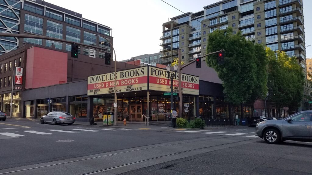
Portland’s short central blocks are a major advantage. Instead of spending long stretches on oversized downtown superblocks, visitors get frequent intersections and many route choices. Portland’s pedestrian wayfinding reinforces this advantage by linking central landmarks such as Powell’s City of Books, Pioneer Courthouse Square and Tom McCall Waterfront Park.
The best walking zone is larger than downtown alone. The Pearl District sits immediately north of the core and places Powell’s, parks, restaurants, galleries and Streetcar stops close together. Old Town Chinatown adds Lan Su Chinese Garden, the Saturday Market area and Union Station. Northwest/Nob Hill then stretches the visitor-friendly network toward NW 23rd Avenue and the base of the West Hills.
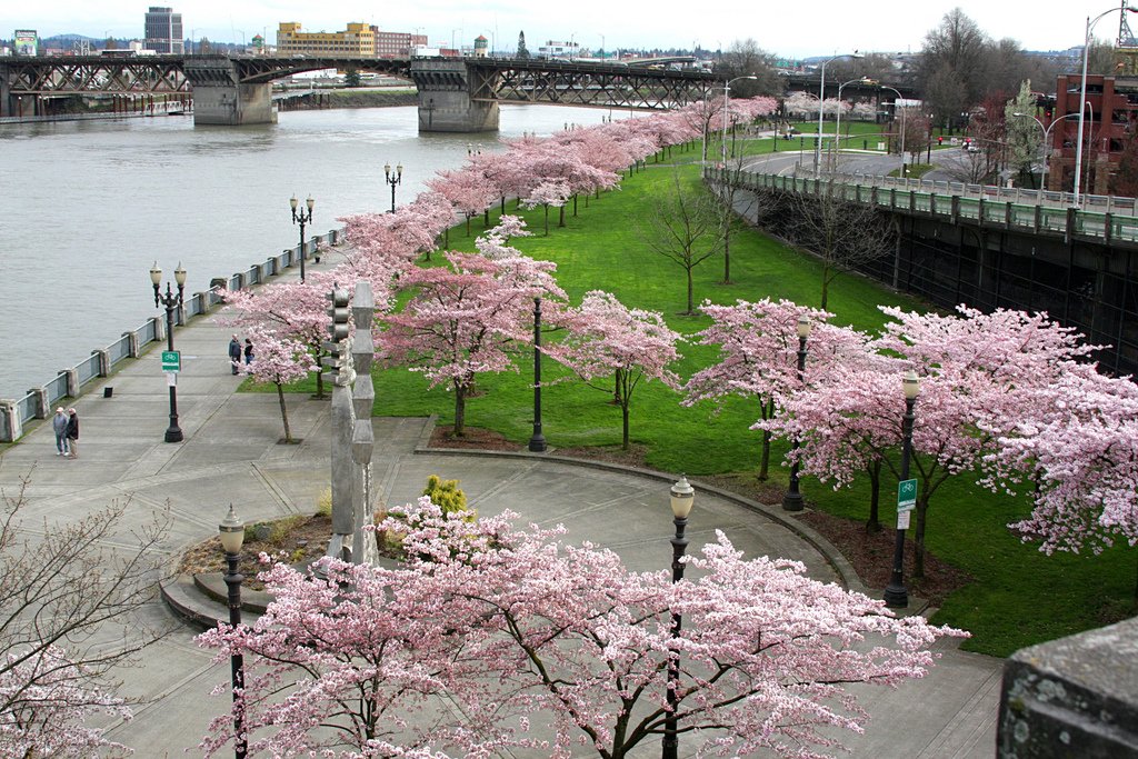
The waterfront gives the central city a useful north–south pedestrian spine. Tom McCall Waterfront Park lets you cover a substantial stretch beside the Willamette River without repeatedly negotiating city traffic, while the South Park Blocks create another comfortable walking corridor near Portland Art Museum. Together, these parks make the city center feel less like a sequence of isolated attractions and more like a connected walking environment.
Best Neighborhoods to Stay In
Downtown is the simplest first-time choice. It balances the walk toward the Pearl and Old Town with the cultural district to the south, has more than 35 hotels, and puts Pioneer Courthouse Square and multiple MAX lines within easy reach. It is also the cleanest base for travelers arriving from PDX on the Red Line.
The Pearl District is arguably the best base if your priorities are Powell’s, restaurants, galleries and an easy walk into Old Town or downtown. It feels distinct from the office core without sacrificing centrality, and Portland Streetcar is useful when you do not want to retrace a longer walk.
Northwest / Nob Hill works well for travelers who want more neighborhood atmosphere around NW 21st and NW 23rd avenues. You can still walk to the Pearl and downtown, and the area gives you a better western starting point for Washington Park. The trade-off is a longer walk to the southern waterfront and some downtown attractions.
Goose Hollow is a practical alternative for Providence Park and Washington Park access. Blue and Red MAX service helps, and the neighborhood is still close to downtown, but it is not as balanced for a first-time sightseeing weekend as Downtown or the Pearl.
Representative Walking Times
- Powell’s City of Books → Jamison Square: about 8–10 minutes.
- Jamison Square → Lan Su Chinese Garden: about 10–12 minutes.
- Lan Su Chinese Garden → Portland Saturday Market: about 6–8 minutes.
- Portland Saturday Market → Pioneer Courthouse Square: about 12–15 minutes.
- Pioneer Courthouse Square → Portland Art Museum: about 8–10 minutes.
- Powell’s City of Books → NW 23rd Avenue at Lovejoy: about 20–25 minutes.
- NW 23rd/Burnside area → Portland Japanese Garden: roughly 25–35 minutes and uphill; transit is the better choice when you want to conserve energy.
These are practical planning estimates rather than guaranteed walking times. Crossings, construction, mobility needs, crowds and individual pace can change the actual time. Washington Park is the main exception where elevation can make a relatively short distance considerably more demanding.
Where Walking Gets Harder
Washington Park is the clearest limit. The park sits in the West Hills, and the Japanese Garden is above the International Rose Test Garden. Walking up from downtown or NW 23rd is possible, but it spends time and energy on the least interesting part of the transfer. Line 63 runs directly from Pioneer Square to the garden area, while Blue and Red MAX serve Washington Park with a free park shuttle for internal connections.
The other limit is geographic spread. Portland’s eastside neighborhoods are part of the city’s appeal, but Hawthorne, Division/Clinton, Mississippi, Alberta and other districts should usually be treated as separate transit-assisted outings rather than added to one giant central walking loop. The Central Eastside itself has walkable streets and paths, yet bridges, larger arterials and industrial blocks make the transition less consistently pedestrian-friendly than the short-block westside core.
A 2-Day Walking Route
Day 1: Pearl District, Old Town & Downtown Waterfront
Walking route
Pearl District, Old Town & Downtown Waterfront
- Powell's City of Books
- Jamison Square
- Lan Su Chinese Garden
- Portland Saturday Market
- Salmon Street Springs
- Pioneer Courthouse Square
Start at Powell’s City of Books, then move into the Pearl District for Jamison Square. From there, angle southeast to Lan Su Chinese Garden in Old Town Chinatown. Continue to the Portland Saturday Market area and the river, follow Tom McCall Waterfront Park south to Salmon Street Springs, then finish at Pioneer Courthouse Square. The route is deliberately compact and avoids unnecessary backtracking.
Portland Saturday Market operates seasonally, so check its current opening days and hours before building Day 1 around the stalls. If it is closed, continue along the waterfront; the rest of the route still works well. If Day 1 falls on another day, simply skip the market stalls and keep walking along the waterfront. The geography still works, and the route remains a good introduction to the relationship among the Pearl, Old Town, the river and downtown.
Day 2: Washington Park, Nob Hill & Cultural District
Walking route
Washington Park, Nob Hill & Cultural District
- Portland Japanese Garden
- International Rose Test Garden
- NW 23rd Avenue at NW Lovejoy Street
- Providence Park
- Portland Art Museum
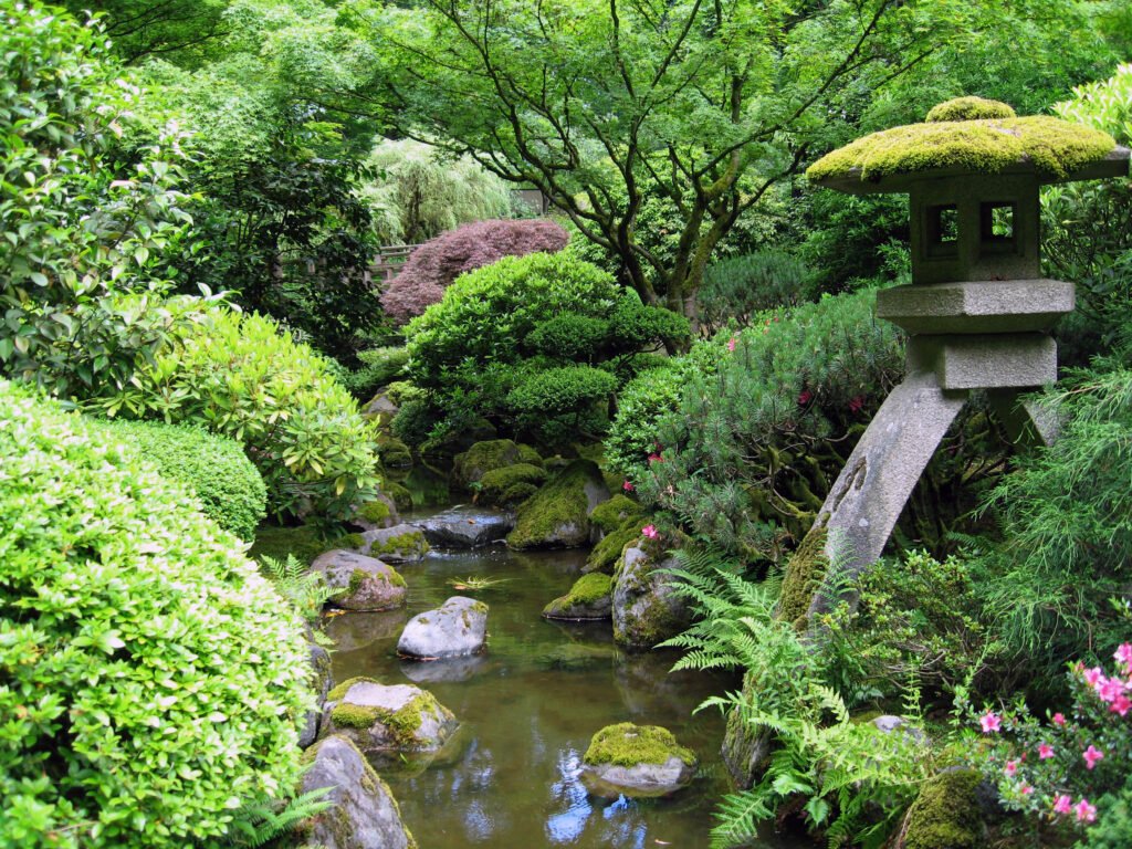
Use transit for the uphill connector before the walking route begins. Use public transport for the uphill connector before beginning the walking route. Local buses and MAX connections can bring you toward Washington Park, with the park shuttle useful for internal connections. Check current TriMet information for the simplest option on your travel date. Start the mapped walk at Portland Japanese Garden, continue to the free International Rose Test Garden, then descend toward NW 23rd Avenue in Nob Hill.
From NW 23rd, continue toward Providence Park and finish at Portland Art Museum on the South Park Blocks. This direction is intentional: transit handles most of the climb, while your walking day trends downhill and back toward the central city. If you spend several hours inside the Japanese Garden or Art Museum, shorten the middle shopping segment rather than rushing every stop.
Getting Around Portland Without a Car
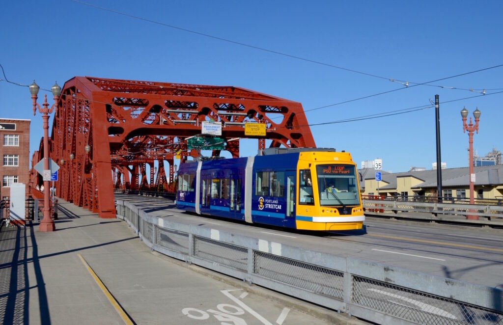
MAX light rail is the main rapid-transit backbone for visitors. The Blue and Red lines are especially useful through the city center and toward Washington Park, and the Red Line continues directly to Portland International Airport. Buses fill the corridors MAX does not serve, while Portland Streetcar is useful for Downtown, the Pearl, Northwest Portland, South Waterfront and the Central Eastside.
MAX service patterns can change over time, so check the current TriMet map and trip planner before relying on a specific line or transfer. The MAX Green Line now runs only between Clackamas Town Center and Gateway Transit Center. Riders coming from Green Line stations who want downtown generally transfer at Gateway to Blue or Red MAX or use an alternative bus. The Blue and Red lines were not shortened, so the core visitor and airport strategy in this guide remains strong.
Portland Streetcar is useful across several central districts, although walking can still be faster for very short trips. Check the current timetable when deciding whether to wait or continue on foot.
TriMet supports contactless payment and integrated travel across MAX, buses and Portland Streetcar. Fares, transfer rules and daily caps can change, so check current TriMet fare information before travel.
Arriving Without a Car
Portland International Airport is one of the city’s biggest car-free strengths. MAX Red Line service connects PDX directly with the central city, and the airport station is attached to the terminal area. Check current TriMet information for travel times, frequencies and fares before departure.
Rail travelers also arrive well. Portland Union Station is at 800 NW Sixth Avenue, inside the central visitor geography rather than at a suburban edge. Lan Su Chinese Garden is about a quarter mile southeast, and both the Pearl District and downtown are close enough to continue on foot or by a very short transit ride.
When a Car Becomes Useful
A car becomes useful when Portland stops being the destination and becomes the base for the region. The Columbia River Gorge, Mount Hood, Willamette Valley wine country and the Oregon Coast are the kinds of extensions where a rental car can add flexibility, especially when you want to combine multiple stops on your own schedule.
For a standard two- or three-day city weekend, the opposite is true. Keeping a car means managing parking while still walking around the same compact districts and using transit for Washington Park. Unless your itinerary includes substantial regional travel, Portland is easier to experience by combining walking with MAX, Streetcar and buses.
Practical Walking Tips
Build each day around one connected cluster instead of zigzagging across the river. The westside central city is compact enough that Downtown, Pearl and Old Town can share a day; Washington Park and Nob Hill belong together because the hill is the meaningful transport problem.
Use transit uphill and walking downhill whenever Washington Park is involved. Line 63 can provide a direct connection between the central city and the Japanese Garden/Rose Garden area, although service is limited enough that checking the departure time is worthwhile. Blue or Red MAX to Washington Park, followed by the park shuttle, provides another useful option. Check current TriMet schedules before travel.
Do not wait automatically for Streetcar on very short central trips. Portland’s blocks are short enough that a 10-minute walk can beat a 15- or 20-minute wait. Conversely, use Streetcar or MAX early when your legs are already tired; transit is most valuable when it preserves energy for the neighborhoods and attractions you came to see.
Check TriMet’s current Trip Planner or service alerts on the day you travel. Portland has a strong transit network, but schedules, construction and event detours can change. Check TriMet’s trip planner or service alerts on the day you travel. Construction, events and timetable changes can alter the best route even when the overall transit network remains useful.
Seasonal Walking Note
Portland remains practical to explore on foot year-round, but summer is the easiest time for very long walking days. Travel Portland describes summers as warm and mostly dry, with long evenings, while fall and winter are cooler and wetter. Pack layers, a light waterproof outer layer and shoes that stay comfortable on wet pavement if you visit outside the dry season.
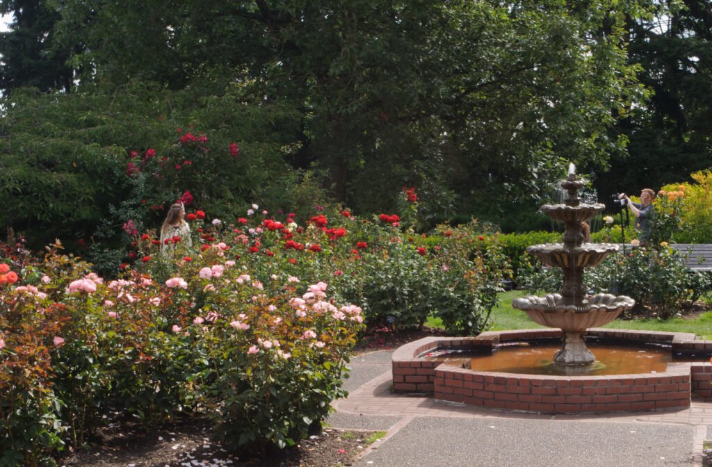
Spring adds the waterfront cherry blossoms, and the International Rose Test Garden generally has roses from late May through October.
Bottom Line
Portland is an excellent car-free weekend city when you treat walking and transit as one system. The short-block central grid, adjoining Pearl/Old Town/Northwest districts, useful Streetcar and MAX network, and direct airport rail connection make the city easy to experience without renting a car. The main limitation is not basic pedestrian access; it is the combination of West Hills terrain and a wider set of neighborhood attractions beyond the central core. Walk the compact clusters, let transit handle the hills and longer gaps, and save a car for regional excursions.