
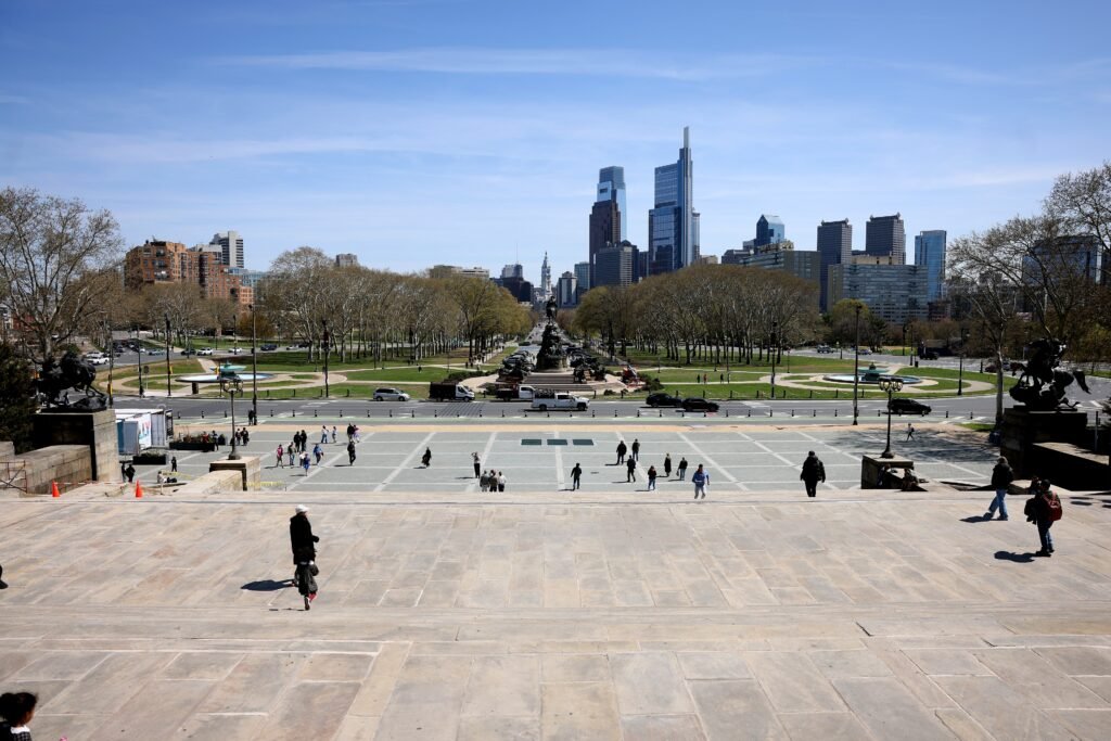
Between the Delaware and Schuylkill, Philadelphia compresses several major visitor zones into only about 2.4 miles of Center City. Old City and Independence National Historical Park form a tight eastern cluster around the city’s major early-American sights. Reading Terminal Market and City Hall sit near the middle, while Rittenhouse extends the useful walking area west. Numbered north-south streets and familiar east-west names make progress easy to judge during a long sightseeing day. The Benjamin Franklin Parkway then breaks the regular grid and draws visitors diagonally toward the major museums and Schuylkill. That shift turns an otherwise compact center into a noticeably longer walk.
Why Philadelphia Works So Well on Foot
Philadelphia’s layout does a lot of the work for you. In Center City, north-south streets are largely numbered, many east-west streets have memorable names, and City Hall sits near the middle of the visitor map. Old City and Independence National Historical Park form a tight eastern cluster; Reading Terminal Market, Chinatown and City Hall sit in the center; Rittenhouse is a short walk farther west; and the Parkway museums line up on a clear diagonal toward the Philadelphia Museum of Art.
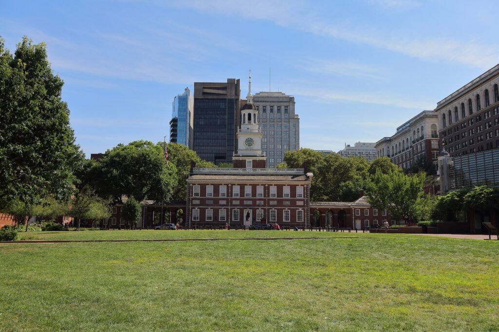
The historic district is particularly strong. The National Park Service describes Independence National Historical Park as compact, with most core sites concentrated between roughly 2nd and 7th streets and Walnut and Arch streets. Main visitor routes use paved walks and curb cuts, and major anchors such as the Independence Visitor Center, Liberty Bell Center and first floor of Independence Hall have mobility-access provisions. Historic cobblestones and older paving still appear in the district, so the atmosphere can be more charming than perfectly smooth, but the main sightseeing network is unusually pedestrian-friendly for a historic American core.
Best Neighborhoods to Stay In
Rittenhouse Square is the strongest all-around base if you want restaurants, hotels, evening activity and easy access to both City Hall and the western half of Center City. Washington Square West and Midtown Village offer perhaps the best geographic compromise, putting you between the historic sights and Rittenhouse. Old City is ideal if Independence Hall, the Liberty Bell and early-American history are the priority. Market East and the Convention Center area are extremely practical for Reading Terminal Market, Jefferson Station and transit. Logan Square and the Benjamin Franklin Parkway work especially well for museum-focused trips.
For a short first visit, there is little reason to stay far outside these central neighborhoods unless the hotel itself is the purpose of the trip. A cheaper room on the edge of the city can quickly trade away the time savings that make Philadelphia such a strong walking destination.
Useful Walking Times
Useful planning estimates are: Independence Visitor Center to the Liberty Bell in about 2–3 minutes; the Liberty Bell to Independence Hall in another 2–4 minutes; Independence Hall to Reading Terminal Market in roughly 15 minutes; Reading Terminal to City Hall in about 7–9 minutes; City Hall to Rittenhouse Square in about 10–12 minutes; LOVE Park to the Barnes Foundation in roughly 12–15 minutes; the Barnes to the Rodin Museum in about 5 minutes; Rodin to the Philadelphia Museum of Art in roughly 10–12 minutes; and the museum to Fairmount Water Works in about 5 minutes. Walking all the way from Independence Hall to the Philadelphia Museum of Art is closer to a 35–40 minute cross-town walk, which is where transit starts to become a useful choice rather than an admission of defeat.
These are practical planning estimates rather than guaranteed walking times. Crossings, crowds, attraction entrances and individual pace can change the actual time.
A 2-Day Philadelphia Walking Route
These routes are designed around two compact sightseeing clusters instead of forcing one giant loop. They assume a normal sightseeing pace with stops, meals and indoor visits; the walking itself is only part of each day.
Day 1: Historic Philadelphia, Reading Terminal and Rittenhouse
Walking route
Historic Philadelphia to Rittenhouse
- Independence Visitor Center
- Liberty Bell Center
- Independence Hall
- Washington Square
- Reading Terminal Market
- Philadelphia City Hall
- Rittenhouse Square
Start at the Independence Visitor Center, then cross into the core of Independence National Historical Park for the Liberty Bell Center and Independence Hall. Timed-entry logistics at Independence Hall can dictate the exact order, so it is smarter to build the morning around the ticket than around a rigid minute-by-minute schedule. From there, walk through Washington Square before turning northwest toward Reading Terminal Market for lunch.
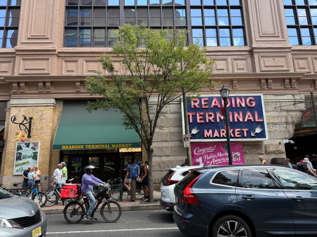
After the market, continue to Philadelphia City Hall and Dilworth Park, the point where the city’s grid and transit network become easiest to read. Finish with the short walk to Rittenhouse Square. This final stretch is useful because it shifts the day from formal sightseeing into the part of Center City where restaurants, cafes and evening activity are concentrated.
Day 2: The Parkway Museums and Schuylkill River
Walking route
Benjamin Franklin Parkway and the Schuylkill
- LOVE Sculpture at LOVE Park
- Sister Cities Park
- Barnes Foundation
- Rodin Museum
- Philadelphia Museum of Art
- Fairmount Water Works
Begin at the LOVE sculpture in LOVE Park, then follow the Benjamin Franklin Parkway west. The route passes Sister Cities Park, the Barnes Foundation and the Rodin Museum before reaching the Philadelphia Museum of Art. The Parkway is about a mile long, so the geography is easy; the real planning decision is how many museums you want to enter. Trying to do full visits at every institution can turn a pleasant walking day into an indoor marathon.
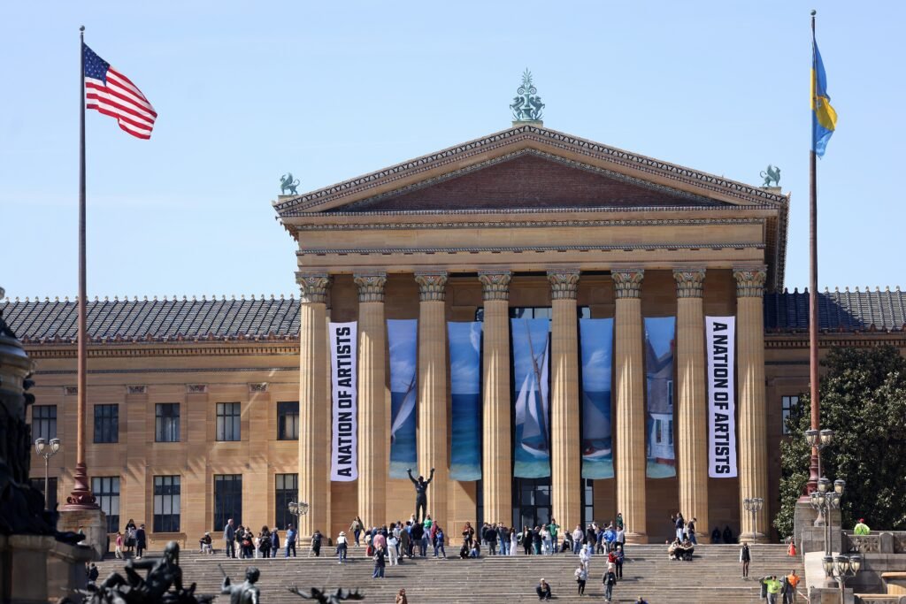
From the museum, descend to Fairmount Water Works beside the Schuylkill River. The riverfront makes a natural endpoint and gives you the option of adding a short riverside walk rather than another ticketed attraction. If your legs are finished by this point, the PHLASH or SEPTA can remove the need to retrace the whole Parkway on foot.
Getting Around Philadelphia Without a Car
SEPTA works best as a supplement to walking. The L line is the main east-west Metro spine through Center City and is useful for trips between the historic district, City Hall and 30th Street. The B line runs north-south under Broad Street and becomes especially useful for the South Philadelphia sports complex. Buses, trolleys and Regional Rail expand coverage well beyond those two lines.
Payment is now much easier for visitors than it used to be. SEPTA accepts contactless credit cards, debit cards and mobile wallets across Bus, Metro and Regional Rail. Bus and Metro riders receive the same transfer benefits as the SEPTA Key Travel Wallet when they keep using the same payment method; Regional Rail requires a tap when entering and leaving the trip.
The Philly PHLASH is a visitor-focused seasonal service connecting several central attractions and museum areas. Its operating days and frequency vary by season, so check the current PHLASH schedule before relying on it. It complements SEPTA rather than replacing the regular transit network.
Arriving in Philadelphia Without a Car
Philadelphia International Airport is one of the city’s strongest car-free advantages. SEPTA’s Airport Line serves the airport terminals directly and continues to several central Philadelphia stations, allowing travelers to reach Center City without a rental car. Check current SEPTA schedules before travel because service frequency can change.
Intercity rail arrival is equally convenient. William H. Gray III 30th Street Station is a major Amtrak Northeast Corridor hub with SEPTA connections into Center City. William H. Gray III 30th Street Station is a major Amtrak Northeast Corridor hub with SEPTA connections into Center City, making intercity rail arrival particularly convenient.
When a Car Becomes Useful
A car becomes useful when the trip stops being primarily about central Philadelphia. Regional destinations such as Longwood Gardens, Brandywine Valley attractions or a multi-stop countryside itinerary are much easier to combine by car. Inside the standard 2-day visitor footprint, however, parking, traffic and the need to return to the vehicle usually create more friction than value. Even some farther city destinations remain reachable by SEPTA, so renting a car solely for Center City sightseeing rarely makes sense.
Practical Walking Tips
Use the grid to simplify navigation: numbered streets tell you roughly how far east or west you are, while City Hall acts as the central reference point. Treat the historic district, central Center City and the Parkway as three linked walking clusters rather than one continuous attraction strip. Wear shoes that handle brick and occasional cobblestones, keep an eye on larger crossings around Market Street, Broad Street and the Parkway, and use transit before fatigue turns a pleasant 15-minute walk into an unwanted 35-minute one. During major events, check same-day SEPTA alerts and attraction notices because temporary crowd-control measures can change the easiest route.
Seasonal Walking Note
Spring and fall are the easiest seasons for long days on foot. Summer remains manageable on foot, but heat and humidity make shade, water and midday indoor stops more important. Winter is also manageable because distances are short and there are plenty of indoor attractions, though cold, wind and occasional snow or ice can make the exposed Parkway and riverfront feel much longer than the map suggests.
Bottom Line
Philadelphia is an excellent city for a car-free weekend. Stay in a central visitor neighborhood, walk the historic core and Center City, give the Parkway its own half-day or full day, and use SEPTA or the PHLASH for the longer gaps. The city is compact enough that walking feels like the natural default, while transit is good enough that you do not have to prove anything by walking every mile.