
From the Ferry Building to Fisherman’s Wharf, San Francisco’s northeast core links major sights through continuous visitor districts. Chinatown and the terrain extend that chain inland, while Union Square anchors the hotel-heavy downtown side. The Mission, Golden Gate Park, Presidio, and Golden Gate Bridge sit beyond that compact central zone. Muni and BART connect those separated clusters efficiently, while BART also provides direct airport access to downtown. Elevation remains the defining challenge, because short San Francisco walks can become demanding when routes climb sharply.
Why San Francisco Works Well on Foot
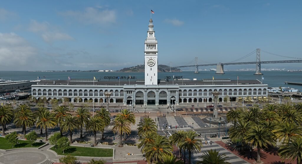
The strongest walking zone runs from the Ferry Building and Embarcadero through Chinatown and North Beach to PIER 39 and Fisherman’s Wharf, with Union Square immediately south of that core. Representative route checks put Union Square to Chinatown at about 12 minutes, Chinatown to Washington Square at about 6 minutes, and the Ferry Building to PIER 39 at about 25 minutes along the waterfront. Those are useful visitor-scale distances rather than theoretical residential walkability.
San Francisco’s street environment is also designed to support walking. The city’s Transportation Element explicitly calls for continuous sidewalks, safe crossings and streets designed for convenient walking. The experience is not equally easy everywhere, but in the main visitor districts a private car is generally unnecessary and often adds parking and traffic friction that walking and transit avoid.
The Hills Are the Main Catch
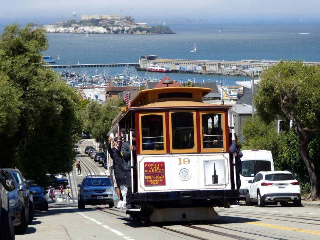
Terrain is the main reason short distances can feel much harder than they look on a map. The Fisherman’s Wharf-to-Lombard Street connection is geographically short, for example, but the climb is what matters. Russian Hill, Nob Hill and several cross-town routes require more effort than their distance suggests. The practical solution is not to avoid walking; it is to use Muni, a cable car or a bus to erase the least rewarding climb and save your walking energy for the neighborhoods and waterfront.
Best Areas to Stay for a Car-Free Weekend
Union Square / Downtown
This is the most efficient all-around base for a first visit. San Francisco Travel identifies Union Square as the city’s biggest concentration of major hotels and a transit hub for Muni, BART and cable cars. Chinatown is roughly a 12-minute representative walk away, while the Ferry Building is about 18 minutes on foot or a short transit ride.
Embarcadero / Financial District
Choose this area if you value flatter walking and straightforward airport access. The Ferry Building, waterfront promenade, BART and Muni are close together, and the walk toward PIER 39 stays comparatively gentle. The tradeoff is that the Mission, Golden Gate Park and Presidio are clearly transit trips.
Fisherman’s Wharf
The Wharf is practical for families and first-time visitors prioritizing Alcatraz departures, PIER 39 and the northern waterfront. It has abundant visitor services and strong F-line, bus and cable-car access. It becomes less convenient if your weekend is built around the Mission or western neighborhoods.
North Beach / Chinatown
These adjoining neighborhoods work especially well for travelers who want atmosphere, restaurants and short evening walks close to the northeast core. They connect naturally with Union Square and Fisherman’s Wharf, but daily grades are more noticeable than on the Embarcadero.
Mission District
The Mission is a strong choice when neighborhood walking, murals, food and BART access matter more than being beside the classic waterfront sights. San Francisco Travel’s own self-guided Mission route covers about 1.9 miles, illustrating how well the district works once you are there. It is simply less central for the bridge, Presidio and Golden Gate Park.
Useful Walking Times
| Walk | Typical time |
|---|---|
| Union Square → Chinatown | 12 min |
| Chinatown → Washington Square / North Beach | 6 min |
| Union Square → Ferry Building | 18 min |
| Ferry Building → PIER 39 | 25 min |
| PIER 39 → Fisherman’s Wharf | 9 min |
| Fisherman’s Wharf → Lombard Street | about 10 min, uphill |
| de Young Museum → Conservatory of Flowers | about 10 min |
| Presidio Main Post → Golden Gate Bridge | about 30–35 min |
These are practical planning estimates rather than guaranteed walking times. Crossing waits, crowds, route choice and especially elevation can change the actual time.
A 2-Day Car-Free Walking Route
The two routes below deliberately use different parts of the city. Day 1 exploits the compact northeast visitor core. On the second, a scenic linear walk through the Marina and Presidio finishes with an easy Muni return.
Day 1 — Waterfront, Fisherman’s Wharf, North Beach & Chinatown
Walking route
Waterfront, Fisherman's Wharf, North Beach & Chinatown
- San Francisco Ferry Building
- PIER 39
- Fisherman's Wharf
- Lombard Street Crooked Block
- Washington Square
- City Lights Booksellers
- Chinatown Dragon Gate
- Union Square
Start at the Ferry Building and follow the Embarcadero north to PIER 39 and Fisherman’s Wharf. This first section is the easiest walking of the day: long enough to feel like a real city walk, but relatively flat. From the Wharf, climb toward the crooked block of Lombard Street. If the hill is not appealing, this is exactly where the Powell-Hyde cable car can function as useful transport rather than just a sightseeing ride.
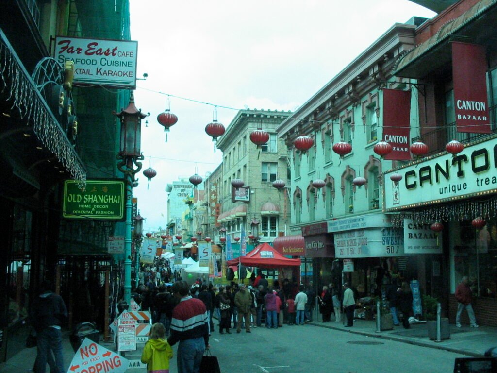
After Lombard Street, descend toward Washington Square and move through North Beach to City Lights and Chinatown. Finish at Union Square, where multiple transit options make the return to your hotel easy. The route links several signature districts without repeatedly doubling back, while acknowledging one intentional hill instead of pretending San Francisco is flat.
Day 2 — Palace of Fine Arts, Crissy Field, Presidio & Golden Gate Bridge
Walking route
Palace of Fine Arts, Crissy Field, Presidio & Golden Gate Bridge
- Palace of Fine Arts
- Crissy Field East Beach
- Presidio Tunnel Tops
- Main Parade Lawn
- Battery Bluff Park
- Crissy Field Overlook
- Battery East Vista
- Golden Gate Bridge Welcome Center
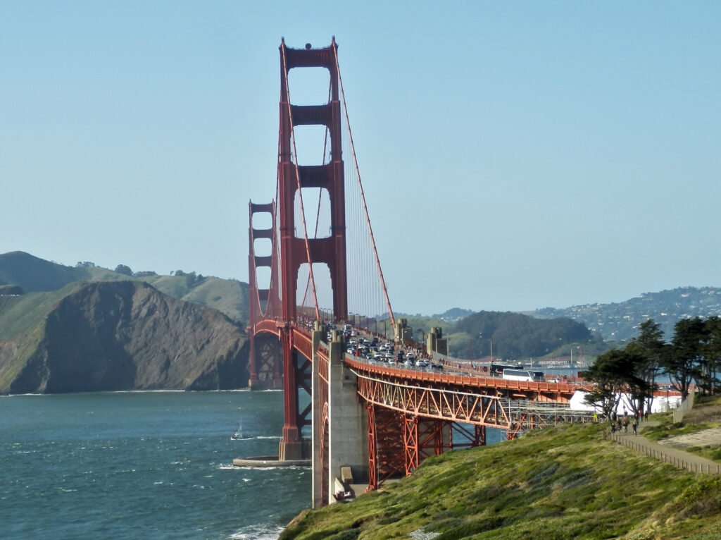
Begin at the Palace of Fine Arts and walk toward Crissy Field, where the bayfront terrain is gentle and the bridge gradually dominates the view. Continue to Presidio Tunnel Tops and the Main Post, then follow the paved Presidio Promenade west through Battery Bluff and the bridge overlooks. The Presidio Trust specifically describes the Promenade as a paved connection toward the Golden Gate Bridge.
Finish at the Golden Gate Bridge Welcome Center. The bridge itself spans about 1.7 miles, so crossing it should be treated as an optional extension rather than an automatic part of a two-day city itinerary. Muni route 28 is a practical way back from the bridge when you would rather save your legs for dinner or another neighborhood.
Getting Around San Francisco Without a Car
Muni is what turns San Francisco from a collection of walkable neighborhoods into an excellent car-free weekend city. Buses, rail, historic streetcars and cable cars connect the downtown waterfront with Golden Gate Park, the Mission, the Presidio and other areas beyond the compact northeast core.
Clipper and contactless bank-card payment make occasional transit use straightforward. Fares, transfer rules, cable-car pricing and individual route frequencies can change, so check current SFMTA information before travel.
Getting From SFO to the Visitor Core
San Francisco International Airport has direct BART service toward downtown San Francisco. The airport station connects with the terminals through the airport circulation system, making a car unnecessary for most central arrivals. Service hours and journey times vary, so check current BART information when planning early-morning or late-night flights.
When a Car Becomes Useful
For the city itself, a rental car is usually unnecessary for a first weekend. The main visitor districts are either walkable or well connected by Muni/BART, and parking does not solve the hills. A car becomes more defensible when San Francisco is only the starting point for a regional road trip or for destinations where the itinerary is primarily outside the city. For a city-focused 48- to 72-hour visit, walking plus transit is the simpler default.
Practical Walking Tips
- Plan by elevation, not just distance. A short uphill route can be harder than a much longer waterfront walk.
- Use transit to remove low-value climbs. Cable cars, buses and Muni Metro are part of the walking strategy, not a failure to walk.
- Keep layers handy. Waterfront and western neighborhoods can feel much cooler or windier than sheltered streets.
- Use Clipper or contactless tap-to-pay. It is the simplest payment option for most visitors.
- Check live SFMTA service. Route frequencies, stops and temporary diversions can change.
Seasonal Walking Note
San Francisco is well suited to a walking-focused visit year-round, but comfort varies sharply between neighborhoods and even within the same day. The waterfront, bridge and western districts can be windy or foggy while inland streets feel milder. Treat layers as normal walking gear and use transit sooner when conditions make exposed routes less pleasant.
Bottom Line
San Francisco is an excellent city to visit without a car. It is not a city where every attraction belongs to one flat pedestrian core, but that is the wrong standard. The useful question is whether a visitor can combine satisfying neighborhood walks with reliable transit and easy airport arrival. On that measure, San Francisco works extremely well: walk the waterfront and compact northeast neighborhoods, use Muni to bridge the larger gaps and the steepest climbs, and leave the rental car out of the city weekend.