
Six UK city breaks sit only two points apart here, yet their walking patterns diverge almost immediately. Liverpool flows from Lime Street through the center to the waterfront with little wasted mileage. London rewards long walks inside distinct districts, then asks the Tube to bridge the gaps. Manchester stretches across a broad, mostly flat central chain. Bath sits in a compact basin below steeper Georgian streets. Edinburgh compresses sights across ridges, valleys, stairs, and steep closes. York keeps distances tiny, but medieval paving, crowds, and wall access add friction.
The UK Ranking at a Glance
| Rank | City | Overall score | Strongest advantage | Main limitation |
|---|---|---|---|---|
| 1 (tie) | Liverpool | 90/100 | Station-to-center-to-waterfront continuity | Southern gradients and a less convenient airport transfer |
| 1 (tie) | London | 90/100 | Strongest transit and outstanding walking districts | Major visitor areas are spread across multiple clusters |
| 1 (tie) | Manchester | 90/100 | Flat central chain and easiest car-free arrival | Wide junctions and outer extensions add friction |
| 4 (tie) | Bath | 88/100 | Exceptionally concentrated historic sightseeing | Georgian-quarter hills and lighter transit |
| 4 (tie) | Edinburgh | 88/100 | Dense sights backed by excellent transit | The most demanding terrain of the six |
| 4 (tie) | York | 88/100 | Exceptionally tight medieval visitor core | Historic surfaces, crowds, and wall access friction |
Liverpool, London, and Manchester share rank 1, so ranks 2 and 3 are skipped. Bath, Edinburgh, and York share rank 4, leaving no ranks 5 or 6. The ties matter because each city reaches the same total through a different kind of weekend.
Three Different Ways to Share First Place
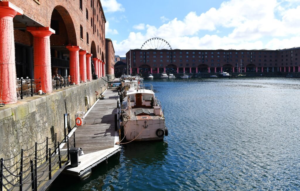
Liverpool is the most naturally concentrated of the three leaders. A rail traveler can leave Lime Street, meet St George’s Hall almost immediately, and continue west toward Mathew Street and the Cavern Quarter. Liverpool ONE then carries the route toward Royal Albert Dock, Mann Island, and Pier Head. The waterfront feels like a continuation of the center rather than a separate excursion. That pattern keeps most first-time sightseeing inside a coherent central walking network. The main caveat appears south and uphill. Hope Street, the Georgian Quarter, and the two cathedrals introduce more gradient, while dock basins and The Strand can make waterfront routing less direct. The Baltic Triangle works best as a deliberate southern extension. Merseyrail and buses are useful backups, not the reason the central spine succeeds.
London reaches the same total through almost the opposite geography. Westminster and St James’s, Covent Garden and Soho, the South Bank, the City and Tower area, Bloomsbury, and South Kensington all support excellent walking. They simply sit too far apart to treat as one continuous sightseeing district. London is less compact than the other cities here, but its exceptionally strong transit makes the gaps easy to manage. The Tube, Elizabeth line, and buses protect the best walking by removing low-value mileage between clusters. Use transit to reposition, then walk inside Westminster, the West End, South Bank, City/Tower, or South Kensington. Exceptional transit makes London outstanding without a car; it does not make those districts geographically closer.
Manchester sits between Liverpool’s concentration and London’s scale. Piccadilly leads quickly into the Northern Quarter, which blends into the shopping and civic center. Cathedral Gardens, Deansgate, Spinningfields, Albert Square, and St Peter’s Square remain practical parts of the same broad central chain. Ancoats extends the map east across Great Ancoats Street, while Castlefield stretches it southwest along canals and viaducts. The center is broadly flat, but flat does not mean flawless. Wide junctions, tram tracks, canal edges, historic setts, and selected crossings add friction. Metrolink is most useful for extensions and repositioning. Piccadilly already touches the walking core, while direct airport rail makes the start unusually simple.
These three co-leaders are not interchangeable. Liverpool gives the strongest station-to-waterfront continuity. London gives the greatest freedom to combine separate walking districts. Manchester offers a medium-scale, flatter center with the easiest overall arrival. Each suits a different kind of weekend.
Bath, Edinburgh and York: Compact in Three Different Ways
Bath puts an exceptional amount of sightseeing inside a small river-valley footprint. From Bath Spa Station, the Roman Baths, Bath Abbey, central shopping streets, and Pulteney Bridge are all unusually close together. That concentration makes the historic center especially efficient for sightseeing on foot. The important limitation is not attraction spread. North of the central basin, Queen Square leads toward Gay Street, the Circus, and Royal Crescent, with further climbing toward Lansdown-facing streets. Pulteney Bridge and the Avon are part of the real walking network, but the historic crossing is constrained. Crowding and older paving around the Abbey and Roman Baths can also slow very short routes. Buses help with hillier extensions, while the smaller transit system offers less depth than London or Edinburgh.
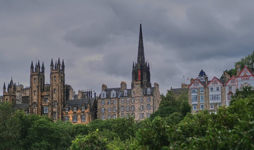
Edinburgh is the clearest example of compactness and physical effort pulling in opposite directions. Edinburgh Castle, the Royal Mile, St Giles’, the National Museum, Grassmarket, Princes Street, and much of New Town sit inside a remarkably concentrated first-visit area. Yet the Old Town occupies a ridge, Grassmarket lies below it, and Castle Rock rises sharply. Calton Hill adds another climb, while Dean Village demands a descent followed by a return ascent. The Mound, North Bridge, Princes Street Gardens, and the Waverley rail cutting expose the city’s vertical structure. Waverley is brilliantly located, but the station sits below street level. Edinburgh has the most demanding terrain of the six, while excellent buses and trams provide valuable relief from repeated climbs.
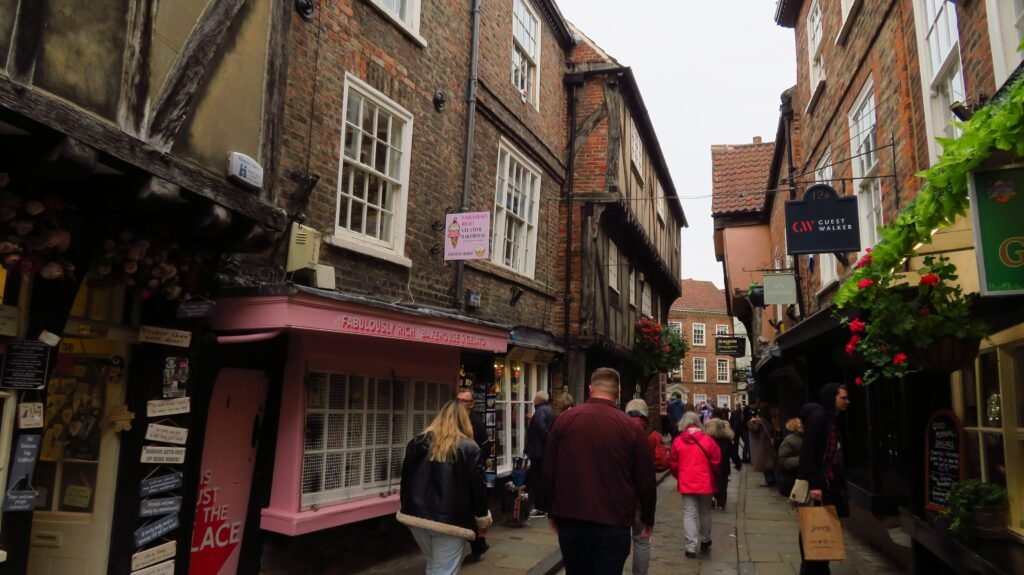
York matches Bath’s exceptional sightseeing concentration with a very different kind of walking friction. York Minster, Stonegate, the Shambles, Museum Gardens, and the Castle area form an exceptionally tight network. The railway station remains close enough to enter that geography on foot. Between principal central sights, walking will often beat waiting for a bus. The limitations come from medieval form rather than long distances. Narrow lanes, crowds, cobbles, stone paving, and constrained footways can make five-minute walks feel slower. The City Walls are memorable, but they are not a universal shortcut. Access uses stairs, elevated sections can narrow, and the route drops to ground-level connectors where the ramparts stop. The Ouse and surviving walls also funnel movement toward specific bridges and openings.
The shared 88/100 total hides almost opposite tradeoffs. Bath combines extraordinary concentration with uphill Georgian extensions and lighter transit. Edinburgh is steeper but uses excellent buses and trams to protect energy. York is easier underfoot than Edinburgh, yet its historic surfaces and wall access create different pedestrian friction. None is simply a lesser version of the first-place cities.
Compactness Is Not the Same as an Easy Walking Day
Bath and York have tighter first-visit geography than London, yet neither automatically produces the easiest walking day. Bath concentrates sights superbly, then asks visitors to climb toward the upper Georgian city. York keeps distances short, but crowds, cobbles, narrow lanes, and wall stairs can slow progress. Edinburgh compresses major sights too, but vertical separation dominates the experience. London demonstrates the reverse pattern: individual districts are excellent on foot, while the distance between them makes transit part of a sensible plan. Manchester shows how flat terrain and simple arrival can support a broader central chain. Liverpool shows how a continuous station-to-waterfront spine can reduce the need for transit in the first place.
Choose by the Weekend You Want
| Traveler priority | Best fit | Why |
|---|---|---|
| Most concentrated sightseeing | Bath or York | Both place an exceptional share of first-time sights inside very small visitor cores. |
| Strongest public transport | London | The Tube, Elizabeth line, rail and buses make separated walking districts easy to combine. |
| Easiest car-free arrival | Manchester | Piccadilly sits beside the central walking network, with direct rail from the airport. |
| Easiest terrain | London or Manchester | Both keep most standard visitor routes relatively flat, although London still requires transit between major clusters. |
| Most demanding hills | Edinburgh | Ridges, steep closes, stairs and repeated level changes make it the most physically demanding of the six. |
| Waterfront walking | Liverpool | The waterfront continues naturally from the center through Royal Albert Dock, Mann Island, and Pier Head. |
| River-focused walking | London or Bath | London offers long Thames promenades; Bath uses the Avon and Pulteney Bridge inside a much tighter core. |
| Medieval-center walking | York | The Minster, Stonegate, Shambles, walls, and Castle area sit in a remarkably small footprint. |
| Georgian-city walking | Bath | Queen Square, Gay Street, the Circus, and Royal Crescent form a compact but clearly uphill sequence. |
| Big-city cluster walking | London | Walk deeply inside Westminster, West End, South Bank, City/Tower, Bloomsbury, or South Kensington, then reposition. |
| Minimize local transit | Bath or York | Most headline sightseeing is close enough that waiting for a bus often adds little value. |
Waterfronts, Rivers and Walls Change the Route
Liverpool has the clearest waterfront advantage because the docks sit on the natural continuation of a central sightseeing walk. Royal Albert Dock, Mann Island, and Pier Head add meaningful visitor time without feeling like a transfer. London’s Thames plays a different role. The South Bank creates a long, flat walking corridor, while bridges connect it to Westminster, St Paul’s, and the City. The river helps organize individual walking days, but it does not erase the wider distances to South Kensington or Bloomsbury.
Bath uses the Avon on a much smaller scale. Pulteney Bridge is both a useful crossing and a constrained historic link between the center and Bathwick. York’s Ouse also shapes movement, but the surviving walls matter just as much. Bridges, bars, and wall openings funnel pedestrians toward specific routes. Manchester’s canals add character around Castlefield and Ancoats, yet they can also introduce edges, towpaths, and crossing choices that are less direct than the street grid.
Where Transit Protects the Walking Day
Transit matters most in London because the city is too large to walk efficiently between every major visitor cluster. Edinburgh also benefits greatly from buses and trams, especially for Leith, Newhaven, the airport and tired-leg returns after steep sightseeing. Liverpool and Manchester have strong networks too, but most central sightseeing does not require them.
Bath and York rely less on internal transit because their headline sights sit closer together. Bath’s buses become more valuable on hillier edges or when energy is limited. York’s buses matter more for outer districts, universities, and park-and-ride travel than for Minster-to-Shambles sightseeing. That is why a smaller transit system does not automatically mean a worse walking weekend.
The Rail Station Can Shape the First Hour
Manchester has the easiest overall car-free arrival result. Piccadilly is already attached to the central walking network, and airport trains enter the same gateway. Liverpool Lime Street offers an equally satisfying rail start because St George’s Hall sits beside the station and the waterfront lies straight ahead through the center. Airport arrival is more burdensome, which keeps Liverpool below Manchester on that part of the trip.
Bath Spa and York Station also place rail travelers close to the first sightseeing stop. Edinburgh Waverley sits between Old Town and New Town, but the platforms lie below street level and luggage can meet immediate gradients. London has several superbly placed rail terminals and strong airport links, yet the airport-to-center ride remains longer and the ideal terminal depends on the chosen neighborhood. All six work well without a car, but they do not begin with the same amount of effort.
When a Car Actually Helps
A private car adds little to the standard two- or three-day city break in any of these six destinations. Central parking, traffic, and the need to walk once you reach the sights usually reduce its value. A car becomes more useful when the trip expands into rural areas, dispersed regional attractions, or multi-stop itineraries that rail and buses serve poorly. Inside the city weekends compared here, walking plus public transport is the more practical default.
Bottom Line
The tied cities suit different kinds of trips. Liverpool suits travelers who want the strongest center-to-waterfront walking sequence. London works best for unmatched transit between excellent but separate walking districts. Manchester combines a flat central chain with the easiest arrival. For a tiny historic basin with rewarding Georgian climbs, Bath stands out. Edinburgh is the better fit when strong transit can offset demanding terrain. York favors travelers seeking exceptionally concentrated medieval sightseeing, where surfaces, crowds, and wall access matter more than distance.