
Six Canadian city breaks can feel equally easy until the first long walking day begins. Toronto spreads major sights across a broader map, then rescues the gaps with transit. Vancouver keeps more of the weekend on one downtown peninsula. Ottawa and Montréal both support long central walks, but their outer districts pull the itinerary in different directions. Quebec City and Halifax compress major sights tightly, then make short distances harder with steep climbs. Those contrasts matter more than municipal size. Choosing among these six means choosing a walking rhythm, not simply the highest score.
Six Canadian City Breaks, Side by Side
The ranking highlights how each city’s strongest walking advantage comes with a different tradeoff
| Rank | City | Overall score | Strongest advantage | Main limitation |
|---|---|---|---|---|
| 1 | Toronto | 89/100 | Best transit support in the group, plus direct Pearson–Union rail | A broader visitor map spreads beyond the strongest downtown walking core |
| 1 | Vancouver | 89/100 | Coherent downtown peninsula and excellent sidewalk-and-crossing continuity | Stanley Park, Granville Island, UBC and North Shore trips stretch the map |
| 3 | Ottawa | 86/100 | Tight Parliament–Canal–ByWard sightseeing core | Waterways and outer museums create longer crossings and extensions |
| 4 | Montréal | 85/100 | Long central walking chain with strong Metro support for neighborhoods | Mile End, Jean-Talon Market and Olympic Park sit beyond the tight core |
| 5 | Quebec City | 82/100 | Joint-highest visitor compactness, especially across Old Québec | Upper Town–Lower Town climbs and lighter transit increase effort |
| 6 | Halifax | 81/100 | Joint-highest visitor compactness around waterfront and downtown sights | Steep inland blocks, thinner transit and a less convenient airport transfer |
Toronto and Vancouver share rank 1 at 89/100, so the next position is rank 3. Vancouver keeps more sightseeing inside a coherent central geography, while Toronto uses stronger transit to make its broader visitor map easy to manage.
Toronto and Vancouver: Same Score, Different Weekend Rhythm
Our Toronto walkability guide starts with a strong downtown chain around Union Station, the CN Tower, Harbourfront, City Hall and St. Lawrence. That core can absorb hours of walking without transit. The map becomes less compact once Yorkville, Kensington, Chinatown, Queen West, the Distillery extension and Toronto Islands enter the same weekend.
Toronto handles that spread unusually well. TTC subway and streetcars remove low-value mileage between clusters, while UP Express links Pearson directly with Union Station.Toronto has the strongest transit support in this group, while UP Express makes airport arrival particularly straightforward. PATH can soften bad-weather days, but it does not make outdoor attractions geographically closer.
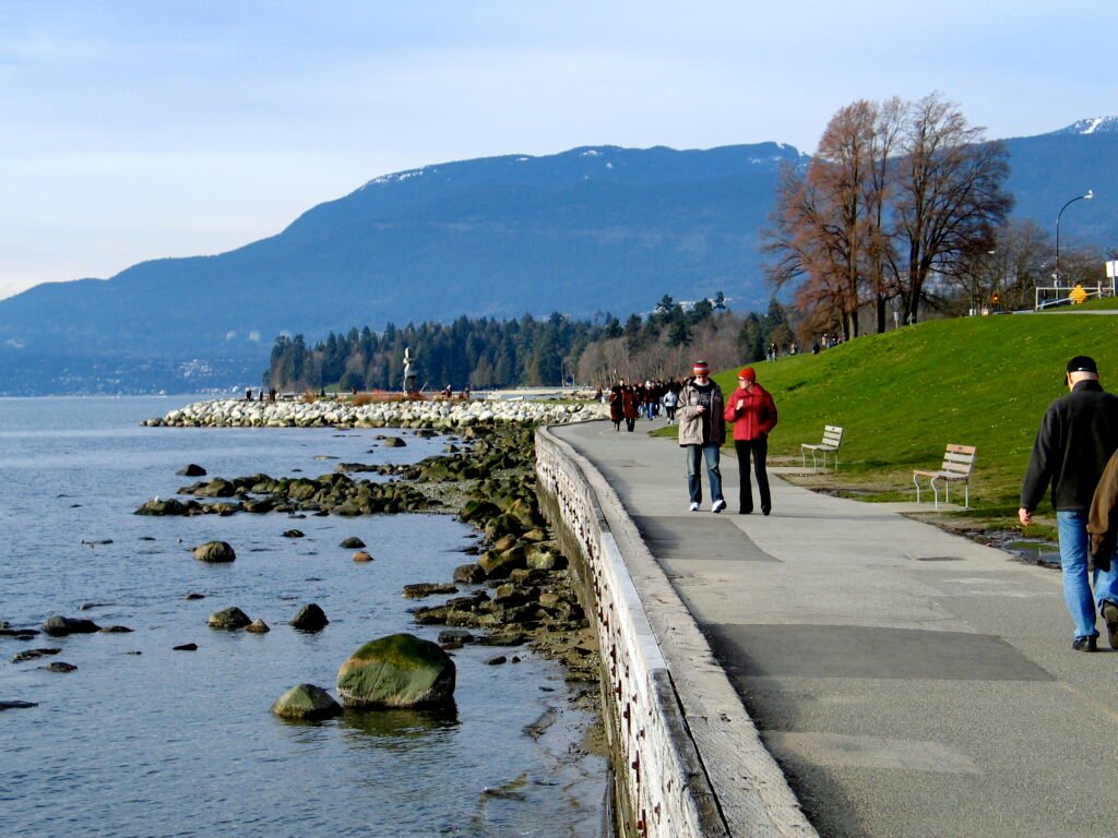
The Vancouver walking guide describes a different shape. Waterfront Station, Canada Place, Gastown, Yaletown, Robson Street, Coal Harbour, the West End and English Bay connect naturally across the downtown peninsula. Sidewalk and crossing continuity is especially strong, and the waterfront paths make long central walks feel coherent.
Vancouver still has real extensions. Granville Island sits across False Creek, Stanley Park adds serious distance, and UBC or North Shore attractions become separate outings. SkyTrain, buses and SeaBus cover those gaps, while the Canada Line gives YVR a direct downtown rail link. Travelers who want one walk-heavy central base may prefer Vancouver’s rhythm; travelers wanting broader big-city variety may prefer Toronto’s.
Ottawa and Montréal: One Point Apart, Different Shapes
Ottawa’s car-free weekend guide revolves around Parliament Hill, Sparks Street, the Rideau Canal locks, Major’s Hill Park, ByWard Market and the National Gallery. That central cluster is exceptionally useful for a short visit. The Ottawa River and Rideau Canal also make walking more scenic, but they channel movement through bridges and defined crossings.
The capital starts to spread at the Canadian Museum of History, the War Museum, Glebe, Lansdowne and Dow’s Lake. O-Train and buses keep those extensions practical. Ottawa keeps more of its headline sightseeing close together than Toronto or Vancouver, although its outer museums and neighborhoods require more deliberate repositioning.
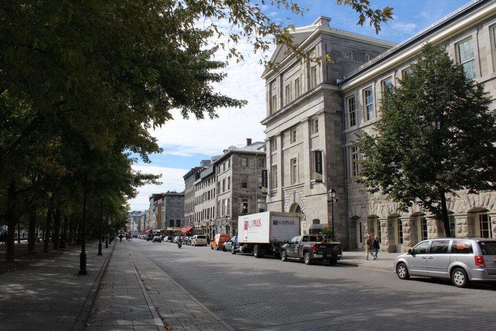
The Montréal walkability guide offers a longer urban chain rather than a single ceremonial core. Downtown, Quartier des spectacles, Chinatown, Old Montréal and the Old Port can flow into one substantial walking day. The Plateau can continue that pattern, while Mile End, Jean-Talon Market and Olympic Park work better as separate Metro-supported outings.
Ottawa and Montréal offer similarly strong car-free weekends through different layouts. Ottawa concentrates more headline sights around its ceremonial core, while Montréal offers a longer central walking chain backed by Metro trips to distinct neighborhoods. Airport arrival in Montréal currently relies on surface transport rather than direct airport rail.
Quebec City and Halifax: Compact Sights, Steeper Days
Quebec City’s walking guide shows why short map distances can still demand energy. Place Royale, Petit-Champlain, Dufferin Terrace, Château Frontenac and Upper Town sit remarkably close together. The problem is vertical separation. Lower Town and Upper Town are linked by steep streets, stairs and the funicular, so compact sightseeing does not mean level sightseeing.
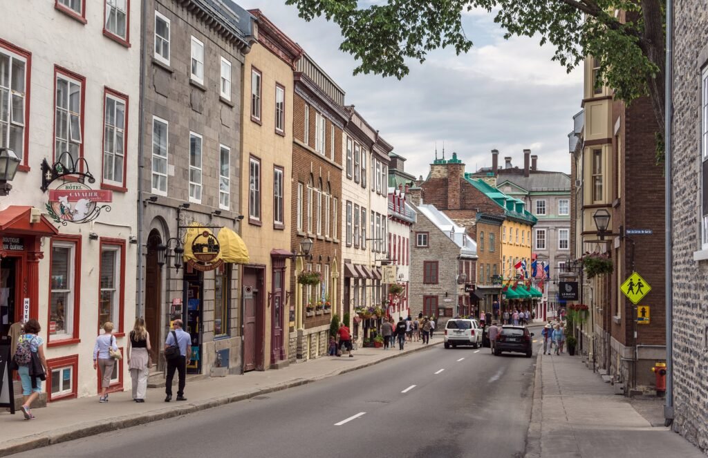
Quebec City combines exceptional sightseeing concentration with some of the most demanding walking terrain in the group. The funicular is useful, but it does not erase the underlying climb. Regional trips such as Montmorency Falls or Île d’Orléans also sit outside the compact Old Québec experience.
The Halifax walkability guide reaches the same compactness score through a harborfront pattern. Historic Properties, the Maritime Museum, Grand Parade, Citadel Hill and Spring Garden sit close enough for an efficient central weekend. The waterfront itself is level and comfortable; the effort appears when routes turn inland toward upper downtown.
Halifax has a similarly compact core and similarly demanding inland terrain. Its main disadvantage is arrival: the airport sits well outside downtown, and Route 320 requires more time than the direct airport-rail links available in Toronto or Vancouver.
Where the Hills Change Your Pace
Terrain is the clearest reason these cities can feel different despite similar sightseeing distances. Toronto is the easiest of the six for grade, while Vancouver, Ottawa and Montréal remain manageable across their main visitor areas. Quebec City and Halifax are the outliers. In both, a ten-minute route can feel much harder when elevation changes quickly.
The important distinction is effort, not attraction spacing. Old Québec and central Halifax remain highly concentrated. Their lower walking-environment results reflect climbs, stairs and grade changes rather than distant landmarks. Travelers with limited mobility or low tolerance for hills should plan shorter walking arcs and use available transit or vertical aids where practical.
When Transit Saves the Weekend
Toronto needs transit most often because its visitor map is broad, and it also supplies the strongest network for solving that problem. Vancouver uses transit more selectively after a walk-heavy downtown day. Ottawa and Montréal sit between those patterns: both support long central walks, then use rail or buses to reach outer museums, markets and neighborhoods.
Quebec City and Halifax depend less on transit inside their tight cores, but their systems offer less depth when a visitor wants to expand the day. Halifax’s airport bus is direct but slower and less frequent than the rail arrivals in Toronto and Vancouver. In Montréal, the Metro makes neighborhood jumps easy even though those neighborhoods remain geographically separate.
Airport arrival creates another practical split. UP Express carries Toronto visitors to Union Station, while Vancouver’s Canada Line reaches downtown directly from YVR. Those links make both tied leaders unusually easy to start without a car. Ottawa, Montréal, Quebec City and Halifax remain workable, but arrival requires more time, transfers or surface travel.
Waterfronts, Old Streets and Everyday Footing
Waterfront walking means something different in each city. Vancouver’s seawall creates long, continuous pedestrian routes around downtown and Stanley Park edges. Halifax’s boardwalk does the opposite: it concentrates many visitor sights along a relatively level harborfront. Toronto’s Harbourfront provides another comfortable segment, but the rest of its visitor map spreads inland.
Ottawa’s waterways improve scenery while limiting where crossings occur. In Montréal, Rue de la Commune and the Old Port extend central walking through a historic setting, though cobbles and uneven surfaces can slow some visitors. Old Québec compresses historic sights even more tightly, but steep grade changes matter far more than the short distances suggest.
Bicycle infrastructure matters to walkers mainly at crossings and shared movement points. Vancouver’s strongest pedestrian routes benefit from continuous sidewalks, well-defined crossings and waterfront paths, while busy cycle lanes still require attention.
Which Canadian City Fits Your Walking Style?
Different trip priorities can make a lower-ranked city the better personal fit.
| Traveler priority | Best fit | Why |
|---|---|---|
| Strongest transit support | Toronto | Subway and streetcars make its broad visitor map unusually manageable. |
| Easiest car-free airport arrival | Toronto and Vancouver | Both have direct airport rail into central visitor areas. |
| Maximum visitor compactness | Quebec City and Halifax | Both concentrate an unusually large share of headline sightseeing into small central areas. |
| Easiest terrain | Toronto | Its main visitor geography is the least demanding for grade among these six. |
| Downtown walking before transit | Vancouver | The downtown peninsula links many first-visit districts before a transit hop becomes necessary. |
| Capital sights with little initial transit | Ottawa | Parliament, Sparks Street, the canal, Major’s Hill Park and ByWard Market form a tight first-day cluster. |
| Neighborhood-based city break | Montréal | Long central walks pair naturally with Metro-supported outings to distinct neighborhoods. |
| Historic-center walking | Quebec City | Old Québec concentrates major historic sights tightly, provided hills and stairs are acceptable. |
| Waterfront walking | Vancouver or Halifax | Vancouver offers long continuous waterfront routes; Halifax offers a compact, level harborfront sightseeing corridor. |
| Minimizing transit inside the main sightseeing core | Quebec City or Halifax | Both keep many headline sights close together, although hills increase physical effort. |
When a Car Starts to Make Sense
A rental car is unnecessary for the standard central weekend in all six cities. The differences concern how much transit and physical effort a visitor wants to manage, not whether downtown sightseeing requires driving.
Driving becomes more useful when the itinerary leaves the city-break core. Île d’Orléans from Quebec City, remote North Shore destinations from Vancouver and coastal trips beyond Halifax can change the calculation. Similar regional extensions from the other cities should be judged separately from the central weekend.
Bottom Line
Toronto and Vancouver share first place because different strengths balance exactly. Toronto uses stronger transit to manage a broader visitor map, while Vancouver keeps more of the weekend inside a coherent downtown peninsula. Ottawa and Montréal are separated by only one point and feel more alike than the ranking gap suggests. Quebec City and Halifax concentrate sights most tightly, yet their hills make those compact weekends more demanding. All six remain strong choices for a Canadian trip without a private car.