
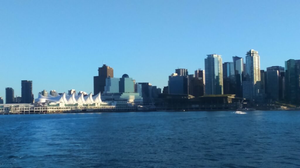
Between Burrard Inlet, English Bay and False Creek, Vancouver’s downtown peninsula concentrates much of a first weekend into a manageable area. Waterfront Station, Gastown, Canada Place, downtown shopping, Yaletown, and the West End form a practical pedestrian chain. Coal Harbour and English Bay add continuous waterfront walking without requiring a cross-city transfer. Stanley Park begins beside that network, but its interior and full seawall quickly add serious distance. Granville Island sits differently, across False Creek and below the Granville Bridge. That contrast defines Vancouver: excellent central walking, followed by transit-supported extensions rather than one endless pedestrian core.
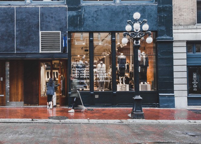
Why Vancouver Works Well on Foot
Waterfront Station is the clearest orientation point for a first visit. Gastown begins just east, while Canada Place and Coal Harbour run west along the harbor. The downtown grid then carries you toward Robson Street, Yaletown, the West End, and English Bay without needing transit. That is Vancouver’s strongest walking geography. The limitation appears when the itinerary crosses False Creek or reaches deep into Stanley Park. Those places are still practical without a car, but they no longer belong to one compact pedestrian cluster.
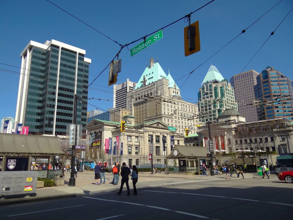
The seawall improves several waterfront links, especially through Coal Harbour, Yaletown, and the West End. It should not be mistaken for evidence that every major attraction is close together. The City describes the Stanley Park seawall alone as roughly nine kilometres, usually taking two to three hours to walk. That makes it a recreational circuit, not a shortcut between central blocks.
Best Areas to Stay for Walking
Downtown around Robson, Burrard, or Vancouver City Centre gives the best balance for a first weekend. Canada Place, Gastown, Yaletown, Coal Harbour, and the West End remain reachable with manageable walks. Coal Harbour suits waterfront access and puts Stanley Park closer without sacrificing downtown convenience. The West End is especially useful for Robson, Denman, English Bay, and the park’s southern entrances. Yaletown works well for False Creek and southern downtown. Gastown is central, but its older street surfaces feel less uniformly smooth.
Realistic Walking Times in Vancouver
Waterfront Station to Canada Place: about 5–7 minutes; Waterfront Station to the Gastown Steam Clock: about 5–8 minutes; Canada Place to Robson Square: about 12–15 minutes; Robson Square to Yaletown-Roundhouse: about 15–18 minutes; Yaletown-Roundhouse to David Lam Park: about 5 minutes; Robson Square to English Bay: about 25–30 minutes; English Bay to Second Beach: about 10–15 minutes. These are practical planning estimates rather than guaranteed walking times.
A 2-Day Walking Route
The two days use different sides of Vancouver’s central visitor geography. Day 1 follows the historic and commercial core toward False Creek. The second day moves west through Robson and Coal Harbour before touching Stanley Park and finishing at English Bay.
Day 1 — Gastown, Waterfront, Downtown and Yaletown
Walking route
Day 1 — Gastown, Waterfront, Downtown and Yaletown
- Maple Tree Square
- Gastown Steam Clock
- Waterfront Station
- Canada Place
- Robson Square
- Yaletown-Roundhouse Station
- David Lam Park
Start at Maple Tree Square and follow Water Street past the Steam Clock to Waterfront Station. Continue to Canada Place before turning inland through the downtown grid toward Robson Square. From there, head south to Yaletown-Roundhouse and finish beside False Creek at David Lam Park. This sequence shows how much of the peninsula works on foot without turning the day into a long waterfront loop.
Granville Island is tempting from the False Creek finish, but it is better treated as a separate extension. Route 50 reaches the island entrance from downtown, while Aquabus and False Creek Ferries operate separate private ferry services. That access is useful, yet it does not make Granville Island part of the same compact downtown walking cluster.
Day 2 — Robson, Coal Harbour, Stanley Park Edge and English Bay
Walking route
Day 2 — Robson, Coal Harbour, Stanley Park Edge and English Bay
- Robson Square
- Robson Street and Bute Street
- Harbour Green Park
- Devonian Harbour Park
- Lost Lagoon
- Second Beach
- English Bay Beach
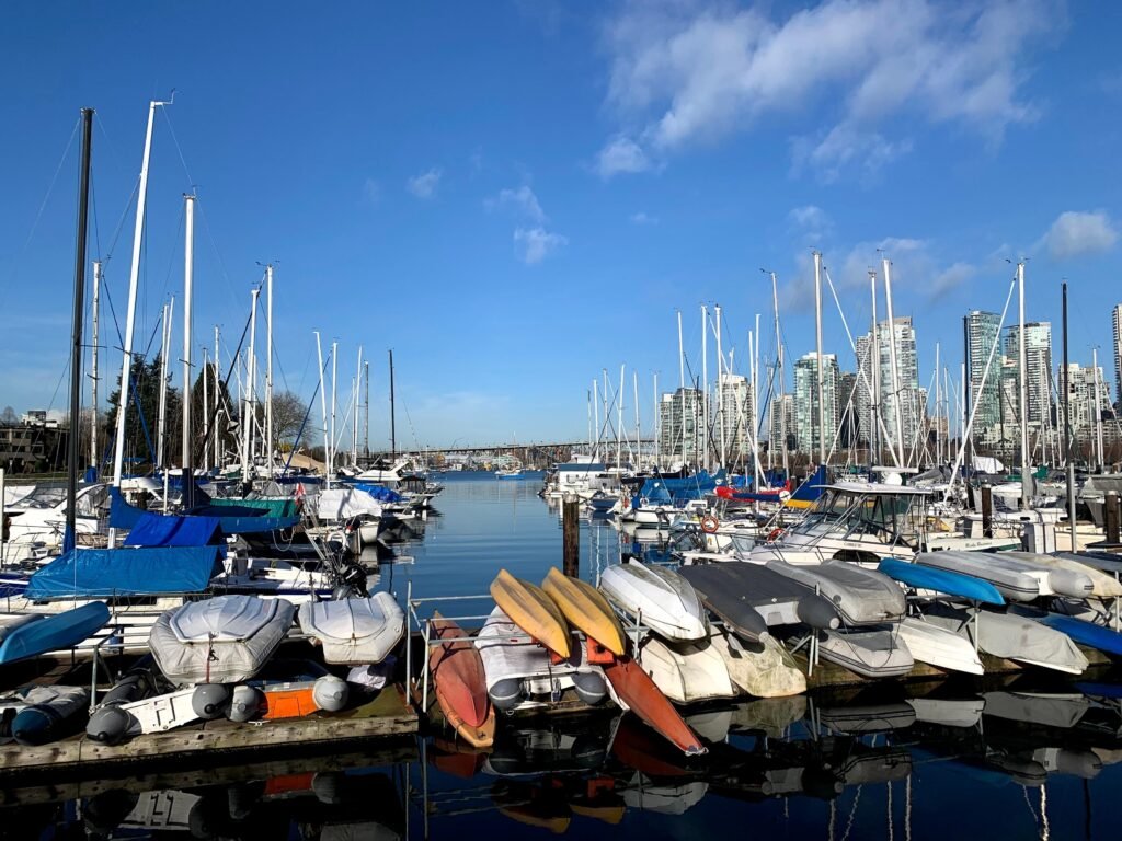
Begin again at Robson Square, then walk west along Robson Street before turning north toward Harbour Green Park. Follow Coal Harbour toward the Georgia Street entrance of Stanley Park and cross into the Lost Lagoon area. Continue only as far as Second Beach, then finish at English Bay. This route samples the park’s near-downtown edge without committing the city day to the full seawall circuit.
How Transit Extends the Weekend
TransLink is most valuable after the central walking geography ends. The Canada Line links Waterfront, Vancouver City Centre, Yaletown-Roundhouse, and YVR Airport. The Expo Line gives fast access eastward, while frequent buses reach Stanley Park, Granville Island, Kitsilano, Main Street, Commercial Drive, and UBC corridors. SeaBus is regular public transit between Waterfront and Lonsdale Quay, not merely a sightseeing ride.
Visitors can tap a contactless debit or credit card, or use a mobile wallet, on the TransLink system. Compass Stored Value gives discounted adult fares, while contactless uses the cash-fare rate. A single fare is valid for 90 minutes across buses, SkyTrain, and SeaBus when the same payment method is used. All weekend travel is charged as one zone, although the YVR Airport AddFare still applies to many airport-origin trips.
Fare amounts can change, so check TransLink’s current pricing before travel if you plan to use contactless payment or a DayPass.
Granville Island and False Creek
Granville Island is close to downtown on a map but separated by False Creek and the Granville Bridge structure. Walking is possible, yet bridge approaches and the under-bridge access add distance compared with a simple downtown block sequence. Route 50 stops at Anderson Street and West 2nd Avenue near the island entrance. Other buses stop near Granville Street and West 5th Avenue, followed by roughly five to ten minutes on foot.
Small ferries are often the most enjoyable visitor connection, but they are separate private operators with their own fares. Treat them as practical local transport rather than proof of continuous pedestrian geography. Kitsilano can extend a south-False-Creek outing, but it is better reached with transit support than forced into the downtown route.
Arriving Without a Car
YVR is one of Vancouver’s strongest car-free advantages. The Canada Line runs directly from YVR-Airport to downtown in under 30 minutes, with the station between the two terminal areas. Canada Line trains run frequently between YVR and downtown. An airport-origin AddFare applies to many trips leaving Sea Island, so check the current TransLink fare before travel.
Pacific Central Station is useful for VIA Rail, Amtrak, and some intercity bus arrivals. It sits east of downtown beside Main Street-Science World SkyTrain station, so the final transfer is straightforward. Canada Place is exceptionally central for cruise passengers, while most air travelers reach downtown through YVR and the Canada Line.
Outer Attractions Without Stretching the Walking Core
Grouse Mountain and Capilano Suspension Bridge belong to the North Shore, not the downtown pedestrian footprint. Both can be visited without a rental car through transit or attraction shuttles. For Grouse, SeaBus plus North Shore bus service is the standard public-transit chain. Capilano currently offers a ticket-holder shuttle from downtown pickup points.
UBC and the Museum of Anthropology are also outer destinations. Frequent buses make them practical, but the campus sits far beyond a normal downtown walking day. The same principle applies to Commercial Drive, Main Street, Queen Elizabeth Park, and farther Kitsilano stops. Walk once you arrive rather than spending limited weekend time on low-value cross-city mileage.
Walking Limitations and Practical Tips
Downtown’s grid is legible, but wide streets and turning traffic can make some crossings feel slower than the map suggests. West Georgia is a particularly important approach to Stanley Park, and the City is actively redesigning it for better connections. Gastown remains close to Waterfront Station, yet aging street and sidewalk surfaces are undergoing longer-term renewal. Long-term street renewal can therefore affect the most comfortable route through Gastown.
On the seawall, follow the marked pedestrian sections and watch for bicycle interactions at crossings and shared transition points. Cycling infrastructure can improve separation on some routes, but pedestrians should still watch for bicycle interactions at crossings and shared transition points. Away from the waterfront, ordinary downtown street conditions still matter.
Seasonal Context
Vancouver remains practical for walking throughout the year, but weather can substantially change comfort. Rain can make long waterfront walks less appealing, while occasional snow, heat or wildfire smoke can change daily plans. Build transit fallbacks into wet days and check air-quality or weather guidance when conditions are unusual.
When a Car Helps
A private car adds little to the standard downtown weekend and can complicate parking around central attractions. It becomes more useful for regional combinations beyond the transit-rich visitor map, especially multiple Sea-to-Sky or remote trail destinations in one day. Grouse, Capilano, UBC, Granville Island, and the main city neighborhoods remain practical without one.
Bottom Line
A downtown-based Vancouver weekend works best as a compact peninsula trip with selected extensions. Walk Gastown, Canada Place, Robson, Yaletown, Coal Harbour, the West End, and English Bay by cluster. Use transit when False Creek, Stanley Park’s scale, the North Shore, or UBC turns a short map impression into real distance. That approach preserves Vancouver’s strongest walking advantages without pretending the entire visitor map is equally compact.