
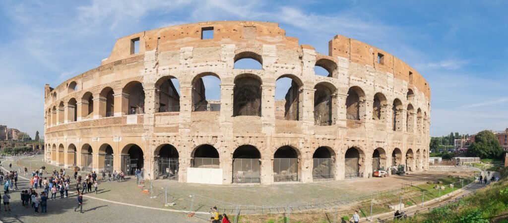
Across the historic center, many of Rome’s headline sights fit into a remarkably tight visitor zone. The Colosseum, Forum, Piazza Venezia, Trevi, Pantheon, Piazza Navona, the Ghetto, and Trastevere connect naturally on foot. That concentration makes long sightseeing walks efficient, even when individual streets are not especially comfortable. Historic paving, constrained sidewalks, crowds, and busy crossings can slow progress more than map distance suggests. The city therefore feels compact without feeling uniformly easy underfoot. Short map distances can still demand patience where historic paving meets heavy pedestrian and vehicle flows.
Why Rome Is Walkable — but Not Effortless
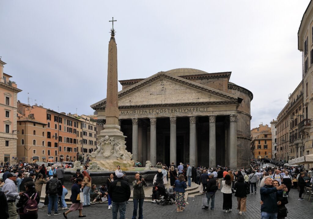
The best argument for walking in Rome is what happens between the landmarks. From the Colosseum, the archaeological spine leads toward Piazza Venezia and the Centro Storico. Farther west, Trevi Fountain, the Pantheon and Piazza Navona sit close enough that taking transit between them would usually waste more time than it saves. Official Turismo Roma itineraries make the same geographic point by linking these central sights into continuous walking days.
The Ghetto, Tiber Island and Trastevere extend that network across the river. A visitor can move from Campo de’ Fiori through Portico d’Ottavia, cross the Tiber and finish around Santa Maria in Trastevere without creating a long stretch of empty transfer mileage. This is high-value walking: the route itself remains part of the sightseeing.
Rome becomes less effortless when the focus shifts from distance to street conditions. The city’s own mobility planning identifies discontinuities even on the Navona–Trevi–Pantheon tourist route, along with undersized pedestrian space and conflicts with motor vehicles. The historic center also retains extensive sampietrini paving. Those conditions do not make Rome a poor walking city, but they are the reason a short map distance can feel slower and more tiring than expected.
Where Rome Works Best on Foot
Centro Storico: the strongest all-day walking base
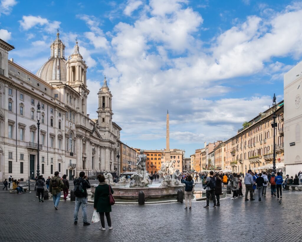
Pantheon, Piazza Navona and Campo de’ Fiori form Rome’s most efficient first-time walking zone. Trevi Fountain is a short extension northeast, while the Ghetto and river sit to the south. If you want to minimize transit and maximize the number of headline sights reached through interesting streets, this is the strongest base.
Ancient Rome and Monti: best for the Colosseum side of the city
Monti places you beside the Colosseum, Roman Forum and the Via dei Fori Imperiali axis while keeping Termini and Metro connections within reach. The walk toward Piazza Venezia is sightseeing in its own right, so staying here works especially well when ancient Rome is the priority.
Vatican, Borgo and Prati: a separate western cluster
Prati is the practical walking base for Vatican Museums and St Peter’s. Once you are in the area, the Vatican, Borgo and Castel Sant’Angelo connect well on foot. The limitation is their position relative to the Colosseum and eastern center. On a short trip, Metro A usually makes more sense than turning the cross-city connection into a long transfer walk.
Ghetto and Trastevere: best river-linked continuation
The Jewish Ghetto, Tiber Island and Trastevere fit naturally after Campo de’ Fiori or Castel Sant’Angelo. The bridges are part of the route rather than barriers, and the distances stay reasonable. Trastevere itself has no Metro station in its core, so buses and trams become more useful when you are leaving the neighborhood for a farther part of the city.
Representative Walking Times
At a normal city pace, plan on roughly 20 minutes from the Colosseum to Trevi Fountain if you walk it directly, though Day 1 breaks that distance into worthwhile stops. Trevi to the Pantheon is about 7–10 minutes, and the Pantheon to Piazza Navona is only about 5–10 minutes. These short connections explain why walking dominates the central sightseeing core.
The Vatican needs more planning. After the standard public exit from the Vatican Museums, reaching St Peter’s Square generally means walking around the Vatican walls for about 15–20 minutes; do not plan around an internal shortcut. From Castel Sant’Angelo to Campo de’ Fiori, roughly 15 minutes is a useful planning estimate. These are practical planning estimates rather than guaranteed walking times, and crowds can materially slow the central routes.
Where to Stay for a Walking-First Weekend
Centro Storico around the Pantheon and Piazza Navona is the best overall position for a first visit because the baroque core, Trevi, Campo de’ Fiori, the Ghetto and the river are close in multiple directions. The trade-off is limited direct Metro coverage, so you will rely heavily on walking and occasional buses.
Monti is the strongest alternative for ancient Rome and easy access to Termini-side transport. Prati makes the Vatican exceptionally easy and gives you Metro A for the rest of the city. Trastevere is attractive for river-side walking and evenings, but it is less convenient for rail-based cross-city travel because the neighborhood core lacks a Metro station.
A 2-Day Rome Route Built Around Walking
These routes do not try to prove that every famous Rome sight belongs in one giant loop. Day 1 stays inside the ancient-to-baroque core, where walking continuously adds value. Day 2 starts in the separate Vatican cluster, then follows the river and historic streets toward Trastevere. That structure keeps the walking scenic and cuts the low-value cross-city mileage.
Day 1: Ancient Rome to the Baroque Core
Walking route
Day 1: Ancient Rome to the Baroque Core
- Colosseum
- Roman Forum
- Capitoline Hill
- Piazza Venezia
- Trevi Fountain
- Pantheon
- Piazza Navona
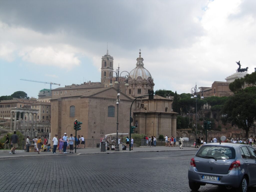
Start at the Colosseum and continue through the Roman Forum. If you enter the Forum and Palatine, remember that the archaeological site adds far more walking than the street-route estimate. Climb to Capitoline Hill, then descend toward Piazza Venezia. This keeps the ancient section moving west rather than forcing a return to the Colosseum.
From Piazza Venezia, continue to the Trevi Fountain, then walk the short central link to the Pantheon and finish at Piazza Navona. The anchors are only about 4–5 km apart in total, but a full Colosseum/Forum visit can turn the day into a substantial amount of walking. If you book long interior visits, shorten optional detours rather than chasing a step count.
Day 2: Vatican, Castel Sant’Angelo, Ghetto and Trastevere
Walking route
Day 2: Vatican, Castel Sant’Angelo, Ghetto and Trastevere
- Vatican Museums
- St Peter’s Square
- Castel Sant’Angelo
- Ponte Sant’Angelo
- Campo de’ Fiori
- Portico d’Ottavia
- Tiber Island
- Basilica of Santa Maria in Trastevere
Use Metro A to start near the Vatican if your hotel is elsewhere in central Rome. Begin at the Vatican Museums, then walk around the walls to St Peter’s Square. From there, follow the ceremonial axis toward Castel Sant’Angelo and cross Ponte Sant’Angelo into the historic center.
Continue through Campo de’ Fiori to Portico d’Ottavia in the Ghetto, then cross via Tiber Island and finish at Santa Maria in Trastevere. This creates a one-direction route of roughly 5–6 km after reaching the Vatican area. Use transit for the return instead of walking the same streets back.
Getting Around Rome Without a Car
Rome’s Metro is most useful when it connects the walking clusters rather than replacing walking inside them. Line A serves the Spanish Steps side of the center and the Ottaviano/Cipro approaches to the Vatican. Line B connects Termini with the Colosseum area, while Line C now reaches Colosseo/Fori Imperiali after the new central stations opened in December 2025. Pantheon, Piazza Navona and inner Trastevere still depend more on walking and surface transport.
Payment is straightforward. ATAC’s standard BIT costs €1.50 and is valid for 100 minutes, while current 24-, 48- and 72-hour products cost €8.50, €15 and €22. Tap&Go lets you use a supported contactless card or device at Metro gates and on surface services. For a walking-first weekend, pay-as-you-go can be more sensible than automatically buying an unlimited pass unless you expect several rides each day.
Normal Metro hours also support evening sightseeing. The network generally runs from about 5:30 a.m. to 11:30 p.m. Sunday through Thursday and to about 1:30 a.m. on Friday and Saturday nights, with night buses extending mobility afterward. Always check live ATAC alerts before the trip because construction can temporarily change the best route.
Arriving in Rome Without a Car
Fiumicino Airport is straightforward by rail. The airport station is inside the terminal complex, and the Leonardo Express runs non-stop to Roma Termini in about 32 minutes. Aeroporti di Roma publishes departures roughly every 15 minutes across a long daily operating span. The FL1 regional train is useful when another Rome station fits your hotel better, but it does not serve Termini.
Ciampino Airport has a workable but less direct public-transport chain. Trenitalia’s Ciampino Airlink combines a dedicated airport bus with the rail station for onward travel to Termini, while airport coaches provide another common option. The extra transfer or road segment makes the journey less direct than arriving from Fiumicino by rail.
For intercity and high-speed rail travelers, Roma Termini is an unusually convenient gateway. You arrive inside the city with Metro A and B plus a large surface-transport network immediately available. Many central hotels still require one onward ride or a luggage walk, but renting a car adds no advantage for the normal weekend described here.
When a Car Becomes Useful
A private car is unnecessary for the standard Rome city break and can become a burden in the historic center. It becomes more useful when the trip expands into rural Lazio, dispersed archaeological sites, countryside lodging or a multi-stop regional road trip that is awkward to assemble by train and bus. For central Rome, the practical combination remains walking plus public transport.
Walking Limitations to Expect
Sampietrini paving is the most persistent comfort issue. Even supportive footwear does not make every stone surface smooth, and rolling luggage can be especially awkward. Historic paving is not a temporary construction problem; it is part of the normal walking environment in the center.
Sidewalk and crossing quality also varies. Some central piazzas and pedestrian-priority streets are excellent, while other blocks squeeze pedestrians beside traffic or funnel them through large intersections. Rome’s mobility planning specifically identifies route-continuity problems in the tourist center, so a dense attraction map should not be confused with consistently wide, protected pedestrian space.
Crowds are another practical limiter. Trevi, Pantheon, Piazza Navona, the Colosseum approaches and Vatican entrances can move much slower than an ordinary street. Build time around the attraction entrance you actually need, especially at the Vatican and archaeological sites, rather than relying only on point-to-point distance.
Practical Walking Tips
Wear shoes that handle stone surfaces rather than choosing footwear only for distance. Treat the shortest map line as a suggestion around the Forum, Palatine and Vatican walls because entrances and controlled-access spaces can force a longer legal route. Use Metro for the Vatican-to-eastern-core jump or any connection where the next 30–45 minutes would mostly be transfer mileage.
For the central baroque core, do the opposite: walk. Trevi, Pantheon, Piazza Navona, Campo de’ Fiori and the Ghetto are close enough that waiting for a bus often adds complexity without saving meaningful time. Check ATAC service alerts on the day you travel, especially when a route depends on a tram or a specific Metro station.
Seasonal Walking Note
Rome supports a walking-focused visit throughout the year, but seasonal conditions change the experience. Summer heat can make the exposed Forum, Palatine and large piazzas tiring at midday, while rain can make polished stone and sampietrini more slippery. Spring and fall often suit long walking days especially well.
Bottom Line
Rome works exceptionally well as a walking-first city break, but not because every street is easy. The central sightseeing geography is the major advantage: ancient Rome, the baroque core, the Ghetto and Trastevere can fill long days with very little empty mileage. The trade-off is a rougher pedestrian environment than the attraction map suggests, with historic paving, variable sidewalks, traffic interaction and crowding. Treat the Vatican as a separate cluster, use Metro and surface transport for the gaps, and a private car is unnecessary for a typical 2–3 day visit.