
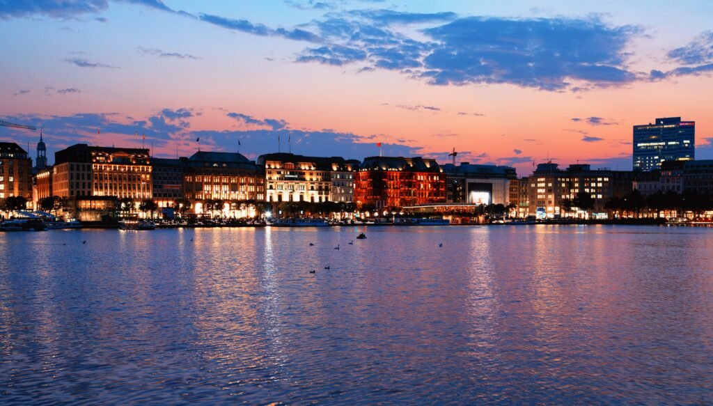
Water shapes Hamburg’s visitor map more than street distance alone suggests. The strongest walking chain runs from Hauptbahnhof through thple Altstadt to Speicherstadt and the Elbphilharmonie. Around Rathaus and Jungfernstieg, recent public-space upgrades give pedestrians generous room beside the Binnenalster. Southward, bridges and canals create attractive routes but occasionally force indirect crossings. Westward, the harbor promenade continues toward Landungsbrücken, St. Pauli and the Reeperbahn, stretching the weekend footprint. Flat terrain keeps the mileage manageable. Hamburg therefore works best when you walk the central waterfront in sections and use rail for longer repositioning.
Why Hamburg Works Well on Foot
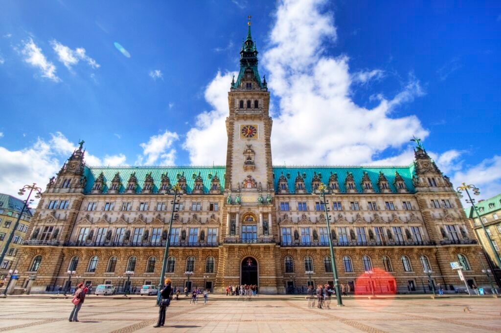
Hamburg’s best walking geography sits between Hauptbahnhof, the Binnenalster and the Elbe. Mönckebergstraße leads into the Altstadt, while Rathausmarkt and Jungfernstieg form a clear central hinge. From there, Deichstraße and the canal crossings pull the route naturally toward Speicherstadt and HafenCity. An official city-center walking tour follows essentially this same chain before finishing at the Elbphilharmonie.
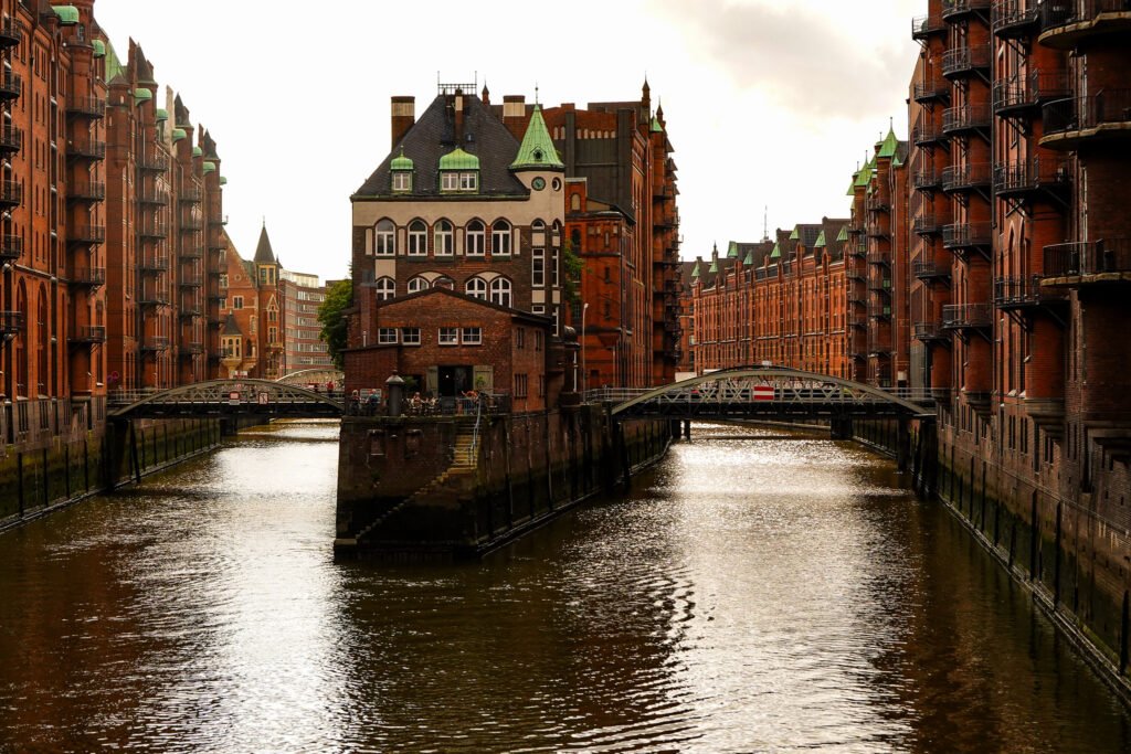
The pedestrian environment is strongest around the central shopping streets, Rathaus and Jungfernstieg. The permanent Jungfernstieg redesign was completed in spring 2026, with wider walking space and improved crossings. Speicherstadt is more intricate because bridges and canals dictate the route, yet it remains rewarding on foot. HafenCity adds broad promenades and public spaces, though its blocks become larger as you move east.
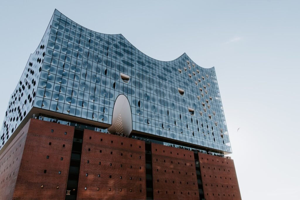
The main geographic limitation appears west of the Elbphilharmonie. Landungsbrücken, St. Pauli and the Reeperbahn remain connected to the central waterfront, but they add meaningful mileage. A visitor can walk the whole chain, yet doing so repeatedly wastes time and energy. Hamburg is therefore easy without a car without being compact enough to cover every headline area entirely on foot.
Best Areas to Stay for a Walking Weekend
Altstadt and Rathaus–Jungfernstieg: the strongest all-around base for a first visit. Rathaus, Binnenalster, central shopping streets and Speicherstadt are close, while rail connections shorten trips west.
Neustadt: a balanced base between the Binnenalster and harbor. St. Michael’s Church, Planten un Blomen, Rathaus and Landungsbrücken are all realistic walks from much of the district.
Speicherstadt and HafenCity: ideal if the maritime architecture and Elbphilharmonie are priorities. The trade-off is a longer trip toward St. Pauli and the Reeperbahn, especially from eastern HafenCity.
St. Pauli: best for harbor access, the Reeperbahn and evening activity. Use U-Bahn or S-Bahn when the next day begins around Hauptbahnhof, Rathaus or the eastern center.
St. Georg and the Hauptbahnhof edge: strongest for rail convenience and airport arrival. The Altstadt and Binnenalster are close, but Landungsbrücken and St. Pauli are better reached by train.
Realistic Walking Times
These are practical planning estimates rather than guaranteed walking times. Bridge approaches, crowds, construction and exact entrances can change the actual time.
Hauptbahnhof to Rathaus: about 15 minutes. This is an easy first central walk through the main shopping core.
Rathaus to Jungfernstieg: about 5 minutes. The two anchors effectively function as one central visitor cluster.
Rathaus to Speicherstadt: about 12–15 minutes. Deichstraße makes a useful historic link on the way south.
Speicherstadt to Elbphilharmonie: about 12–15 minutes. Canals and bridges make the route more interesting than the raw distance suggests.
Elbphilharmonie to Landungsbrücken: about 20 minutes. This is a pleasant waterfront extension when weather and energy cooperate.
Landungsbrücken to Spielbudenplatz/Reeperbahn: about 10 minutes. The harbor and St. Pauli connect closely once you are already west.
Hauptbahnhof to Landungsbrücken: roughly 35–40 minutes. Rail is usually the better choice when the walk would only repeat central mileage.
A 2-Day Walking-Focused Route
These two days divide Hamburg along its natural visitor geography instead of forcing one long waterfront march. Day 1 follows the strongest central chain from Hauptbahnhof to the Elbphilharmonie. For the second day, begin west of the center and continue through Neustadt toward Landungsbrücken and St. Pauli. The route finishes near convenient rail connections for an easy return.
Day 1: Hauptbahnhof, Rathaus, Speicherstadt and Elbphilharmonie
Walking route
Day 1: Hauptbahnhof, Altstadt, Speicherstadt and Elbphilharmonie
- Hamburg Hauptbahnhof
- St. Peter's Church
- Hamburg City Hall / Rathausmarkt
- Jungfernstieg / Binnenalster
- St. Nikolai Memorial
- Deichstraße
- Speicherstadt / Wasserschloss
- Elbphilharmonie
Start at Hauptbahnhof and walk west through the Altstadt toward St. Peter’s Church and Rathausmarkt. Make the short detour to Jungfernstieg for the Binnenalster before turning south. Continue past St. Nikolai and Deichstraße, then cross into Speicherstadt. Finish at the Elbphilharmonie after roughly 4.8 kilometers of active route walking.
This route concentrates Hamburg’s most continuous sightseeing terrain into one direction of travel. It avoids using transit for short central hops, yet it does not force a return to Hauptbahnhof. Baumwall U-Bahn station provides a simple exit after the Elbphilharmonie if your hotel is elsewhere.
Day 2: Neustadt, Landungsbrücken and St. Pauli
Walking route
Day 2: Neustadt, Landungsbrücken and St. Pauli
- Planten un Blomen
- St. Michael's Church
- Krameramtsstuben
- St. Pauli Landungsbrücken
- Old Elbe Tunnel north portal
- Spielbudenplatz
- Reeperbahn
- Beatles-Platz
Begin at Planten un Blomen, then walk south through Neustadt to St. Michael’s Church and the Krameramtsstuben. Continue downhill toward Landungsbrücken and the Old Elbe Tunnel entrance. From the harbor, move inland to Spielbudenplatz and follow the Reeperbahn west to Beatles-Platz.
The route finishes near Reeperbahn S-Bahn station, so there is no reason to retrace the harbor promenade. If you want more Elbe scenery, add public ferry 62 from Landungsbrücken toward Övelgönne or Finkenwerder. Treat it as a separate harbor outing rather than an extension of the walking route.
When U-Bahn, S-Bahn, Buses and Ferries Help
Hamburg’s transit network is what turns a long waterfront city into an easy car-free weekend. U-Bahn and S-Bahn cover the principal visitor corridors, while buses fill the gaps. The S-Bahn is particularly useful along the Hauptbahnhof–Jungfernstieg–Landungsbrücken–Reeperbahn axis, and the U3 provides a useful loop around the harbor-facing center.
Weekend service is a major strength. hvv states that U-Bahn and S-Bahn lines run through the night before weekends and public holidays. That makes evening returns from St. Pauli unusually easy without a taxi or private car.
Public ferries are particularly useful for extending a harbor-focused day without adding unnecessary waterfront mileage. Line 62 links Landungsbrücken with Fischmarkt, Dockland, Övelgönne and Finkenwerder using the standard hvv fare system. It is useful for extending a harbor-focused day while avoiding long, low-value walks along working waterfront corridors.
Ticketing is integrated but requires a little attention. Single and day tickets are available through hvv apps, machines and online channels, with a stated discount for digital purchase. The Hamburg CARD can be useful when its attraction discounts match your plans, but it is not automatically the best value for every walking-heavy itinerary.
Arriving in Hamburg Without a Car
Hamburg Airport has one of the simpler arrival chains for a major city weekend. The S1 runs directly between the airport and Hauptbahnhof every 10 minutes, with a published trip of about 25 minutes. The airport rail station is directly accessible from the arrivals areas of Terminals 1 and 2.
Intercity rail arrival is even more central. Hamburg Hauptbahnhof sits beside the eastern edge of the main sightseeing core, near Mönckebergstraße, St. Georg and the Binnenalster. Many central hotels can be reached on foot, while U-Bahn and S-Bahn handle luggage-heavy or west-side stays.
When a Car Helps
A private car is unnecessary for the standard Hamburg weekend. Parking and urban traffic add little value when the main visitor districts are connected by walking, rail and ferries. Even harbor extensions such as Övelgönne are practical by public transport.
A car becomes more useful only when Hamburg is the starting point for a road-based regional itinerary with several dispersed rural stops. If that is your plan, collect the car after the city stay rather than carrying it through the central weekend.
Walking Limitations and Practical Tips
The biggest walking limitation is cumulative distance. Hamburg’s visitor geography stretches from Hauptbahnhof through the Altstadt and HafenCity to St. Pauli. Walking every link once can be enjoyable; repeating the same east-west mileage quickly becomes inefficient.
Water also shapes route directness. Speicherstadt and HafenCity contain canals, basins, bridges and quay edges, so the nearest visible landmark may require an indirect crossing. Keep the next bridge in mind rather than relying on straight-line map distance.
Busy intersections, cycle traffic and active harbor infrastructure require attention even where sidewalks are continuous. Jungfernstieg and the main central pedestrian streets are especially comfortable, while large transport nodes and waterfront approaches can feel less seamless.
Seasonal Walking Conditions
Hamburg’s underlying distances do not change by season, but waterfront comfort does. Spring and early fall are generally well suited to long mixed walking-and-transit days. Summer offers long daylight, while winter brings shorter days, cold and more exposure to wind or rain along the Elbe. Use transit more aggressively when conditions make open waterfront mileage less appealing.
Bottom Line
Hamburg works best as a series of connected waterfront walking sections rather than one compact pedestrian core. The Altstadt, Binnenalster, Speicherstadt and western HafenCity form the strongest continuous route. Landungsbrücken and St. Pauli add valuable but longer extensions. With U-Bahn, S-Bahn and public ferries available for those gaps, a private car adds little to a first-time weekend.