
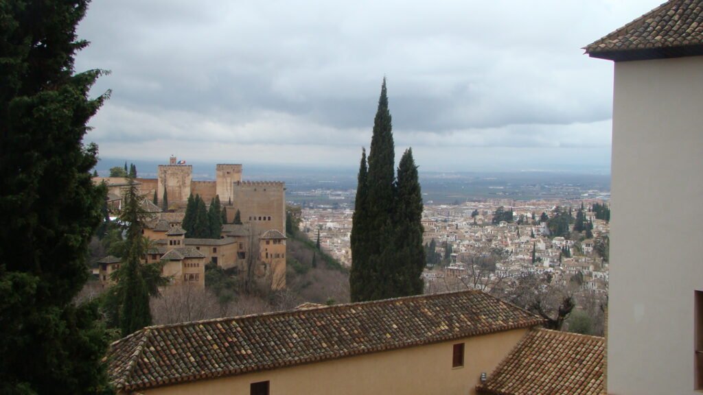
Granada compresses many first-visit sights into a tight center, then stacks signature neighborhoods onto steep hills above it. Around the Cathedral, Plaza Nueva, and Realejo, most visitor errands and sights fit into short, connected walks. The Darro corridor then narrows the route between the Alhambra and Albaicín before the pavement begins climbing sharply. Official accessible itineraries rate the center-to-Alhambra walk as high difficulty over 2.3 kilometers. Upper Albaicín and Sacromonte add even steeper gradients, irregular lanes, and more demanding surfaces. This creates a city where distances look modest, but elevation often decides whether walking remains efficient.
Why Granada Works Well on Foot
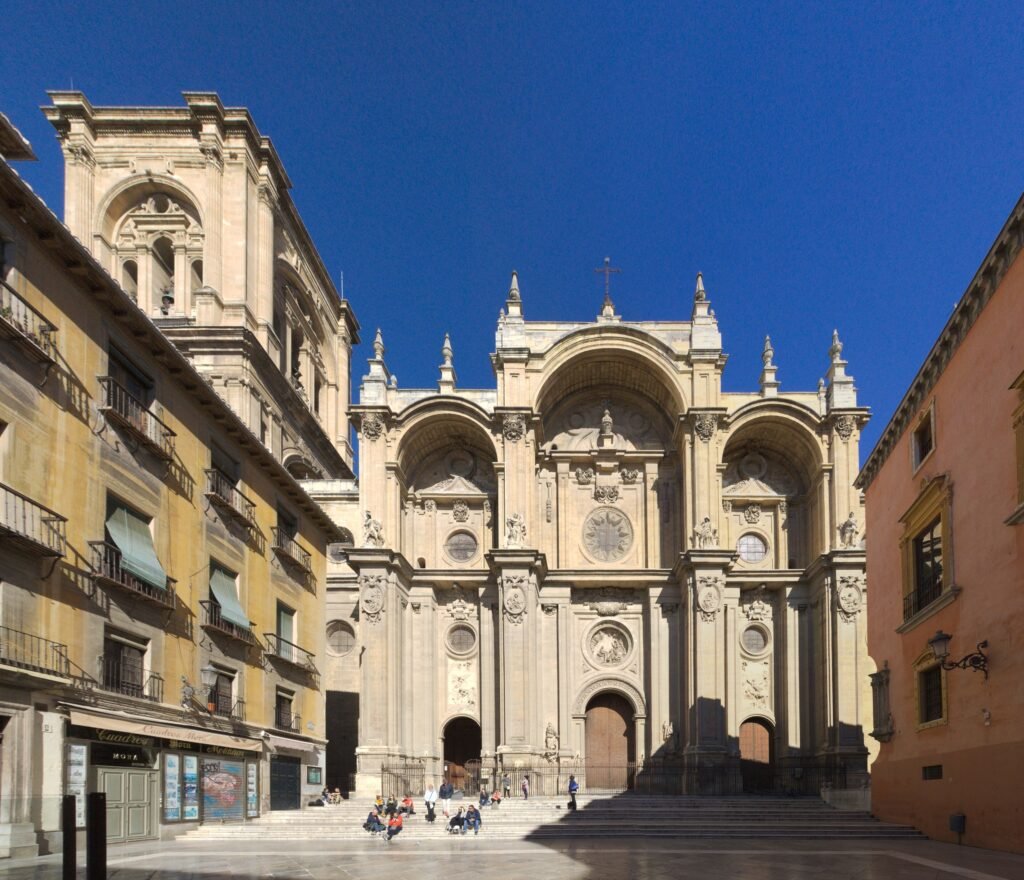
Granada’s strongest walking zone runs from Puerta Real and the Cathedral through Plaza Nueva to the lower Darro. The city’s 2026 visitor guide groups the Cathedral, Royal Chapel, Alcaicería, Corral del Carbón, Bib-Rambla and Plaza Nueva into a compact walking route. That makes the first half of a weekend unusually efficient. Realejo sits directly southwest and adds historic streets, plazas, cafés and visitor services without requiring a separate cross-city transfer.
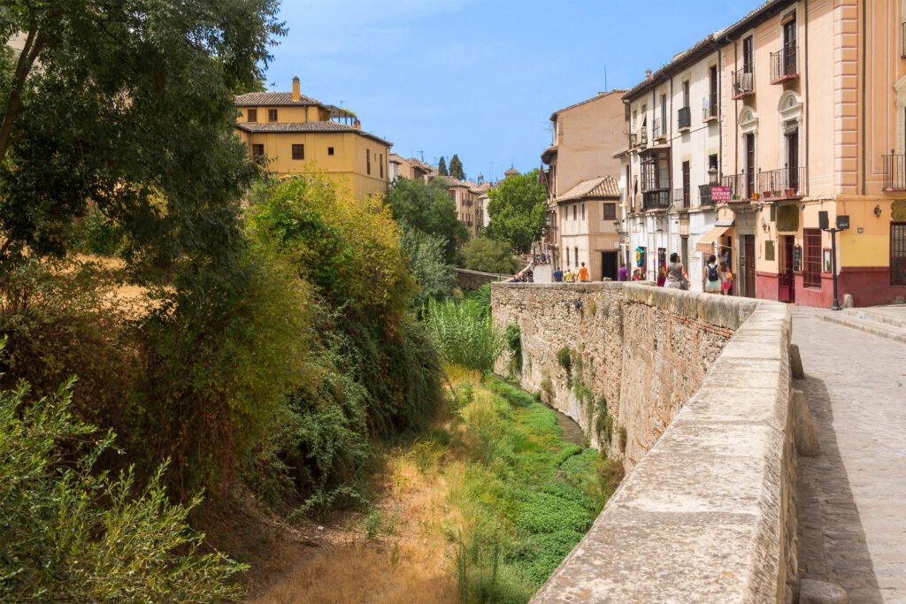
The character changes quickly on the slopes. Carrera del Darro is a rewarding pedestrian corridor, but the streets above it become narrower, steeper and less direct. The official accessibility map rates the walk from Plaza del Carmen to Cuesta del Chapiz as high difficulty. The upper Albaicín continues through very steep lanes toward San Nicolás and other viewpoints. Sacromonte extends the same hillside pattern farther east, making its cave district better treated as a separate walking objective.
Best Areas to Stay for a Walking Weekend
Centro, Cathedral and Plaza Nueva: This is the strongest default for a first visit. You can reach the Cathedral, Royal Chapel, Alcaicería, Realejo and lower Darro on foot, while hill minibuses are close when the terrain turns upward. The municipal accommodation directory lists many options across these central zones.
Realejo: Choose this area if you want a central base with a slightly more neighborhood-focused feel. Campo del Príncipe and lower Realejo connect naturally with the historic center. The district also creates an efficient downhill finish after visiting the Alhambra, although its upper streets still climb.
Plaza Nueva and lower Albaicín: This edge works well when Carrera del Darro and Albaicín atmosphere matter more than perfectly flat walking. You remain close to the center while avoiding the full luggage burden of the upper hill. Upper Albaicín is more atmospheric but less convenient for travelers who dislike steep approaches or uneven surfaces.
Realistic Walking Times
Granada’s official accessible-itinerary map is especially useful because it pairs distance with difficulty. The times below are route estimates, not promises; gradients and historic surfaces matter as much as mileage.
| Walk | Distance | Official time | Difficulty |
|---|---|---|---|
| Plaza del Carmen to Cathedral via Corral del Carbón | 300 m | 3 min | Low |
| Plaza del Carmen to Alhambra | 2.3 km | 30 min | High |
| Plaza del Carmen to Paseo de los Tristes / Cuesta del Chapiz | 1.4 km | 20 min | High |
| Cuesta del Chapiz to Palacio de Dar al-Horra | 1.25 km | 25 min | Very high |
| Plaza del Carmen to Sacromonte Abbey | 2.9 km | 41 min | High |
The useful lesson is simple: Granada’s map can make hill destinations look deceptively close. A 20-minute flat walk in Centro is not comparable with a 20-minute climb through Albaicín. Use distance and gradient together when building each day.
A 2-Day Walking Route
Day 1: Cathedral, Darro and Albaicín
Walking route
Day 1: Cathedral, Darro and Albaicín viewpoints
- Granada Cathedral
- Alcaicería
- Corral del Carbón
- Plaza Nueva
- El Bañuelo
- Paseo de los Tristes
- Casa del Chapiz
- Mirador de San Nicolás
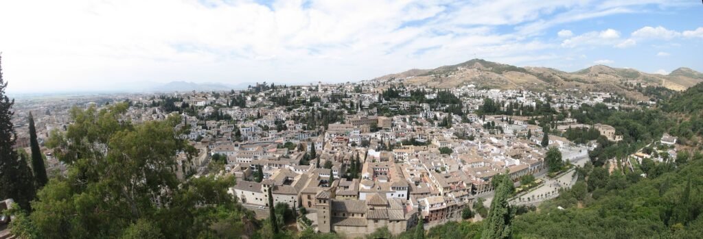
Start at Granada Cathedral, cut through the Alcaicería and Corral del Carbón, then use Plaza Nueva as the transition toward Carrera del Darro. This keeps nearly every early kilometer sightseeing-rich. Continue past El Bañuelo and Paseo de los Tristes before climbing through Cuesta del Chapiz toward Mirador de San Nicolás. The climb is the day’s main physical effort. If your legs are finished, use C31 for the return rather than retracing the steep descent solely on foot.
Day 2: Alhambra, Generalife and Realejo
Walking route
Day 2: Alhambra, Generalife and Realejo descent
- Alhambra Generalife Entrance Pavilion
- Generalife
- Nasrid Palaces
- Palace of Charles V
- Puerta de la Justicia
- Carmen de los Mártires
- Campo del Príncipe
- Cuarto Real de Santo Domingo
- Plaza del Carmen
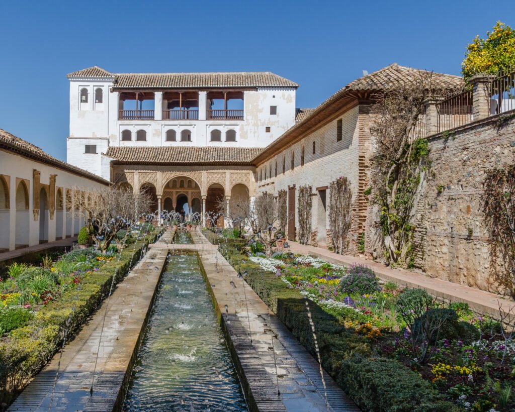
Use C30 from the current Plaza Isabel la Católica/Pavaneras terminus to climb to the Alhambra. This replaces the official 2.3-kilometer, high-difficulty ascent from the center with a short transit repositioning. Inside the complex, let your timed Nasrid Palaces entry determine the exact sequence. After the monument, exit toward Puerta de la Justicia and descend through Carmen de los Mártires, Campo del Príncipe and lower Realejo to Plaza del Carmen. That direction avoids an unnecessary second climb.
Using Transit Without Overusing It
Granada’s small hill buses matter more to most visitors than the light rail. C30 serves the Alhambra, C31 serves Albaicín, C32 normally links Alhambra and Albaicín, and C34 serves Sacromonte. A city-bus single ticket costs €1.60, accepts card payment and includes 60 minutes of free transfers between bus lines. C31 also extends until 1:00 a.m. on Fridays, Saturdays and holidays.
The metropolitan light rail is more useful for the railway station, bus station, university areas and southern districts. It does not run through the old visitor core. Normal service ends at 11:00 p.m. on most nights and 2:00 a.m. on Fridays and Saturdays. Saturday trains run about every ten minutes through most of the daytime and evening. Metro and city-bus ticketing remain separate, so occasional visitors should choose the simplest product for each trip.
Arriving Without a Car
Federico García Lorca Granada-Jaén Airport has a direct bus into Granada. Aena lists central stops including Gran Vía de Colón and Paseo del Violón and gives about 45 minutes for the full journey. The airport is roughly 17 kilometers from the center. That is a simple arrival chain, but it is not a high-frequency airport-rail service, so check the current timetable before landing.
Rail arrivals are easier. Granada station is on Avenida de los Andaluces inside the urban area, with buses and light rail available for onward travel. The main bus station sits farther north, but Line 33 runs directly to the Cathedral and other central stops. Once you reach the center, the hill minibuses handle the remaining Alhambra, Albaicín and Sacromonte connections.
When a Car Helps
A private car adds little to the normal Granada city weekend. Vehicle access is controlled across parts of Centro, Realejo, Albaicín and Sacromonte, while central parking and hotel access can require advance planning. A car becomes more useful when Granada is the start of a wider road trip through Sierra Nevada, the Alpujarras or several smaller provincial destinations. For the city itself, walking plus buses is usually simpler.
Walking Limitations and Practical Tips
Treat elevation as a scheduling problem rather than a challenge to conquer. Use the bus for one uphill leg, then walk downhill through a rewarding neighborhood whenever the route permits. Shoes with stable grip help on textured historic paving. Travelers with limited mobility should review the city’s accessibility map carefully because some headline routes and monuments remain difficult despite short distances.
Reserve the Alhambra before building the rest of the weekend. Nasrid Palaces access is tied to the time on your ticket, and Granada Card purchases also require selecting an Alhambra date and time. Give that fixed slot priority, then arrange the center and Albaicín around it. This is more reliable than trying to fit the Alhambra spontaneously into an otherwise flexible walking day.
Seasonal Walking
Granada’s street pattern does not change with the season, but the effort of its hills does. The city’s tourism office warns that summers can be very hot and winters cold. In summer, put the Alhambra and Albaicín climbs in the morning or later afternoon. Save the flatter Cathedral, shopping streets and lower Realejo for the hottest part of the day, and carry water on hill routes.
Bottom Line
Granada is a strong car-free weekend city because its central monuments sit close together and buses solve the least efficient climbs. The tradeoff is physical rather than geographic: upper Albaicín, the Alhambra and Sacromonte demand real elevation and less forgiving surfaces. Stay in Centro, Realejo or the lower Albaicín edge, walk the compact historic routes, and use a hill minibus strategically. That balance preserves the city’s best street-level experience without turning every day into an endurance test.