
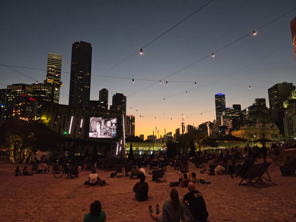
One compact grid does most of the work for a first-time visit, with Federation Square anchoring the southern edge. Flinders Street’s lanes, Collins Street arcades, Bourke Street Mall, Chinatown, and State Library link through short, legible blocks. Southbank and NGV sit just across the Yarra, reached by bridges and continuous promenades rather than a separate transit trip. Queen Victoria Market stretches the core northward, while Carlton Gardens and Melbourne Museum form a distinct but walkable extension. Beyond that, Fitzroy and Docklands are better treated as separate neighborhoods, even though trams make both easy to reach.
Why Melbourne Works Well on Foot
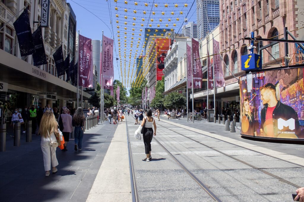
The strongest walking chain runs from Federation Square through Flinders Street’s lanes and into the retail grid. City of Melbourne’s official arcades-and-lanes walk covers about 2.4 kilometres, illustrating the short internal scale. Degraves Street, Centre Place, Block Arcade, Royal Arcade and Bourke Street Mall sit close enough for continuous exploration. Chinatown and State Library then extend the same pedestrian network north and east without requiring transit.
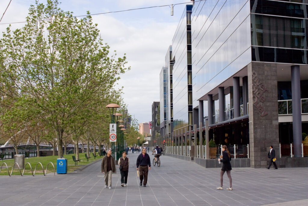
Southbank works as a genuine pedestrian extension rather than a separate district reached only by transit. Princes Bridge links Federation Square and Flinders Street directly with Arts Centre Melbourne and NGV International. The riverside promenade provides another continuous east-west path, with little meaningful elevation along the central stretch. NGV lists its St Kilda Road gallery about 500 metres from Flinders Street Station.
Where the Walking Core Ends
Queen Victoria Market is the first meaningful stretch beyond the tight CBD chain, but it remains a natural walking extension. State Library is roughly 8–11 minutes from the market, depending on the entrance used. Carlton Gardens and Melbourne Museum sit farther north, about 13 minutes from State Library and roughly 17–20 minutes from the market. Fitzroy is another step outward, while Docklands is close to Southern Cross but removed from the main sightseeing sequence.
Best Areas to Stay for Walking
For the easiest walking weekend, stay inside the CBD between Flinders Street, State Library, Queen Street and Spring Street. This keeps the laneways, arcades, Chinatown and most central tram stops within short walks. Southbank is also practical for the river, Arts Centre and NGV, with quick bridge access back into the CBD. A Southern Cross base improves airport arrival and Docklands access but adds distance to Federation Square and the eastern CBD.
Walking Times Between Major Melbourne Sights
Federation Square to State Library Victoria takes about 12 minutes and covers roughly 1.1 kilometres. State Library to Queen Victoria Market is about 8–11 minutes, depending on the market entrance. From the market, Melbourne Museum is roughly 17–20 minutes on foot. Flinders Street Station to NGV International is about 500 metres. Southern Cross to Docklands takes around nine minutes, while Federation Square is roughly 23 minutes from Southern Cross. These are practical planning estimates rather than guaranteed walking times.
A 2-Day Walking Route
The two days use different parts of Melbourne’s visitor footprint. Day 1 follows the compact CBD chain, while Day 2 pairs a northern walk with one useful tram reposition.
Day 1 — Federation Square, Laneways, Arcades and State Library
Walking route
Day 1 — Federation Square, laneways, arcades and State Library
- Federation Square
- Hosier Lane
- Flinders Street Station
- Degraves Street
- Centre Place
- Block Arcade
- Royal Arcade
- Bourke Street Mall
- Chinatown Melbourne
- State Library Victoria
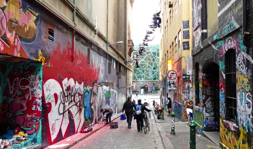
Start at Federation Square, step east into Hosier Lane, then turn west through the Flinders Street laneway network. Continue through Degraves Street and Centre Place before crossing Collins Street through Block Arcade. Royal Arcade leads naturally toward Bourke Street Mall, followed by Chinatown on Little Bourke Street. Finish at State Library Victoria, leaving Queen Victoria Market and Carlton for the second day.
Day 2 — Queen Victoria Market, Carlton and Southbank
Walking route
Day 2 — Queen Victoria Market, Carlton and Southbank
- Queen Victoria Market
- Carlton Gardens
- Melbourne Museum
- Southbank Promenade
- Arts Centre Melbourne
- NGV International
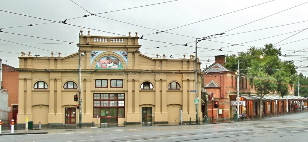
Begin at Queen Victoria Market and walk northeast through the northern CBD toward Carlton Gardens and Melbourne Museum. After the museum, Route 96 provides a useful cross-city reposition from Stop 11 toward Southbank. Alight at Casino/MCEC, then follow Southbank Promenade east along the Yarra. Finish with Arts Centre Melbourne and NGV International, keeping the final arts cluster entirely on foot.
Using Trams, Trains and the Free Tram Zone
Melbourne’s Free Tram Zone covers the CBD and Docklands, including the main central visitor corridor. Trips made entirely inside that zone require no myki tap, which is particularly useful for short central repositioning. Outside the zone, full-fare visitors can use eligible contactless Visa or Mastercard cards, phones and watches. The Metro Tunnel is operational, adding Town Hall and State Library stations to the central rail network.
Weekend and evening coverage is another strength, with Night Network services supplementing normal late trains, trams and buses. Route 96 is especially useful because it links Melbourne Museum, the CBD, Southern Cross and Southbank before continuing toward St Kilda.
Arriving from Melbourne Airport Without a Car
Melbourne Airport does not have a passenger rail connection. SkyBus City Express provides the simplest public-transport link between the terminals and Southern Cross Station, with frequent service throughout most of the day. The trip takes around 30 minutes in typical conditions. Southern Cross is central, although many hotels still require an onward walk or local transit connection with luggage.
When a Car Helps
A private car adds little to the standard CBD, Southbank, market and Carlton weekend. Trams are generally more useful for Fitzroy, St Kilda and other inner-city extensions, while central parking creates extra friction. A car becomes more defensible for regional day trips such as the Great Ocean Road or Phillip Island. Those trips are regional excursions rather than part of a central Melbourne weekend.
Walking Limitations and Practical Tips
The main walking friction comes from busy intersections, signal waits, tram tracks and crowded laneways rather than missing sidewalks. Shared little streets use 20 km/h limits and pedestrian-priority treatments, but visitors still need to watch mixed traffic carefully. Street works around areas such as Flinders Lane and Queen Victoria Market can occasionally create detours or narrowed passages, so check local signs when construction affects your route.
Seasonal Walking Notes
Melbourne’s changeable conditions can alter how comfortable the same route feels across a long day. Spring visitors should expect variable temperatures, wind and occasional rain, while summer can produce hot walking periods. A light layer and compact rain protection are sensible, especially for Southbank and longer northern extensions.
Bottom Line
Melbourne’s central visitor geography supports long sightseeing days on foot, provided outer districts are treated honestly. The CBD laneways, Southbank and arts precinct connect naturally, while Queen Victoria Market and Carlton extend the walkable zone. Fitzroy and Docklands are easy additions by tram, not proof of a tiny core. For a two- or three-day first visit, walking plus public transport is the efficient default.