
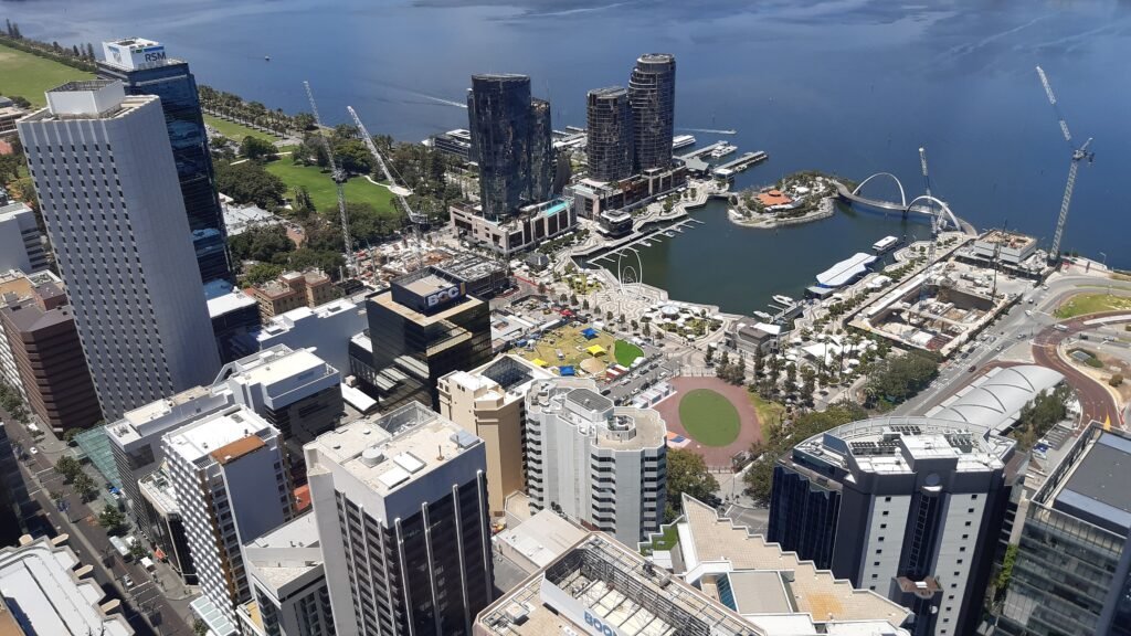
Between the Swan River and Northbridge, the central visitor spine stays unusually tight for an Australian capital. Elizabeth Quay, the Hay and Murray Street malls, Forrest Place, and the Cultural Centre fit into one connected walking sequence. Perth Station does not sever that sequence because pedestrian links and Yagan Square carry walkers across the rail corridor. West of the CBD, Mount Eliza rises toward Kings Park and turns a short map distance into real effort. East Perth and Claisebrook Cove remain pleasant extensions, but their added mileage makes transit repositioning useful on a two-day visit.
How Perth’s Central Walking Core Fits Together
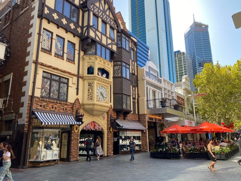
The strongest pedestrian chain begins at Elizabeth Quay and moves north through the CBD instead of following scattered attractions. Hay Street Mall and Murray Street Mall each remove traffic from the blocks between Barrack and William Streets. Forrest Place then creates a pedestrianised link between Murray Street Mall and Perth Railway Station. Outside those traffic-free blocks, wider streets such as Wellington and St Georges Terrace bring normal signal waits and vehicle exposure.
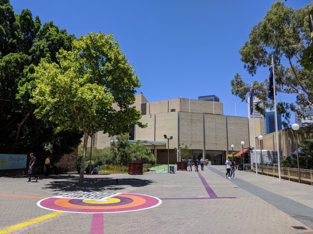
The rail corridor does not end the walk. Yagan Square explicitly links the CBD with Northbridge, while the Cultural Centre has wide paved entrances from the station concourse. Inside the precinct, pedestrians move without vehicle traffic between the gallery, museum and State Library. WA Museum Boola Bardip places Perth Station only about 200 metres away. Construction can occasionally alter paths through the Cultural Centre, with signed alternatives provided where routes are affected
Where to Stay for the Shortest Walks
The CBD around Forrest Place and Perth Station is the most balanced base for a first visit. It keeps the malls, Cultural Centre and Northbridge close while leaving Elizabeth Quay within an easy central walk. Staying beside Elizabeth Quay favors the riverfront and Barrack Street Jetty, but adds distance to Northbridge. A Northbridge or Cultural Centre base reverses that tradeoff. East Perth works well for quieter surroundings, though it adds unnecessary mileage for a sightseeing-heavy first weekend.
Typical Walking Times in Central Perth
| Walk | Typical time |
|---|---|
| Elizabeth Quay to Barrack Street Jetty | about 5–8 minutes |
| Elizabeth Quay to Hay Street Mall | about 7–10 minutes |
| Hay Street Mall to Murray Street Mall | about 2–4 minutes |
| Murray Street Mall to Forrest Place | about 2–4 minutes |
| Perth Station to WA Museum Boola Bardip | about 3–5 minutes; roughly 200 m |
| Forrest Place to Northbridge Piazza | about 8–12 minutes |
| Central CBD to Kings Park’s Fraser Avenue precinct | about 20–30 minutes uphill |
| Perth Station to Claisebrook Cove | about 25–30 minutes on foot |
These are practical planning estimates rather than guaranteed walking times. The Kings Park figure varies most because starting points and chosen uphill approaches change the effort substantially.
Kings Park Is Close, but Not Effortless
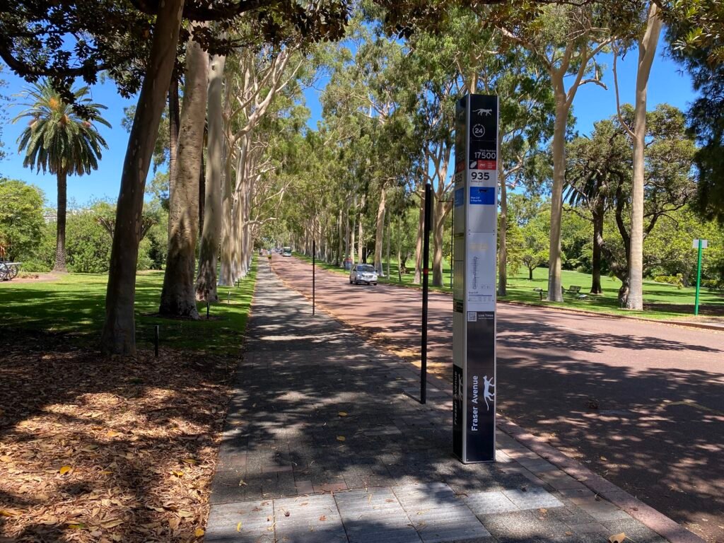
Kings Park sits only about 1.5 kilometres from the CBD, but that figure hides the important part. Mount Eliza is the park’s highest point, so the approach from central Perth involves a real climb. Jacob’s Ladder alone has 242 steps between Mount Street and Kings Park. Individual hillside paths can close or change with restoration work, so Fraser Avenue remains the clearest general walking approach from the city.
Using the Blue CAT is often the better weekend choice when you want to save energy for the park itself. The bus runs from Perth Busport through Perth Station and Elizabeth Quay to Kings Park. Purple CAT also passes the park. That convenience reduces practical effort, but it does not make Kings Park part of the flat CBD walking core.
East Perth and Claisebrook Cove
East Perth is a useful second cluster rather than a natural continuation of every CBD walking day. Claisebrook’s documented underpasses support a continuous waterside route into Claisebrook Cove, and the paths remain accessible. The problem is mileage, not poor local walking conditions. Yellow CAT connects Perth Station with Claisebrook Station. Inner-city rail also falls inside the Free Transit Zone under current fare rules.
A 2-Day Walking Route
Day 1 — Elizabeth Quay to Northbridge
Walking route
Day 1 — Elizabeth Quay, CBD malls, Cultural Centre and Northbridge
- Elizabeth Quay
- Barrack Street Jetty
- Supreme Court Gardens
- Hay Street Mall
- Murray Street Mall
- Forrest Place
- Art Gallery of Western Australia
- WA Museum Boola Bardip
- State Library of Western Australia
- Northbridge Piazza
Start at Elizabeth Quay, then use the riverfront to reach Barrack Street Jetty and Supreme Court Gardens. Turn north into Hay Street Mall, cross to Murray Street Mall, and continue through Forrest Place. The station interface leads directly into the Cultural Centre for AGWA, WA Museum Boola Bardip and the State Library. Finish in Northbridge rather than retracing the route to the river.
Day 2 — Kings Park and East Perth
Walking route
Day 2 — Kings Park, then East Perth and Claisebrook Cove
- Kings Park Fraser Avenue Precinct
- State War Memorial
- Kaarta Gar-Up Lookout
- Western Australian Botanic Garden
- Claisebrook Station
- Claisebrook Cove
- Victoria Gardens
- Mardalup Park
Take the Blue CAT uphill to Fraser Avenue. Then walk the State War Memorial, Kaarta Gar-Up and Botanic Garden area. Return by Blue CAT rather than repeating the descent. From central Perth, use Yellow CAT to Claisebrook Station. Finish on foot through Claisebrook Cove, Victoria Gardens and Mardalup Park. This keeps both walking clusters coherent and removes low-value cross-city mileage.
Using Free CAT Buses, Trains and Ferries
Perth’s free central transit is unusually useful for a short visitor stay. CAT buses are free and generally run every five to 15 minutes, depending on route and period. Bus trips entirely inside the Free Transit Zone are also free. Train trips within City West, Elizabeth Quay and Claisebrook are free when you tag on and off correctly. Visa and Mastercard contactless cards and digital wallets work across Transperth.
Blue CAT is the most useful park connector, while Yellow CAT is especially helpful for East Perth. The ferry crosses from Elizabeth Quay to South Perth in around 10 minutes. Check the current ferry timetable before travel because frequencies vary by day and season.
Arriving at Perth Airport Without a Car
At Terminal 1 International, Airport Central Station connects to the terminal by an elevated Skybridge. Perth Airport gives an 18-minute train time from Airport Central to Perth Station. The published Airport Line pattern is every 12 minutes at peak, 15 minutes by day and 30 minutes at night. Trains run until about midnight, with later Friday and Saturday service. Travelers using Terminal 3 should instead plan the Redcliffe Station and Route 292 connection.
When a Car Helps
A car is unnecessary for the standard CBD, Northbridge, Kings Park and East Perth weekend. Fremantle remains a separate urban destination despite its convenient rail link from Perth. Cottesloe and Scarborough are also separate coastal trips rather than extensions of the central walking core. Rottnest Island and Swan Valley are regional excursions. A car becomes more useful for flexible Swan Valley touring or other dispersed regional combinations, not for central sightseeing.
Walking Limitations and Practical Tips
Do not judge the whole center by its two pedestrian malls. Major roads still create signal waits, and the riverfront can feel exposed when sun or wind is strong. Kings Park needs separate energy planning because the climb is structural. Construction can alter some Cultural Centre paths, while restoration work can affect individual Mount Eliza routes. Check local notices before relying on a specific path or CAT service.
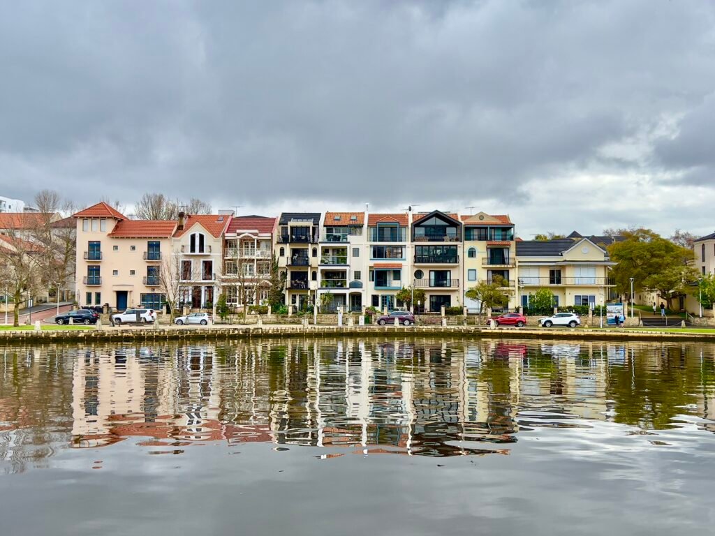
Seasonal Walking Context
Perth is generally easier to explore on foot outside the hottest summer periods. Exposed riverfront sections and Kings Park still require water and sun protection on warmer days, while cooler months can bring rain and wind. A light layer is useful when conditions are changeable.
Bottom Line
Build a first Perth weekend around the compact Elizabeth Quay–CBD malls–Cultural Centre–Northbridge spine. Add Kings Park as a distinct elevated cluster rather than pretending it is effortless downtown walking. Use free CAT buses to preserve energy and reposition to East Perth when useful. With that pattern, the city’s main central experiences work comfortably without a private car.