
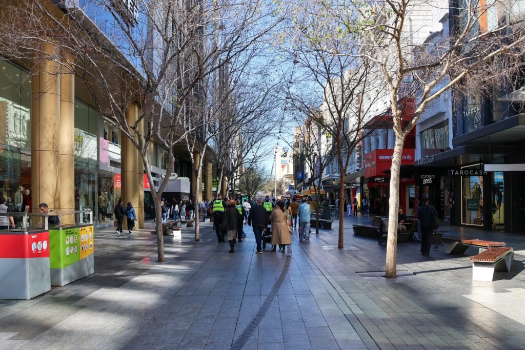
A broad central grid lets visitors move between the market, shopping streets, cultural institutions, and riverbank without complicated detours. Central Market and Rundle Mall sit about a 13-minute walk apart, with Victoria Square linking the southern CBD. North Terrace clusters the State Library, South Australian Museum, Art Gallery, university precinct, and Botanic Garden into one sightseeing spine. The riverbank adds a second layer below the grid, connected to Adelaide Oval by the pedestrian bridge. East End remains part of this network, although parklands and the river create a clearer break toward North Adelaide.
Why Adelaide Works Well on Foot
Adelaide’s strongest visitor geography runs from Central Market through Victoria Square and Rundle Mall to North Terrace. The market and Rundle Mall are about 1.2 kilometers apart, roughly a 10–13-minute walk on practical central routes. Rundle Mall itself creates a 500-meter pedestrian-only spine between King William and Pulteney streets. From its northern edge, the State Library, South Australian Museum, Art Gallery, university precinct and Botanic Garden line North Terrace in sequence. That concentrates much of a first weekend within ordinary walking range.
The planned grid helps because King William Street, North Terrace and the east-west city streets make route choices easy to understand. It does not remove every friction point. Wide signalized intersections interrupt the pace, and city walking work still identifies crossing priority and footpath quality as issues. The strongest central paths are sealed and direct, while some riverbank and parkland segments become narrower or more uneven. Rundle Mall’s pedestrianization is the clearest high-quality walking segment.
Best Areas to Stay for Walking
Rundle Mall and the East End are the most convenient base for visitors prioritizing the central cultural spine. Victoria Square and Central Market place the southern CBD first, while keeping Rundle Mall within about 10–13 minutes. North Terrace and the railway-station/Festival Plaza edge suit travelers expecting to use trains, trams or the riverbank bridge. Any of these central zones keeps the core itinerary practical without daily vehicle use.
Useful Walking Times
- Central Market to Rundle Mall: about 10–13 minutes; roughly 1.2 kilometers.
- Victoria Square to Rundle Mall: about 10 minutes; roughly 870 meters.
- Rundle Mall to the Art Gallery: about 7–8 minutes; 600 meters.
- Rundle Mall to Adelaide Botanic Garden: about 15 minutes; roughly 1.3 kilometers.
- Adelaide Railway Station to the Art Gallery: about 5–8 minutes; 600 meters.
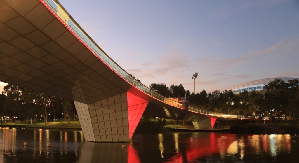
- Adelaide Railway Station to Adelaide Oval: about 5–10 minutes; roughly 600 meters via Riverbank Bridge.
These are practical planning estimates rather than guaranteed walking times. Signals, construction, events and your exact entrance can change the result.
A 2-Day Walking Route
Day 1 — Central Market to North Terrace
Walking route
Day 1 — Central Market to North Terrace and Botanic Garden
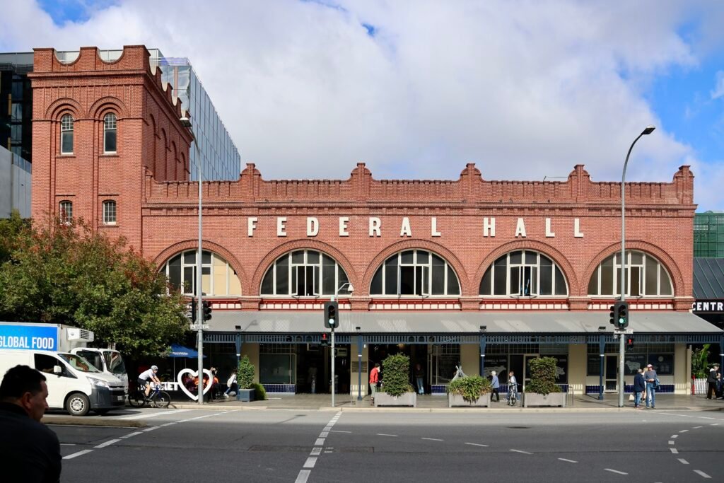
- Adelaide Central Market
- Chinatown Adelaide
- Victoria Square / Tarntanyangga
- Rundle Mall
- State Library of South Australia
- South Australian Museum
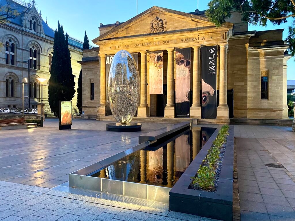
- Art Gallery of South Australia
- University of Adelaide North Terrace Campus
- Adelaide Botanic Garden Main Gate
Start at Central Market so the southern CBD is handled before the route moves north. Chinatown sits beside the market, and Victoria Square provides the logical transition toward King William Street. Continue to Rundle Mall, then turn north to the State Library, South Australian Museum, Art Gallery and university precinct. Finish at Adelaide Botanic Garden instead of returning across the same blocks. No transit is needed unless heat or mobility makes the final stretch less comfortable.
Day 2 — East End, Riverbank and Adelaide Oval
Walking route
Day 2 — East End, Riverbank, Adelaide Oval and North Adelaide edge
- Hindmarsh Square / Mukata
- Rundle Street East End
- University Footbridge
- Elder Park
- Adelaide Festival Centre
- Riverbank Footbridge
- Adelaide Oval
- St Peter's Cathedral
Begin in the East End, then move north to the river instead of repeating Rundle Mall. The University Footbridge provides a direct transition to the River Torrens paths. Follow the south bank west to Elder Park and Festival Centre, then cross the Riverbank Footbridge. Adelaide Oval sits immediately beyond the bridge, with St Peter’s Cathedral forming a natural North Adelaide edge. Return by the bridge or use the free connector if you have finished walking for the day.
When Transit Helps
Adelaide’s central tram zone is free between South Terrace and the Entertainment Centre, Festival Plaza and Botanic Gardens branches. That makes it useful for conserving energy across the CBD. The GLNELG route continues to Glenelg, while BTANIC runs along North Terrace between Botanic Gardens and Entertainment Centre. FESTVL links Glenelg and Festival Plaza on weekends, public holidays and Adelaide Oval special-event days.
Free 98A and 98C City Connector buses operate seven days and extend through North Adelaide. The smaller 99A and 99C inner-city loops are weekday services. Tap and Pay and Buy & Go now work across trains, buses and trams, so occasional paid trips are straightforward. Daytime tram frequencies are useful for spontaneous trips, while evening and weekend coverage remains practical.
Arriving from Adelaide Airport Without a Car
Adelaide Airport has no direct rail station, but public transport into the city is straightforward. J1 and J2 buses run directly between the airport and the city center, with the stop only a short walk from the terminal. Service runs through the day into the evening, and the trip to central Adelaide typically takes around 20 minutes depending on traffic. The one-seat bus avoids the need for a transfer with luggage.
When a Car Helps
Keep Glenelg as a separate tram excursion rather than part of the central walking footprint. North Adelaide and Adelaide Zoo are reachable without a car, but the river and parklands make them distinct extensions. Himeji Garden is closer and can fit into a southern CBD walk, yet it is not part of the main cultural spine. A car or organized excursion becomes more useful for Barossa Valley, McLaren Vale, Adelaide Hills, Hahndorf or Kangaroo Island logistics. Those regional trips do not change how Adelaide itself works on foot.
Walking Limitations and Practical Tips
Adelaide’s regular grid can make a longer walk feel simpler than in a tangled historic center, but crossings still accumulate. King William Street and other wide signalized intersections are the most noticeable interruptions. Some city and parkland routes have uneven or narrow sections, and the parklands create a clear edge around the CBD. The riverbank is well connected around Festival Centre and Adelaide Oval, although level changes near Festival Plaza can require ramps, lifts or escalators.
Check Adelaide Metro alerts before travel because tram works, events and road projects can alter the best route on a particular day. On foot, use Rundle Mall and North Terrace as the simplest orientation spines, then treat the riverbank as a parallel lower-level corridor.
Seasonal Walking Conditions
Summer heat can materially shorten the walking day even though central gradients remain gentle. Tree cover, arcades and parkland edges provide relief, but broad streets and riverbank sections can still feel exposed. Start earlier, use the free central tram for low-value mileage, and save indoor cultural stops for hotter periods. Cooler months allow the same distances to feel substantially easier.
Bottom Line
A central Adelaide weekend works best as one south-to-east cultural spine plus one riverbank extension. Central Market, Rundle Mall, North Terrace and East End are close enough to connect naturally on foot. Adelaide Oval is also easy to add because the pedestrian bridge removes a major river detour. Transit is most valuable for conserving energy, reaching North Adelaide, or treating Glenelg as a separate outing. A rental car is unnecessary for the standard two-day city itinerary.