
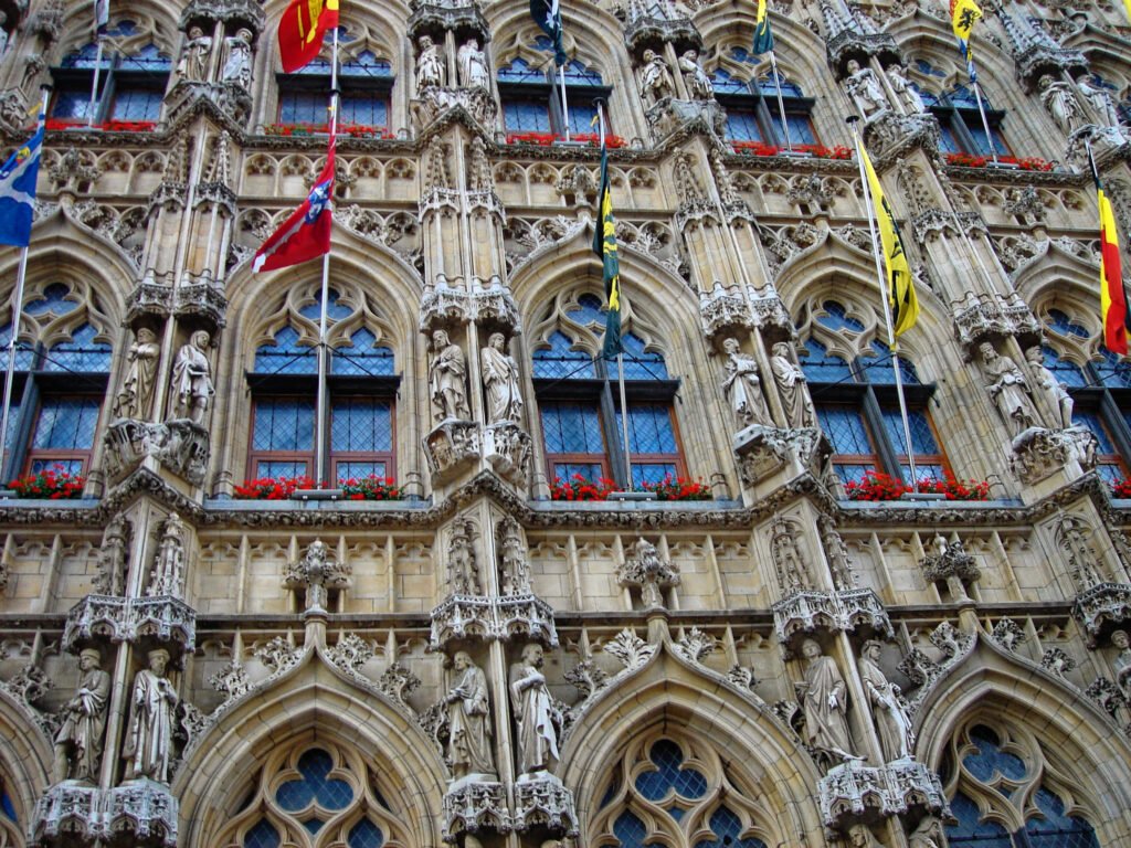
Belgium’s leading walking weekends separate quickly once you leave the train platform. Leuven turns Martelarenplein into a direct station-to-university approach, while Antwerp stretches sightseeing along a long east-west spine. Ghent packs medieval sights tightly but keeps Gent-Sint-Pieters outside that core. Mechelen converts its station walk into useful Bruul mileage, while Bruges compresses landmarks around canals and bridge choices. Brussels changes the equation again, with lower and upper districts connected by gradients, stairs, and excellent transit. Cobbles, bicycles, station placement, and water crossings matter as much as raw map distance.
Belgium’s Six-City Ranking
| Rank | City | Overall score | Strongest advantage | Main limitation |
|---|---|---|---|---|
| 1 | Leuven | 92/100 | Direct station-to-center axis, compact flat core, and exceptionally easy arrival | Cobbles and bicycle interaction; Park Abbey sits outside the core |
| 2 (tie) | Antwerp | 90/100 | Legible station–Meir–historic-center spine with excellent tram support | Eilandje and Zuid stretch the visitor map north and south |
| 2 (tie) | Ghent | 90/100 | Exceptional concentration of major medieval sights | Gent-Sint-Pieters sits outside the historic core |
| 2 (tie) | Mechelen | 90/100 | Compact center plus exceptionally low-friction rail and airport arrival | Dijle bridge choices and a smaller transit role |
| 5 (tie) | Bruges | 89/100 | Exceptionally concentrated historic core on flat terrain | Cobbles, canal crossings, and a station outside Markt |
| 5 (tie) | Brussels | 89/100 | Strong transit with excellent rail and airport access | Broader visitor geography and lower-to-upper-city climbs |
Antwerp, Ghent and Mechelen share rank 2, so ranks 3 and 4 are skipped. Bruges and Brussels share rank 5, leaving no rank 6. This ranking compares these six Belgian city breaks rather than every destination in the country.
Why Leuven Stays Ahead Without Feeling Frictionless
Leuven’s advantage starts before sightseeing begins. Leuven Station opens onto Martelarenplein, where Bondgenotenlaan points directly toward Rector De Somerplein and Grote Markt. Ladeuzeplein, the University Library, and M Leuven branch from that same approach. Oude Markt and the Great Beguinage extend the walking area south without breaking its basic continuity. The station walk therefore feels like part of the city rather than a transfer into it.
That continuity is why Leuven leads this group. The central visitor geography is tight, the terrain is easy, and local transit is useful without becoming necessary for routine sightseeing. Rail arrival from Brussels is frequent, while Brussels Airport connects directly to Leuven by train. The result is a weekend with few forced repositioning moves between arrival, lodging, central sights, and evening streets.
Short distances still demand attention. Cobbles, shared streets, busy university activity, and frequent bicycle movement make some central blocks less effortless than the map suggests. Park Abbey is the clearest outer stop and should stay that way in trip planning. Buses make it easy to reach, but they do not turn the abbey into part of Leuven’s compact central geography. See the full Leuven walkability guide for the two-day route and Park Abbey strategy.
Three Different Weekends Behind the 90-Point Tie
Antwerp, Ghent, and Mechelen finish together, yet they produce very different walking days. Antwerp is the broadest and most linear. Ghent concentrates the most headline sights inside one medieval core. Mechelen feels smaller and calmer, with the cleanest station-to-center arrival of the three. Their shared total is useful only when those differences stay visible.
Antwerp: Follow the Spine, Then Let Trams Save Mileage
Antwerpen-Centraal gives Antwerp an unusually clear first move. De Keyserlei leads toward Opera and Meir before the route compresses around Groenplaats, the Cathedral, Grote Markt, Het Steen, and the Scheldt. Once you reach the historic center, many monumental sights sit within a few minutes of one another. The city feels simple because the east-west line is so legible.
The limitation is length, not confusion. Eilandje and MAS extend the visitor map north, while Zuid and KMSKA pull it south. Both districts are pleasant to explore on foot after arrival, but neither is just a few extra blocks from Grote Markt. Antwerp’s trams protect time and energy across those longer gaps without making the geography physically smaller. The city is flat, yet tram tracks, bicycle flows, cobbles, broad Leien crossings, and crowded shopping streets still affect comfort.
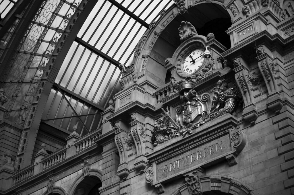
Arrival is one of Antwerp’s strongest assets. Antwerpen-Centraal sits directly on the main visitor spine, and direct rail from Brussels Airport keeps the air-arrival chain simple. Travelers who want a larger urban weekend with strong walking and tram backup can use the Antwerp walkability guide for detailed routing.
Ghent: Tiny Medieval Distances, One Important Station Gap
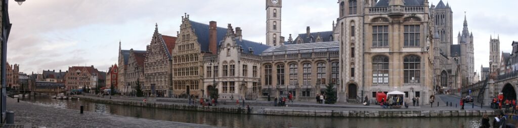
Ghent compresses first-time sightseeing more tightly than Antwerp. Korenmarkt, Saint Nicholas’ Church, the Belfry, Saint Bavo’s Cathedral, Graslei, Korenlei, Gravensteen, Patershol, and Vrijdagmarkt form an unusually dense central network. Rivers and canals give that network structure, while bridges decide where the shortest practical crossing actually exists. The water rarely creates a major barrier, but the correct bridge still matters.
The main contrast with Leuven, Antwerp, and Mechelen appears at arrival. Gent-Sint-Pieters sits outside the medieval core, so a tram or bus can be more sensible than adding station mileage to every first-day walk. Once you are based centrally, most headline sightseeing becomes naturally walking-first. Cobbles, tram tracks, bicycles, shared streets, and bridge approaches still demand attention despite the flat terrain and extensive low-traffic center.
That combination makes Ghent ideal for travelers who value concentrated historic sightseeing more than station adjacency. The Ghent walkability guide explains the station transfer and central walking loops in detail.
Mechelen: The Small-City Weekend With the Cleanest Arrival
Mechelen sits between Leuven’s balance and Ghent’s concentrated core. The station is about fifteen minutes from Grote Markt, and Bruul makes much of that approach useful commercial walking. Grote Markt, St. Rumbold’s, IJzerenleen, Vismarkt, Haverwerf, Hof van Busleyden, the Begijnhof, and Kazerne Dossin remain inside a manageable visitor footprint. The Dijle adds attractive riverfront walking while directing pedestrians toward specific bridges.
Arrival is Mechelen’s clearest advantage within the three-way tie. Direct trains connect it frequently with Brussels, Antwerp, and Leuven, while Brussels Airport also has a direct rail link. The center is genuinely compact without that transport advantage. Local buses help with occasional extensions, but they are not what makes the standard weekend work.
Choose Mechelen when you want a compact Belgian city with minimal transfer friction and little need to manage a large transit network. The full Mechelen walkability guide covers the Bruul approach, Dijle crossings, and central route.
Bruges and Brussels Reach 89 From Opposite Directions
An identical score hides two very different travel experiences here. Bruges compresses sightseeing into a tiny historic core and asks little from transit after arrival. By contrast, Brussels spreads more widely, introduces meaningful elevation, and depends much more on metro, tram, and rail. Neither profile is inherently better for every traveler.
Bruges: Short Distances, Rougher Historic Walking
Markt, Burg, the Basilica of the Holy Blood, and Rozenhoedkaai sit almost on top of one another. The Church of Our Lady and Saint John’s Hospital extend the route south toward the Begijnhof and Minnewater. Jan van Eyckplein and the quieter eastern districts remain realistic walking extensions rather than separate transit trips. Few cities here make the headline sightseeing map feel smaller.
Compactness does not equal perfect pedestrian conditions. Canals limit crossing points, medieval streets can bend short routes away from straight lines, and historic cobbles slow rolling luggage. Curbs, bridge ramps, bicycles, selected bus corridors, crowds, and horse-drawn carriages add further friction. Bruges is fundamentally flat, while a few bridge approaches create only local steepness. Surface difficulty and terrain are different issues.
Brugge Station also remains outside the historic heart. Markt is about a twenty-minute walk away, while ’t Zand works as a useful hinge roughly midway. Frequent buses help with luggage, but they do not place the station inside Markt. Bruges loses ground to Leuven mainly through arrival and transit depth, not because its attractions are less concentrated. See the Bruges walkability guide for the station walk and surface details.
Brussels: More City, More Climbing, More Transit
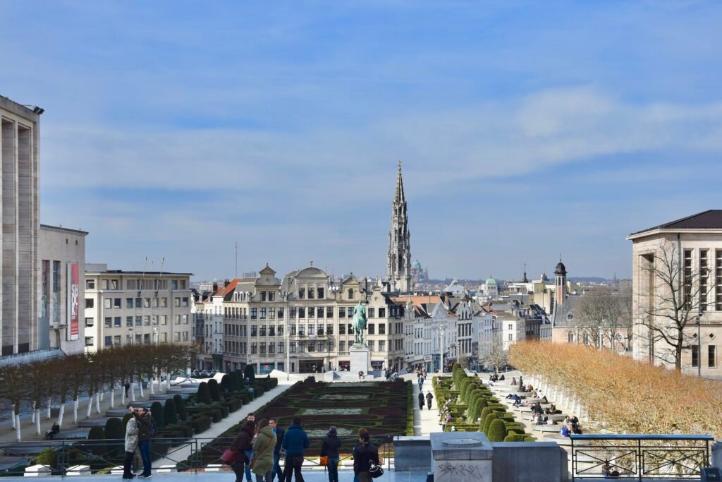
Brussels works through a broader sequence. Grand Place, the Galeries, Sainte-Catherine, and Dansaert form a dense lower-city network. Mont des Arts then rises toward Place Royale, Brussels Park, and the Royal Quarter. Sablon and Marolles extend the central geography south, while the European Quarter forms a longer eastern cluster. The Atomium remains a genuine outer destination and belongs on a transit trip to Heysel.
Terrain is the key physical difference. Grand Place and much of the western historic center sit below the Royal Quarter. Mont des Arts gives a direct connection, but gradients and stairs make repeated lower-to-upper-city movements more tiring. Brussels has the most noticeable elevation changes of the six, while the other five are substantially flatter. That does not make Brussels a steep hillside city; it simply changes how a full walking day feels.
Transit compensates for distance without erasing it. Metro, trams, and buses make the European Quarter, Heysel, and longer cross-city movements easy without a car. Brussels-Central is the better rail arrival for a historic-core stay because it sits beside the lower-city sightseeing network. Brussels-Midi is crucial for Eurostar and international rail, but it usually needs a short local reposition with luggage. The Brussels walkability guide separates those gateway choices and the lower-to-upper-city routes.
Your First Walk Starts at the Station
Station placement changes the first hour more than city size alone. Leuven starts directly on Martelarenplein and Bondgenotenlaan. Antwerp starts on De Keyserlei and the Meir axis. Mechelen turns much of its fifteen-minute station approach into useful walking along Bruul. These three cities make rail arrival feel closely integrated with sightseeing.
Ghent and Bruges require more deliberate first moves. Gent-Sint-Pieters is outside the medieval core, so public transport often saves low-value arrival mileage. Brugge Station sits closer, but Markt still requires a meaningful walk or bus. ’t Zand helps bridge that gap and works well for luggage-heavy arrivals or central accommodation.
Brussels needs two station names, not one. Brussels-Central is immediately useful for Grand Place, the Galeries, and Mont des Arts. Brussels-Midi sits south of the main first-day core but carries Eurostar and other international services. A short local train, metro, or tram often makes the onward move easier with luggage.
Brussels Airport strengthens several cities at once because its railway station sits beneath the terminal. Direct trains reach Brussels, Leuven, Antwerp, and Mechelen especially cleanly, while Ghent and Bruges remain practical with more time or transfer burden. That airport advantage improves arrival convenience; it does not make any city’s attractions closer together.
Canals and Rivers Make Bridge Choice Part of the Route
Water shapes walking differently across the group. Ghent’s Leie and Scheldt organize the historic core around quays and bridges. Graslei and Korenlei feel adjacent, but crossing still depends on a useful bridge. The correct crossing keeps a compact itinerary compact; the wrong one adds small detours that accumulate over a day.
Bruges has the strongest canal effect. The old city remains exceptionally compact, yet canal crossings can force a winding street or a specific bridge. Mechelen’s Dijle creates the same principle on a smaller scale, especially around riverfront paths and pedestrian bridges. In both cities, water adds route choice rather than a major distance penalty.
Antwerp is different because the Scheldt acts more as an edge and orientation line. The river helps make the historic center legible, while Eilandje extends north along the waterfront. The main walking challenge is the city’s length, not repeated river crossings.
Flat Does Not Mean Frictionless
Leuven, Antwerp, Ghent, Mechelen, and Bruges all have easy terrain for a standard visitor weekend. That shared flatness should not be confused with identical pedestrian comfort. Leuven mixes cobbles with constant bicycle movement. Antwerp adds tram tracks, broad crossings, and busy shopping streets. Ghent combines low-traffic streets with historic paving, bicycles, and bridge approaches.
Mechelen is similarly easy in elevation but includes cobbles, shared bicycle space, and river-path access points. Bruges is flat across most of the core, yet old paving, curbs, bridge ramps, crowds, and carriages can make short distances slower. Historic surface difficulty belongs to the walking experience even when there is almost no sustained climbing.
Brussels breaks the pattern. The lower city around Grand Place and the upper Royal Quarter sit close on the map but not at the same level. Mont des Arts is direct, though repeated climbs and stairs change pacing. Transit can remove some uphill repetitions, but it does not turn Brussels into a flat city.
When Transit Changes the Weekend
Antwerp and Brussels gain the most from using transit strategically. Antwerp’s trams shorten the long north-south spread between Eilandje, the historic center, and Zuid. Brussels uses metro, trams, and buses across an even larger visitor map, especially for the European Quarter and Atomium. In both cities, transit protects time and energy rather than proving that those districts are close on foot.
Ghent uses transit differently. The highest-value ride is often the station-to-center move at the beginning or end of the stay. Once inside the medieval core, most major sightseeing is naturally walkable. Leuven mainly needs buses for outer stops such as Park Abbey, while Bruges uses them most effectively between the station and center.
Mechelen shows the opposite case. Its buses are useful, especially around arrival and outer trips, but they contribute less to the standard weekend because the central visitor map already works so well on foot. A strong small-city weekend can therefore rely less on transit without being less practical.
Which Belgian City Fits Your Weekend?
| Traveler priority | Best fit | Why |
|---|---|---|
| Best overall balance | Leuven | The station, university core, historic center, flat terrain, transit backup, and airport rail all work together with few weak points. |
| Tightest medieval sightseeing | Ghent and Bruges | Both place headline historic sights within unusually short walks; Ghent has the bigger station gap, while Bruges has rougher surfaces. |
| Strongest transit-supported city break | Antwerp and Brussels | Antwerp uses trams across an elongated city; Brussels uses metro, tram, and bus across a larger and more vertical visitor map. |
| Easiest rail and airport arrival | Leuven, Antwerp, Mechelen, and Brussels | All combine strong rail gateways with direct or exceptionally simple Brussels Airport connections, though their central geographies differ. |
| Easiest terrain | Leuven, Antwerp, Ghent, Mechelen, and Bruges | All are fundamentally flat for sightseeing. Cobbles, tracks, bicycles, and bridge ramps still create different walking comfort. |
| Canal-city walking | Ghent and Bruges | Water shapes both itineraries through bridge choice; Ghent feels river-and-quay oriented, while Bruges is more continuously canal-laced. |
| Riverfront walking | Antwerp, Ghent, and Mechelen | The Scheldt, Leie/Scheldt, and Dijle each create distinctive waterfront routes without producing the same crossing pattern. |
| University-city walking | Leuven | The station-to-center approach, Ladeuzeplein, University Library, Oude Markt, and university streets form one especially coherent walking sequence. |
| Compact small-city weekend | Leuven and Mechelen; Bruges for historic-core focus | Leuven and Mechelen pair compactness with easier arrival, while Bruges concentrates sights even more tightly after the station leg. |
| Best for minimizing transit | Leuven, Mechelen, and central Bruges; Ghent after arrival | These cities let most sightseeing stay on foot, though Ghent often benefits from one station-to-core ride. |
Where a Car Adds Value—and Where It Does Not
A private car adds little to the standard two- or three-day weekends compared here. Central parking, one-way streets, pedestrian zones, and historic layouts usually create more work than benefit. Belgium’s rail network also makes it easy to combine these cities without turning transfers into road trips.
Driving becomes more useful when the itinerary leaves the urban rail-and-transit pattern. Rural stays, dispersed countryside stops, and multi-stop regional routes can justify a car. Inside Leuven, Antwerp, Ghent, Mechelen, Bruges, or Brussels, walking and public transport remain the practical default for the visitor experiences described here.
Wet Weather and Historic Surfaces
Weather changes walking comfort considerably across these cities. Rain makes old cobbles and bridge approaches more demanding, especially in Bruges and Ghent. Busy warm weekends can increase pedestrian and bicycle pressure in Leuven, Antwerp and the most popular historic cores. Brussels becomes more tiring when repeated climbs are wet. Check current transit and access notices before travel when works or diversions are active.
Bottom Line
Leuven leads because it avoids a major weakness. Its station approach, central sightseeing, flat terrain, transit backup, and airport rail all fit one coherent weekend. Antwerp, Ghent, and Mechelen then split the 90-point tie by travel style: broad city plus trams, concentrated medieval core plus station transfer, or compact small-city simplicity plus exceptional arrival.
Bruges and Brussels make the final contrast even clearer. Bruges is tighter but rougher underfoot and requires a longer station-to-center approach. Brussels is broader and more tiring on foot, yet exceptionally easy to navigate with transit and rail. Choose the city whose walking pattern matches the weekend you actually want, not just the number beside its name.