
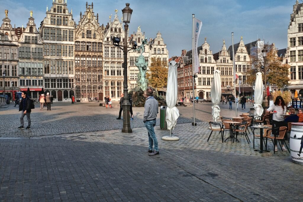
From Antwerpen-Centraal to the Scheldt, Antwerp follows a remarkably legible east-west visitor spine rather than one tiny old-town cluster. Antwerpen-Centraal opens directly onto De Keyserlei, then Meir carries pedestrians toward Groenplaats and the medieval core. Grote Markt, the cathedral, Het Steen and the Scheldt then compress into a short western sequence. The city stretches again beyond that core, with MAS and Eilandje northward and museum-rich Zuid to the south. Most central ground is flat, but cobbles, tram tracks, bicycles, busy crossings and long linear distances still shape comfort. That pattern makes walking the default, while selective tram rides protect time and energy.
Why Antwerp Works So Well on Foot
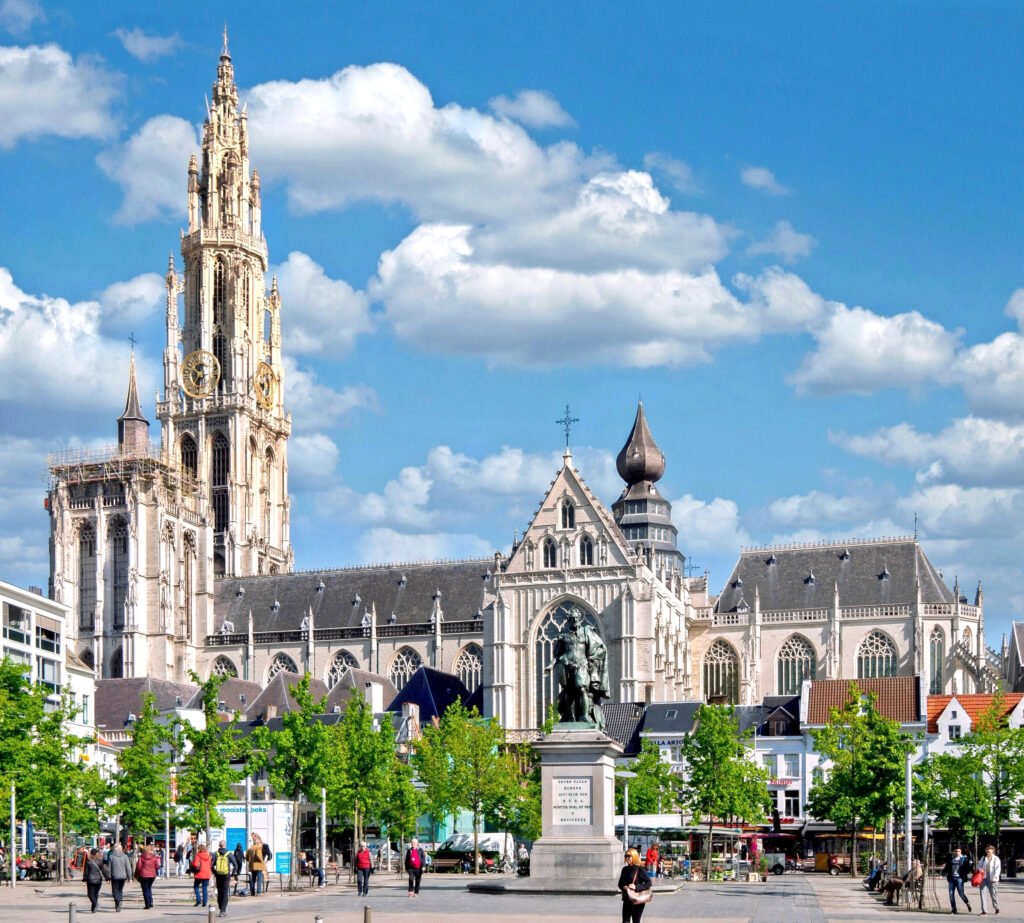
The strongest walking sequence begins the moment you leave Antwerpen-Centraal. De Keyserlei leads toward Opera, while Meir continues west through the busiest central shopping corridor. From Groenplaats, the Cathedral, Grote Markt and Het Steen sit within the tighter historic fabric. Traffic-free Hoogstraat and other pedestrianised lanes make the old centre especially comfortable for browsing. The Scheldt then provides a clear western edge, so the basic east-west geography is easy to understand even on a first visit.
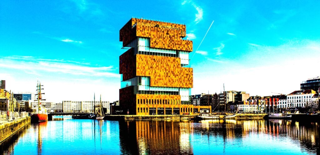
The important correction is length. Eilandje is a genuine northern neighborhood around Willemdok and MAS, not an extension of Grote Markt by a few blocks. Zuid creates the same effect southward around KMSKA, FOMU and the redesigned Zuiderdokken. KMSKA’s official visitor guide gives about 30 minutes on foot from Antwerpen-Centraal. That is still walkable, but it is long enough to make selective tram use sensible on a two-day trip.
Where to Stay for the Easiest Walking
For a first visit, choose your base according to which transfer you want to minimize. Historic Centre and Meir-side stays reduce sightseeing mileage, while the station side minimizes luggage friction. Eilandje and Zuid work best when those neighborhoods are a major reason for the trip.
| Area | Best for | Walking advantage | Main trade-off |
|---|---|---|---|
| Historic Centre / Groenplaats | Maximum first-time sight proximity | Cathedral, Grote Markt, Het Steen, the Scheldt and pedestrianised streets are tightly grouped. | Roughly 20 minutes from Antwerpen-Centraal rather than directly beside the station. |
| Meir / Opera / Theaterbuurt | Best all-around balance | Sits between the station and historic core, with dense dining, shopping, culture and tram options. | Busy shopping flows, tram tracks and bicycles can reduce comfort at peak times. |
| Eilandje / MAS | Waterfront atmosphere and museums | Immediate access to MAS, Willemdok and Red Star Line Museum. | Farther north from the old core and notably farther from Zuid. |
| Zuid | KMSKA, FOMU and galleries | Strong local walking around museums, restaurants, Zuidpark and the southern Scheldt. | KMSKA is about a 30-minute walk from Antwerpen-Centraal. |
| Central Station / Diamond District | Rail convenience and luggage handling | Immediate station access with Meir-side trams and the main visitor spine outside the door. | Not inside the Grote Markt, Eilandje or Zuid sightseeing clusters. |
Useful Walking Times
These are planning estimates rather than promises about live routing. Crowds, crossings, temporary works and exact entrances can change the result.
| Walk | Typical time | What it tells you |
|---|---|---|
| Antwerpen-Centraal → central city / historic-core side | about 20 minutes | The station is highly convenient, but it is not inside every major sightseeing cluster. |
| Antwerpen-Centraal → KMSKA | about 30 minutes | Zuid is a real extension of the visitor map rather than part of the same compact core. |
| Groenplaats → Grote Markt | about 5 minutes | The monumental historic centre is extremely compact once you reach it. |
| Grote Markt → Het Steen | about 5 minutes | The old core and Scheldt riverfront function as one walkable western cluster. |
| MAS → Red Star Line Museum | about 5–7 minutes | Eilandje works well as its own museum-and-waterfront walking district. |
| Theaterplein → KMSKA | about 18–20 minutes | Theaterbuurt provides a useful walking bridge between the main core and Zuid. |
| KMSKA → FOMU | about 8–10 minutes | Zuid’s principal museums are comfortably linked on foot. |
A 2-Day Walking Route
The two days deliberately use different halves of Antwerp. Day 1 follows the station-to-core axis before continuing north into Eilandje. Day 2 begins in Theaterbuurt and moves south through Zuid to the Scheldt. That keeps sightseeing mileage productive and avoids repeating Meir or the old centre simply to reach another district.
Day 1 — Central Station, Historic Core and Eilandje
Walking route
Day 1 — Central Station, Historic Core and Eilandje
- Antwerpen-Centraal
- De Keyserlei
- Operaplein
- Meir
- Groenplaats
- Cathedral of Our Lady
- Grote Markt
- Het Steen
- Noorderterras
- MAS | Museum aan de Stroom
- Willemdok
- Red Star Line Museum
Start at Antwerpen-Centraal and walk west along De Keyserlei toward Operaplein. Continue along Meir rather than taking transit for this first stretch; the corridor itself explains Antwerp’s visitor geography. From Groenplaats, visit the Cathedral and Grote Markt before continuing through the western old streets to Het Steen. Use Noorderterras and the Scheldt as the transition north instead of backtracking toward Meir.
Continue to MAS and Willemdok, then finish at Red Star Line Museum in the Montevideo area. The museum lists the MAS stop about 450 meters away, confirming how closely these Eilandje anchors connect. If you are finished walking, use the nearby De Lijn service for the return. Check the live planner before the return because engineering work can alter individual tram routes.
Day 2 — Theaterbuurt, Zuid and the Southern Scheldt
Walking route
Day 2 — Theaterbuurt, Zuid and the Southern Scheldt
- Theaterplein
- Bourla Theatre
- Botanical Garden (Den Botaniek)
- Mechelseplein
- Royal Museum of Fine Arts Antwerp (KMSKA)
- Zuidpark
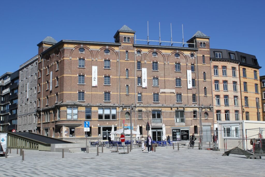
- FOMU Photo Museum
- Cockerillkaai
Begin at Theaterplein, then move through the Bourla side of Theaterbuurt to Den Botaniek and Mechelseplein. Continue south toward KMSKA rather than returning to the historic centre. After the museum, cross through Zuidpark to FOMU on Waalsekaai and finish along Cockerillkaai beside the Scheldt. This creates a second directional day instead of recycling Day 1’s Meir and Grote Markt streets.
For the return, FOMU lists tram 4 at Pacificatie about five minutes away and trams 1 or 10 at Bestorming about ten minutes away. Those options make the long station-side return a transit trip rather than low-value walking. Confirm the exact service pattern on the travel day because individual lines can be rerouted.
When to Use Trams and Buses
Antwerp’s trams are most valuable when the visitor map stretches beyond the central walk. De Lijn’s network includes corridors linking Meir and Groenplaats with KMSKA and Antwerp South, plus a corridor from the old city toward Eilandje and MAS. Several principal routes run six to eight times per hour during daytime periods. Line 11 also gives an above-ground connection between Central Station, Meir and the historic heart.
Ticketing is unusually simple for occasional use. A contactless bank card, phone or compatible wearable works across De Lijn buses and trams. A single ride costs €3, and a transfer within 60 minutes does not trigger another charge. Adult day tickets cost €9 and three-day tickets cost €18. Engineering work can change exact routes, so use the official planner before boarding.
Arriving in Antwerp Without a Car
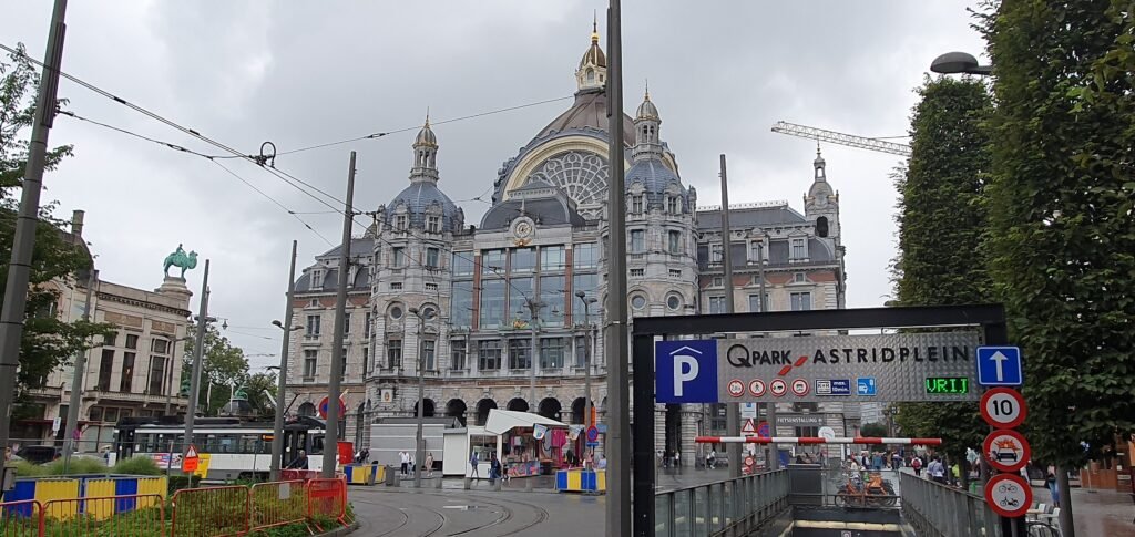
Antwerpen-Centraal is one of Antwerp’s biggest car-free advantages. You arrive at the eastern end of the main visitor corridor rather than at a remote suburban terminal. The station has lockers, lifts, escalators, buses and trams. Eurostar describes the broad city centre as about a 20-minute walk away, which is convenient with light luggage. That centrality should not be confused with being beside Grote Markt, MAS or KMSKA; those remain separate walking distances.
Domestic rail is also frequent. SNCB lists 71 direct trains per day between Antwerp and Brussels, with an average trip of about 45 minutes. Air travelers using Brussels Airport have an unusually clean chain: the railway station sits beneath the terminal, and direct trains reach Antwerp in about 30 minutes. International travelers can also arrive directly at Antwerpen-Centraal on Eurostar services.
When a Car Helps
A private car adds little to the normal two-day Antwerp itinerary. The station, central sights, Eilandje and Zuid are all practical by walking and transit, while central parking introduces extra friction. FOMU also notes that Antwerp city centre and Linkeroever sit inside the low-emission zone. A car becomes more useful for deliberately road-based rural or multi-stop regional extensions rather than for the city weekend itself.
Walking Limitations and Practical Tips
Pedestrianised streets do not mean perfectly smooth walking. Historic paving, tram rails, bicycles and busy shared corridors require attention, especially around shopping streets and tram stops. Meir can be crowded, while the broad Leien create larger crossings than the old-town lanes suggest. Travelers using rolling luggage, wheelchairs or strollers should allow more time on older surfaces even though Antwerp is fundamentally flat.
The Scheldt gives Antwerp a clear orientation edge, but it also makes the city strongly linear. Riverfront redevelopment can occasionally alter local walking routes, so follow posted diversions where works affect the promenade.
Seasonal Comfort
Antwerp remains practical for walking throughout the year, but seasonal conditions change comfort and pacing. Rain and wind can make exposed Scheldt stretches less comfortable, while short winter daylight compresses long walking days. Mild-season evenings are better suited to extending Eilandje or Zuid routes after museums close.
Bottom Line
Antwerp’s strongest asset is how naturally the station, Meir and historic core connect. The visitor map is longer than that spine suggests, but MAS, Eilandje and Zuid remain easy additions with selective transit. For a first two- or three-day visit, walking should be the default and trams the backup. A private car adds little to the standard city break.