
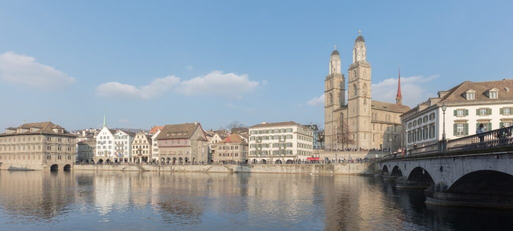
Zürich Hauptbahnhof sits beside the northern edge of the visitor core, changing how a short stay unfolds. Bahnhofstrasse reaches south toward the lake while the Limmat runs roughly parallel through the Altstadt. Most headline sights fit between those two axes, with frequent bridges linking the riverbanks. The eastern Old Town then climbs toward Kunsthaus, ETH, and the university, adding short but noticeable gradients. Zurich West sits beyond this compact center, so it works better as a separate walking cluster reached by tram.
Why Zurich Works So Well on Foot
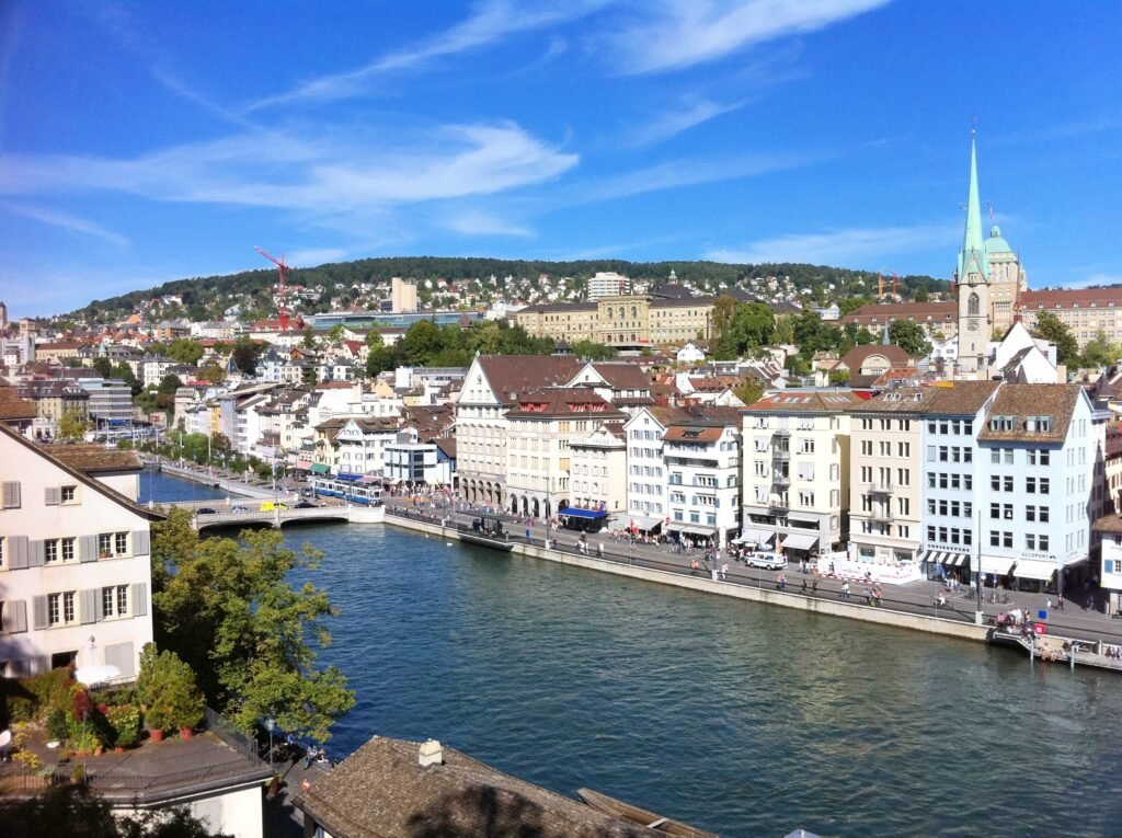
Central Zurich compresses a surprising amount of sightseeing into a small footprint. Zürich Tourism’s official Old Town walk starts at the main station and reaches Bahnhofstrasse, Lindenhof, and Grossmünster on a three-kilometer route. Fraumünster and Münsterhof sit just across the Limmat, while Bürkliplatz and the lake close the southern end of the core. Kunsthaus is only about one kilometer from HB, though its eastern position begins the climb toward the university quarter.
The pedestrian network is stronger than simple distance suggests. The City of Zurich designates a right-bank pedestrian zone through Niederdorf between Central and Bellevue. A second zone runs on the left bank through Lindenhof and Münsterhof. These areas create long low-traffic walking chains, but the Limmat still controls where you can switch sides. Choosing the right bridge matters more than the river’s width would suggest.
Walking conditions are generally comfortable, not perfectly seamless. The official Old Town route is partly cobblestoned and reaches a maximum 12 percent incline. Busy Bahnhofstrasse, tram tracks, bicycle movement, and bridge approaches add small points of friction. Those details matter most with wheeled luggage or limited mobility. They do not change the fact that the standard first-time sightseeing core is highly pedestrian-friendly.
Best Areas to Stay for a Walking Weekend
Zürich HB / northern Bahnhofstrasse: the strongest base for arrival convenience. The station touches the visitor core, and Bahnhofstrasse begins immediately outside. Lindenhof, Niederdorf, the river, and central shopping are all close. Zürich Tourism also lists multiple hotels within five minutes of HB. The tradeoff is a busier transport and commercial setting than the quieter lanes farther south.
Altstadt / Lindenhof / Niederdorf: best for atmosphere and shortest sightseeing walks. Both riverbanks put historic streets, churches, restaurants, and cafés outside the door. Niederdorf is especially convenient for the east bank, while Lindenhof and Münsterhof favor the west. Cobbles, narrow lanes, and evening activity can make luggage handling less effortless than the distances imply.
Bellevue / lakefront: a scenic alternative near Bürkliplatz, the lake, Grossmünster, and Kunsthaus. It remains central but sits farther from HB. Zürich West is better treated as a secondary base for repeat visitors or nightlife-focused stays. It is well connected, yet it sacrifices the instant Old Town access that makes a first Zurich weekend so easy.
Realistic Walking Times in Zurich
Zürich HB to Lindenhof: about 7–10 minutes. HB to Bürkliplatz via Bahnhofstrasse: about 18–20 minutes. Lindenhof to Niederdorf: about 5–8 minutes using a nearby bridge. Niederdorf to Grossmünster: about 7–10 minutes. Grossmünster to Fraumünster: about 5 minutes across Münsterbrücke. Kunsthaus to ETH/Polyterrasse: about 10–15 minutes uphill. These are practical planning estimates rather than guaranteed walking times.
A 2-Day Walking Route
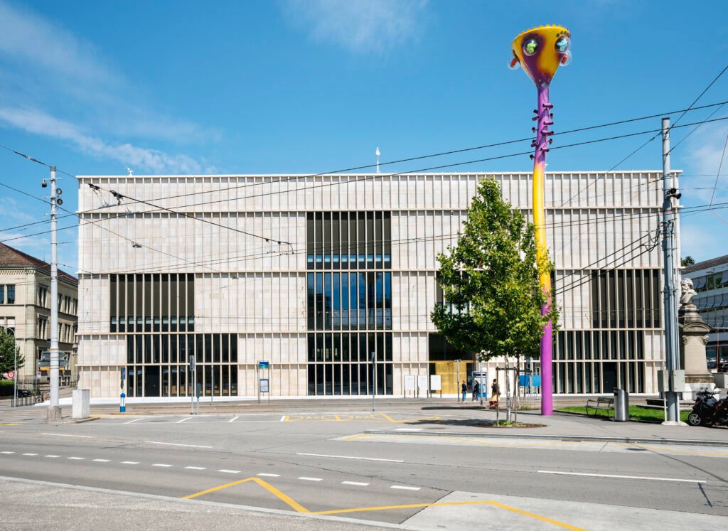
The two days use different parts of Zurich. Day 1 follows the main-station–Old Town–lake axis. Day 2 climbs through the eastern cultural and university quarter, then uses rail to reach Zurich West without repeating central mileage.
Day 1 — Main Station, Old Town and Lake Zurich
Walking route
Day 1 — Main Station, Old Town and Lake Zurich
- Zürich Hauptbahnhof
- Bahnhofstrasse / Rennweg
- Lindenhof
- Niederdorf
- Grossmünster
- Münsterhof
- Fraumünster
- Bürkliplatz
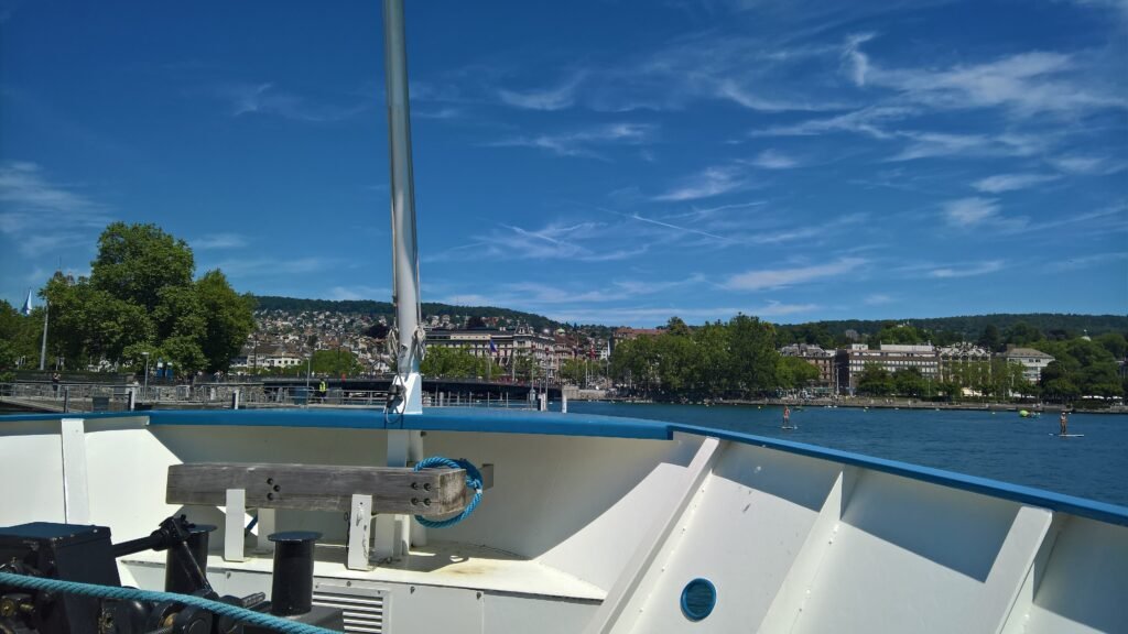
Start at Zürich Hauptbahnhof and enter Bahnhofstrasse before turning toward Lindenhof. Cross the Limmat into Niederdorf, then continue south to Grossmünster instead of returning north. Münsterbrücke leads directly to Münsterhof and Fraumünster on the opposite bank. Finish at Bürkliplatz and the Lake Zurich promenade. The route changes riverbanks only when it adds value, so the day remains compact rather than zigzagging through the Altstadt.
Day 2 — Kunsthaus, ETH and Zurich West
Walking route
Day 2 — Kunsthaus, Hochschulquartier and Zurich West
- Kunsthaus Zürich
- University of Zurich Main Building
- ETH Zurich Main Building
- Polyterrasse
- Prime Tower
- Frau Gerolds Garten
- Schauspielhaus Zürich — Schiffbau
- Im Viadukt
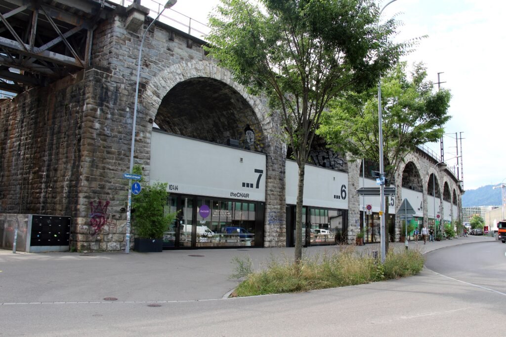
Begin at Kunsthaus and walk uphill through the Hochschulquartier toward ETH and Polyterrasse. Take the Polybahn down to Central, then continue to HB for one S-Bahn stop to Zürich Hardbrücke. This removes a low-value cross-city walk. From Hardbrücke, move through Prime Tower and Frau Gerolds Garten toward Schiffbau and Im Viadukt. The western cluster then finishes closer to the center instead of retracing the route.
When to Use Trams, S-Bahn and the Polybahn
Most central sightseeing does not require transit, but Zurich’s network is extremely useful once you leave the core. Trams and S-Bahn connect Zurich West efficiently, while the Polybahn removes the short climb from Central to ETH and Polyterrasse. ZVV also runs a dedicated night network after about 1 a.m. on Friday and Saturday nights. That makes evening returns practical without a car.
Ticketing is capable but deserves one minute of attention. ZVV uses zones, and Zurich city zone 110 counts as two zones for pricing. A 24-hour ticket for one to two zones currently costs CHF 9.40. The ZVV app accepts major cards plus Apple Pay and Google Pay. Its check-in function can calculate the appropriate fare, which is useful for occasional visitors who do not want to study products.
Construction around Zürich HB can temporarily reroute tram services and change the most convenient stop. Nearby station-area stops usually provide alternatives, but visitors should check the live ZVV or VBZ planner before travel rather than relying on a fixed temporary arrangement.
Arriving in Zurich Without a Car
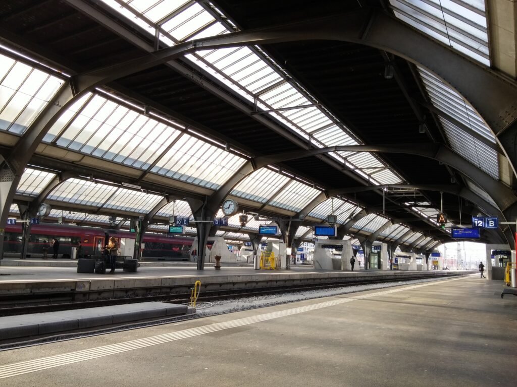
Zürich Hauptbahnhof is one of the city’s biggest practical advantages. It sits beside Bahnhofstrasse and within a short walk of both Old Town riverbanks. Zürich Tourism reports around 3,000 train services per day across 26 tracks. International and domestic rail passengers therefore arrive directly inside the urban sightseeing geography rather than at a peripheral terminal.
Zurich Airport is nearly as straightforward. The airport states that trains leave for Zürich HB every ten minutes and take about fifteen minutes. That creates a direct airport-to-core arrival with no road transfer. The final step is usually a short walk, tram ride, or hotel connection from HB. Airport convenience strengthens the car-free arrival case without making the Old Town itself any more compact.
Walking Limitations and Practical Tips
Do not read Zurich as uniformly flat. Bahnhofstrasse, much of the Limmat corridor, and the lakefront are manageable, but Lindenhof rises above the river. The eastern Old Town climbs more clearly toward Kunsthaus, ETH, and the university. The Polybahn is useful when conserving energy, though walking uphill can still fit comfortably into a normal day for many visitors.
The Limmat is an excellent orientation tool, but crossings occur at specific bridges. A route that repeatedly switches banks can add unnecessary distance. Historic paving also matters: parts of the official Old Town walk are cobblestoned. Around busier corridors, watch for tram tracks, bicycles, and crowding rather than assuming every central street functions like a fully separated pedestrian mall.
When a Car Actually Helps
A car adds little to a normal Zurich city weekend. Uetliberg is a good example: it sits outside the central walking geography, yet rail makes it a straightforward excursion followed by a short walk. A car becomes more useful for deliberately remote regional stops, dispersed countryside itineraries, or luggage-heavy trips beyond strong rail corridors. It is unnecessary for the Altstadt, lakefront, Zurich West, or standard airport transfer.
Seasonal Note
Season changes walking comfort more than Zurich’s underlying visitor geography. Lakefront exposure, wet historic paving, winter cold, or hot summer afternoons can alter pacing. The compact center and dense transit network remain useful throughout the year. Check current conditions before long waterfront walks or hillier routes, especially when traction or heat affects your preferred walking range.
Bottom Line
Zurich combines a compact historic core with one of the easiest rail arrivals of any major European city. Bahnhofstrasse, both sides of the Altstadt, the Limmat, churches, Kunsthaus, and the lake fit naturally into walking days. The main compromises are short hills, bridge-dependent river crossings, and the separate Zurich West cluster. Use transit for those gaps and Uetliberg. A private car offers little value during the standard first-time weekend.