
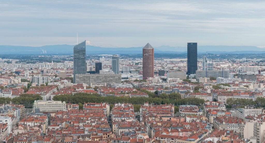
Two rivers organize Lyon’s visitor core into a compact peninsula, a narrow old town, and two prominent hills. Presqu’île carries many sightseeing walks between Bellecour, Jacobins, Cordeliers, and Terreaux across mostly level central streets. Across the Saône, Vieux Lyon compresses Renaissance lanes, traboules, cathedral streets, and Fourvière approaches against the hillside. Fourvière and Croix-Rousse create Lyon’s real walking challenge, adding steep vertical effort to otherwise short central distances. Frequent bridges keep district changes simple, while transit prevents Tête d’Or, Confluence, and the hilltops from consuming a short weekend.
Why Lyon Works So Well on Foot
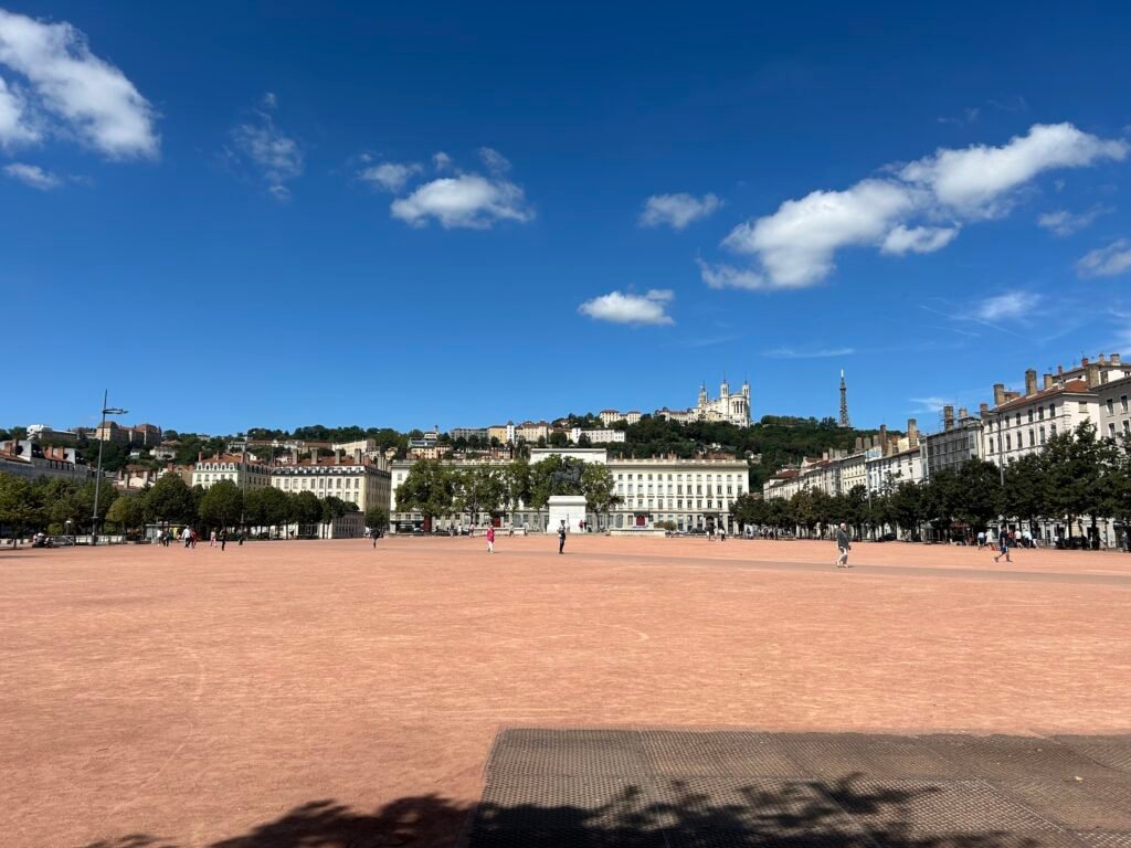
Lyon’s biggest walking advantage is the way its historic districts sit beside one another. UNESCO’s 427-hectare historic site preserves Fourvière, Vieux Lyon, the Presqu’île, and the Croix-Rousse slopes as adjoining layers of the city. For a first visit, that means Saint-Jean Cathedral, Place du Change, Bellecour, Jacobins, Cordeliers, Hôtel de Ville, and Terreaux can fit into one high-value central walking network.
The Presqu’île has also become more pedestrian-focused. Grand Lyon’s limited-traffic zone operates 24 hours a day from the lower Croix-Rousse slopes to Bellecour, excluding through motor traffic. It does not make every street car-free, but it reduces vehicle pressure across the exact central area many visitors use most.
The rivers add another layer of useful walking space. The Rhône banks include a five-kilometer developed corridor with a strip adapted to walking and wheelchair use. Along the Saône, a much longer quasi-continuous promenade extends through and beyond the center. These river edges create scenic alternatives to busy street routes and make the water part of Lyon’s navigation system.
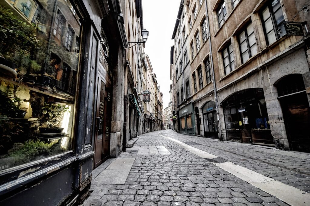
The main caveat is the historic fabric itself. Vieux Lyon is compact, but its narrow Renaissance lanes, older surfaces, crowds, and hillside approaches are not uniformly effortless. The short distances remain valuable, yet travelers using wheelchairs, strollers, or rolling luggage should expect more friction than on the flatter Presqu’île.
Best Areas to Stay for a Walking Weekend
For most first-time visitors, Presqu’île around Bellecour, Jacobins, or Cordeliers is the strongest all-around base. It keeps Vieux Lyon across a short river crossing, places major squares on foot, and gives easy access to Metro A and D. The official tourism inventory also shows substantial lodging throughout this central district.
| Area | Best for | Walking advantage | Main trade-off |
|---|---|---|---|
| Presqu’île / Bellecour–Cordeliers | Best all-around first-time base | Flat access to central squares, Vieux Lyon crossings, shopping, dining and multiple Metro stations | Less historic atmosphere than staying inside Vieux Lyon |
| Vieux Lyon | Renaissance streets and evening atmosphere | Immediate access to Saint-Jean, traboules, Saône crossings and the Fourvière funicular | Narrow lanes, older surfaces and hill access make luggage movement less smooth |
| Part-Dieu | Rail and airport-arrival convenience | Major rail gateway with Metro B, trams, buses and Rhônexpress at the station | Not inside the strongest sightseeing walking core; expect an initial transit ride west |
| Croix-Rousse | Neighborhood atmosphere and canut heritage | Walkable plateau and slope sights with direct Metro C access | Repeated walks to the central core add significant uphill effort |
Useful Walking Times
These are representative visitor walking estimates, not promises about live routing. Crowds, crossings, steep grades, and the exact hotel entrance can change them.
| Walk | Typical time | What it tells you |
|---|---|---|
| Place Bellecour → Saint-Jean Cathedral | about 10–12 minutes | The Presqu’île and Vieux Lyon function as one central walking cluster. |
| Place Bellecour → Place des Terreaux | about 18–20 minutes | Most of the central Presqu’île is short enough to cross on foot. |
| Perrache station → Place Bellecour | about 10–15 minutes | A rail arrival at Perrache can continue directly into the visitor core. |
| Vieux Lyon → Fourvière via Montée du Gourguillon | about 30 minutes uphill | The official route gains 124 meters in 1.4 kilometers, so short map distance hides real effort. |
| Hôtel de Ville → Parc de la Tête d’Or south entrance | about 25–30 minutes | The park is walkable from the core, but the round trip adds meaningful mileage. |
| Place de la Croix-Rousse → Hôtel de Ville | about 20–25 minutes downhill | Croix-Rousse is close geographically, but elevation changes how the same route feels in reverse. |
A 2-Day Walking Route
Both routes use transit only to remove a low-value climb at the start. From there, the days move mostly in one direction and finish somewhere different from where they began.
Day 1 — Fourvière, Vieux Lyon and the Presqu’île
Walking route
Day 1: Fourvière, Vieux Lyon and the Presqu’île
- Basilique Notre-Dame de Fourvière
- Théâtres Romains de Fourvière
- Montée du Gourguillon
- Église Saint-Georges
- Cathédrale Saint-Jean-Baptiste
- Place du Change
- Passerelle du Palais de Justice
- Place Bellecour
- Place des Jacobins
- Rue de la République
- Place des Terreaux
Start at Vieux Lyon–Cathédrale Saint-Jean and take funicular F2 to Fourvière. This is the rare Lyon transit ride that can materially improve a walking day without replacing worthwhile sightseeing. The official walking ascent via Montée du Gourguillon gains 124 meters, so beginning at the top saves energy for the historic streets below.
Visit the basilica and Roman theaters, then descend toward Montée du Gourguillon and Saint-Georges. Continue north through Saint-Jean and Place du Change before crossing the Saône at the Palais de Justice footbridge. The second half becomes flatter: Bellecour, Jacobins, Rue de la République, and Terreaux form a natural northbound Presqu’île sequence with little backtracking.
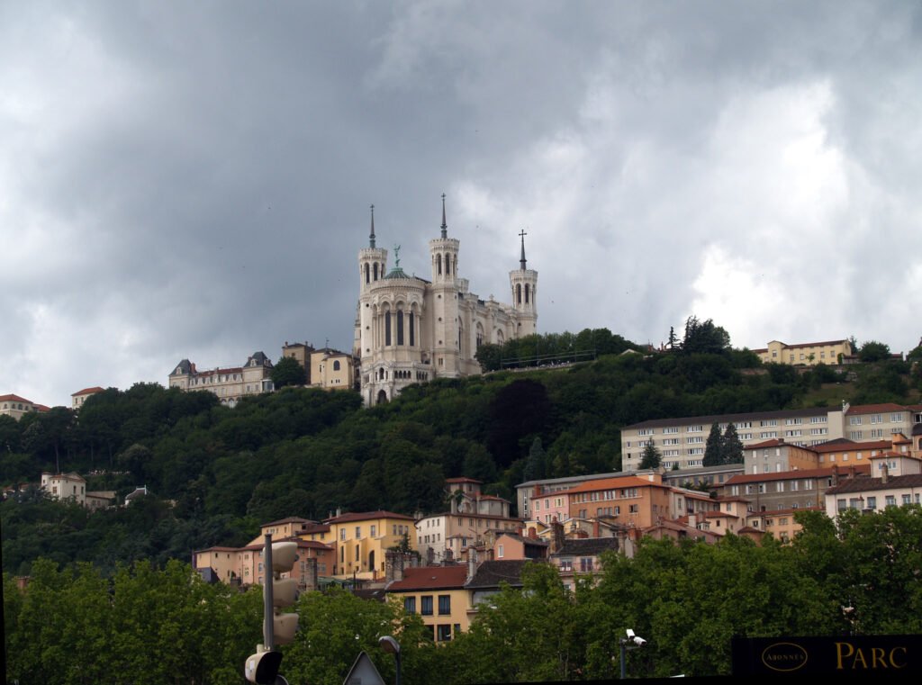
Downhill does not mean effortless. Gourguillon remains steep, and old paving can become slick when wet. Travelers who prefer gentler grades can return by funicular and start Vieux Lyon from Saint-Jean instead.
Day 2 — Croix-Rousse to Parc de la Tête d’Or
Walking route
Day 2: Croix-Rousse slopes to Parc de la Tête d’Or
- Place de la Croix-Rousse
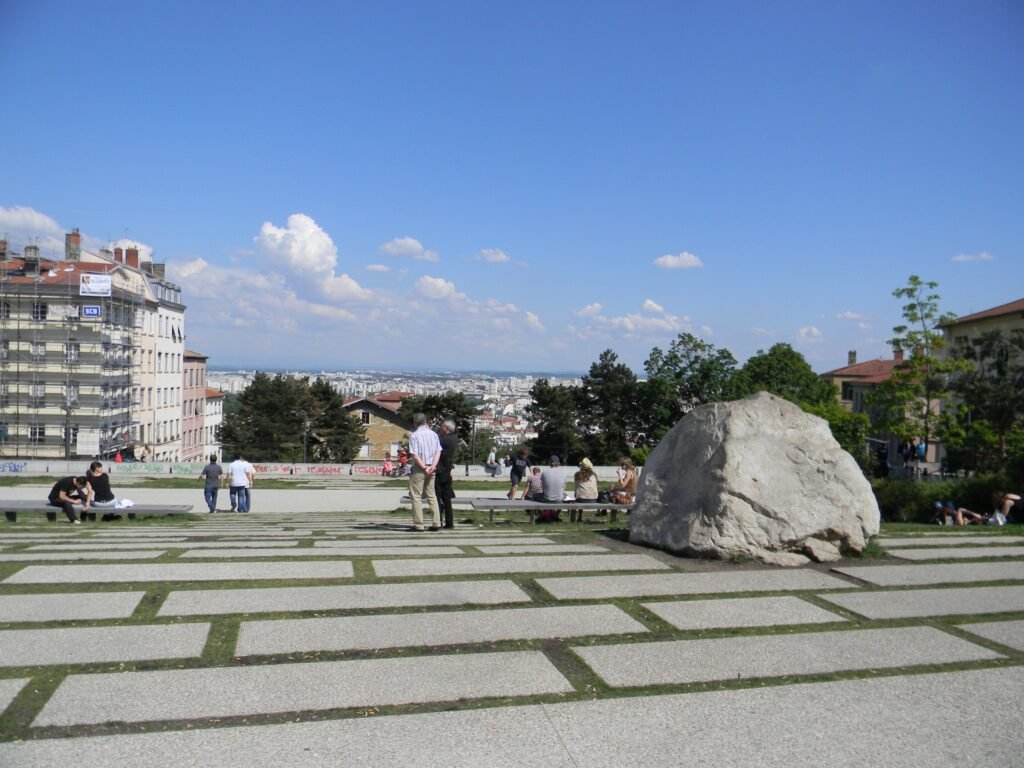
- Gros Caillou
- Cour des Voraces
- Passage Thiaffait
- Amphithéâtre des Trois Gaules
- Place Sathonay
- Opéra de Lyon
- Pont Morand
- Place Maréchal Lyautey
- Parc de la Tête d'Or – Porte des Enfants du Rhône
Take Metro C from Hôtel de Ville to Croix-Rousse, then begin on the plateau. Gros Caillou gives an immediate sense of the elevation before the route drops through the canut slopes. Cour des Voraces and Passage Thiaffait keep the descent focused on the district’s defining pedestrian passages rather than a generic arterial road.
Continue past the Amphithéâtre des Trois Gaules and Place Sathonay to the Opera. Cross the Rhône on Pont Morand, pass Place Maréchal Lyautey, and finish at the southern entrance to Parc de la Tête d’Or. The park covers 105 hectares, so treat its interior as an optional final loop rather than another compulsory cross-city march.
How to Use Transit Without Overusing It
Lyon’s transit works best as a hill and distance tool. Metro A follows the Presqu’île through Perrache, Bellecour, Cordeliers, and Hôtel de Ville. Metro D adds Bellecour and Vieux Lyon access. Metro C climbs from Hôtel de Ville toward Croix-Rousse, while F2 links Vieux Lyon directly with Fourvière.
Payment is unusually simple for occasional rides. On most zone 1 and 2 services, tap the same contactless bank card, phone, or watch at every validation. A current single trip costs €2.10 and covers one hour of connected travel. With bank-card payment, the daily charge is capped at €6.90 beyond three trips.
Weekend evenings are also well covered. TCL runs all four metro lines until 2 a.m. every Friday and Saturday. Pleine Lune overnight buses add selected late-night departures from September through June. Check the live TCL planner on travel days because maintenance and short-term disruptions can affect the best route.
Arriving in Lyon Without a Car
Lyon-Saint Exupéry Airport has a dedicated Rhônexpress rail link to Part-Dieu. The trip takes under 30 minutes and runs every 15 minutes through most of the day. Early-morning and late-evening intervals are 30 minutes, with service operating daily from 4:25 a.m. to midnight.
Part-Dieu is a strong transfer gateway rather than the perfect sightseeing doorstep. Metro B, trams, buses, and Rhônexpress meet at the station, so continuing toward a central hotel is straightforward. For Bellecour, the Tourist Office suggests either bus or a Metro connection.
Perrache is even easier for a Presqu’île stay. Official guidance places Bellecour roughly 10–15 minutes away on foot, with pedestrian Rue Victor Hugo forming the direct approach. Metro A is available if luggage, weather, or mobility makes that short walk inconvenient.
When a Car Helps
A private car adds little to a standard Lyon weekend focused on the historic center, Croix-Rousse, Tête d’Or, and Confluence. Central access restrictions can also make driving less convenient than walking and transit. A car becomes more useful for multi-stop regional countryside trips, remote accommodations, or itineraries built around places that do not share a practical rail or bus corridor.
Walking Limitations to Expect
The hills are real. Fourvière and Croix-Rousse can turn short map distances into sustained climbs. Use F2 or Metro C when the ascent adds little sightseeing value, then walk downhill through the districts.
Historic streets are not uniformly smooth. Vieux Lyon’s narrow lanes and older paving add character, but they can slow rolling luggage, strollers, and travelers who need flatter surfaces. Croix-Rousse traboules and stair-heavy passages can create similar accessibility gaps.
The outer visitor map is larger than the historic core. Parc de la Tête d’Or and Confluence remain easy without a car, but repeatedly walking to both wastes weekend mileage. Treat them as separate extensions and use transit when the journey itself is not the attraction.
Seasonal Walking in Lyon
Lyon remains practical for a walking-focused visit throughout the year, but comfort changes with the season. Météo-France’s Lyon-Bron normals record about 130 days with precipitation each year, so rain is a realistic planning factor. Wet stone on steep historic slopes deserves more caution than the flat Presqu’île. In warmer periods, riverside and park sections offer more open space, while cold or wet days make the short transit alternatives more valuable.
Bottom Line
Lyon’s most important visitor districts fit together unusually well on foot. Presqu’île and Vieux Lyon supply the compact core, short bridges keep both sides connected, and the two rivers make orientation easy. The main challenge is vertical rather than horizontal: Fourvière and Croix-Rousse demand real climbing. Use the funicular and Metro C strategically, add Tête d’Or or Confluence as separate extensions, and a private car becomes unnecessary for the standard 2–3 day city break.