
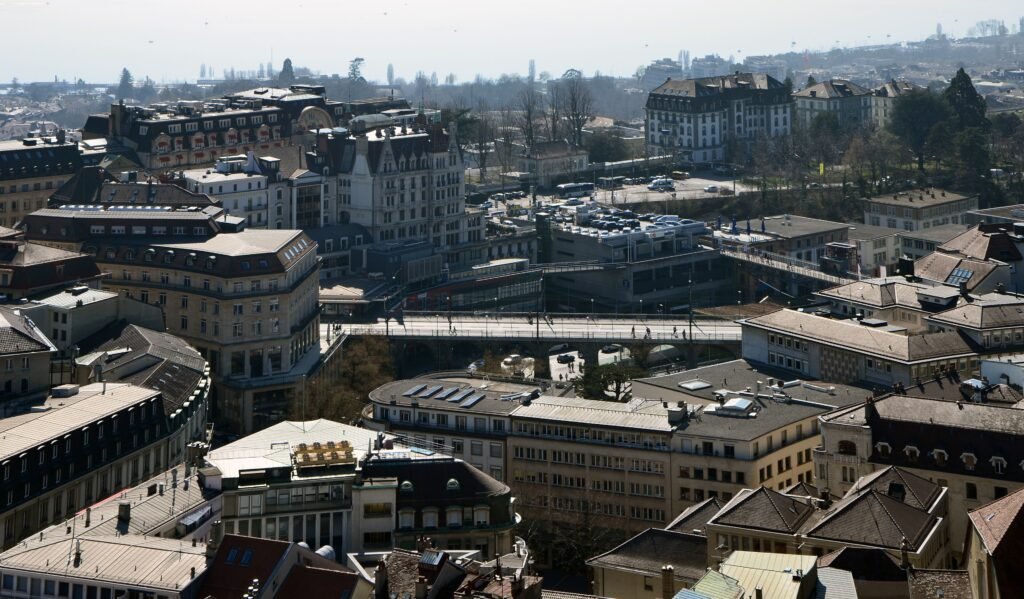
Lausanne stacks its visitor districts on a steep north–south slope above Lake Geneva, turning map distances into real climbs. The historic center compresses Cathedral, Palud, Saint-François, Rue de Bourg, and Flon into a surprisingly tight pedestrian network. Lausanne railway station sits one level lower, with Plateforme 10 beside the tracks and Ouchy farther downhill. Covered stairs, cobbled lanes, footbridges, elevators, and pedestrian streets create direct connections, but not always effortless ones. Walking works best when routes follow the slope, while M2 handles repeated vertical repositioning between lake and upper city.
Why Lausanne Feels Compact Until You Start Climbing
The upper center is genuinely compact. Cathedral, Palud, Rue de Bourg and Saint-François occupy a small first-time sightseeing area. Flon sits just below them, connected by streets, stairs and pedestrian links. The challenge is vertical rather than horizontal. A ten-minute-looking route can feel longer when it includes cobbles, stairways or a sustained climb.
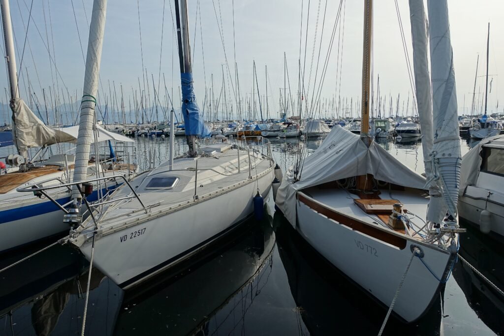
Lausanne station complicates the picture in a useful way. It is not embedded inside the Cité, yet it is close to the center. Plateforme 10 sits beside the tracks, placing three major art institutions immediately at the gateway. Ouchy and the Olympic Museum then create a separate lakeside cluster farther downhill. That arrangement favors walking within each tier and selective M2 rides between them.
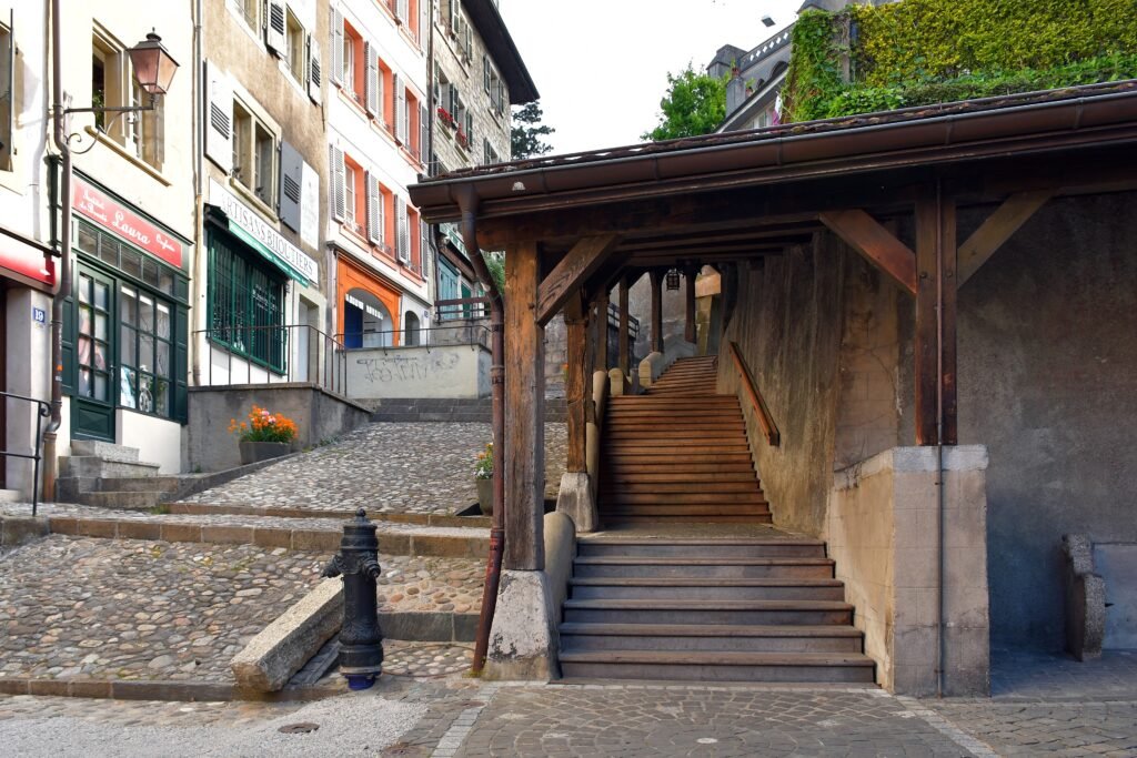
Pedestrian conditions are strongest inside the historic and shopping core. Palud and nearby streets prioritize walking, while the Cité adds atmospheric cobbles. The Market Stairs are unusually direct, but their steep steps are a real accessibility limitation. Around Ouchy, long waterfront paths make walking easy once the descent is finished.
Where to Stay for the Easiest Walking
The best base depends on which level you want outside your hotel door. Saint-François minimizes historic-center walking, Flon balances walking with transit, and the station minimizes rail-arrival friction. Ouchy is strongest for lakefront time but makes the M2 more important for upper-city sightseeing.
| Area | Best for | Walking advantage | Main trade-off |
|---|---|---|---|
| Saint-François / Rue de Bourg | Upper-center sightseeing | Palud, Cathedral, shopping streets and Flon are close. | Station and Ouchy are downhill, so return climbs matter. |
| Flon / Centre | Best all-around balance | Immediate M1/M2 access with dense dining, shopping and short central walks. | Cathedral and the Cité are still uphill on foot. |
| Gare / Sous-Gare | Rail convenience | Plateforme 10 is beside the station, with upper center and Ouchy both reachable. | Neither main visitor tier is quite at the doorstep. |
| Ouchy | Lakefront and Olympic Museum | Waterfront paths, parks and the museum cluster begin nearby. | Historic-center sightseeing needs a climb or M2 ride. |
Representative Lausanne Walking Times
These are practical planning estimates rather than guaranteed walking times. Lausanne’s grades matter, so an uphill trip can take longer than the same route downhill.
| Walk | Typical time | What changes the effort |
|---|---|---|
| Lausanne station → Plateforme 10 | about 3–5 min | Very short station-edge connection. |
| Lausanne station → Flon | about 8–12 min | Uphill on foot; M2 removes the climb. |
| Flon → Lausanne Cathedral | about 10–15 min | Short but noticeably uphill. |
| Place de la Palud → Lausanne Cathedral | about 5–10 min | Direct but steep via Market Stairs. |
| Lausanne station → Place Saint-François | about 8–12 min | Short central climb. |
| Lausanne station → Ouchy | about 17–20 min | Mostly downhill; reverse direction is harder. |
| Ouchy-Olympique → Olympic Museum | about 8–10 min | Easy connection within the lakeside cluster. |
A 2-Day Walking Route
The two days follow Lausanne’s levels instead of repeatedly climbing between them. Day 1 starts high in the Cité and trends downhill through the historic center. Day 2 begins at the station cultural district and continues downhill to Ouchy, with M2 recommended for the return.
Day 1 — Cité, Cathedral, Palud, Saint-François and Flon
Walking route
Day 1: Cité, Cathedral, Palud, Saint-François and Flon
- Château Saint-Maire
- Lausanne Cathedral
- Escaliers du Marché
- Place de la Palud
- Rue de Bourg
- Place Saint-François
- Esplanade de Montbenon
- Place de l'Europe / Lausanne-Flon
Begin at Château Saint-Maire and walk through the Cité to Lausanne Cathedral. Descend the Escaliers du Marché rather than climbing them later, then continue through Place de la Palud. Rue de Bourg leads naturally toward Saint-François. From there, cross toward Montbenon before finishing below at Place de l’Europe and Flon. This order uses elevation once instead of turning every central stop into another uphill return.
If stairs are a problem, do not force the Market Stairs segment. Use M2, elevators or an accessible street alternative between levels, then rejoin the route around Palud or Flon.
Day 2 — Plateforme 10, Station, Ouchy and the Olympic Museum
Walking route
Day 2: Plateforme 10, Station, Ouchy and the Olympic Museum
- Plateforme 10
- Lausanne Railway Station
- Lausanne-Grancy
- Parc de Milan
- Place du Port, Ouchy
- Château d'Ouchy
- Quais d'Ouchy
- The Olympic Museum
Start at Plateforme 10 before crossing the station area and moving into Sous-Gare. Continue through Grancy and Parc de Milan, then follow the descent toward Ouchy. At the lake, move east along the quays past the port and Château d’Ouchy. Finish at the Olympic Museum without retracing the waterfront. Afterward, walk back toward Ouchy-Olympique and take M2 uphill.
How the M2 Changes a Lausanne Weekend
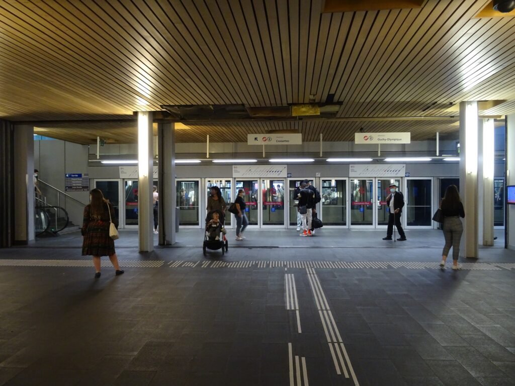
M2 is the most useful transit line for a first visit because it follows Lausanne’s main vertical sightseeing axis. Ouchy-Olympique, Lausanne-Gare and Lausanne-Flon sit on the same line, with upper-center stops continuing beyond Flon. That makes it ideal for removing repeated climbs rather than replacing short, valuable walks inside each visitor cluster.
Mobilis ticketing requires a little attention because Grand Lausanne combines zones 11 and 12. Single tickets and day-ticket products are available through tl and SBB channels, including digital options. Check current fares before travel and choose the product that best matches the number of trips you expect to make.
Qualifying overnight guests receive the Lausanne Transport Card, which includes local public transport during the stay for up to 15 days. That is a valuable visitor convenience, but it does not change the city’s underlying walking geography. M1 is useful toward the university and EPFL corridor, yet it is secondary for a standard first weekend.
Arriving in Lausanne Without a Car
Geneva Airport has frequent direct rail connections to Lausanne, making it a straightforward international arrival option without a car. Lausanne station leaves you between the upper center and Ouchy rather than directly inside either visitor cluster. Check the current SBB timetable for travel times and frequencies.
That position is convenient with one caveat: luggage makes Lausanne’s slopes more noticeable. Use M2 for an uphill hotel transfer when the alternative is dragging bags toward Flon or Saint-François. Zurich Airport also has direct long-distance rail options to Lausanne, so a car is unnecessary from either gateway.
Construction around Lausanne station can temporarily change pedestrian circulation near Place de la Gare. Follow current signs and SBB notices when passing through the work zone rather than relying on a fixed temporary route.
When a Car Actually Helps
A private car adds little to a two-day Lausanne city break. Lavaux, Vevey, Montreux, Château de Chillon and Geneva are regional extensions, and several are straightforward by rail. They should not be treated as part of Lausanne’s central walking footprint. A car becomes more useful for dispersed rural, alpine or multi-stop plans that public transport does not connect efficiently.
Walking Limitations and Practical Tips
Plan the direction of each long walk before leaving. Descending from the Cité toward Flon, or from the station toward Ouchy, saves energy without hiding Lausanne’s real terrain. For the reverse trip, M2 often gives more sightseeing value than another sustained climb.
Cobbles and historic stairs deserve special attention for travelers with mobility limitations. The Market Stairs are scenic and direct, but they are not the default accessible connection between Palud and Cathedral. Lausanne also uses elevators and escalators between some levels, so accessible routes can differ substantially from the shortest walking line.
Collection de l’Art Brut is worth treating as an optional extension rather than stretching a central walking day. Buses from the center reach the Beaulieu–Bergières area more efficiently, preserving time for the compact historic and lakefront clusters.
Seasonal Walking Context
Summer makes the Ouchy waterfront especially attractive, while winter can make steep or shaded surfaces less comfortable. Weather changes the experience more than the underlying distances. Seasonal traffic rules, events and temporary works should be checked close to travel rather than treated as permanent walkability conditions.
Bottom Line
Lausanne fits a car-free weekend well because its important visitor areas are close and public transport targets the hardest gaps. The upper center rewards walking, Ouchy works as a coherent lakeside cluster, and the station sits usefully between them. The deciding factor is not distance but elevation. Walk downhill when the route is worthwhile, then let M2 handle repeated climbs.