
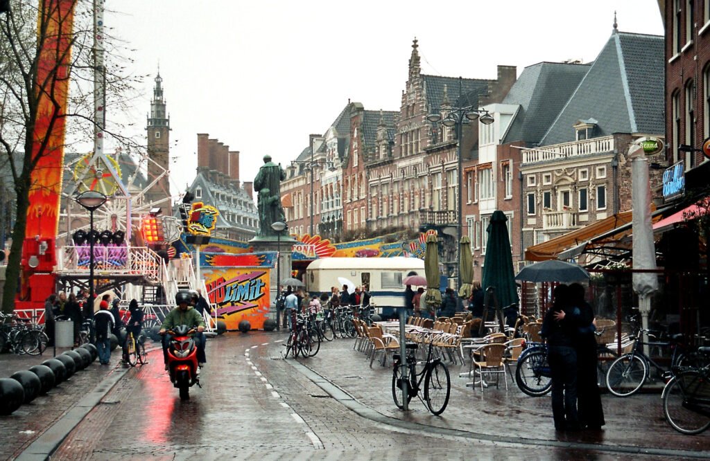
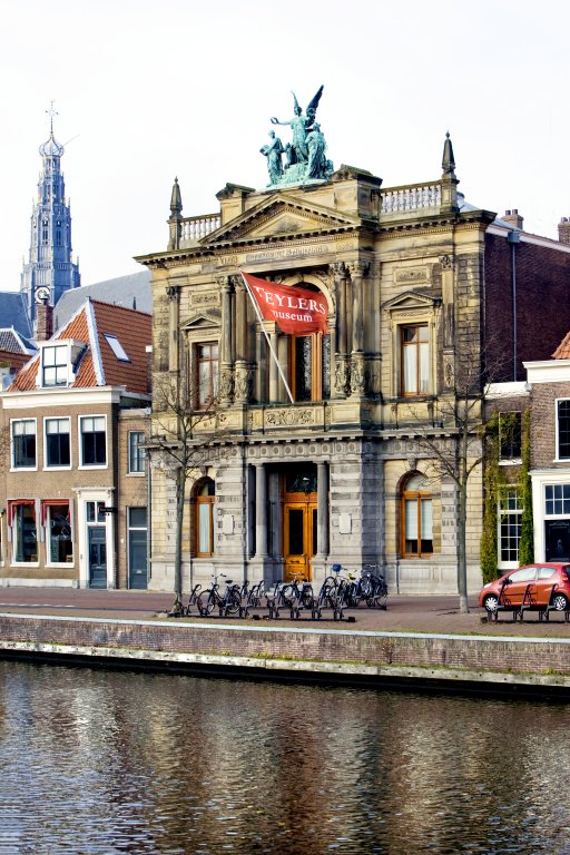
Around Grote Markt and the Spaarne, museums, shopping streets, historic lanes and riverfront scenery fit into a remarkably compact visitor area. Grote Markt acts as the hinge between the station, the southern museum quarter, and the Spaarne. Teylers Museum sits directly on the river, while Frans Hals Museum lies only a short walk south. The center’s traffic-restricted streets make continuous walking easy, although brick paving and bicycles demand attention. De Adriaan stretches the route northward without breaking the compact pattern. For most weekend visitors, walking remains the default rather than simply one transport option.
Why Haarlem Works So Well on Foot
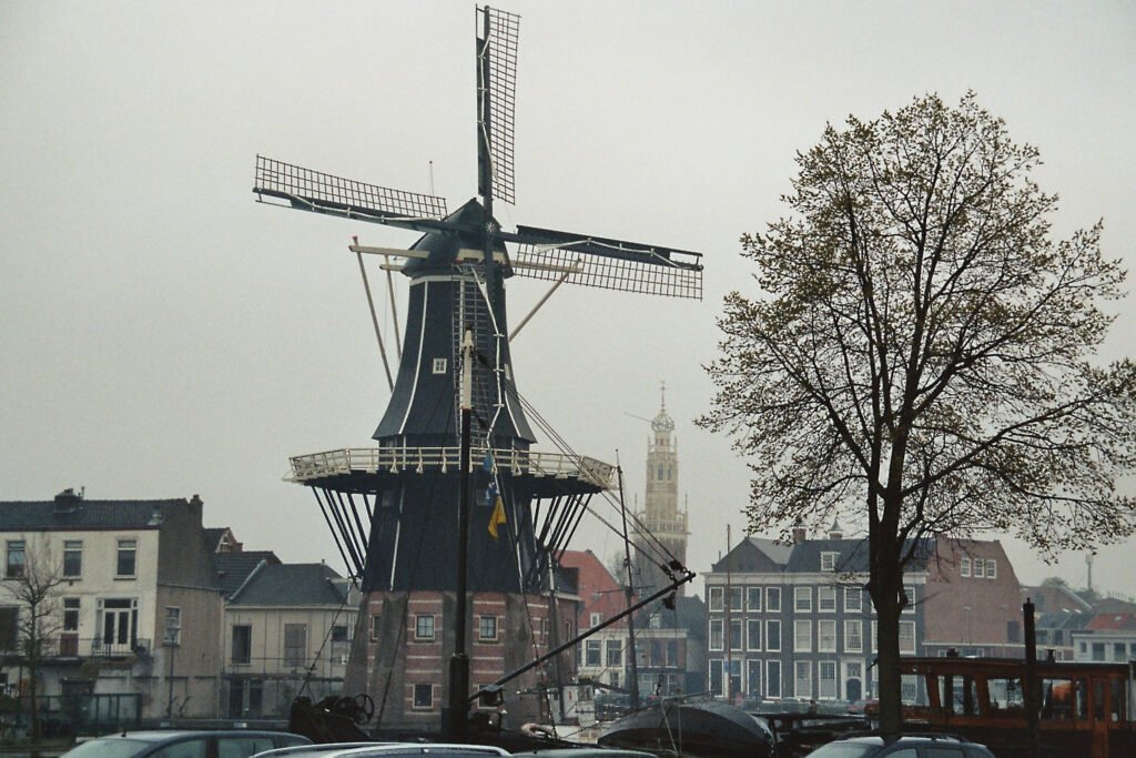
The strongest feature is not just short distances. It is how Haarlem’s visitor areas connect without awkward dead zones. From the station, Kruisstraat leads toward Grote Markt and the pedestrian core. Grote Houtstraat, Anegang, Warmoesstraat, Gierstraat and smaller lanes extend that network south and west. East of the square, Damstraat reaches the Spaarne quickly. Teylers Museum, riverfront walks and De Adriaan then fit naturally into the same weekend geography.
The municipality formally restricts vehicles across much of the center, including Grote Markt and major shopping streets. That improves continuity, but it does not remove every walking friction. Historic brick surfaces can be uneven, bicycles remain a constant consideration, and some perimeter crossings feel busier. Bridges across the Spaarne are short and flat, so the river is more a visual edge than a serious barrier.
Best Areas to Stay for Walking
The easiest bases sit between Haarlem Station and Grote Markt, or immediately south of the square. A station-side hotel minimizes arrival effort without isolating you from the center. Staying around Grote Markt puts restaurants, museums and shopping at your door. The southern edge near Grote Houtstraat also works well, especially for Frans Hals Museum and the Proveniershof. There is little reason to trade this compact core for a peripheral hotel on a short first visit.
Useful Walking Times
Haarlem Station to Grote Markt is roughly ten minutes for most visitors. Grote Markt to Teylers Museum is about five minutes. Teylers Museum to De Adriaan takes about eight minutes along the Spaarne. Grote Markt to Frans Hals Museum is roughly eight to ten minutes. Frans Hals Museum to Proveniershof is only a few minutes. These are planning estimates, not guaranteed journey times.
A 2-Day Walking Route
These routes keep each day inside one continuous walking arc. Day 1 moves south from the station through the historic core and museum quarter. The second day follows the Spaarne northward and finishes near the station, avoiding a pointless return across town.
Day 1: Station, Grote Markt, Golden Streets and Frans Hals Museum
Walking route
Day 1: Station, Grote Markt, Golden Streets and Frans Hals Museum
- Haarlem Station
- Grote Markt
- Grote or St. Bavo Church
- Warmoesstraat
- Anegang
- Grote Houtstraat
- Frans Hals Museum
- Proveniershof
- Botermarkt
Start at Haarlem Station and walk south through Kruisstraat toward Grote Markt. Visit the Grote or St. Bavo Church, then thread through Warmoesstraat, Anegang and Grote Houtstraat. Continue to Frans Hals Museum on Groot Heiligland. The nearby Proveniershof adds a quieter courtyard stop before you finish around Botermarkt or Houtplein. This route concentrates the city’s strongest pedestrian streets and avoids unnecessary retracing.

Day 2: Teylers Museum, Hofjes, the Spaarne and De Adriaan
Walking route
Day 2: Teylers Museum, Hofjes, the Spaarne and De Adriaan
- Grote Markt
- Teylers Museum
- Bakenessergracht
- Hofje van Bakenes
- Molen De Adriaan
- Nieuwe Gracht
- Haarlem Station
Begin again at Grote Markt and take Damstraat toward the Spaarne. Teylers Museum anchors the first stop. Continue through the Bakenessergracht area and Hofje van Bakenes, then return to the riverfront. Walk north along the Spaarne to De Adriaan. From the windmill, Nieuwe Gracht and Jansweg form a direct finish toward Haarlem Station.
How Useful Is Public Transit?
Transit is good, but Haarlem’s center rarely needs it. Connexxion buses are most useful for peripheral accommodations, regional trips and reducing mileage after a long day. Haarlem Station and Centrum/Houtplein are the clearest visitor hubs. R-net line 300 has especially strong weekend frequency, and line 346 gained more frequent Sunday service in 2026. Contactless payment keeps occasional rides simple.
Arriving in Haarlem Without a Car
Rail arrival is one of Haarlem’s biggest practical advantages. The main station is inside the visitor geography, not on a distant edge. The Grote or St. Bavo Church is about a ten-minute walk away. Frequent trains connect Haarlem with Amsterdam and other Randstad cities. Schiphol also has direct regional bus links toward Haarlem, although airport conditions and temporary stop changes should be checked before travel.
When a Car Helps
A car adds little to the standard Haarlem weekend. It becomes more useful for trips that combine several places outside the city, especially rural or coastal stops. Zandvoort and other regional destinations still have public-transport options, so a car is a convenience rather than a default requirement. Inside the center, restricted vehicle access and parking logistics make walking the simpler choice.
Walking Limitations and Practical Tips
Compact does not mean frictionless. Expect brick paving, occasional uneven surfaces and narrow historic lanes. Watch for bicycles when crossing cycle tracks or moving through mixed streets. Grote Markt and the shopping streets can become crowded at peak times. Some bridges and perimeter roads introduce busier crossings, but they rarely force large detours. Visitors with rolling luggage may notice surface quality more than ordinary walkers.
Seasonal Walking Note
Haarlem remains easy to explore on foot throughout the year, but seasonal conditions change comfort. Rain and wind can make the Spaarne feel exposed, while busy summer weekends increase crowding. Winter darkness shortens daylight for riverfront wandering. These conditions affect comfort rather than the city’s underlying walking distances and connections.
Bottom Line
Haarlem is built around a compact historic center that genuinely supports a car-free weekend. Most major visitor stops connect through pleasant, direct walking routes. Transit remains useful as insurance rather than as the engine of the itinerary. The main compromises are historic surfaces, bicycle awareness and occasional busy crossings, not distance or terrain.