
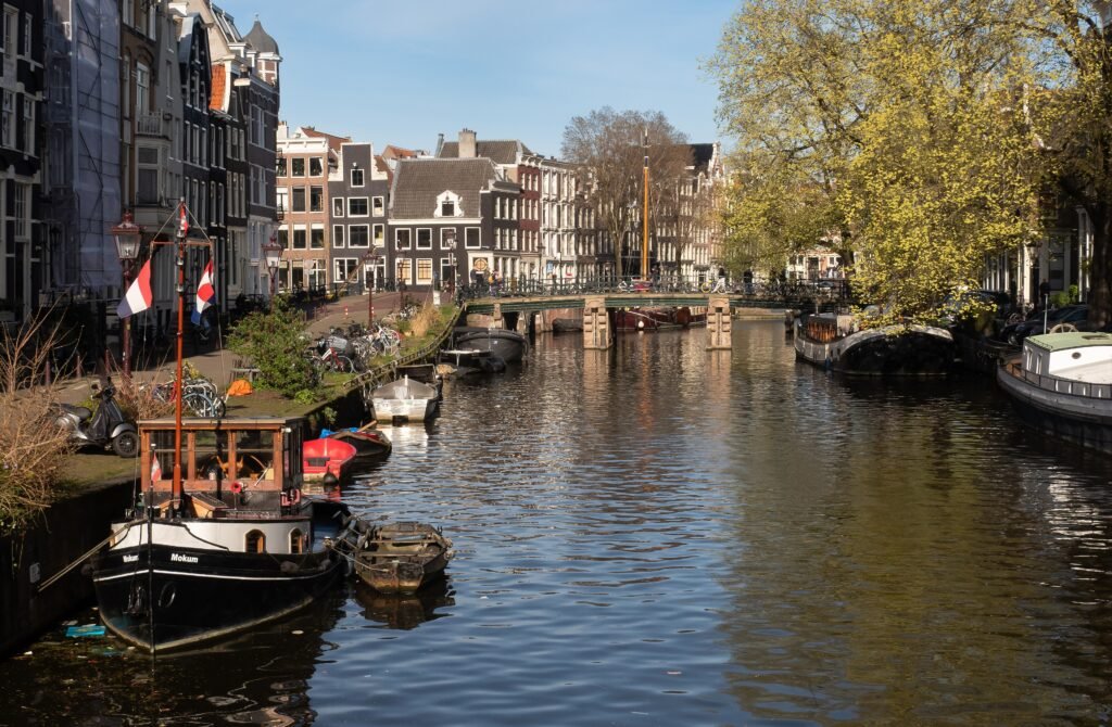
Along the canal rings, Amsterdam’s walking logic follows water rather than a conventional street grid. The canal rings keep major central sights close, yet bridge locations can bend seemingly direct routes. Almost no meaningful climbing interrupts those walks, so effort comes mainly from navigation and crowded shared street space. Beyond the canal core, visitor districts spread outward in manageable steps rather than large disconnected jumps. That pattern keeps many transfers walkable while making selective tram or metro use worthwhile. Bicycle lanes and tram tracks add movement layers, especially where historic pavements narrow near bridges and busy central streets.
Why Amsterdam Works So Well on Foot
Amsterdam’s biggest advantage is density. I amsterdam describes the city centre as a tightly woven network of canals and micro-neighborhoods within easy walking distance. That matches the visitor geography: Centraal, Dam Square, the Canal Ring, the Nine Streets, Jordaan, Westerkerk and the Anne Frank House can be linked without treating each stop as a separate transportation problem.
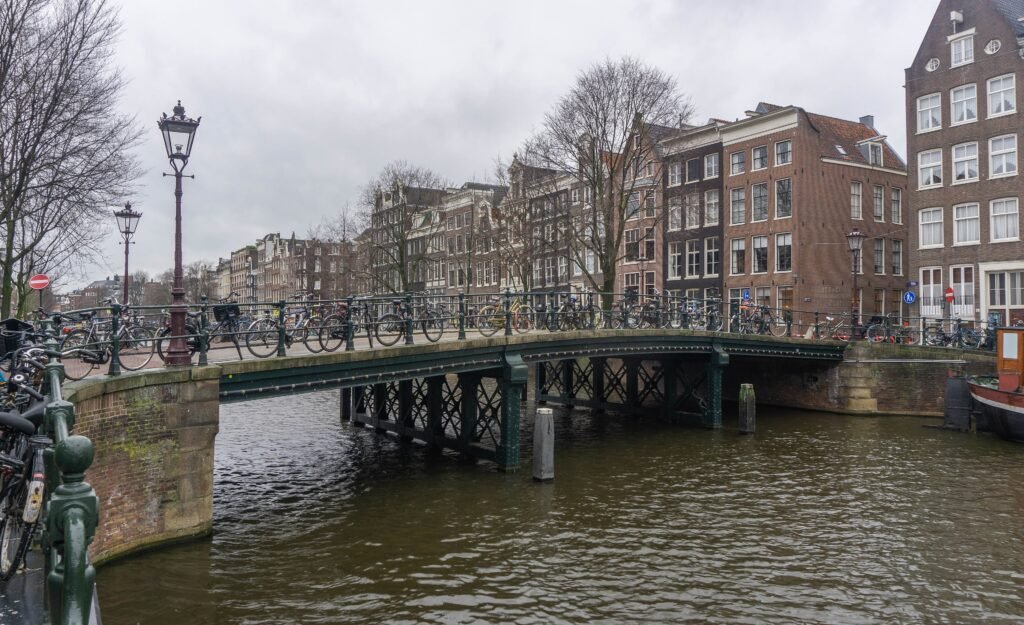
The city is also unusually flat. Most of the effort comes from distance and street complexity rather than climbing. Canal bridges add small rises, but they are minor compared with the hills that shape walking days in cities such as San Francisco or parts of Paris. For an able-bodied visitor, a 5- or 6-kilometer sightseeing route is therefore more about pacing, museums and crowds than elevation.
The second strength is the way nearby districts stack around the centre. De Plantage is roughly a 20-minute neighborhood-level walk from the City Centre, De Pijp about 30 minutes and Oud-Zuid/Museum Quarter about 40 minutes according to I amsterdam. Those distances are walkable, but they also reveal the best strategy: walk extensively inside each cluster, then use a tram or metro when a 30- to 40-minute transfer adds little sightseeing value.
Where to Stay for the Most Walkable Amsterdam Weekend
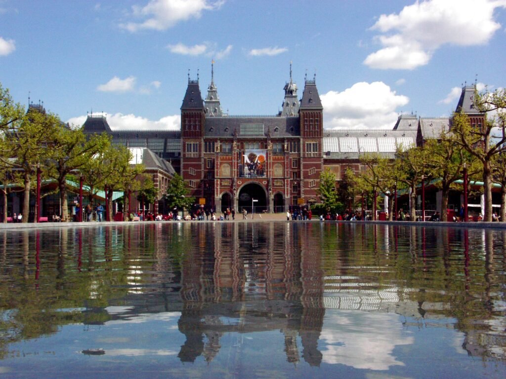
For a first visit, the Canal Ring and Nine Streets offer the simplest all-around base. You can walk to Dam, Jordaan, major canal scenery, shopping streets and many central attractions without starting the day on transit. The tradeoff is intensity: the most central streets are also among the busiest, and narrow historic space can feel crowded.
Jordaan is nearly as strong if your priority is canal atmosphere and neighborhood walking. Anne Frank House, Noordermarkt, Prinsengracht and Brouwersgracht are close together, and the Nine Streets sit immediately to the east. You give up a little efficiency for Museumplein, De Pijp and the eastern districts, but not enough to make Jordaan a poor car-free base.
The Museum Quarter/Oud-Zuid is the better choice for travelers building the trip around the Rijksmuseum, Van Gogh Museum and Vondelpark. It is calmer than the busiest centre and works beautifully on foot locally, but the representative 40-minute walk from the City Centre is exactly the kind of distance where a tram becomes useful. De Pijp works similarly for food, Albert Cuyp Market and a more local street scene, while Plantage is a strong eastern base for ARTIS, Hortus Botanicus and the Amstel.
Representative Walking Times
A few planning times show how compact the city really is. The Anne Frank House publishes roughly 20 minutes on foot from Amsterdam Centraal and about 10 minutes from Dam Square. I amsterdam gives neighborhood-level walking estimates of around 20 minutes from the City Centre to Plantage, 30 minutes to De Pijp and 40 minutes to Oud-Zuid. Museumplein to the Jordaan is roughly 25–30 minutes in representative route planning. These are practical planning estimates rather than guaranteed walking times; exact bridges, attraction entrances, crowds and pedestrian signals can change the actual time.
A 2-Day Amsterdam Route Built Around Walking
These two days avoid turning Amsterdam into one long out-and-back walk. The first day stays inside the strongest continuous canal-core network. The second starts at Museumplein, walks east through De Pijp and the Amstel to Plantage, then uses a tram for the low-value return toward Centraal.
Day 1: Centraal, the Canal Ring and Jordaan
Walking route
Day 1: Centraal, historic core, Nine Streets and Jordaan
- Amsterdam Centraal
- Dam Square
- Begijnhof
- De 9 Straatjes (Nine Streets)
- Westerkerk
- Anne Frank House
- Noordermarkt
- Brouwersgracht at Keizersgracht
Start at Amsterdam Centraal and follow the simple Damrak axis to Dam Square. From there, cut through the old centre toward the Begijnhof, then turn west into the Nine Streets. This sequence gives you the dense historic core before the day shifts into slower canal-side walking.
Continue to Westerkerk and the Anne Frank House. If you have a timed museum reservation, build the day’s pace around it; if not, the streets and canals still make this a logical route. Walk north through Jordaan to Noordermarkt, then finish around Brouwersgracht and Keizersgracht. The outdoor route is roughly 5–6 km before optional detours, shopping and museum time.
The key Day 1 skill is not endurance but lane awareness. A canal bridge may carry pedestrians, bicycles and motor traffic through a narrow space, and people stopping for photos can compress the remaining pavement. Stay out of cycle lanes while waiting or looking at a map, and make deliberate checks before crossing them.
Day 2: Museumplein, De Pijp, the Amstel and Plantage
Walking route
Day 2: Museum Quarter, De Pijp, Amstel and Plantage
- Rijksmuseum
- Van Gogh Museum
- Albert Cuyp Market
- Sarphatipark
- Magere Brug
- H'ART Museum
- Hortus Botanicus Amsterdam
- ARTIS
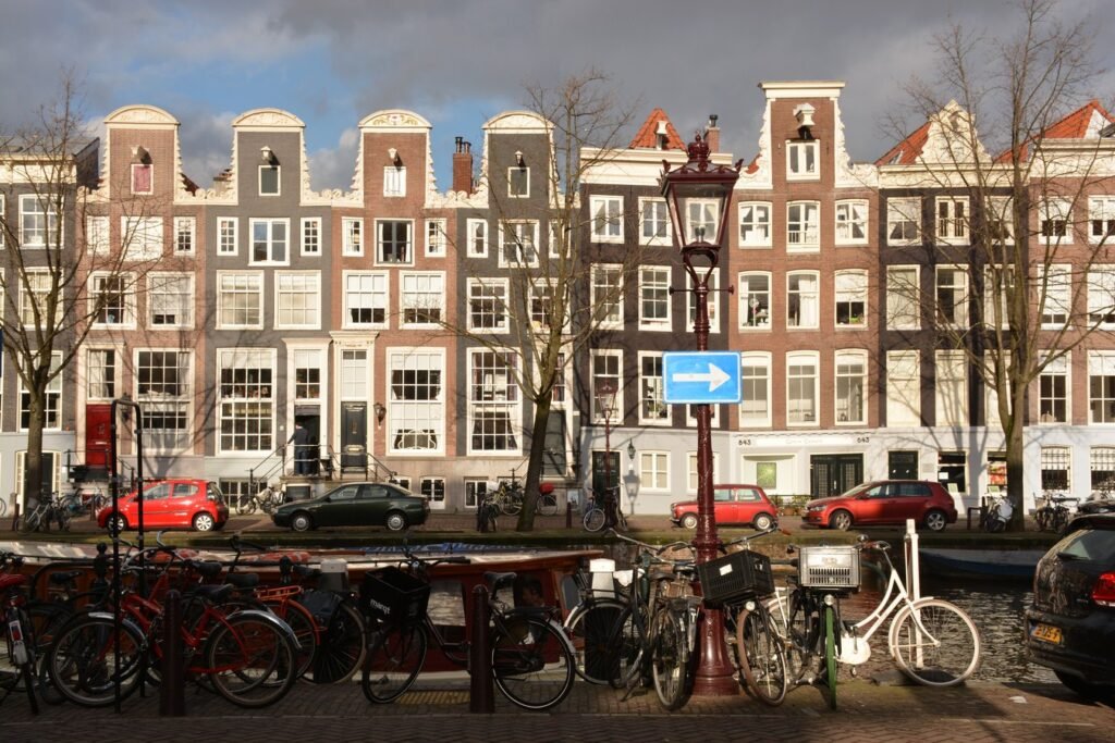
Begin at the Rijksmuseum and Van Gogh Museum. If you are staying in the northern canal core, take a tram or metro-assisted connection to the Museum Quarter rather than spending your first 35–40 minutes retracing a route you may already have walked. From Museumplein, continue into De Pijp for Albert Cuyp Market and Sarphatipark.
From De Pijp, walk northeast to the Magere Brug, then follow the Amstel toward H’ART Museum. Finish through Hortus Botanicus and ARTIS in Plantage. That keeps the day moving in one direction rather than bouncing back toward Museumplein. The walking portion is about 5–6 km, again before museum interiors.
After ARTIS, use tram 14 toward the central area instead of walking the same ground back. GVB engineering can temporarily alter exact stop patterns, so check the live journey planner on the day. The eastern visitor cluster is close enough to explore on foot, while the return ride preserves time and energy.
Getting Around Amsterdam Without a Car
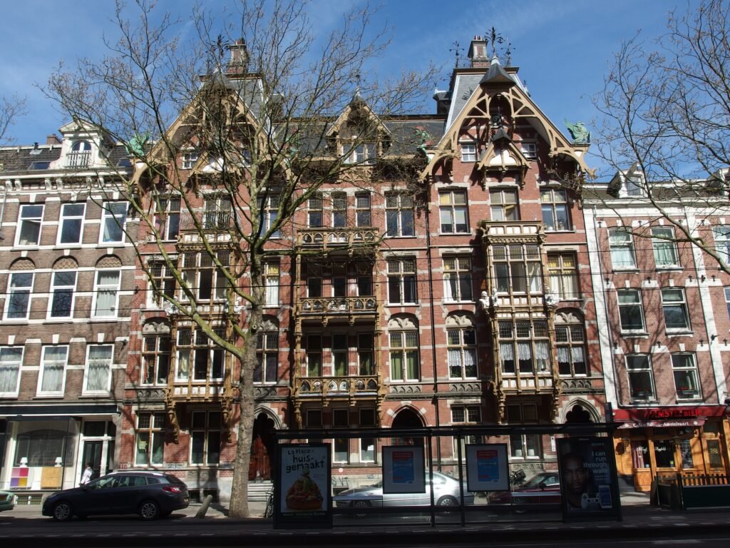
For most weekend visitors, trams are the best walking companion. They reach the surface districts where a metro station may not sit directly beside the attraction, and I amsterdam specifically highlights connections between Centraal and areas such as De Pijp, Jordaan and Museumplein. Metro line 52 is the fastest north-south spine, linking Centraal and the central Rokin/Vijzelgracht corridor with De Pijp and Amsterdam Zuid.
Payment is unusually simple. GVB accepts OVpay with contactless debit or credit cards, phones and smartwatches, with no advance registration. Use the same card or device to check in and out. In 2026, GVB lists a €3.40 one-hour ticket, a €10 day ticket, a €16 two-day ticket and a €21.50 three-day ticket. If your itinerary is mostly walking with two or three strategic rides, pay-as-you-go can be more sensible than automatically buying a pass.
Amsterdam Noord is also easy to add without a car. GVB’s IJ ferries F1–F7 are free for pedestrians and other permitted slow traffic, and the F3 between Buiksloterweg and Centraal runs day and night. That makes the waterfront north of the IJ feel like a separate but very low-friction visitor cluster rather than a destination that requires a taxi.
Arriving in Amsterdam Without a Car
Schiphol is one of Amsterdam’s strongest car-free advantages. The railway station sits directly below the terminal, so there is no airport shuttle between baggage claim and the train platform. Schiphol and NS publish eight trains per hour between the airport and Amsterdam Centraal, with a representative journey of roughly 14–17 minutes. Contactless bank-card or phone payment is available.
Rail travelers can have an even simpler start. Amsterdam Centraal is already on the edge of the historic core, and direct international services include Eurostar links with London and Paris. From the station, Dam Square, the canals and Jordaan-side attractions are walkable; luggage is the main reason to take a short tram or taxi rather than distance.
Together, these gateways make Amsterdam exceptionally easy to reach without driving: Schiphol has a direct, high-frequency rail connection into the city, while Amsterdam Centraal places rail passengers directly on the edge of the historic core.
The Pedestrian Reality of Amsterdam’s Bike-First Streets
This is the part of Amsterdam’s walkability that deserves the most nuance. Fewer cars can create calmer streets and more space for people, and municipal projects sometimes widen pavements while reducing through traffic. But bicycle-oriented design can also create another fast-moving lane that pedestrians must cross correctly. A low-car street is therefore not assumed to be a perfect walking street.
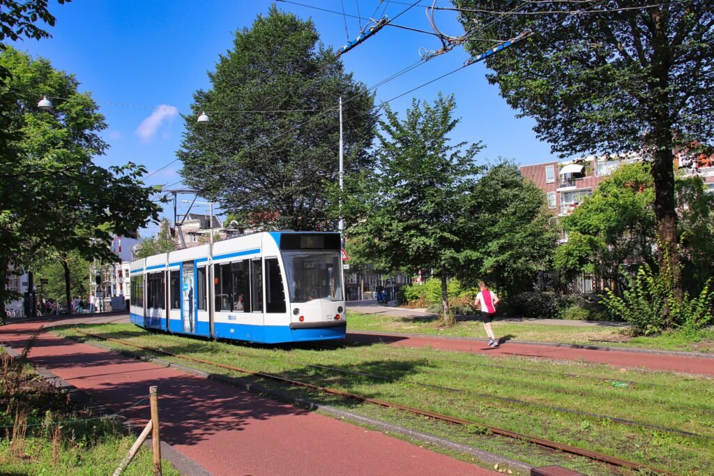
In the historic centre, watch for cycle lanes—often red—before stepping sideways for a canal view or crossing toward a bridge. Do not stand in a cycle lane while checking directions. At tram corridors, read the stop layout and rails as another movement channel rather than treating the entire street as pedestrian space. On narrow canal streets, parked bicycles, terraces and groups can leave less passing room than the postcard view suggests.
Wayfinding has a similar tradeoff. The canals are excellent orientation landmarks once you understand the ring, but Herengracht, Keizersgracht and Prinsengracht can look deceptively similar, and the shortest-looking line on a map may depend on where the next bridge actually is. A quick route check before crossing a canal is often more useful than correcting course two bridges later.
When a Car Becomes Useful
For a typical Amsterdam city break, a private car adds more hassle than value. The core is compact, parking is unnecessary for sightseeing, transit covers the longer gaps and both major gateways work without one. Even many obvious day trips in the wider Netherlands are rail- or bus-friendly.
A car starts to make sense only when Amsterdam is one stop on a wider regional itinerary built around several rural or dispersed destinations that are awkward to combine by public transport, or when a traveler’s specific mobility or luggage needs make point-to-point road transport materially easier. That is a different trip from a normal two- or three-day Amsterdam visit.
Practical Walking Tips
Build each day around one side of the city rather than using the canal core as a hub you repeatedly return to. Day 1 can stay west and central; Day 2 can move from Museumplein through De Pijp to the eastern centre. This reduces both mileage and unnecessary canal crossings.
Use transit when the walk is mostly a transfer. A 30-minute walk from the centre to De Pijp can be enjoyable once; doing it again after a museum-heavy day may not be. The same applies to Museumplein: if the route has already given you plenty of canal walking, a tram is not a failure of a walkable itinerary—it is what keeps the walking focused on the streets that add the most value.
For the Anne Frank House and major Museumplein institutions, plan timed-entry attractions before locking the route order. The Anne Frank House notes a Westermarkt tram interruption through February 2028, so check same-day transit directions if your route depends on that stop.
Seasonal Walking Note
Amsterdam supports a walking-focused visit throughout the year, but seasonal conditions change comfort and crowding. Winter’s short daylight, wind and wet paving can make long canal days feel slower, while spring and summer bring heavier visitor density around the centre and headline attractions.
Bottom Line
Amsterdam works exceptionally well for a walking-first two- or three-day visit because its main sightseeing districts connect naturally on foot, while excellent transit handles the relatively few gaps where walking stops being efficient. The city is flat, compact and easy to reach without a car. Its main pedestrian caution is not distance but attention: canal bridges, narrow historic space, bicycle lanes, tram tracks and crowds keep the walking environment just short of effortless.