
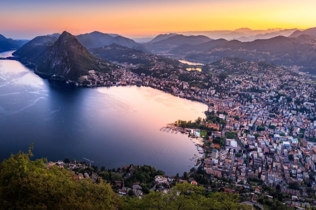
Lake Lugano organizes the visitor map more clearly than the street grid does. Piazza della Riforma, Via Nassa, LAC, and Parco Ciani sit close enough for short, connected walks. The historic center is largely pedestrianized, and the waterfront provides a direct promenade between major central sights. The main physical break is vertical: Lugano railway station stands above the lower city rather than beside it. Walking between them is quick but noticeably steeper than the lakeside routes. This contrast defines the weekend: easy walking on the lake level, with targeted transit for climbs and outer extensions.
Why Lugano Works Well on Foot
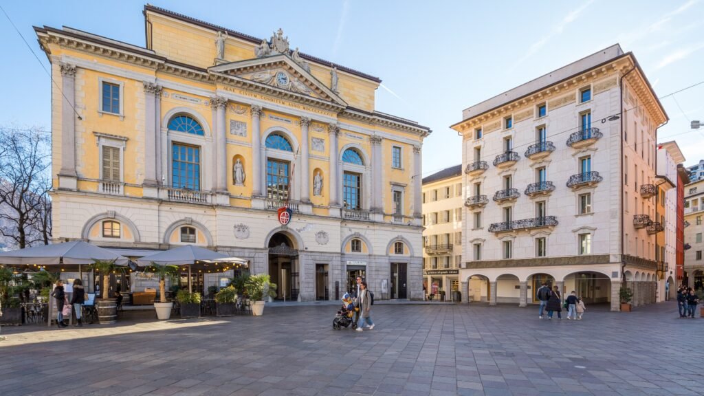
Lugano’s strongest walking geography sits between the historic center and the lake. Piazza della Riforma is the natural reference point, with Via Nassa running southwest toward Santa Maria degli Angioli and LAC. Parco Ciani begins only a short walk east, so the main central sights rarely require a long repositioning walk.
The City of Lugano’s own pedestrian map reflects that compactness. It says the center can be crossed in about 45 minutes, while listed point-to-point walks stay within 15 minutes. Piazza della Riforma to the railway station is about eight minutes, and Lanchetta in the Cassarate direction is about 13 minutes.
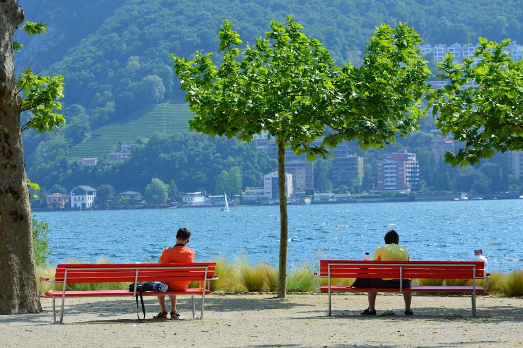
The pedestrian environment is strong but not frictionless. Via Nassa and much of the historic center sit inside formal pedestrian or pedestrian-priority areas. Parco Ciani adds dedicated paths, shade and an easy lakeside connection. Along parts of the waterfront, however, road traffic still separates central streets from the lake and requires designated crossings.
That lakeside road matters because scenery can make Lugano feel more pedestrianized than it actually is. The City’s current waterfront masterplan still targets lower traffic, more shared space and further pedestrianization. Those plans support the underlying picture: walking is already practical, but several central interfaces can become calmer and more continuous.
Best Areas to Stay for Walking
Historic center and Piazza della Riforma: the best all-around base for a first visit. Via Nassa, the lake, Parco Ciani and LAC are all close, while the station funicular removes most luggage-related inconvenience.
Via Nassa and the LAC lakefront: ideal if you want culture, waterfront walks and the historic center outside your door. This side also works well for an evening promenade toward Paradiso without committing to a long cross-city walk.
Station and upper center: excellent for early trains and short stays built around rail. The tradeoff is elevation. You will either descend on foot, climb back later, or use the station funicular for repeated trips.
Cassarate: a good secondary choice for Parco Ciani, the Lido and Monte Brè access. It remains easy without a car, but the historic-center sights are less immediate than from Piazza della Riforma.
Realistic Walking Times in Lugano
Piazza della Riforma to Lugano railway station: about 8 minutes on the City’s pedestrian map. The distance is short, but the uphill direction requires more effort than a lakeside walk.
Piazza della Riforma to Lanchetta: about 13 minutes by the same official walking guidance. This is a useful benchmark for the Cassarate and Monte Brè side of the visitor map.
Piazza della Riforma to Lido Riva Caccia: about 12 minutes. That time shows how quickly the lower city spreads along the lakeshore even when the route leaves the historic center.
Piazza della Riforma to LAC: roughly 7–10 minutes. Piazza della Riforma to Parco Ciani: roughly 5–8 minutes. LAC to Parco Ciani: roughly 12–15 minutes along the central lakefront. These last three are practical planning estimates rather than guaranteed walking times.
A 2-Day Walking Route
These routes keep Lugano compact rather than manufacturing mileage. The first day exposes the station descent and historic core. The second follows the lower lakeside eastward through Parco Ciani and Cassarate, with transit used only to avoid retracing the same ground.
Day 1 — Station, Historic Center, Via Nassa and LAC
Walking route
Day 1 — Station, Historic Center, Via Nassa and LAC
- Lugano Railway Station
- Cathedral of San Lorenzo
- Piazza Cioccaro
- Piazza della Riforma
- Via Nassa
- Church of Santa Maria degli Angioli
- LAC Lugano Arte e Cultura
- Giardino Belvedere
Begin at Lugano railway station and walk downhill toward the Cathedral of San Lorenzo. Via Cattedrale and the adjoining hillside streets make the city’s main central elevation change immediately visible. The descent is short, but it feels very different from the lower lakefront.
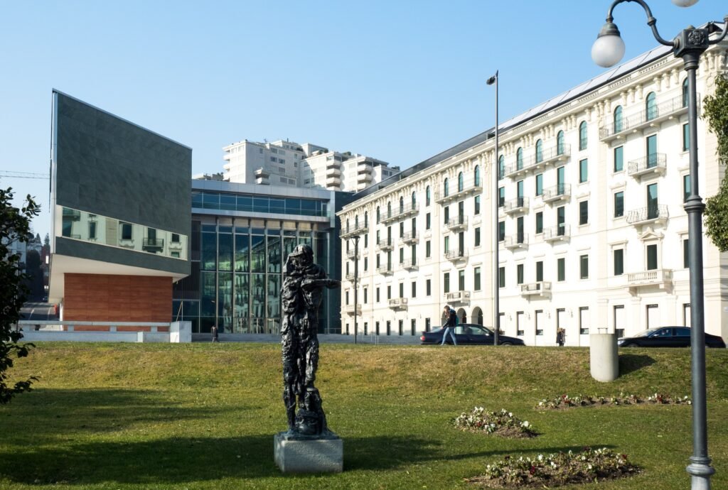
Continue through Piazza Cioccaro to Piazza della Riforma, then enter Via Nassa. The pedestrian street and its porticoes make a comfortable route toward Santa Maria degli Angioli. From there, LAC is only a few steps away, followed by the Belvedere garden and lakeshore.
There is no reason to use a bus during this sequence. If you arrived with luggage, use the station funicular first and save the walking descent for later. Returning uphill at the end of the day is another good moment to let the funicular handle the climb.
Day 2 — Parco Ciani, Cassarate and the Monte Brè Edge
Walking route
Day 2 — Parco Ciani, Cassarate and the Monte Brè Edge
- Piazza della Riforma
- Piazza Indipendenza
- Villa Ciani
- Parco Ciani
- Foce del Cassarate
- Lido di Lugano
- Monte Brè Funicular Lower Station
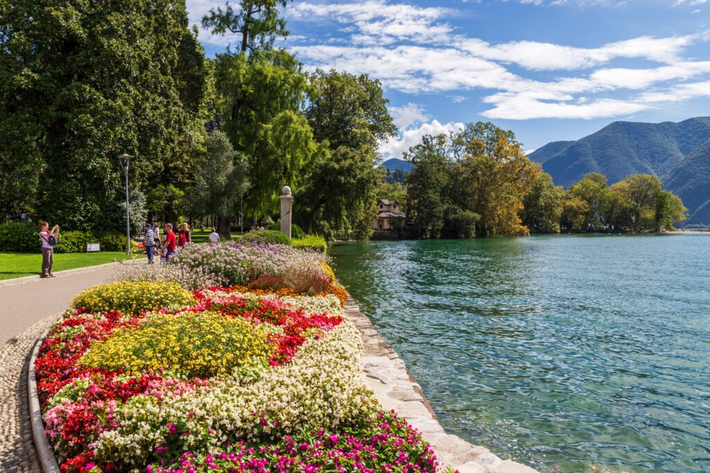
Start again at Piazza della Riforma, then head east through Piazza Indipendenza into Parco Ciani. Villa Ciani sits inside the park, while the pedestrian paths continue toward the mouth of the Cassarate River. This is the easiest long-form walk in central Lugano.
Continue to the Lido and then toward the lower Monte Brè funicular area in Cassarate. That endpoint is useful because it shows where the compact center gives way to an excursion zone. The mountain ascent itself is not part of the city walking route.
If you finish near Cassarate, TPL Line 2 is the efficient return. It serves the Lido, Lanchetta, Lugano Centro and the railway station, so there is little value in walking the same lakeside corridor backward.
How Transit Helps a Lugano Weekend
The station funicular is one of Lugano’s most useful visitor connections, linking Lugano FFS with Piazza Cioccaro and removing the steep climb between the station and lower city. It runs frequently through most of the day, and valid local transport tickets can be used. Check the current TPL timetable and fares before travel.
That funicular is valuable because it solves a specific problem rather than replacing useful walking. It handles the station climb for luggage, tired legs or repeated trips while leaving the lower historic center and lakefront easy to explore on foot.
TPL Line 2 is another useful service, linking Paradiso, the railway station, Lugano Centro, the Lido, Lanchetta, Cassarate and Castagnola. It is especially helpful for avoiding repeated walks along the same lakefront corridor. Check the current timetable for evening and weekend frequencies.
Line 1 is useful along the southern side toward Piazza Luini and Paradiso. For Monte Brè, the city points visitors toward the Cassarate side, while Monte San Salvatore begins in Paradiso. Both mountains are easy car-free extensions, but neither belongs to Lugano’s compact central walking footprint.
Arcobaleno Tickets and the Ticino Ticket
Arcobaleno offers single tickets and day passes covering local buses, trains and the Lugano station-center funicular within the selected zones. Check current prices and zone requirements before purchase.
SBB Mobile and FAIRTIQ are practical digital purchase options, and ticket machines remain widely useful. Eligible hotel, hostel and campsite guests receive the Ticino Ticket for regional public transport from check-in through midnight on checkout day. The Ticino Ticket cannot be purchased separately.
Lake boats should be treated differently. Standard Lake Lugano sightseeing navigation is not the same thing as Lugano’s urban transit network. Ticino Ticket holders receive a discount on Lake Lugano day-pass navigation, which makes boats useful for excursions without making them essential city transport.
Arriving in Lugano Without a Car
Lugano railway station is the principal gateway and one of the city’s biggest car-free strengths. It is directly served by long-distance trains from Zürich HB and Milan, while the S50 corridor connects Lugano with Varese and Milan Malpensa Airport.
From Zurich Airport, the normal rail strategy is straightforward: take one of the many trains to Zürich HB, then continue south on a direct IC2 or EuroCity service. The transfer adds time, but there is no need for an airport car rental to reach Lugano.
Milan and Milan Malpensa are also practical rail-based gateways for Lugano. Direct cross-border trains connect Lugano with Milan, while TILO provides rail access toward Malpensa. Check the current SBB and TILO timetables for travel times and frequencies.
Lugano Airport has a limited role for ordinary scheduled international arrivals. Most overseas visitors are more likely to reach Lugano through Zurich Airport, Milan Malpensa or the major cross-border rail corridors, all of which allow the city to be reached without renting a car.
When a Car Actually Helps
A car adds little to the normal two-day city break. The historic center, LAC, Parco Ciani, Cassarate and Paradiso are all practical by walking and public transport. Even Monte Brè and Monte San Salvatore have public-transport approaches when their funiculars are operating.
Driving becomes more useful when the trip changes from a Lugano weekend into a broader rural itinerary. Remote trailheads, multiple small Ticino villages in one day, or accommodation far outside the urban network can justify a car. Gandria and Morcote remain lake-region extensions rather than evidence that the city itself has a huge walkable footprint.
Walking Limitations and Practical Tips
Do not judge the station walk by distance alone. Eight minutes is short, but the climb is real. Use the funicular with luggage, after a long day, or when mobility is limited.
Use the lake as your orientation spine, not as proof that every route is traffic-free. Several central lakefront sections still meet a roadway, so use marked crossings rather than drifting between the promenade and historic streets.
Walk the historic center instead of riding through it. Piazza della Riforma, Via Nassa and adjoining pedestrian streets are close enough that a short bus ride usually saves little time.
Treat Cassarate and Paradiso as extensions. Both are easy without a car, but adding them to every central loop creates unnecessary mileage. Use TPL when the goal is a mountain-funicular base rather than the streets between.
Check live service before mountain or airport extensions. Rail engineering works, road construction and funicular maintenance can temporarily change the best route. Those disruptions do not change Lugano’s underlying walking structure.
Seasonal Note
The central walking distances stay manageable year-round, but summer heat can make exposed lakeside sections feel longer. Parco Ciani, Via Nassa’s porticoes and shaded historic streets offer useful relief. Mountain funiculars and lake excursions follow seasonal timetables, so verify operating dates before making them the centerpiece of a day.
Bottom Line
Lugano works best as a compact lakeside city with one important vertical exception. Walk the historic center, Via Nassa, LAC and Parco Ciani; use the station funicular for the hill; and add buses only when the itinerary reaches Cassarate, Paradiso or a mountain base. A private car is unnecessary for the standard first weekend.