
Within the Avon valley, Bath concentrates its headline sights into a small central area before rising noticeably toward the Georgian upper city. The Roman Baths, Bath Abbey, shopping streets, and Pulteney Bridge sit within minutes of one another. Bath Spa Station enters this network from the south, keeping arrival unusually close to the first sightseeing stop. The pattern changes beyond Queen Square and Gay Street, where routes toward The Circus and Royal Crescent climb steadily. Pulteney Bridge also channels east-west movement across the Avon through a narrow historic crossing. That combination makes Bath easy to explore on foot, but not uniformly effortless once the route leaves the central basin.
How Bath Works on Foot
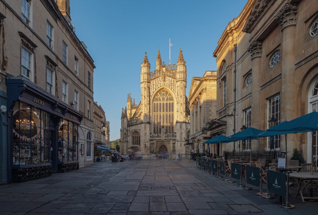
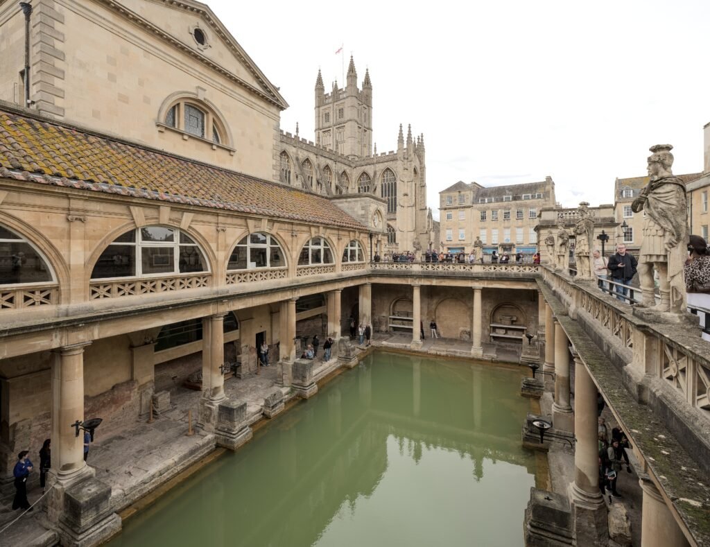
Bath’s strongest walking zone runs from Bath Spa through SouthGate and Stall Street to the Roman Baths and Bath Abbey. Union Street then continues toward Milsom Street, placing shopping, cafés and visitor services on the same north–south axis. Pulteney Bridge is only a short extension east of the Abbey, and it carries pedestrians directly toward Laura Place and Great Pulteney Street. The result is unusually efficient sightseeing: several headline stops can be linked without transit, lengthy road crossings or wasted mileage.
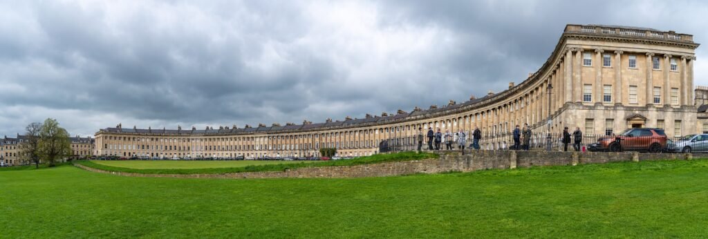
The compact centre should not be mistaken for a completely level city. Official accessibility guidance describes the central area as mostly flat, but the upper Georgian quarter tells a different story. No.1 Royal Crescent describes the walk from Bath Spa as just under a mile uphill. Gay Street rises from Queen Square toward The Circus, and the approach continues west toward Royal Crescent. Streets above that level climb farther toward Lansdown, so a short map distance can still require meaningful effort.
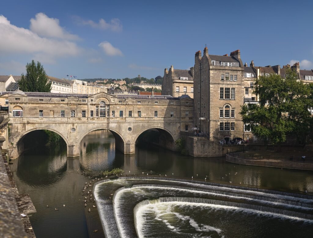
Pedestrian continuity is strongest around the Abbey, Bath Street and the main shopping streets. Bath & North East Somerset Council permanently restricts general vehicle access on several central streets during daytime hours. That creates a calmer walking core, but historic surfaces remain part of the experience. Flagstones can be uneven, narrow streets become congested, and Pulteney Bridge mixes sightseeing pedestrians with a constrained roadway. Crowds around the Roman Baths and Abbey can slow walking even when the actual distance is tiny.
Best Areas to Stay for a Walking Weekend
Abbey Quarter and SouthGate give the shortest walks to the Roman Baths, Bath Abbey and Bath Spa Station. Milsom Street and Queen Square balance central shopping with quicker access to The Circus and Royal Crescent. Pulteney and Bathwick suit travelers who prefer Great Pulteney Street, the Holburne Museum and a quieter eastern base. Walcot adds independent shops and character, but some addresses sit farther from the tightest sightseeing cluster. Upper Lansdown-facing stays can be attractive, yet they add climbing to every central return.
Walking Times That Matter
- Bath Spa Station to the Roman Baths: about 5–10 minutes.
- To the Holburne Museum from Bath Spa Station: about 15 minutes.
- Royal Crescent from Bath Spa Station: roughly 15–20 minutes, with an uphill approach.
- Central Bath to No.1 Royal Crescent: roughly 10 minutes from the city-centre side.
- Queen Square to The Circus: around five minutes for most visitors.
- The Circus to Royal Crescent: around five minutes via Brock Street.
- Pulteney Bridge to the Holburne Museum: roughly 10 minutes along Great Pulteney Street.
These are planning ranges, not guarantees. Crowds, crossings, wet stone and the uphill approach to the upper Georgian quarter can all change the pace. A traveler with limited mobility may find the station-to-Royal-Crescent walk much more consequential than its distance suggests.
Where Bath Gets Harder to Walk
Terrain is the main reason Bath does not feel equally effortless in every direction. The Roman and Abbey core sits low in the Avon valley, while The Circus and Royal Crescent occupy higher streets. Continuing north toward Lansdown adds more elevation. A sensible itinerary therefore avoids repeated up-and-down trips between the centre and upper city. Walk the Georgian quarter as one connected circuit, then finish downhill or use a bus if energy is limited.
Historic fabric creates a second limitation. Royal Crescent’s pavements are wide, but official accessibility information notes flagged surfaces that can be slightly uneven. Central lanes and bridge approaches can also feel narrow when visitor numbers are high. Bath remains highly usable on foot, yet travelers using wheelchairs, walkers or heavy luggage should choose routes by surface and gradient, not distance alone.
A 2-Day Walking Route
The most efficient weekend separates the river-level core from the upper Georgian quarter. Day 1 moves east and north after crossing the Avon once. Day 2 climbs into the Georgian streets once, then finishes downhill toward the main shopping area. This reduces repeated hill work and avoids unnecessary backtracking.
Day 1: Station, Roman Core, Pulteney and Walcot
Walking route
Day 1 — Bath Spa, Roman core, Pulteney and Walcot
- Bath Spa Station
- Roman Baths
- Bath Abbey
- Pulteney Bridge
- Laura Place
- The Holburne Museum
- Henrietta Park
- Walcot Street
Start at Bath Spa and walk straight into the historic core for the Roman Baths and Bath Abbey. Continue east to Pulteney Bridge, cross the Avon, and follow Laura Place into Great Pulteney Street. The Holburne Museum gives the long avenue a natural endpoint. From there, use Bathwick-side streets and Henrietta Park to continue north toward Walcot rather than retracing the entire avenue. Finish among Walcot Street’s independent shops and cafés, with central Bath still close enough for an easy return.
Day 2: Queen Square, The Circus and Royal Crescent
Walking route
Day 2 — Queen Square, Circus and Royal Crescent
- Queen Square
- Gay Street
- The Circus
- Bath Assembly Rooms
- Royal Crescent
- Royal Victoria Park
- Margaret’s Buildings
- Milsom Street
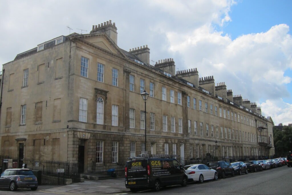
Begin at Queen Square and climb Gay Street toward The Circus. Add the Assembly Rooms while you are already at the upper level, then continue along Brock Street to Royal Crescent. Spend time around the Crescent and Royal Victoria Park before turning back through Margaret’s Buildings. Finish by descending toward Milsom Street. The route concentrates most of the weekend’s climbing into one deliberate sequence instead of making you repeat the same slope several times.
When Buses Are Worth Using
Most first-time sightseeing inside the historic centre is faster on foot. Buses become more valuable for Lansdown-facing streets, universities, residential districts, park-and-ride connections and tired returns after a hillier walk. First Bus accepts contactless Tap On Tap Off and applies automatic fare capping, which removes much of the ticket-planning friction. The bus station sits beside Bath Spa, so rail-to-bus transfers are unusually simple.
Weekend service is useful but not uniform. Several park-and-ride corridors run about every 15 minutes during their main operating periods, while individual city routes vary. Sunday spans can be shorter than Saturday service.
Arriving in Bath Without a Car
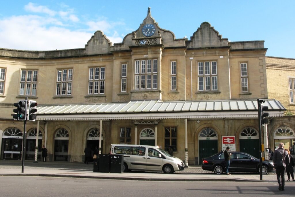
Bath Spa is one of the city’s strongest car-free advantages. The station is in the centre, has step-free access to all platforms, and places the Roman Baths roughly 5–10 minutes away. Great Western Railway links Bath directly with London, Bristol and Cardiff; London journeys are commonly around 80 minutes. The adjacent bus station handles local and regional services, so luggage-heavy arrivals can switch modes without crossing the city.
Bristol Airport is the principal nearby air gateway. The A4 Airport Flyer runs directly between the terminal and Bath Bus Station on an approximately hourly pattern. That is straightforward, but it is still a surface transfer of roughly an hour rather than a city-centre airport rail link. Bath’s rail arrival is therefore exceptionally straightforward, while the airport connection remains easy enough without being as direct.
Do You Need a Car in Bath?
A private car is unnecessary for the standard two- or three-day Bath weekend. Parking and central access restrictions can make driving less convenient than walking once you arrive. A car becomes more useful for rural Cotswold combinations, dispersed country houses or countryside itineraries that do not align with bus service. For Bath itself, rail arrival, walking and selective buses cover the visitor experience more cleanly.
Limitations and Practical Walking Tips
- Do the upper city once. Combine Queen Square, The Circus, Assembly Rooms and Royal Crescent to avoid repeating the same climb.
- Treat “mostly flat” as a central-core description. Royal Crescent and streets toward Lansdown sit above that easy basin.
- Expect historic surfaces. Flagstones and older paving can be uneven even where sidewalks are wide.
- Use Pulteney Bridge strategically. It is the most atmospheric connection to Great Pulteney Street, but it can feel narrow and busy.
- Allow crowd time. The Abbey, Roman Baths and main shopping streets can move slower than their distances suggest.
- Use buses to save your legs rather than replacing easy central walks. Central Bath works independently on foot; buses mainly improve hillier and outer extensions.
Seasonal Walking Note
Bath remains highly practical for walking throughout the year, but seasonal conditions change comfort and pace. Wet weather makes stone and flagged surfaces feel less forgiving, while winter darkness reduces the appeal of river and park extensions. Summer and holiday periods can intensify crowding around the Abbey, Roman Baths and Pulteney Bridge.
Bottom Line
Bath is built for a walking-first weekend because the station, Roman core, shopping streets, river crossing and Georgian landmarks sit unusually close together. The important qualification is vertical. The central basin is easy, while Royal Crescent and Lansdown-facing streets add enough gradient to deserve deliberate route planning. Stay central, group the upper Georgian sights into one climb, and use buses only when they save meaningful effort. For most first-time visitors, a rental car adds little inside the city.