
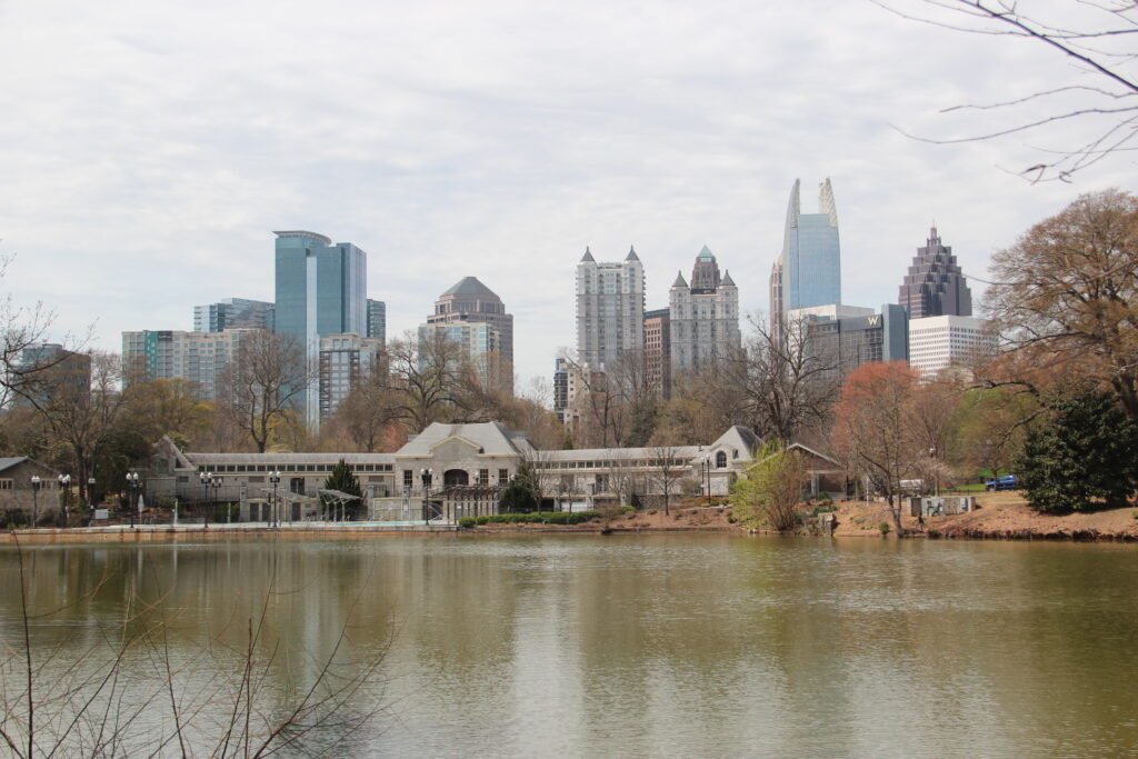
Centennial Olympic Park anchors a compact Downtown cluster around the Georgia Aquarium and World of Coca-Cola. Midtown forms another pedestrian base around the High Museum and Piedmont Park, with a different street rhythm from Downtown. East of Midtown, the BeltLine Eastside Trail links Old Fourth Ward and Inman Park into Atlanta’s strongest continuous walking corridor. The city changes character between these clusters, where wider roads and longer gaps make spontaneous cross-city walking less practical. Unlike cities with one dense historic core, Atlanta rarely keeps every major sight within a 15-minute walk.
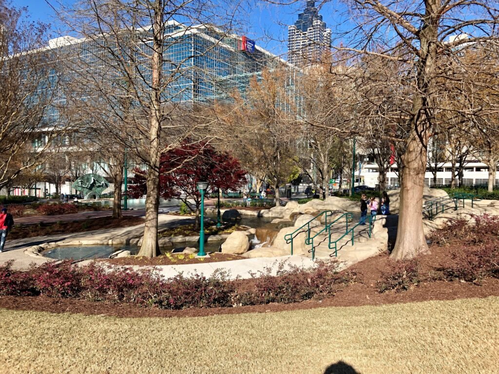
Where to Stay for a Walkable Atlanta Weekend
Midtown: Best Overall Balance
For most first-time visitors, Midtown is the best compromise between walking and transit. Arts Center and Midtown stations put the Red/Gold Line close to hotels, restaurants and cultural attractions. The High Museum, Woodruff Arts Center and Piedmont Park are all practical on foot, and the eastern side of the neighborhood leads toward the BeltLine. Midtown also works well in the evening because you can return by rail instead of building every day around rideshares.
Downtown: Best for Major Attractions and Airport Simplicity
Downtown is the strongest choice for families, convention visitors and anyone prioritizing the Aquarium, World of Coca-Cola, Centennial Olympic Park, State Farm Arena or Mercedes-Benz Stadium. Peachtree Center and Five Points provide rail access, while the Streetcar gives a useful east-west link toward Sweet Auburn and the King Historic District. The trade-off is that Downtown is excellent for specific attractions but does not by itself show the full neighborhood character of Atlanta.
Old Fourth Ward and the BeltLine: Best for Trail-Based Walking
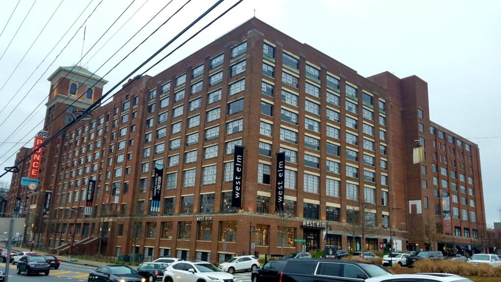
Old Fourth Ward is the most appealing base if the BeltLine, Ponce City Market, parks and food are the priority. Once on the Eastside Trail, movement is simple and enjoyable. The compromise is rail access: there is no station directly at Ponce City Market, so a stay here can require a bus, longer walk or occasional rideshare for Downtown and airport connections.
Inman Park: Best for Neighborhood Character
Inman Park combines residential streets, dining, BeltLine access and the Inman Park-Reynoldstown Blue/Green Line station. It is a strong second-visit or neighborhood-focused base. For a first weekend centered on the biggest Atlanta sights, Midtown or Downtown usually minimizes transfers.
Useful Walking Times
These are practical planning estimates rather than guaranteed walking times. Crossings, route choice, crowds, weather and individual pace can change the actual time.
Centennial Olympic Park to World of Coca-Cola is roughly 5 minutes; the park to Georgia Aquarium about 5–7 minutes; Centennial Olympic Park to Woodruff Park about 15–20 minutes; Woodruff Park to Sweet Auburn Curb Market about 10 minutes; and the market to the King Historic District around 15–20 minutes.
On the second-day corridor, High Museum to Piedmont Park is roughly 15–20 minutes. Piedmont Park to Ponce City Market can take around 25–35 minutes depending on which park exit and BeltLine access point you use. Ponce City Market to Krog Street Market is roughly 30–35 minutes along the Eastside Trail, and Krog Street Market to Inman Park-Reynoldstown MARTA is around 15 minutes.
A 2-Day Atlanta Walking Route
Day 1: Downtown to Sweet Auburn and the King Historic District
Walking route
Day 1: Centennial Park District to Sweet Auburn and the King Historic District
- Centennial Olympic Park
- World of Coca-Cola
- Georgia Aquarium
- Woodruff Park
- Sweet Auburn Curb Market
- Historic Fire Station No. 6
- Historic Ebenezer Baptist Church
- The King Center
- Martin Luther King Jr. Birth Home
Start at Centennial Olympic Park and use the morning for the compact Downtown cluster. World of Coca-Cola and Georgia Aquarium sit only minutes away, so choose one major timed attraction rather than trying to rush both. From there, walk southeast through central Downtown to Woodruff Park. It is a useful reset point because Five Points, Peachtree Center and Atlanta Streetcar stops are all nearby.
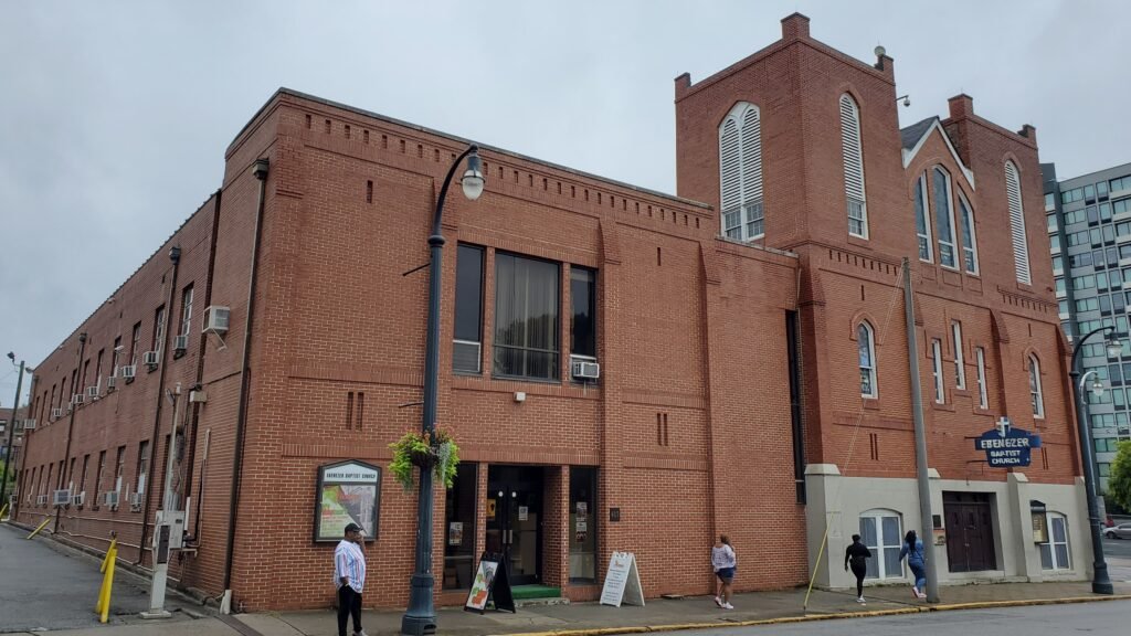
Continue east to Sweet Auburn Curb Market for lunch, then follow the historic corridor toward the Martin Luther King Jr. National Historical Park.Continue toward the Martin Luther King Jr. National Historical Park, where Historic Ebenezer Baptist Church, The King Center and the Birth Home block form a compact walking cluster. Check current National Park Service guidance if a Birth Home interior tour is important to your visit. Historic Ebenezer Baptist Church, The King Center and the Birth Home block are clustered close enough to explore on foot once you arrive.
If the full Downtown-to-Sweet-Auburn walk feels too long, the Atlanta Streetcar follows the same general east-west corridor and can save some walking. Check current service information before relying on a particular stop or frequency.
Day 2: Midtown, Piedmont Park and the BeltLine Eastside Trail
Walking route
Day 2: Midtown, Piedmont Park and the BeltLine Eastside Trail
- High Museum of Art
- Piedmont Park
- Ponce City Market
- Historic Fourth Ward Park
- Krog Street Market
- Inman Park-Reynoldstown MARTA Station
Take MARTA to Arts Center and begin at the High Museum of Art. From there, walk east toward Piedmont Park. This is the point where Atlanta’s urban walking becomes greener: the park has broad paths, skyline views and a direct relationship with the expanding BeltLine network.
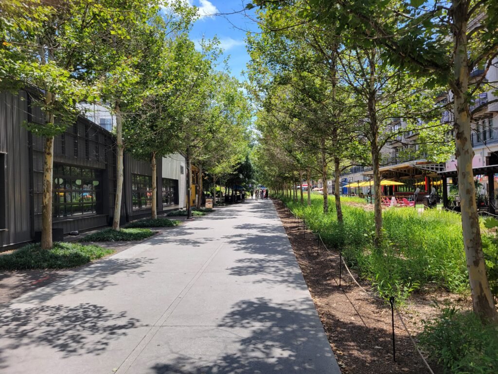
Continue toward the Eastside Trail and Ponce City Market. After a meal or break, drop into Historic Fourth Ward Park, then keep following the BeltLine south toward Krog Street Market. This is the city’s strongest visitor walking sequence because the route itself is part of the experience; markets, parks, public art and neighborhood entrances face the trail.
Finish at Inman Park-Reynoldstown MARTA Station rather than reversing the whole walk. That lets the day stay linear and demonstrates the best way to experience Atlanta without a car: use transit to create a one-way walk through a district instead of wasting energy retracing your route.
Getting Around Atlanta Without a Car
MARTA rail is more useful to visitors than Atlanta’s reputation sometimes suggests. The Red and Gold Lines run from the Airport through Five Points and Peachtree Center, then north through Civic Center, North Avenue, Midtown and Arts Center. That single spine covers the airport, the two best first-time hotel areas and several major attractions. Blue and Green Lines add east-west access, including Inman Park-Reynoldstown and King Memorial.
MARTA rail operates across the week, but frequencies and service patterns vary by line, day and maintenance schedule. Check current MARTA information before travel, particularly for weekend journeys.
Contactless payment makes MARTA easier for short-stay visitors, while standard fare products cover bus and rail travel. Streetcar fares and transfer rules can differ from the main MARTA network, so check current fare information rather than relying on fixed prices in the guide.
Weekend track work or single tracking can occasionally change rail service. Check current MARTA alerts when your itinerary depends on a particular line or transfer.
Arrival Without a Car: ATL Airport Is a Major Advantage
Hartsfield-Jackson is one of the strongest parts of a car-free Atlanta trip. MARTA’s Airport Station sits inside the Domestic Terminal, and Red/Gold Line trains provide a direct ride into Downtown and Midtown. If your hotel is near Peachtree Center, Midtown or Arts Center, there is usually little reason to begin the trip with a rental car.
International arrivals may require an additional airport transfer before reaching MARTA. Follow current airport signs and ATL ground-transportation guidance after landing. Even with that extra step, Downtown and Midtown remain straightforward to reach without renting a car.
When a Car Becomes Useful
A car is not necessary for the two-day route above. It becomes useful when the itinerary stops being an intown weekend and starts combining widely separated or regional destinations. Stone Mountain, suburban attractions, multiple outer neighborhoods in one day and broader Georgia side trips are all easier by car. Even inside the metro area, a rideshare can be more efficient than forcing a weak transit connection between two rail-detached destinations.
The key is not to rent a car simply because Atlanta is spread out. Parking, traffic and hotel fees can turn a car into friction in Downtown and Midtown. Build the core weekend around MARTA and walking first; add a car only for the day whose destinations actually require it.
The Main Walking Limitations
Atlanta’s pedestrian environment changes quickly from one corridor to another. The BeltLine and major parks can feel purpose-built for walking, while nearby arterials may have long crossings, heavier traffic, or less consistent sidewalk quality. ATLDOT itself notes that Complete Street elements vary by location and that not every street has the same sidewalk, bicycle, or transit facilities. That inconsistency is one of Atlanta’s main walking limitations outside its strongest visitor corridors.
Terrain is another smaller factor. Atlanta is not a mountain city, but it is not flat. Repeated hills become noticeable on a 4–6 mile sightseeing day, especially in hot weather. Visitors with mobility constraints should lean more heavily on MARTA, the Streetcar and shorter district loops rather than treating the BeltLine route as an all-day endurance walk.
Practical Walking Tips
Choose a hotel within an easy walk of a MARTA station, not merely one that lists ‘Downtown’ or ‘Midtown’ in its marketing. Use rail to start one-way walking routes, as on Day 2. On the BeltLine, keep water with you and expect the popular Eastside Trail to be busy with walkers, runners and cyclists. Around Downtown, use marked crossings and do not assume the most direct-looking arterial is the most pleasant pedestrian route.
For the King Historic District, If the Birth Home interior is important to you, check current National Park Service guidance before visiting. Tour availability, registration procedures and capacity can change during rehabilitation periods.
Seasonal Walking Note
Spring and fall offer Atlanta’s easiest walking conditions. Summer is warm and humid; National Park Service climate guidance places average afternoon highs in the lower 90s. In July and August, start outdoor routes earlier, put an indoor attraction around midday, and use MARTA for the hottest inter-neighborhood jump. Winters are generally milder, with average highs from the mid-50s to lower 60s, though day-to-day variation still matters. Seasonal conditions mainly affect walking comfort and pace, so adjust longer outdoor routes accordingly.
Bottom Line
Atlanta is walkable enough for a well-planned weekend without a private car, but only if you respect the gaps. Downtown, Midtown and the BeltLine Eastside corridor each work well on foot. MARTA makes the airport, Downtown and Midtown unusually easy to connect, while the Streetcar helps with the Sweet Auburn corridor. The mistake is expecting those districts to merge into one continuous pedestrian center. Walk inside the clusters, take transit between them, and save a car for genuinely regional plans.