
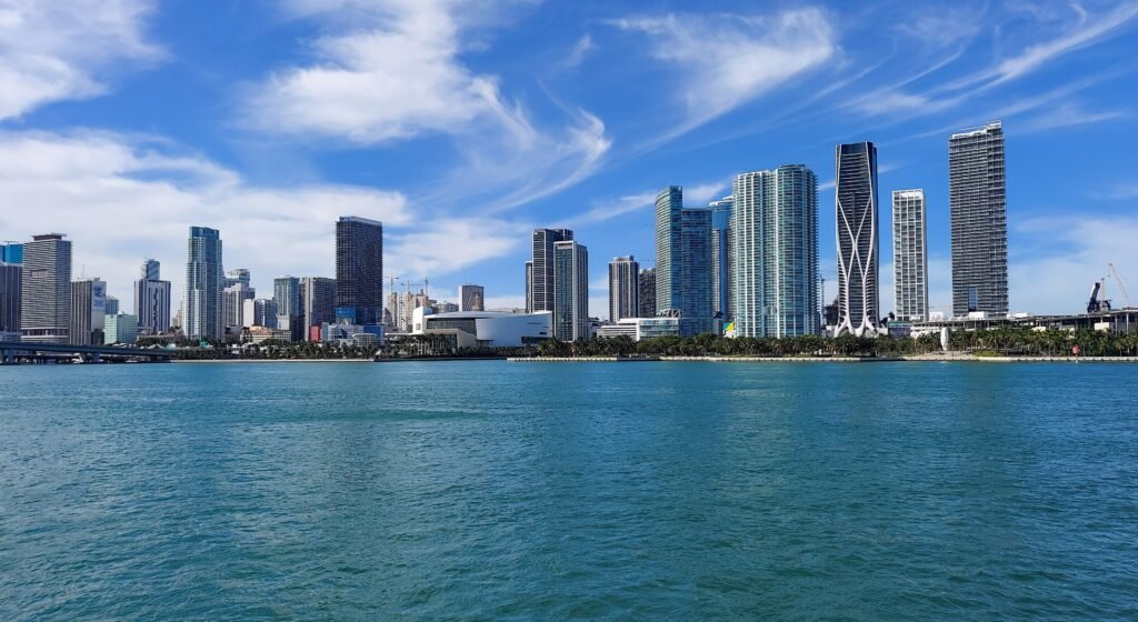
Miami’s visitor map behaves less like a single center than a set of separate walking districts. South Beach supports long stretches on foot, while Downtown and Brickell form another practical base for pedestrian exploration. That structure becomes more important once Wynwood, Little Havana, or Coconut Grove enters a short weekend itinerary. The distances between these zones make spontaneous neighborhood-to-neighborhood walking less realistic than focused walking inside each one. The result is a city best understood through concentrated walking sessions, not one continuous route linking every major visitor district.
Why Miami works on foot—and where it does not
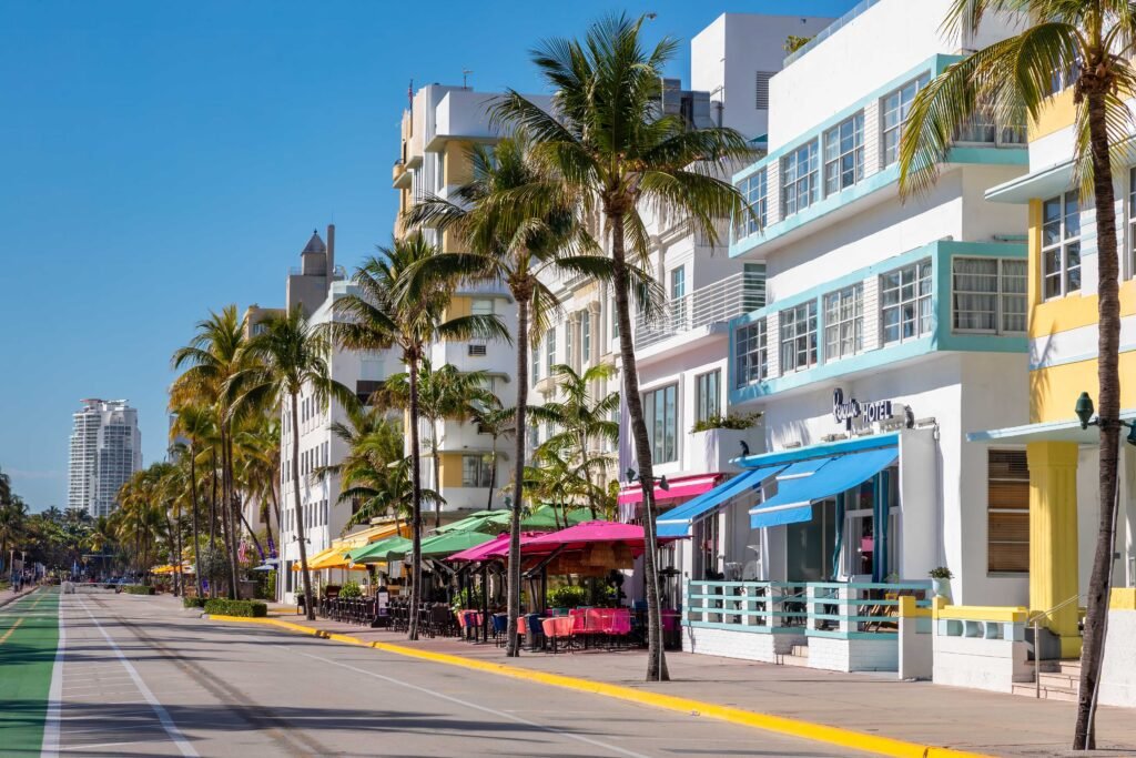
Inside South Beach, the visitor experience is unusually legible on foot. Ocean Drive, Lummus Park, the Art Deco Historic District, Española Way and Lincoln Road fit into a compact north-south/east-west pattern, and Lincoln Road itself is an eight-block pedestrian-only stretch. South Pointe adds a waterfront park and promenade at the southern end. A visitor based here can build a full day around walking without needing a vehicle.
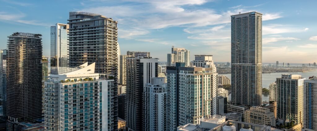
Downtown and Brickell work differently. The bayfront parks, museums, Bayside, the Miami River, Brickell and Brickell Key form a useful mainland corridor, but the free Metromover is what makes the core especially practical without a car. It lets you shorten repetitive or tired-leg sections rather than forcing every transfer to become a long street walk.
The weakness appears when you try to connect Miami’s districts on foot. South Beach sits across Biscayne Bay from the mainland. Wynwood is north of Downtown; Little Havana is west of it; Coconut Grove and Vizcaya are farther south. Those areas can each be walkable once you arrive, but they do not combine into one seamless sightseeing grid. For Miami, the smartest strategy is walk within a zone, then use transit between zones.
Best areas to stay without a car
South Beach: best for maximum walking and beach access
Choose South Beach if your weekend is primarily about the beach, Art Deco architecture, Ocean Drive, Lincoln Road and easy access to restaurants and visitor services. The core is flat, dense with things to do and supported by the free Miami Beach trolley. The trade-off is that every mainland outing becomes a transit trip.
Downtown and Brickell: best for transit and a mixed city itinerary
Choose Downtown or Brickell if you want the strongest transit base. Metrorail reaches the airport corridor and southern Miami-Dade, while Metromover connects the Downtown, Omni and Brickell cores for free. You can walk waterfront parks, museums, Bayside, the riverfront and Brickell, then use transit for South Beach, Wynwood or other districts.
Wynwood, Little Havana and Coconut Grove
These are better treated as destination neighborhoods than as the default base for a first Miami weekend. Wynwood is compact once you are in the arts district; Little Havana’s visitor activity concentrates around Calle Ocho; Coconut Grove has a walkable village-and-parks feel but sits farther from the classic South Beach/Downtown circuit. They are useful additions when your interests justify the extra transfer.
Useful Walking Times in Miami
UsThese are practical planning estimates rather than guaranteed walking times. Crossings, route choice, weather and exact entrances can change the actual time.
South Pointe Park to the Art Deco Welcome Center: about 20–25 minutes; Art Deco Welcome Center to Española Way: about 10 minutes; Española Way to Lincoln Road: about 5–8 minutes; and Lincoln Road to The Bass: about 12–15 minutes. The exact time changes with your chosen promenade, crossings and where you enter each district.
On the mainland, Maurice A. Ferré Park to Bayside Marketplace is about 12–15 minutes, Bayside to Bayfront Park about 8–10 minutes, and Bayfront Park to Miami Circle about 15–18 minutes. From Miami Circle, allow roughly 10–15 minutes to reach Brickell Key, then another 25–35 minutes if you want a relaxed loop around the island. By contrast, Downtown to South Beach should be treated as a transit connection, not as a core sightseeing walk.
A 2-day walking route
Day 1: South Beach from South Pointe to The Bass
Walking route
South Beach: oceanfront, Art Deco and pedestrian streets
- South Pointe Park
- Art Deco Welcome Center
- Lummus Park
- Española Way
- Lincoln Road
- The Bass
Start at South Pointe Park and work north along the South Beach waterfront and Art Deco core. Stop at the Art Deco Welcome Center around 10th Street, then use Lummus Park and Ocean Drive as the visual spine of the morning. Cut inland to Española Way, continue to pedestrianized Lincoln Road, and finish around The Bass at 21st Street. This route deliberately keeps the first day inside one strong walking zone instead of wasting time commuting across the bay.
Day 2: Downtown waterfront to Brickell Key
Walking route
Downtown to Brickell: bayfront parks, river crossing and Brickell Key
- Maurice A. Ferré Park
- Pérez Art Museum Miami
- Bayside Marketplace
- Bayfront Park
- Miami Circle National Historic Landmark
- Brickell Key
Begin at Maurice A. Ferré Park and Pérez Art Museum Miami, then follow the Downtown waterfront south toward Bayside Marketplace and Bayfront Park. Continue to the Miami River and cross into Brickell for Miami Circle, then finish on Brickell Key’s waterfront path. The route is continuous enough to walk, but Metromover gives you a free fallback if you want to shorten a section or return to your hotel without retracing the entire corridor.
Getting around Miami without a car
Metromover is one of Miami’s most useful visitor transit tools. It is free and connects Downtown, Omni and Brickell, making it easy to shorten longer walks within the mainland core. Operating hours can change during system work, so check current Miami-Dade Transit information before relying on it late at night.
Metrorail is most useful for airport connections, Downtown and destinations along the south corridor. Miami-Dade also operates an extensive bus network, while South Beach remains outside the rail system. Fares, payment options and service hours can change, so check current Miami-Dade Transit information before travel.
On Miami Beach, the free city trolley can shorten longer north-south trips when you do not want to walk the full beach corridor. For cross-bay journeys, use public transport or another direct transfer rather than treating the causeways as part of the sightseeing walk.
Arriving in Miami without a car
Miami International Airport connects with Metrorail through the airport transport complex, giving Downtown and Brickell visitors a practical public-transport route into the city. Service patterns can vary by day and timetable, so check current Miami-Dade Transit and airport information before travel.
South Beach also has public-transport connections from the airport. If you arrive by intercity rail at MiamiCentral, Downtown and Metromover connections are close enough that a rental car is unnecessary for the central itinerary.
When a car becomes useful
A car becomes useful when your plan expands beyond the compact visitor districts: for example, an Everglades outing, the Florida Keys, farther suburbs, or a schedule that tries to combine several widely separated Miami neighborhoods in one day. It is much less useful when your day is already concentrated in South Beach, Downtown or Brickell, where walking, Metromover and local transit handle the core movements.
Practical walking tips
Plan Miami by cluster rather than by a single citywide walking line. Put the longest South Beach walk in one block of time, keep Downtown and Brickell together, and give Wynwood or Little Havana its own transit hop. Use signalized crossings on the larger mainland roads, and treat Metromover as a walking extender rather than only as transportation. Check current transit alerts before heading out because maintenance or temporary service changes can affect the easiest connection on a particular day.
Seasonal walking note
Miami is physically easy to walk because the terrain is flat, but summer conditions can reduce the distance most travelers enjoy covering at midday. National Weather Service climate data puts the normal July average high at roughly 91°F, so an early start, indoor breaks and shorter transit-assisted segments are sensible in the hottest months. Atlantic hurricane season runs from June 1 through November 30; if you travel in that window, monitor official forecasts and destination guidance.
Bottom line
Miami is not a city where the entire visitor map collapses into one walkable center. It is a city where the right base and the right grouping of neighborhoods can make a car optional. South Beach delivers the strongest pure walking experience; Downtown and Brickell deliver the strongest walking-plus-transit combination. Accept the gaps between those zones, use transit for the jumps, and a first Miami weekend can work very well without a private car.