
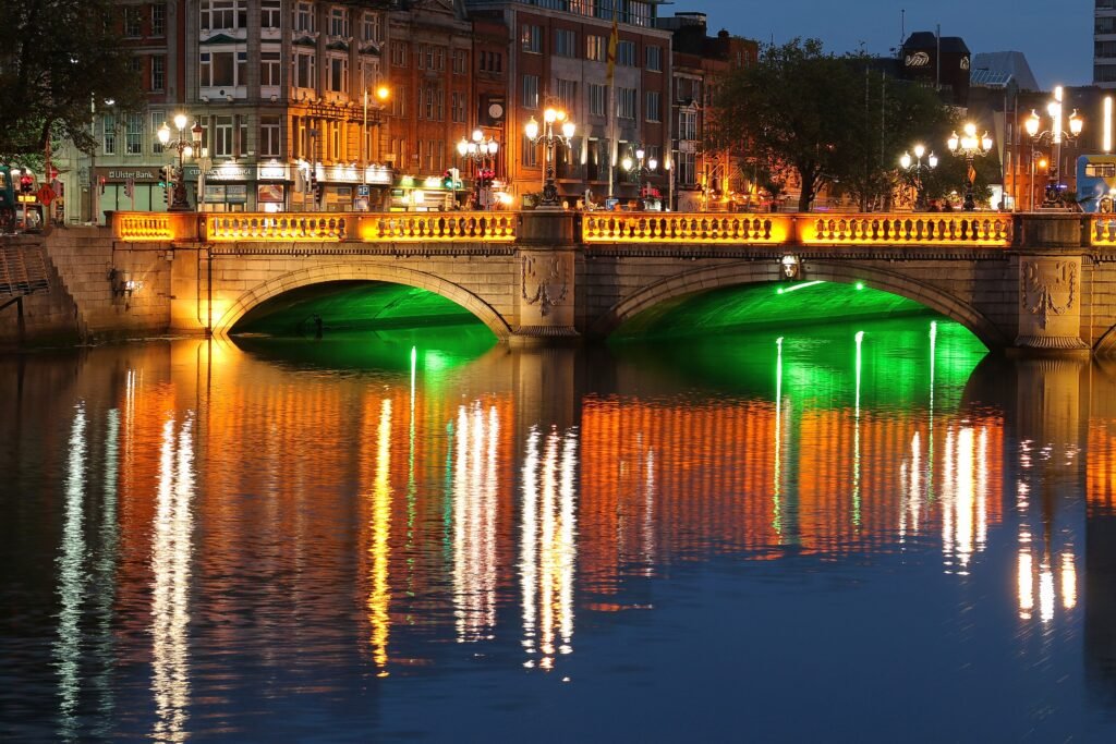
Irish city breaks can look equally compact on a map, then behave very differently once pavement replaces scale bars. Dublin links a broad central sightseeing network across frequent Liffey crossings. Waterford compresses most first-time sights around the Viking Triangle, The Mall, and the quays. Cork starts flat on its river island, then climbs toward Shandon and the cathedral districts. Limerick uses Shannon and Abbey River bridges to connect distinct central quarters. Kilkenny turns the Medieval Mile into a remarkably tight walking spine. Galway feels equally compact downtown, until a full weekend reaches west toward Salthill.
Six Irish Cities, Six Different Walking Patterns
Dublin and Waterford are tied at 89/100, while Cork and Limerick share 88/100. Kilkenny follows at 86/100 and Galway at 84/100. Their shared positions explain why the displayed ranking moves from first to third and then from third to fifth.
| Rank | City | Overall score | Strongest walking advantage | Main limitation |
|---|---|---|---|---|
| 1 | Dublin | 89/100 | A broad, connected central sightseeing network with frequent Liffey crossings and strong transit backup | Scale: Kilmainham, Phoenix Park and parts of Docklands extend beyond the compact central walking network |
| 1 | Waterford | 89/100 | Exceptional concentration around the Viking Triangle, The Mall, central streets and the quays | Plunkett Station sits across the Suir, making Rice Bridge part of the rail-arrival walk |
| 3 | Cork | 88/100 | A comparatively level river-island core connected to surrounding districts by frequent Lee bridges | Localized climbs toward Shandon and parts of the south-side cathedral district |
| 3 | Limerick | 88/100 | Flat, bridge-linked central districts that support practical loops around the Shannon and Abbey River | Traffic-heavy bridge approaches and crossings create localized comfort friction |
| 5 | Kilkenny | 86/100 | The Medieval Mile creates one of the tightest continuous historic walking chains in the set | Shallower urban transit plus narrow historic footways, older surfaces and a modest rise toward St Canice’s |
| 6 | Galway | 84/100 | A compact, largely pedestrian-focused center from Eyre Square through the Latin Quarter to Spanish Arch | Salthill is a genuine westward extension, while the bus-only network has less depth than the strongest cities |
Dublin and Waterford Share First for Opposite Reasons
Dublin’s strength is not tiny geography. It is the way a large central visitor network stays connected. Trinity College, Grafton Street, St Stephen’s Green, Temple Bar and Dublin Castle sit inside one practical chain. Christ Church Cathedral and St Patrick’s Cathedral continue that route west, while O’Connell Street remains close across the Liffey. Frequent central bridges keep the river from becoming a meaningful divide. Georgian Dublin extends the network east and southeast without requiring a vehicle for ordinary sightseeing.
The trade-off is scale. Kilmainham, Phoenix Park and parts of Docklands are real extensions rather than pieces of one compact pedestrian core. Luas and buses make those longer extensions practical without turning them into short central walks. Central routes are mostly flat and direct. Crowds, cobbles, narrow older footways, traffic interfaces and tram tracks create localized friction. Dublin also has the strongest urban transit backup in this six-city set. Airport arrival is less seamless because the airport connection still depends on road-based public transport.
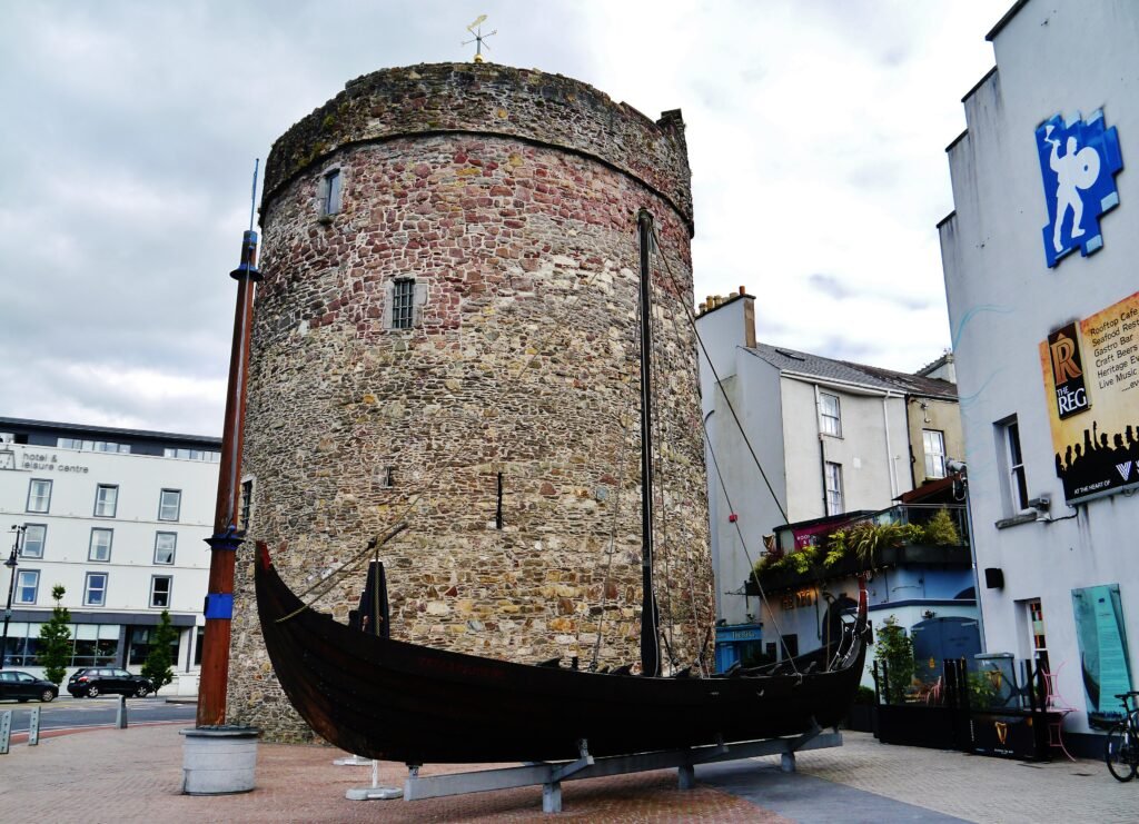
Waterford reaches the same total through concentration. The Viking Triangle, Reginald’s Tower, Waterford Treasures museums, Christ Church Cathedral, House of Waterford Crystal, The Mall and John Roberts Square form a remarkably tight network. The central quays provide a strong orientation line beside that cluster. Most first-time sightseeing is short enough that waiting for a city bus often makes little sense. The streets are generally flat and direct, although historic paving, quay traffic and larger junctions keep the experience from being completely frictionless.
Waterford’s clearest complication appears when you arrive by rail. Plunkett Station sits north of the Suir, so the walk into the main visitor core depends on Rice Bridge. The distance is modest, but luggage, traffic exposure and the bridge approach matter. Urban buses are useful, yet they are materially less powerful than Dublin’s Luas, bus and rail combination. Waterford therefore wins differently: it asks less of transit once you are in the center.
Dublin offers the broader major-city sightseeing network and stronger public-transport backup, while Waterford offers shorter central distances and a more concentrated walking weekend. Their equal score comes from those different strengths.
Cork and Limerick Tie, but Their Rivers Shape the Weekend Differently
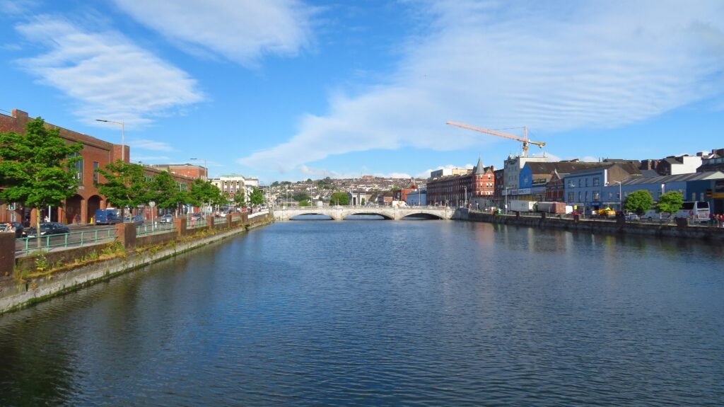
Cork’s center sits on a river island, and that detail explains the walking experience better than calling the whole city hilly. St Patrick’s Street, Grand Parade, Oliver Plunkett Street and the English Market occupy a comparatively level central core. Frequent River Lee bridges then connect MacCurtain Street and Kent Station to the north, with South Parish and St Fin Barre’s Cathedral to the south. UCC and Fitzgerald’s Park extend the network westward.
The hills arrive around the edges. Shandon creates the clearest north-side climb, while the south-side cathedral district also adds elevation. Those slopes matter, but they do not make the central island uniformly difficult. Kent Station sits close to MacCurtain Street and the visitor geography, and Cork Airport has direct bus links into the city. Buses are useful for longer urban jumps, while ordinary central sightseeing remains mainly a walking task. See the full Cork river-and-hills walking guide for route-level detail.
Limerick uses water differently. King’s Island, St Mary’s Cathedral, King John’s Castle, the Hunt Museum, Arthur’s Quay and O’Connell Street form a bridge-linked sequence. The Milk Market, Georgian Quarter, People’s Park and Colbert Station continue the network south. Shannon and Abbey River crossings create useful loops rather than isolating the major visitor districts. Terrain is generally easy. The main pedestrian drawback is localized comfort around traffic-heavy bridge approaches and crossings.
Colbert Station is inside the practical visitor geography, and direct Shannon Airport coaches make a car-free arrival straightforward. Local buses add useful backup for longer trips without becoming necessary for most central sightseeing. Cork and Limerick reach the same score through different walking patterns. Cork offers the denser island core but more noticeable edge climbs. Limerick stays flatter and spreads more of the weekend across bridge-linked districts. The Limerick car-free city guide shows how those loops work in practice.
Kilkenny Proves That the Smallest Map Does Not Automatically Rank First
Kilkenny’s lower position does not mean the city is difficult to explore on foot. Its central visitor concentration matches Waterford’s and exceeds several larger cities in this set. Kilkenny Castle, High Street, the Medieval Mile Museum, Rothe House, Smithwick’s Experience, Black Abbey and St Canice’s Cathedral form an unusually tight chain. The Medieval Mile is one of the clearest continuous historic walking spines here, with most headline stops reached by simple forward progress rather than cross-city repositioning.
Its main limitations appear outside the compact heritage spine. Kilkenny has a smaller urban transit network, narrower historic footways, older surfaces and several traffic interfaces. The approach toward St Canice’s adds a modest rise, but it does not break the attraction chain. The Round Tower climb is an attraction experience, not required city movement. Rail and coach arrivals are useful, although service frequency and the final luggage transfer can require more planning than in some of the larger cities. For the compact details, use the Kilkenny Medieval Mile walking guide.
Galway Finishes Sixth and Still Works Very Well on Foot
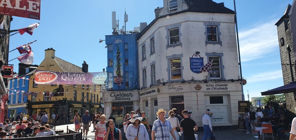
Galway remains very easy to explore on foot despite its lower score in this six-city group. Eyre Square, William Street, Shop Street, High Street, Quay Street, the Latin Quarter, Spanish Arch and Galway City Museum create a compact central spine. Much of that route is pedestrian-focused, and the city is very flat. Ceannt Station sits beside Eyre Square, giving Galway the cleanest station-to-center relationship in this group. Galway Cathedral and University of Galway are manageable walking extensions rather than separate transit-dependent zones.
Salthill is the real geographic change. It continues the westward visitor footprint far enough that it should not be absorbed into the historic core. Corrib channels also influence route choices, although improved pedestrian crossings keep the center connected. The main difference appears once the weekend extends west toward Salthill, where the visitor footprint becomes larger and buses become more useful. Direct public-transport connections from regional airports also make a car unnecessary for most arrivals. The Galway walk-first weekend guide explains when a bus helps with Salthill.
What Changes Once You Start Walking
Compactness
Waterford and Kilkenny stand out for the shortest central distances. Galway is similarly tight inside its inner core, but Salthill enlarges the full visitor footprint. Dublin covers more ground, yet its central districts connect unusually well. Cork and Limerick sit between those extremes: both are manageable on foot, but neither behaves like a single tiny historic center.
Rivers and Bridges
Water does not hurt every city in the same way. Dublin’s frequent Liffey crossings make the river a seam between central districts. Cork’s Lee bridges connect the island core with higher neighborhoods on both sides. Limerick’s Shannon and Abbey River bridges organize useful loops. Waterford’s Suir matters most at arrival because Plunkett Station depends on Rice Bridge. Galway’s Corrib channels shape route choices, while improved crossings maintain connectivity. Kilkenny’s Nore influences local movement without splitting the compact historic center.
Terrain
Dublin, Waterford, Limerick and Galway are the easiest terrain cases overall. Kilkenny adds only a modest rise toward St Canice’s. Cork has the clearest meaningful localized climbing, especially around Shandon and the south-side cathedral district. That distinction matters because a short route can still require effort. It also explains why Cork should not be described as uniformly hilly: its central island remains comparatively level.
Transit
Dublin has the deepest visitor-useful network, with Luas, buses and rail covering genuine gaps. Cork and Limerick offer useful bus backup without needing transit for routine central sightseeing. Waterford’s city buses are capable, but its tiny core reduces how often visitors need them. Kilkenny and Galway have useful bus networks with less depth. Intercity coaches can simplify arrival, while everyday sightseeing still depends on each city’s local walking and transport network.
Arrival Without a Car
Car-free arrival works well across all six cities, but the pattern differs. Dublin Airport relies on road-based public transport into the capital, while Cork Airport has direct bus connections toward central Cork. Shannon Airport provides useful direct links toward Limerick and Galway. Waterford and Kilkenny can be reached by rail or coach from larger gateways, while Galway Ceannt and Limerick Colbert place rail travelers especially close to the central walking areas. Check current rail, coach and airport schedules before travel.
Which Irish City Fits Your Travel Style?
| Traveler priority | Best fit | Why |
|---|---|---|
| Best major-city walking weekend | Dublin | The broadest central sight network, frequent Liffey crossings and the strongest transit backup. |
| Tightest historic visitor core | Waterford and Kilkenny | Both compress major first-time sights into unusually short, legible walking chains. |
| Best for travelers who dislike hills | Dublin, Waterford, Limerick and Galway | All four keep normal visitor routes predominantly flat. |
| Best transit backup | Dublin | Luas, buses and rail cover genuine gaps beyond the central walking network. |
| Easiest to explore mostly without transit | Waterford and Kilkenny | Central visitor distances are short enough that local transport often adds little. |
| Best station-to-center relationship | Galway | Ceannt Station sits immediately beside Eyre Square and the eastern end of the main walking spine. |
| Best bridge-based river walking | Dublin and Limerick | Frequent central crossings keep river districts connected and support practical walking loops. |
| Best compact heritage weekend | Waterford and Kilkenny | Both concentrate heritage anchors into short central sequences without requiring a car. |
| Best for walking with occasional buses | Cork, Limerick and Galway | Walking handles the core, while buses efficiently cover longer urban extensions. |
Seasonal Comfort Still Matters
Rain, wind and shorter winter daylight can change how comfortable the same routes feel. Exposed quays and waterfronts are more demanding in rough weather, while narrow historic streets can feel busier during peak visitor periods. Allow extra time and adjust the length of outdoor sections when conditions are poor.
Which Irish City Should You Choose?
Dublin suits travelers who want the broadest major-city sightseeing network with strong public-transport backup. Waterford and Kilkenny work especially well for short, concentrated heritage walks. Cork combines a level river-island core with several hillier extensions, while Limerick favors flatter bridge-linked loops. Galway offers one of the easiest central walking areas but becomes a longer outing when Salthill is added.
Bottom Line
Ireland’s six-city comparison is unusually close, but the weekends feel very different. Dublin and Waterford share first place through opposite strengths: one connects a broad capital-city sightseeing network, while the other compresses most major sights into a small central area. Cork and Limerick also tie despite different river layouts and terrain. Kilkenny concentrates heritage into an exceptionally short walking spine, while Galway combines a compact center with a longer western extension toward Salthill. Across all six, a private car is unnecessary for the standard city break.