
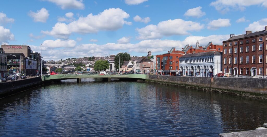
Two River Lee channels shape the center without breaking it into isolated visitor districts. St Patrick’s Street, Grand Parade, Oliver Plunkett Street, and the English Market sit on a comparatively level central island. Frequent bridges connect that core directly with MacCurtain Street and routes toward Kent Station. North of the river, Shandon rises quickly above the quays, concentrating much of Cork’s walking effort into a small area. The south side adds shorter climbs around Elizabeth Fort and St Fin Barre’s Cathedral. Westward, Washington Street and Western Road provide a clear, mostly direct approach to UCC and Fitzgerald’s Park.
Why Cork Works Well on Foot
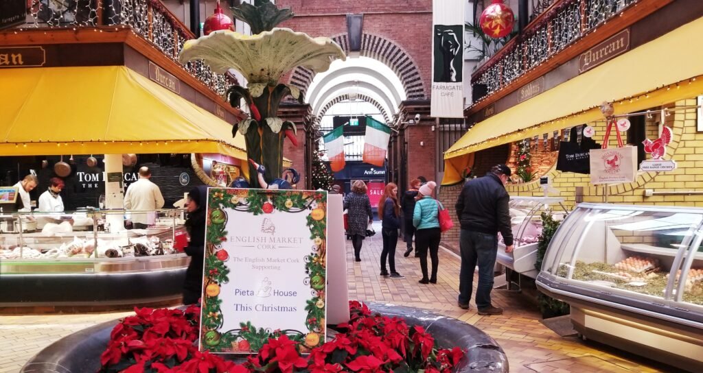
The strongest pedestrian cluster sits on the island between the River Lee channels. St Patrick’s Street, Grand Parade, Oliver Plunkett Street, South Mall and the English Market are close enough to combine without transit. The market reinforces that geometry because it has entrances from Grand Parade, Princes Street, Oliver Plunkett Street and Patrick Street.
Oliver Plunkett Street is more than a reputation-driven pedestrian street. Cork City Council currently restricts ordinary traffic there from 11 a.m. until 4 a.m. every day. Several adjoining streets have similar or longer pedestrian-priority hours, creating a useful low-traffic network inside the central island.
The River Lee does not function as a major pedestrian barrier in the visitor core. Central bridges are frequent, and Mary Elmes Bridge specifically improves the link between the center, MacCurtain Street and Kent Station. The newer southern bridges also strengthen connections around South Main Street and the south channel. Bridge choice matters, but it rarely creates a meaningful sightseeing detour.
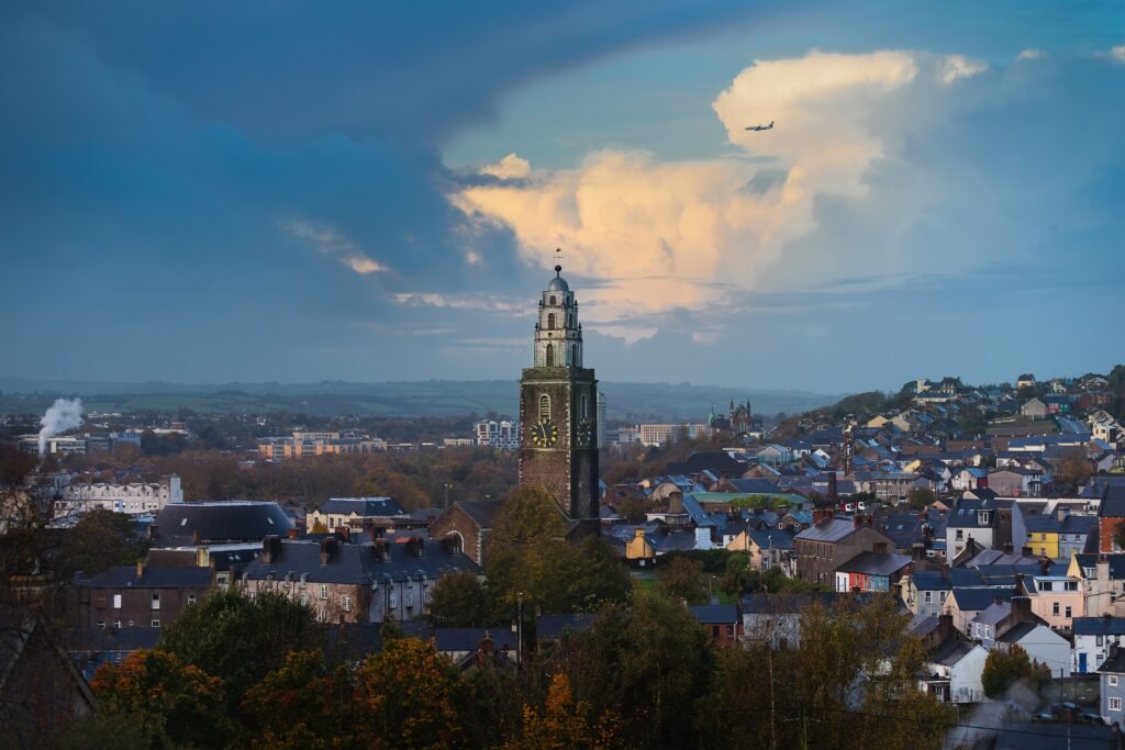
The main change happens at the edges of that flat core. Shandon rises north of the river, while Elizabeth Fort and St Fin Barre’s Cathedral sit above the south channel. These are short climbs rather than long cross-city gaps. They add effort to particular walks without separating the main visitor areas.
MacCurtain Street has also become more comfortable for pedestrians. Cork City Council’s completed scheme added 17 upgraded pedestrian crossings, resurfacing and public-realm improvements across the street and adjoining quays. Traffic still exists, but the Victorian Quarter now connects more convincingly with the bridge network and Kent Station than older descriptions suggest.
Best Areas to Stay for a Walking Weekend
Central island and South Mall offer the easiest all-purpose base. The English Market, Grand Parade, Oliver Plunkett Street, City Hall and multiple bridges are close, while both Shandon and South Parish remain realistic walks.
Victorian Quarter and MacCurtain Street are especially practical for rail arrivals. Kent Station is nearby, and the Mary Elmes Bridge shortens the pedestrian connection into the island core. This area is slightly less central for UCC, but it avoids a luggage-heavy cross-city transfer after arriving by train.
Western Road and the UCC edge work well for visitors prioritizing the university and Fitzgerald’s Park. UCC gives a 15–20 minute walking time from Patrick Street or Grand Parade. The tradeoff is a longer return to Kent and the northeast side.
Realistic Walking Times
Kent Station to MacCurtain Street is roughly 5–8 minutes, while MacCurtain Street to St Patrick’s Street is about 7–10 minutes via a central bridge. St Patrick’s Street to the English Market is usually around 5–7 minutes.
Grand Parade to Nano Nagle Place is about 8–12 minutes. St Fin Barre’s Cathedral is roughly 10–15 minutes from Grand Parade, with the final approach adding some elevation. St Anne’s publishes a 5–10 minute walk from Patrick Street, although the northbound direction is distinctly uphill.
For the western extension, UCC’s own visitor guidance gives 15–20 minutes from Patrick Street or Grand Parade via Washington Street. Fitzgerald’s Park then sits only a short walk beyond the main university quadrangle.
These are practical planning estimates rather than guaranteed walking times.
A 2-Day Walking Route
Day 1: Kent Station, the Island Core and South Parish
Walking route
Day 1: Kent Station, the island core and South Parish
- Cork Kent Station
- MacCurtain Street / Victorian Quarter
- Mary Elmes Bridge
- St Patrick’s Street
- Crawford Art Gallery exterior / Emmet Place
- Oliver Plunkett Street
- English Market
- Grand Parade
- Nano Nagle Place
- Elizabeth Fort
- St Fin Barre’s Cathedral
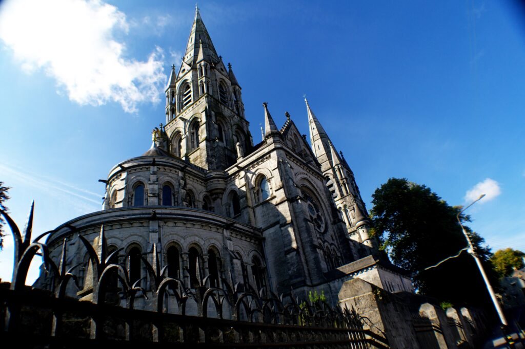
Start at Kent Station and move through MacCurtain Street before crossing the north channel on Mary Elmes Bridge. Continue through St Patrick’s Street and Emmet Place before using Oliver Plunkett Street to reach the English Market and Grand Parade. Use Oliver Plunkett Street to reach the English Market and Grand Parade, then leave the island once for South Parish. Nano Nagle Place, Elizabeth Fort and St Fin Barre’s Cathedral form a logical uphill finish without requiring a later repeat climb.
Day 2: Shandon Downhill to UCC and Fitzgerald’s Park
Walking route
Day 2: Shandon downhill to UCC and Fitzgerald’s Park
- St Anne’s Church Shandon
- Cork Butter Museum
- Christy Ring Bridge
- Washington Street
- University College Cork Main Quadrangle
- Lewis Glucksman Gallery
- Fitzgerald’s Park
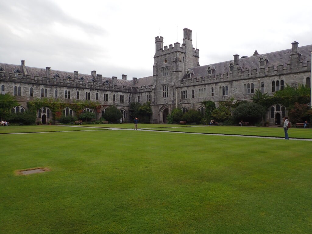
Begin at St Anne’s Church and the Butter Museum, ideally after using a short city bus to avoid an unnecessary uphill start. Then descend through Shandon, cross the north channel and turn west through Washington Street. UCC follows on the same general line, and Fitzgerald’s Park provides a natural western finish. This direction turns Cork’s most obvious hill into a descent instead of repeating it later.
When Transit Helps
Cork’s buses are useful without being essential to the central sightseeing area. They work best for UCC, outer neighborhoods, the airport, Kent Station connections or simply saving energy before or after one of the hillier walks.
Leap Card and other ticket options make local bus travel straightforward, but fares and eligibility rules vary by service. Check current TFI information before travel rather than relying on fixed prices or transfer rules in the guide.
Evening and weekend services provide useful backup after long walking days. Some routes operate late or overnight, but frequency varies, so check the current timetable when planning a late journey.
Arriving in Cork Without a Car
Cork Airport has direct public-bus connections toward the city center, bus station and railway-station area. Service frequency varies by day and timetable, so check current airport and Bus Éireann information before travel.
For centrally located accommodation, the airport journey is straightforward without a car. Hotels on steeper streets in Shandon or the south-side hills may add a more tiring final walk, where a short local connection can be useful.
Rail arrival is even more central. Kent Station sits on Lower Glanmire Road beside the northeast edge of the visitor geography and close to MacCurtain Street. Direct intercity trains from Dublin arrive there, while local rail continues toward Cobh and Midleton. Cobh and Midleton are better treated as separate regional excursions.
Walking Limitations and Practical Tips
Do not treat the entire center as hilly. The island around St Patrick’s Street, the English Market and Oliver Plunkett Street is comparatively level. The strongest terrain penalty is concentrated north of the river in Shandon, with smaller south-side climbs near Elizabeth Fort and the cathedral.
Likewise, do not treat every quay as a pleasant promenade. Some carry substantial traffic, and larger junctions or bridge approaches can feel less comfortable than the pedestrian-priority shopping streets. When two routes are similar in distance, the quieter central street often gives the better walking experience.
Major cultural venues can occasionally close for redevelopment or renovation. Check current opening information before building a walking day around a specific museum or gallery.
Road or service works can temporarily change bus stops and routes, so check current TFI notices when your itinerary depends on a specific connection.
When a Car Becomes Useful
A private car adds little to a two- or three-day trip focused on Cork city. The central island, Shandon, South Parish, UCC and Fitzgerald’s Park are close enough to combine by walking and occasional buses. Parking and central traffic are more likely to add friction than convenience.
A car becomes more useful when the trip expands into dispersed County Cork destinations. Blarney Castle, Cobh, Kinsale, Fota, Midleton and West Cork are separate excursions rather than part of a central Cork weekend. Several have useful rail or bus links, while a car offers more flexibility for multi-stop rural itineraries.
Seasonal Walking Note
Rain, wind and shorter winter daylight can make exposed quays and hill approaches less comfortable, while buses become more useful when conditions are poor. Seasonal weather changes walking comfort rather than the distances between Cork’s main visitor areas.
Bottom Line
Cork works best as a relatively level central island with three manageable extensions: Shandon, South Parish and UCC. Frequent bridges keep the River Lee from fragmenting the visitor core, while buses handle the airport and useful energy-saving hops. The main planning decision is when to walk the hills and when to use transit instead.