
Mexico City can require a Metro ride between excellent walking districts, while Guanajuato can exhaust you within a few blocks. Oaxaca and Puebla keep far more headline sights close to their central plazas, yet their transport backup is lighter. Mérida feels simpler underfoot, with flat streets extending from Plaza Grande toward Paseo de Montejo. Guadalajara splits the weekend between a strong historic center and the Chapultepec-Americana side of town. Those differences matter more than municipal size. The strongest Mexican city break on foot depends on where walking works naturally and how well transit handles the gaps.
Mexico’s Six City Breaks at a Glance
| Rank | City | Overall score | Strongest advantage | Main limitation |
|---|---|---|---|---|
| 1 | Mexico City | 84/100 | Excellent walking clusters with the strongest transit support | Major visitor districts sit far apart |
| 2 (tie) | Oaxaca City | 83/100 | Exceptionally concentrated historic-center sightseeing | Lighter transit and airport-to-center support |
| 2 (tie) | Puebla | 83/100 | Tight monumental center with useful RUTA backup | Outer sights break the compact core |
| 4 | Mérida | 82/100 | Flat central grid and strong car-free arrival | Paseo de Montejo stretches the visitor footprint |
| 5 | Guadalajara | 81/100 | Strong transit between major pedestrian districts | Centro and Chapultepec are not one seamless walk |
| 6 | Guanajuato | 74/100 | Extreme historic compactness | Steep terrain and harder gateways |
Oaxaca City and Puebla both hold rank 2 at 83/100, so the list jumps directly to Mérida at rank 4. Oaxaca concentrates more sightseeing into one central walking chain, while Puebla offers stronger transport backup once the itinerary expands.
1. Mexico City — Walkable Districts Across a Huge City
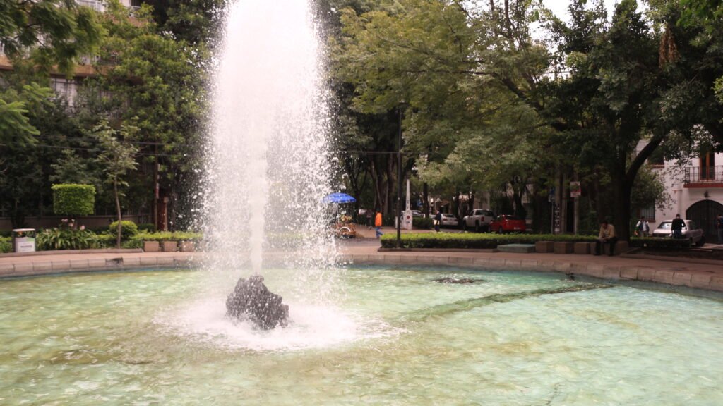
Mexico City leads because its best walking areas work as distinct districts rather than one enormous pedestrian route. Centro Histórico is the tightest cluster, with Madero linking Bellas Artes, the Zócalo and major historic sights. Reforma and Chapultepec create another long visitor corridor, while Roma and Condesa support slower neighborhood walking around parks and local streets. Coyoacán, Xochimilco and the Basílica de Guadalupe remain separate trips. Those distances are real, and the city should not be described as continuously walkable.
Metro and Metrobús are what make that scale practical over a short stay. They let visitors walk deeply inside one district, then reset efficiently before the next cluster. MEX also gives a car-free trip useful public-transport options into the central city, although luggage and terminal differences still add friction. This is the best fit here for travelers who enjoy long urban walks but do not mind using transit between them. The full Mexico City walking guide maps that cluster-and-transit strategy in detail.
2. Oaxaca City and Puebla — A Tie That Feels Nothing Alike
Oaxaca City: a compact chain from the Zócalo to Santo Domingo
Much of Oaxaca City’s first-time sightseeing fits naturally into one coherent central walk. From the Zócalo, Mercado 20 de Noviembre, Benito Juárez Market, Macedonio Alcalá and Santo Domingo form a compact sequence. Nearby Jalatlaco and Xochimilco extend the weekend without becoming indistinguishable from Centro. Uneven surfaces, narrow sidewalks, mixed traffic and busy market streets keep some historic blocks from feeling effortless. For longer urban trips, BinniBus provides useful support, although its network and airport connection remain less extensive than Mexico City or Puebla. Regional destinations such as Monte Albán, Mitla, Hierve el Agua and El Tule remain separate excursions. Use the Oaxaca City route guide for the strongest walk-first pattern.
Puebla: compact monuments with stronger transport backup
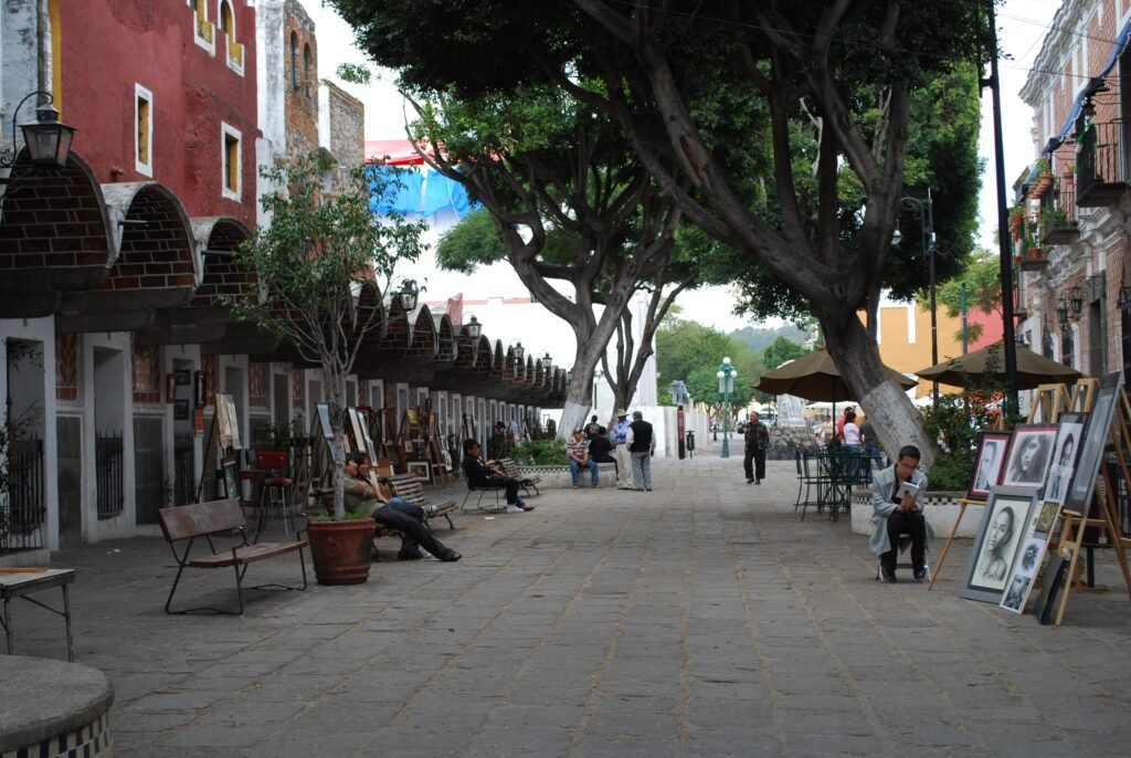
Puebla reaches the same total through a slightly different weekend. The Zócalo, Cathedral, Biblioteca Palafoxiana, Museo Amparo, Capilla del Rosario, Los Sapos, El Parián and Barrio del Artista cluster tightly. That monumental core is excellent on foot, although vehicle streets, historic surfaces and larger crossings add more friction than Oaxaca’s most direct routes. RUTA provides stronger support once the itinerary reaches beyond the center, and frequent intercity coaches make arrival comparatively practical. Los Fuertes and Angelópolis sit beyond the tight central pattern. Cholula remains a separate neighboring destination, not an extension of Puebla’s compactness. The Puebla car-free weekend guide shows where RUTA becomes worth using.
4. Mérida — Flat Streets That Stretch Toward Paseo de Montejo
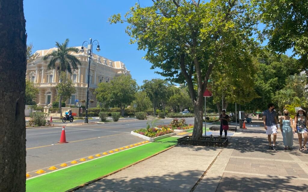
Mérida offers the easiest terrain in this group, but its visitor map is longer than Oaxaca’s or Puebla’s. Plaza Grande, Santa Lucía and Santa Ana form a clear central chain before sightseeing extends north along Paseo de Montejo. The regular grid helps orientation, and climbing effort is minimal. Flat streets do not guarantee perfect sidewalks, however, so narrow sections, surface quality and exposed crossings still matter. Direct airport service to central stops and useful ADO terminals make arrival one of Mérida’s strongest practical advantages. Mérida-Teya remains outside the historic center and requires onward transport. Uxmal, Chichén Itzá, cenotes, Progreso and Izamal stay outside the city walking comparison. See the Mérida walking guide for the Centro-to-Paseo route logic.
5. Guadalajara — Centro and Chapultepec Need a Connection
Guadalajara works best when visitors stop trying to turn the whole weekend into one continuous walk. The Cathedral, Cruz de Plazas, Teatro Degollado, San Juan de Dios and Cabañas create a strong historic-center circuit. Farther west, Americana and Avenida Chapultepec form another important pedestrian district with a different neighborhood feel. Transit is the bridge between those two geographies, not evidence that they are adjacent on foot. Tlaquepaque and Zapopan remain distinct metropolitan destinations that also need a deliberate transfer. Public transport from the airport gives car-free arrivals a practical option, while the urban network makes district hopping realistic. Travelers who enjoy walking by neighborhood can use the Guadalajara walkability guide for the detailed split.
6. Guanajuato — Tiny Distances, Big Climbs
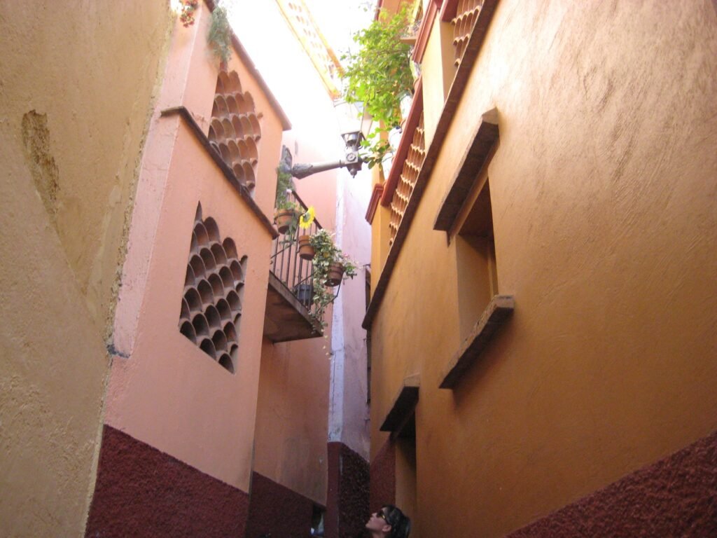
Guanajuato puts more headline sights into a tiny historic footprint than any other city here. Jardín de la Unión, Teatro Juárez, Plaza de la Paz, the university, Callejón del Beso, Mercado Hidalgo and the Alhóndiga sit close together. On a flat map, that looks almost ideal. In practice, stairs, steep grades, uneven paving and layered streets repeatedly turn short distances into physical work. The city is compact, not effortless.
The Pípila funicular is genuinely useful because it removes one major climb above Teatro Juárez. It cannot flatten the rest of the valley or replace a broader transit network. BJX sits outside Guanajuato, and the principal intercity coach terminal is also outside the historic center. Arriving with luggage therefore requires more planning than in Mexico City, Mérida or Puebla. Hill-tolerant travelers may still love how much sightseeing fits into such a small area. The Guanajuato hills and alleys guide explains the most terrain-aware routes.
Where Mexico’s Historic Centers Feel Most Compact
Guanajuato wins on sheer closeness, but Oaxaca and Puebla often deliver a more straightforward day on foot. Oaxaca’s Zócalo-to-Santo Domingo chain is direct, and the market district sits naturally inside the same central outing. Puebla packs an exceptional number of monumental sights around the Zócalo before the trip starts stretching toward Los Fuertes. Mérida’s central grid is easy to understand, but Paseo de Montejo adds a longer northbound shape. Mexico City and Guadalajara are different animals entirely: both contain excellent walking districts, yet neither should be judged as one compact historic core.
Mexico City and Guadalajara: When Transit Changes the Weekend
A spread-out visitor map can still work extremely well without a car, as Mexico City and Guadalajara demonstrate. Across Mexico City, transit links Centro, Reforma, Chapultepec, Roma and Condesa while preserving the real distances between them. On a smaller scale, Guadalajara follows a similar pattern between Centro and Americana-Chapultepec. Beyond Puebla’s Zócalo cluster, RUTA becomes useful when sightseeing starts spreading outward. Central Oaxaca and Guanajuato require transit less frequently, although their networks offer less depth when visitors need assistance. What matters is not simply whether transit exists. The real advantage comes when it saves meaningful time without replacing a strong walking experience.
Flat Mérida, Steep Guanajuato: The Effort Hidden on a Map
Terrain changes the feel of identical-looking distances. Mérida’s central streets are broadly flat, so a long northbound walk along the Paseo is more about heat, crossings and distance. Guanajuato can demand stairs or sharp grades between sights that appear almost adjacent. Oaxaca adds only moderate elevation as routes extend north, while Puebla’s main central circuit is also relatively manageable. Mexico City and Guadalajara are comparatively level across their principal visitor districts, with localized exceptions rather than constant climbing. That is why Guanajuato can be the most compact city here and still require the most physical effort.
Airport and Bus Arrivals Can Change the First Hour
A car-free weekend feels different when public transport starts working before the hotel check-in. Mexico City’s MEX gateway has useful public-transport links into central areas, making the city’s scale manageable from arrival. Mérida is especially convenient because its airport route reaches central visitor stops, while central ADO terminals also reduce onward travel. Guadalajara has a public-transport connection from the airport, while Puebla benefits from frequent intercity coach service with RUTA onward connections. Oaxaca remains practical, but airport passengers using public transport need more connection planning. Guanajuato creates the most friction because both BJX and the main coach terminal require an additional trip into the historic center.
Match the City to Your Walking Style
| Travel style | Best fit among these six | Why it fits |
|---|---|---|
| Strong walking plus the best transit backup | Mexico City | Excellent local walking districts become practical together because transit handles the long gaps. |
| Compact historic-center walking with moderate terrain | Oaxaca City | Most headline sights fit into a tight central chain, with only moderate elevation and localized street friction. |
| Monumental-center walking with stronger transit backup | Puebla | A dense Zócalo-area circuit combines with useful RUTA service for longer hops. |
| Flat central walking with easy car-free arrival | Mérida | The central grid is level and legible, while airport and intercity access reduce arrival friction. |
| Neighborhood-based big-city walking | Guadalajara | Centro and Americana-Chapultepec reward separate walking sessions linked by strong transit. |
| Extreme historic compactness for travelers comfortable with hills | Guanajuato | Very short sightseeing distances come with stairs, grades and more difficult gateway access. |
Pick the Walking Pattern You Actually Want
Mexico City and Guanajuato sit at opposite ends of the same traveler question. Mexico City spreads the weekend across several districts but makes the gaps easy to bridge. Guanajuato compresses the sights dramatically, then asks your legs to solve the elevation. Oaxaca and Puebla offer the strongest compact-center alternatives, Mérida favors flatness and easy arrival, and Guadalajara rewards neighborhood hopping. Use the overall ranking as the starting point, then choose the walking pattern that matches your pace, transit comfort and tolerance for hills.