
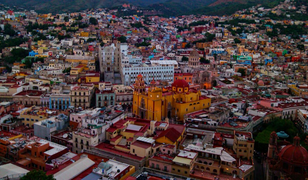
Inside its narrow valley center, Guanajuato packs an extraordinary number of major sights into remarkably short distances. Jardín de la Unión, Teatro Juárez, Plaza de la Paz, the Basilica, and the university sit within minutes. Westward, Callejón del Beso, San Fernando, Mercado Hidalgo, and the Alhóndiga continue the same compact chain. Yet this is not effortless walking. Stairs, sharp grades, cobbled surfaces, tunnel entrances, and stacked street levels turn short distances into repeated bursts of effort. The result is exceptional geographic compactness, but walking comfort depends heavily on elevation and route choice.
Why Guanajuato Feels So Compact on Foot
Few city-break destinations place so many headline sights inside such a short pedestrian chain. Jardín de la Unión and Teatro Juárez practically share the same space. Plaza de la Paz, the Basilica, and Universidad de Guanajuato follow within minutes. Callejón del Beso, Plaza de San Fernando, Mercado Hidalgo, and the Alhóndiga extend the core westward without creating a major gap. An official tourism route links many central anchors in roughly 1.8–2 kilometers. That density is the city’s strongest walking advantage. The central sights are genuinely close enough that buses and the funicular are mainly useful for elevation and outer extensions rather than ordinary sightseeing between the main plazas.
Where Short Walks Become Hard Work
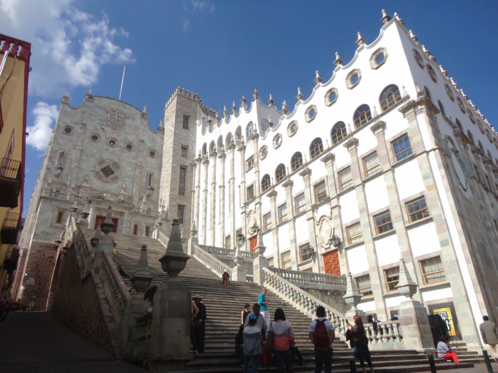
Distance is only half the story. Guanajuato sits in a steep ravine, and normal sightseeing repeatedly crosses stairs and sharp grades. The university’s monumental staircase makes this obvious inside the central core itself. Pípila is even more deceptive on a flat map because it rises directly above Teatro Juárez. Walking there means a demanding ascent, while the funicular removes most of that vertical effort in about five minutes. The Mummy Museum creates a different challenge. Its own visitor information places it only about 10 minutes from Mercado Hidalgo, yet the route climbs toward the municipal cemetery. Compact does not mean flat.
What the Alleys and Tunnels Mean for Pedestrians
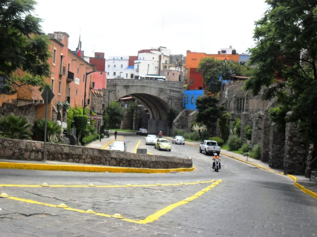
Guanajuato’s unusual street system can help and hinder walking at the same time. Car-light plazas, pedestrian alleys, and stair shortcuts often give walkers direct routes that conventional streets cannot. The municipal mobility plan describes the tourist center as broadly workable for pedestrians without physical impediments. That does not translate into universal accessibility. Narrow or discontinuous sidewalks, steep passages, uneven paving, and missing accessible connections remain important barriers. The tunnel system also needs nuance. The Subterránea Miguel Hidalgo has pedestrian accesses and sidewalks, but municipal planning identifies lighting, signage, and accessibility gaps elsewhere. Vehicles moving underground therefore do not create an automatic pedestrian bonus above ground.
Best Areas to Stay Without a Car
The historic center is the strongest base for a first visit. Lodging directly around Jardín de la Unión and Plaza de la Paz places Teatro Juárez, the Basilica, Universidad, and central museums within minutes. The San Fernando and Mercado Hidalgo side also works well, especially for the Alhóndiga and Day 2 route. San Javier and other outer hotel zones can still be practical with buses or taxis, but they sacrifice instant access to the lower central chain. One caution matters everywhere: a hotel can look centrally located on a map while sitting considerably above the valley floor. Check the final approach for stairs or steep grades when luggage or mobility is a concern.
Realistic Walking Times in Guanajuato
Teatro Juárez to Jardín de la Unión: about 1–2 minutes. Jardín to Plaza de la Paz: about 2–4 minutes. Plaza de la Paz to Universidad: about 3–5 minutes, with the major staircase at the university. Jardín to Callejón del Beso: about 6–8 minutes. Jardín to Mercado Hidalgo: about 8–12 minutes. Mercado to Alhóndiga: about 3–5 minutes. Mercado to Museo de las Momias: about 10–15 minutes, uphill. These are practical planning estimates rather than guaranteed walking times.
A 2-Day Walking Route
The two days deliberately separate the easiest central sightseeing from the city’s steeper extensions. Day 1 stays inside the historic core and makes the university climb only once. The second day starts west at Mercado Hidalgo, adds the Alhóndiga, then climbs toward the Mummy Museum without forcing a return walk up the same slope.
Day 1 — Quijote, Jardín de la Unión and the Historic Core
Walking route
Day 1: Quijote, Jardín de la Unión and the historic core
- Museo Iconográfico del Quijote
- Teatro Juárez
- Jardín de la Unión
- Basílica Colegiata de Nuestra Señora de Guanajuato
- Universidad de Guanajuato - Edificio Central
- Callejón del Beso
- Plaza de San Fernando
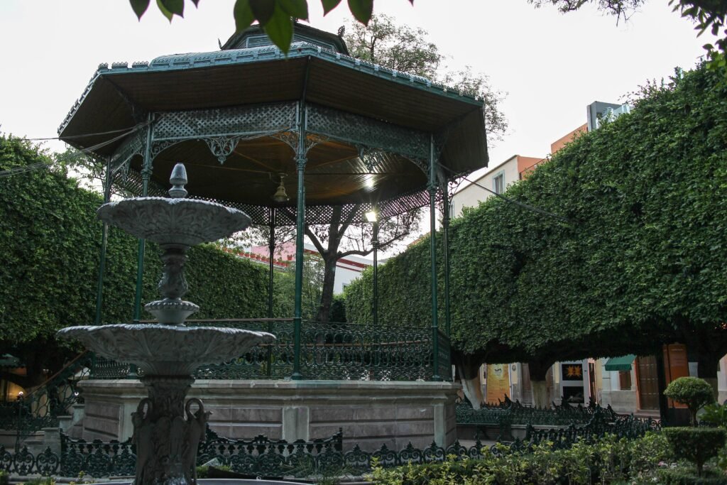
Begin at the Museo Iconográfico del Quijote on Manuel Doblado, an officially described pedestrian zone. Continue to Teatro Juárez and Jardín de la Unión, then move west to Plaza de la Paz and the Basilica. Climb once to the Universidad de Guanajuato before descending toward Callejón del Beso. Finish at Plaza de San Fernando instead of returning east. This sequence demonstrates how little horizontal distance separates the city’s signature sights. If Pípila matters, use the nearby funicular as a separate vertical excursion rather than inserting a steep out-and-back into the walking loop.
Day 2 — Mercado, Alhóndiga and the Mummy Museum
Walking route
Day 2: Mercado, Alhóndiga and the Mummy Museum
- Mercado Hidalgo
- Museo Regional de Guanajuato Alhóndiga de Granaditas
- Museo de las Momias de Guanajuato
Start at Mercado Hidalgo and walk the short distance to the Alhóndiga de Granaditas. From there, continue toward the Museo de las Momias. The mileage stays modest, but the final approach climbs enough to change the character of the day. The museum itself publishes roughly 10 minutes walking from Mercado Hidalgo and 15 minutes from central Guanajuato. Treat those as distance references, not effort guarantees. After the museum, a local bus back toward Centro is reasonable if repeating the hill adds little value. This is where Guanajuato stops behaving like one effortless pedestrian pocket.
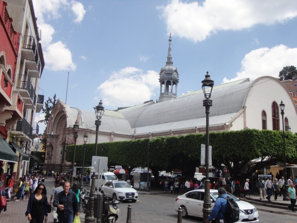
When Local Transit Helps
Local buses matter most when walking stops being efficient. Municipal route inventories include links between the intercity terminal and Mercado Hidalgo, plus services toward Momias, Presa de la Olla, Pípila corridors, and Valenciana. The network therefore has useful reach beyond the tourist center. Service reliability can vary, so allow extra time when using local buses and confirm the latest route information before relying on a tight connection
Local buses generally use simple onboard payment, so carry small bills and confirm the destination before boarding. The Pípila funicular is easier to understand and takes about five minutes. Check current fares and operating hours before visiting, especially if you plan a late return. Use it for the vertical Pípila connection rather than as a substitute for the wider bus network.
Arriving in Guanajuato Without a Car
The airport name can be misleading for city-break planning. Guanajuato International Airport, BJX, sits outside Guanajuato city near the León-Silao corridor. UNEBUS serves the airport, but reaching Guanajuato Centro by scheduled public transport generally requires a transfer, commonly through León. Private taxis are available, but they do not make the public arrival chain more direct.
Intercity coach arrival is stronger, though still not central. Primera Plus places Guanajuato Central at Yerbabuena on the Guanajuato-Silao road, outside the historic core. Long-distance services connect the city with Mexico City, Guadalajara, León, Querétaro, San Miguel de Allende, and other major origins. Municipal route inventories include Central-to-Mercado Hidalgo service, so a public onward connection exists. Luggage, variable waits, and the final transfer still make arrival less effortless than the walking geography suggests.
When a Car Helps
A private car adds little inside the historic core, where streets are tight and the strongest sights cluster on foot. It becomes more useful when several outer destinations are combined in one day. Valenciana and the mining attractions sit beyond the central walking system and are better approached by bus, taxi, or a planned vehicle trip. Presa de la Olla is another optional extension rather than a reason to drive downtown. Regional trips beyond Guanajuato city can strengthen the case for a car, but they do not change the city-center weekend itself.
Limitations and Accessibility
Travelers with limited mobility should plan more carefully than the short distances imply. Many famous alleys are narrow, steep, or stepped, and some sidewalks are too constrained for comfortable universal access. The municipal mobility plan explicitly distinguishes the tourist center’s basic pedestrian usability from true universal accessibility. The University staircase and Pípila climb are obvious barriers, but smaller grades can accumulate throughout the day. The funicular can remove one major ascent, while buses can reduce mileage to outer stops. Neither solves every stair, cobble, or narrow passage inside the historic fabric.
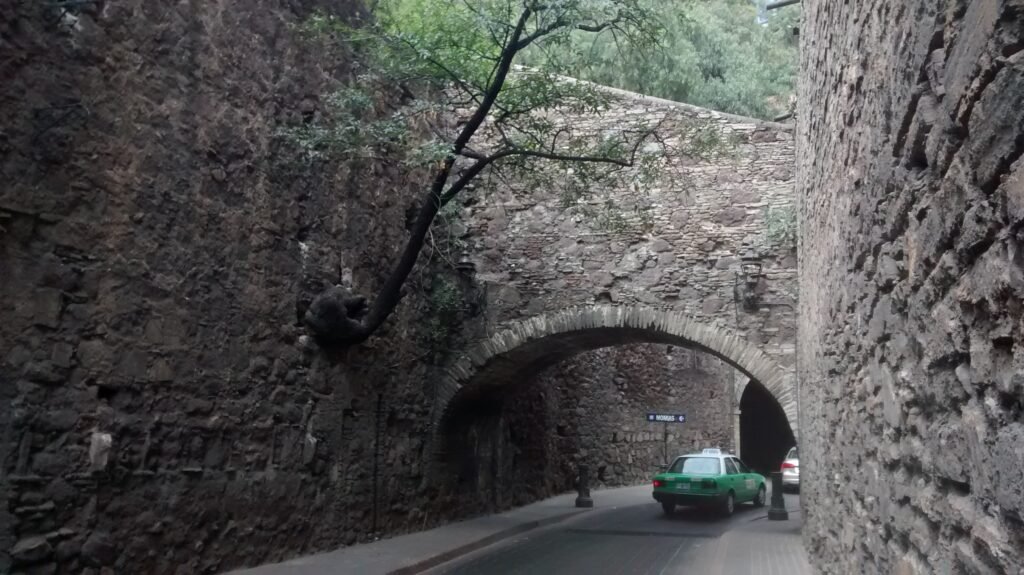
Seasonal and Event Context
Guanajuato remains walkable throughout the year, but weather and major events can substantially change comfort and crowding. Strong sun makes exposed climbs more tiring, while rain requires extra care on polished or uneven surfaces. The Festival Internacional Cervantino can bring much heavier pedestrian volumes and temporary access or service changes around central venues, so autumn visitors should check the current festival calendar before travel.
Bottom Line
Guanajuato works best as a walking-first city with selective transit rather than as a place where every short distance feels easy. The historic core is unusually concentrated, and a central hotel can put a remarkable number of sights within minutes. The trade-off is effort: stairs, grades, multi-level streets, and uneven surfaces repeatedly interrupt the simplicity suggested by the map. Use the funicular for Pípila when the climb adds little value, consider a bus for Momias or outer attractions, and keep Valenciana outside the main walking loop. Route choice matters more here than raw mileage.