
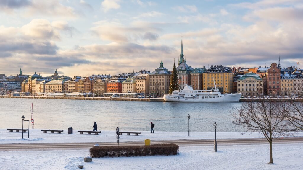
Water divides the center into islands, yet carefully placed bridges make many headline sights feel sequential rather than scattered. From Central Station, walking south reaches City Hall, Riddarholmen, Gamla Stan, Parliament, and the Royal Palace with little wasted mileage. Eastward, Strömbron and nearby crossings lead naturally toward Kungsträdgården, Nationalmuseum, and the start of Strandvägen. The pattern changes beyond that compact chain. Djurgården becomes a longer waterfront extension, while Södermalm adds steeper climbs and more separated viewpoints. Those differences matter because Stockholm works best as connected walking clusters, not as one uniformly compact core.
How Stockholm Connects Across the Water
The strongest walking chain starts at Stockholm Central and runs through Norrmalm toward Gamla Stan. Sergels torg and pedestrianized Drottninggatan sit only a few minutes from the station, making orientation unusually simple. City Hall is a short western spur, then Vasabron brings the route back toward the old city. Once on Gamla Stan, Stortorget, the Royal Palace and Parliament sit close enough to combine without transport.
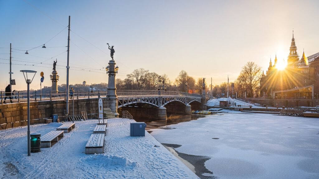
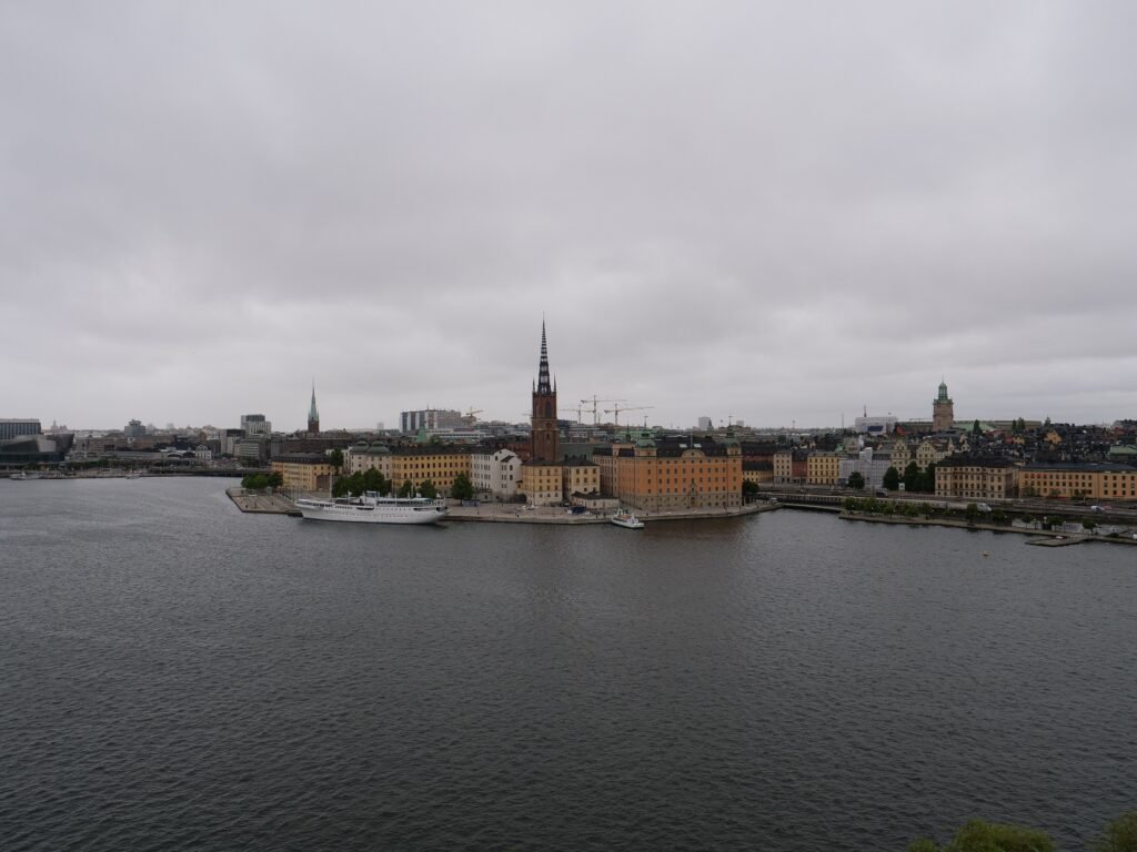
Water matters most at the edges of those clusters. Norrmalm and Gamla Stan have several useful crossings, so the channel rarely feels isolating. Riddarholmen connects to Gamla Stan by a short bridge and fits naturally beside a City Hall walk. Skeppsholmen is different: Skeppsholmsbron makes access easy, but the island behaves more like a spur than a through-route. That distinction prevents every nearby island from being treated as one frictionless grid.
East of the Royal Palace, Strömbron and the Blasieholmen waterfront pull the route toward Nationalmuseum and Kungsträdgården. Strandvägen then becomes the attractive approach to Djurgårdsbron. The Vasa Museum places Djurgården about a 30-minute walk from the city center. That is a pleasant continuation, but it is long enough to remain a distinct visitor cluster.
Where Gamla Stan Adds Friction
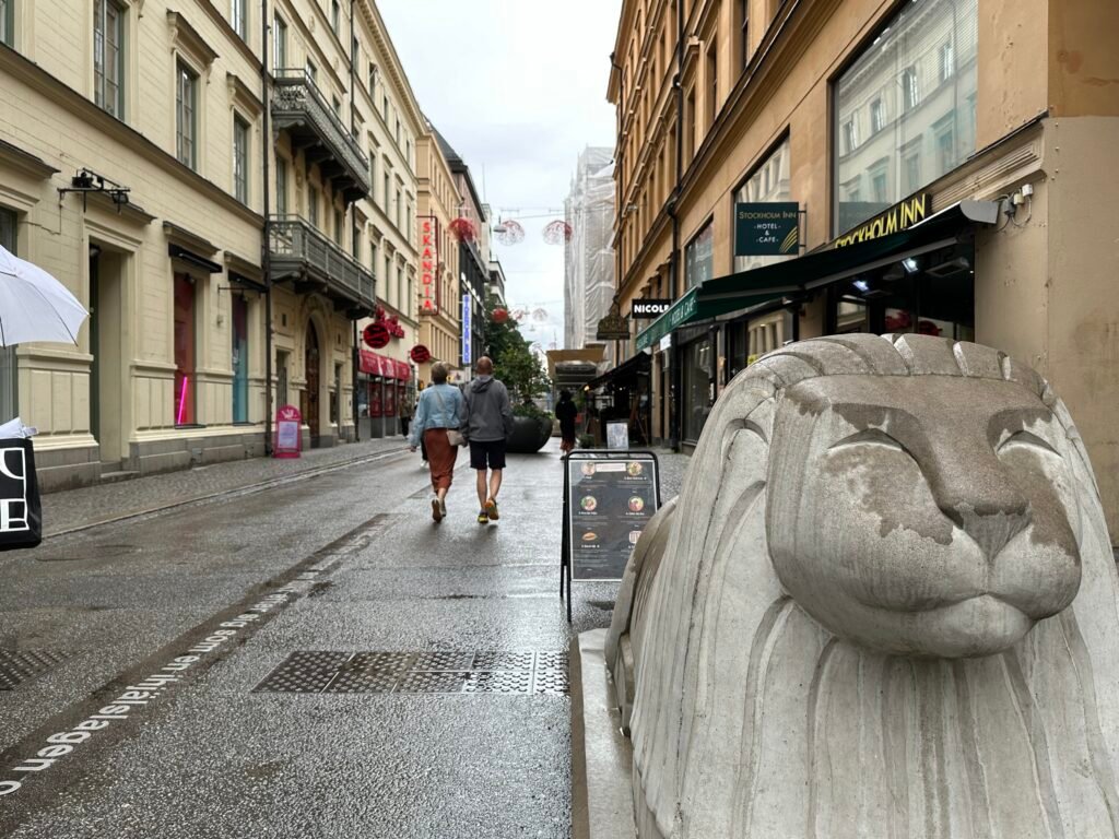
Gamla Stan is compact, but short distance does not mean effortless walking. Its narrow lanes twist around medieval blocks, and many surfaces are cobbled. Stockholm City Museum specifically warns of inclines, stairs and cobblestones on its Old Town walk. Visit Stockholm also notes that wider routes around Västerlånggatan and Stortorget are easier than some narrow alleys. Crowds can slow those streets further during busy sightseeing hours.
For most visitors, the easiest strategy is to use the main streets for through-movement and explore smaller lanes selectively. Travelers using wheelchairs, walkers or rolling luggage should expect more surface friction than the map suggests. The old city remains geographically compact; the deduction comes from walking conditions rather than distance.
Best Areas to Stay for Walking
Norrmalm near Stockholm Central is the most efficient all-purpose base, combining airport arrival, transit and easy walks to Gamla Stan. Gamla Stan puts historic sights at the door, but cobbles and crowds make luggage less convenient. Nybroplan and the Östermalm edge work especially well for Strandvägen, Nationalmuseum and Djurgården. Slussen suits travelers prioritizing Södermalm, though climbs and current construction make it less uniformly easy.
Useful Walking Times
Allow about 10 minutes from Stockholm Central to City Hall and roughly 20–25 minutes from Central to Stortorget. The Vasa Museum gives about 30 minutes on foot from the city center. Skansen places its entrance about 950 meters, or around 10 minutes, beyond Djurgårdsbron. Fotografiska currently directs visitors along an approximately 800-meter waterfront approach from Slussen. Monteliusvägen is closer on the map, but the climb means about 15–20 minutes is a more realistic allowance.
These are practical planning estimates rather than guaranteed walking times. Crowds, bridge crossings, terrain and exact entrances can change the actual time.
Slussen and Temporary Construction
Slussen remains an important walking connection between Gamla Stan and Södermalm, but construction can temporarily change paths, entrances and level changes around the interchange. Pedestrian access remains available, although the exact route may shift as work progresses.
Because redevelopment continues in phases, follow current signs and check City of Stockholm or SL information shortly before travel rather than relying on a fixed construction layout in this guide.
A 2-Day Walking Route
The two days separate the compact central chain from the longer Djurgården and Södermalm extensions. Day 1 moves west to east across the core. Day 2 uses one ferry repositioning to avoid repeating Strandvägen after Djurgården.
Day 1 — Central Station, Gamla Stan and the eastern waterfront
Walking route
Day 1 — Central Station, City Hall, Gamla Stan and the eastern waterfront
- Stockholm Central Station
- Stockholm City Hall
- Riddarholmen
- Stortorget
- Royal Palace
- Riksdagshuset
- Kungsträdgården
- Nationalmuseum
- Nybroplan / start of Strandvägen
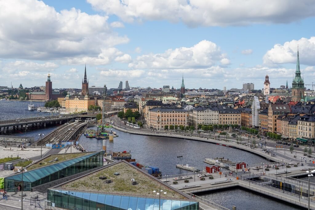
Start at Stockholm Central and make the short westward walk to City Hall before turning back toward the old city. Cross toward Riddarholmen, continue to Stortorget, then work around the Royal Palace and Parliament. From there, cross toward Kungsträdgården and Nationalmuseum before finishing at Nybroplan and the start of Strandvägen. Skeppsholmen works as an optional museum spur from Nationalmuseum, but returning across Skeppsholmsbron is unavoidable.
Day 2 — Djurgården, Slussen and Södermalm
Walking route
Day 2 — Strandvägen, Djurgården and Södermalm
- Nybroplan / Strandvägen
- Djurgårdsbron
- Vasa Museum
- ABBA The Museum
- Skansen
- Allmänna gränd ferry stop
- Slussen / Södermalmstorg
- Monteliusvägen
- Mariatorget
Begin along Strandvägen and cross Djurgårdsbron toward the Vasa Museum. Continue south through the Djurgården museum cluster to ABBA The Museum and Skansen. Afterward, walk to Allmänna gränd and use a regular public ferry toward Slussen. This deliberate repositioning removes a long repeat walk and keeps the afternoon focused on Södermalm. From Slussen, climb toward Monteliusvägen and finish around Mariatorget.
Fotografiska works better as an alternative Slussen spur than as an addition to the full Djurgården-and-Södermalm route. Check the current pedestrian approach from Slussen before travel, since construction can temporarily change access.
When Transit Helps Most
Stockholm’s public transport is most useful for preserving time and energy between walking clusters. Metro, trams, buses and ferries connect Södermalm, Djurgården, Östermalm and other areas that sit beyond the tightest central walking chain.
SL offers integrated ticketing across much of the local network, with several digital and contactless payment options. Fare validity, prices and service patterns can change, so check the current SL planner before travel, especially when construction or maintenance affects a line.
Arriving from Stockholm Arlanda Without a Car
Stockholm Arlanda Airport has direct rail connections into Stockholm Central, placing arriving travelers immediately beside Norrmalm, T-Centralen and the main walking network. Several airport-rail and public-transport options are available, so compare current journey times and fares before travel.
Airport coaches provide another option, while intercity trains from other Swedish and Scandinavian cities also arrive centrally. For a standard city break, public transport makes renting a car unnecessary.
When a Car Helps
A car adds little to a standard two- or three-day Stockholm city break. Parking and island traffic are more likely to complicate central sightseeing than improve it. A vehicle becomes more useful for dispersed regional plans, not for Norrmalm, Gamla Stan, Djurgården or Södermalm. Drottningholm Palace, the archipelago, Vaxholm, Uppsala and Sigtuna are better treated as separate regional excursions.
Walking Limitations and Practical Tips
Wear shoes that handle cobbles well if Gamla Stan is a priority. Use the main old-city streets when mobility or rolling luggage matters, then explore narrower alleys selectively. Treat the Södermalm climb as its own effort rather than stacking it onto a long Djurgården day. At Slussen, follow current signs because construction can temporarily change pedestrian routing.
Cyclists are common on several waterfront and bridge corridors, so watch lane markings where walking and bicycle space run closely together. Cyclists are common along several waterfront and bridge corridors, so watch lane markings where walking and bicycle space run close together.
Seasonal Note
Summer’s long daylight makes extended island walks easier to fit into a short visit. Winter darkness, snow and ice can slow cobbled streets, bridge approaches and Södermalm slopes. Waterfront wind can also make the same distance feel more demanding, especially outside the warmer months.
Bottom Line
Stockholm works best as a series of connected walking clusters rather than one tiny center. Norrmalm, Gamla Stan and the inner waterfront form the strongest continuous walking area, while Djurgården and Södermalm add more distance, water crossings and climbing. Use public transport selectively between those longer sections, and a private car adds little to a standard city break.