
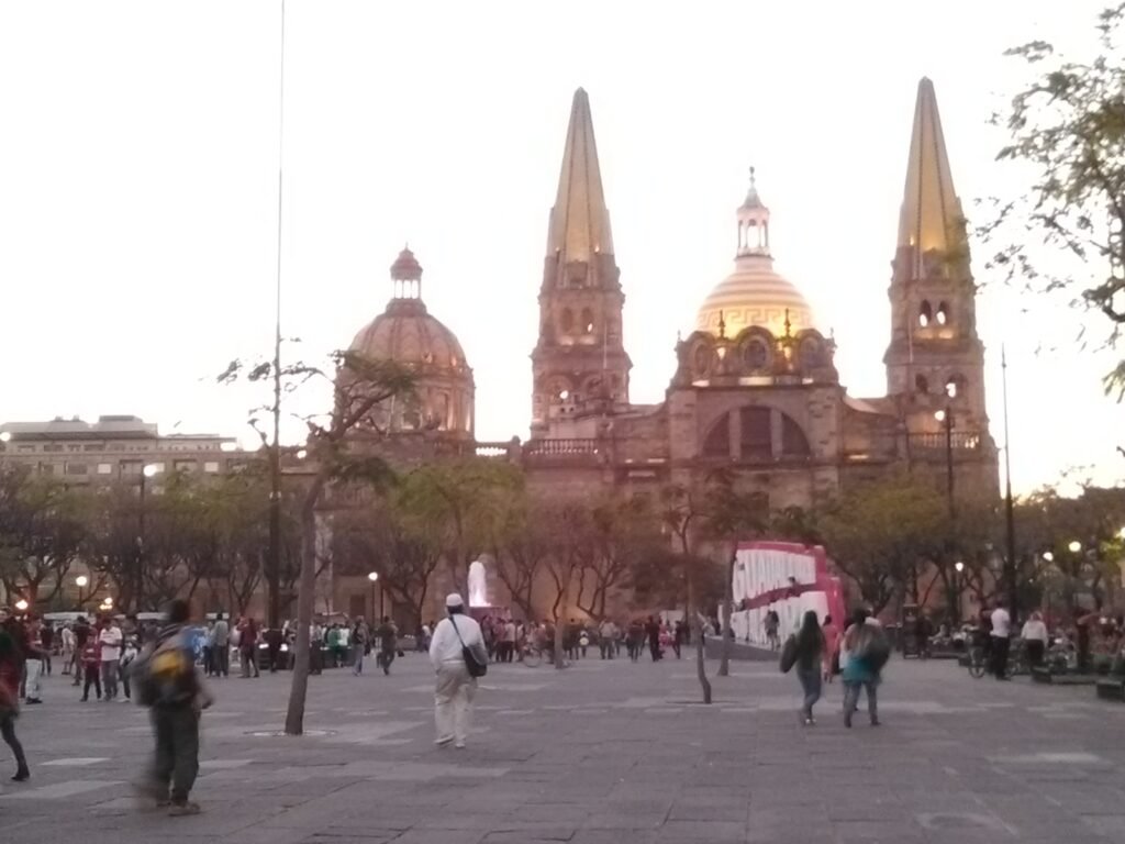
Around the historic center and Colonia Americana, Guadalajara offers two strong walking clusters rather than one continuous sightseeing zone. Around the Cathedral, four civic plazas connect directly with Teatro Degollado and the eastern Plaza Tapatía corridor. Mercado San Juan de Dios and Museo Cabañas extend that historic system without turning it into a long cross-city trek. Westward, Templo Expiatorio introduces a second pattern centered on Colonia Americana and Avenida Chapultepec. The street grid keeps the transition legible, but wide avenues and several busy crossings reduce comfort between clusters. Farther destinations such as Tlaquepaque and Zapopan work better as transit-supported outings than extensions of the central walking footprint.
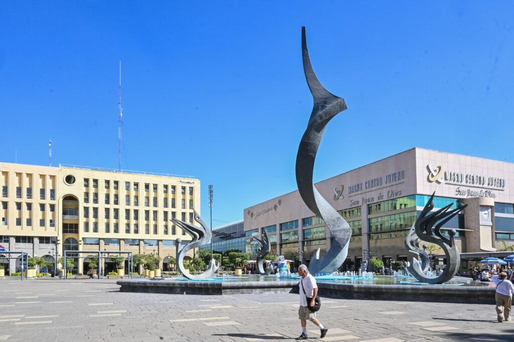
Guadalajara’s Walking Geography: Two Central Clusters
The Cathedral anchors a remarkably concentrated historic visitor system. The official historic-center route groups it with the Cruz de Plazas, Teatro Degollado and Museo Cabañas. Plaza de la Liberación sits directly between the Cathedral and Degollado, while Paseo Degollado continues east into Plaza Tapatía. Mercado San Juan de Dios belongs to this same practical cluster rather than a separate sightseeing zone.
The western transition is different. Templo Expiatorio sits close enough to Centro for a normal visitor walk, but Avenida Chapultepec adds another meaningful leg. The Cathedral is roughly 1.2 kilometers from the Expiatorio area, while Avenida Chapultepec adds another 1.3 to 1.5 kilometers depending on the exact block. The result is a connected urban fabric, not one tiny core.
Tlaquepaque and Zapopan should stay off the central compactness map. Both have attractive pedestrian centers once you arrive, including Tlaquepaque’s Andador Independencia and Zapopan’s basilica-and-plaza cluster. They are best treated as transit-supported outings rather than extensions of central Guadalajara.
Where Walking Feels Best — and Where It Breaks
Paseo Fray Antonio Alcalde is the clearest pedestrian upgrade in Centro. The city describes more than two kilometers of pedestrian-priority space with trees, furniture, fountains and tourist signage. The Cruz de Plazas and Paseo Degollado add large car-light public spaces around the Cathedral and theater. Those pieces materially improve a first-time visitor’s walking day.
They do not describe every adjoining street. Calzada Independencia and the Juárez–Vallarta axis are broad traffic corridors, and crossing comfort can drop quickly outside the plazas. Avenida Chapultepec has a useful median promenade and a strong surrounding street network, but traffic still runs along both sides. Current municipal projects continue improving crossings, sidewalks and Chapultepec public space, so travel-day conditions may differ from normal conditions.
Best Areas to Stay for Walking
Centro Histórico is the best base for maximum first-day sightseeing density. The Cathedral, Teatro Degollado, central plazas, San Juan de Dios and Cabañas are all reachable without using transit. It works especially well for travelers prioritizing history, museums and traditional markets.
Expiatorio and eastern Colonia Americana offer the best compromise between the two central clusters. This area puts Expiatorio close at hand, with the Cathedral and Avenida Chapultepec each roughly a 15-minute walk away. Juárez Station also sits beside this transition zone.
Chapultepec, Americana and Lafayette suit travelers who prioritize restaurants, cafés and evening activity. They remain walkable internally, but a historic-center morning starts with a longer walk or short transit hop. Minerva also has substantial hotel supply, although it sits farther from the Cathedral cluster.
Realistic Walking Times
Cathedral to Teatro Degollado: about five minutes across the central plaza system. Reaching Museo Cabañas from the Cathedral: takes about 16 minutes over 1.3 kilometers. The Expiatorio area: sits roughly 15–20 minutes west of the Cathedral on foot. From Expiatorio to Avenida Chapultepec: allow another 15–20 minutes. These are practical planning estimates rather than guaranteed walking times.
Do not treat Tlaquepaque or central Zapopan as another walking-time entry from the Cathedral. They are metropolitan outings. Use transit to reach each cluster, then walk after arrival.
A 2-Day Walking Route
Day 1 — Centro Histórico
Walking route
Day 1 — Cathedral, Cruz de Plazas, San Juan de Dios and Cabañas
- Plaza de Armas
- Guadalajara Cathedral
- Rotonda de los Jaliscienses Ilustres
- Plaza de la Liberación
- Teatro Degollado
- Plaza Tapatía
- Mercado Libertad / San Juan de Dios
- Museo Cabañas
Start at Plaza de Armas and the Cathedral, then loop around the Rotonda and Plaza de la Liberación before Teatro Degollado. Continue east through Paseo Degollado and Plaza Tapatía. San Juan de Dios adds a market stop before the final walk to Museo Cabañas. This keeps the day inside the strongest historic cluster and avoids wasting time on cross-city mileage.
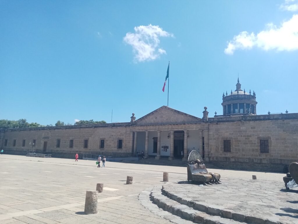
The central plazas provide the easiest walking of the day. Around the San Juan de Dios edge, slow down for wider roads and use marked crossings rather than following the shortest visual line. Cathedral to Cabañas is only about 1.3 kilometers directly, so the route’s extra distance comes from purposeful stops rather than geographic sprawl.
Day 2 — Expiatorio, Americana and Chapultepec
Walking route
Day 2 — Expiatorio, MUSA, Colonia Americana and Chapultepec
- Parque de la Revolución (Parque Rojo)
- Templo Expiatorio del Santísimo Sacramento
- MUSA Museo de las Artes Universidad de Guadalajara
- Avenida Chapultepec at Avenida Vallarta
- Corredor Cultural Chapultepec
- Avenida Chapultepec at Avenida Niños Héroes
Begin at Parque Revolución beside Juárez Station, then walk to Templo Expiatorio and MUSA. Continue west toward Avenida Chapultepec and follow the cultural corridor south through Colonia Americana. This route shows Guadalajara’s second major walking environment: tree-lined neighborhood streets, cafés, restaurants and a median promenade instead of monumental civic plazas.
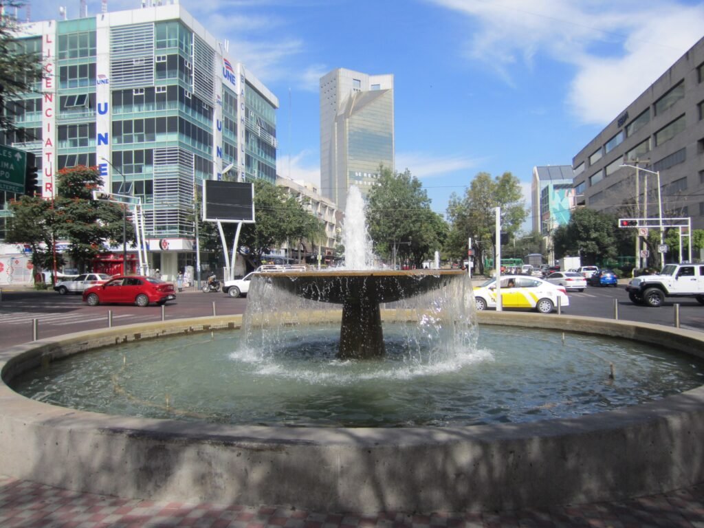
If your hotel is in Centro, using Mi Tren to Juárez can save energy without pretending the districts are closer than they are. Tlaquepaque makes a better optional third outing than an artificial extension of this route.
Using Transit Without Overusing It
Mi Tren is the main rapid-transit tool for a short stay. Lines 1, 2 and 3 run daily from 5:00 a.m. to 11:00 p.m. Line 2 crosses the central Javier Mina–Juárez corridor, while Line 3 connects Zapopan, Guadalajara and Tlaquepaque. Line 4 has operated since December 2025, but it matters less for a classic first weekend.
The standard fare is MXN 11. A regular Mi Movilidad card costs MXN 30 and works across major SITEUR services. Occasional Mi Tren riders can instead buy an MXN 11 Univiaje QR ticket, although vending machines require exact payment. Transfers among Lines 1–3 are free under SITEUR’s stated rules, and some Mi Macro transfers receive a discount.
Use Line 3 when you deliberately choose Tlaquepaque or Zapopan. Tlaquepaque’s Andador Independencia is pedestrianized and packed with galleries, museums, shops and restaurants once you arrive. Central Zapopan similarly groups the Basilica, plazas and Museo de Arte de Zapopan around its own pedestrian center. Transit makes both easy; it does not make them part of central Guadalajara’s walking footprint.
Arriving Without a Car
Guadalajara International Airport sits roughly 16–17 kilometers south of the city. Línea 5 Macro Aeropuerto provides a public-transport connection between Guadalajara International Airport and the city. Route T02 links the airport with Parque Agua Azul and the central Guadalajara network. Trunk routes run every 15 minutes, daily from 3:30 a.m. to 10:30 p.m.
The airport fare is MXN 11, paid with Mi Movilidad or Única. The electric buses include luggage space, which reduces practical arrival friction. Still, Parque Agua Azul is south of the Cathedral cluster, so many hotels require an onward walk or transfer. Guadalajara therefore has a much better airport arrival than older guides suggest, but not a direct airport train into the historic plazas.
Long-distance bus travelers also benefit from Line 3 at Central de Autobuses. That connection can make intercity arrival straightforward, but it is complementary context.
When a Car Helps
A private car adds little for the two central walking days, Tlaquepaque, or central Zapopan. Transit handles those movements without parking overhead. A car becomes more useful for dispersed regional stops, rural Jalisco itineraries, trailheads, or multi-destination day trips that fall beyond the frequent metropolitan network.
Limitations and Practical Walking Tips
Use the pedestrian plazas and Paseo Alcalde whenever they align with your route, but do not assume the next avenue will feel equally calm. Large signalized crossings can add waiting time even when the grid remains easy to understand. Sidewalk obstruction, curb quality, vendors and crowding can also change the usable width from block to block.
Sunday pedestrian programs can make parts of Centro more comfortable, while construction around major streets can occasionally alter routes. Check local notices when planning around closures or works
Seasonal Walking Context
Guadalajara’s central visitor routes are generally manageable on foot, but weather changes comfort. Strong sun can make exposed plazas feel hotter than shaded neighborhood streets, while afternoon rain during wetter periods can slow crossings and make uneven surfaces more noticeable.
Bottom Line
Guadalajara works best when you plan by cluster. Spend one day exploiting the unusually concentrated historic center, then give Americana and Chapultepec their own walking day. Use Mi Tren for Tlaquepaque or Zapopan and Línea 5 for the airport. That approach keeps a first weekend comfortably car-free without pretending the entire metropolitan area is compact on foot.