
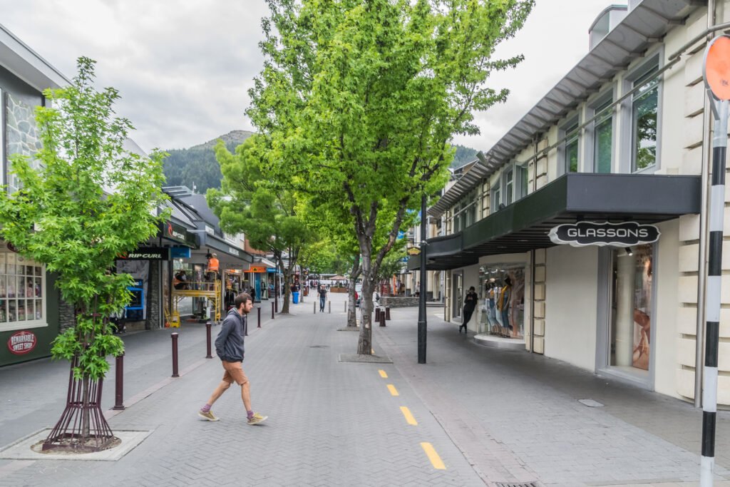
Between the pedestrian mall and the lake, the main visitor sights fit inside a remarkably tight central bowl. Beach Street, Rees Street, Marine Parade, Steamer Wharf, and Queenstown Gardens connect with little wasted distance. Completed street upgrades now continue that pedestrian spine uphill toward the Skyline gondola base on Brecon Street. The compact pattern changes quickly beyond the center. Fernhill rises above the lake, Frankton sits several kilometers away, and Queenstown Hill adds a serious climb. A practical weekend therefore combines easy central walking with selective bus use for outer lodging and longer urban gaps.
How Queenstown’s Central Walking Core Fits Together
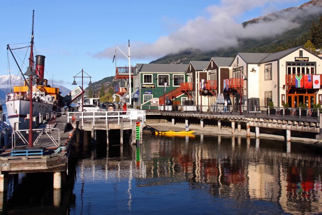
The strongest walking sequence starts around Queenstown Mall and Beach Street, then reaches Steamer Wharf within a few central blocks. From there, the lakefront continues past Queenstown Bay and Marine Parade toward Queenstown Gardens. QLDC completed upgrades on Beach, Rees, Brecon and Park Streets specifically to improve pedestrian continuity. The same project describes a continuous link from the Gardens to the Gondola. That continuity is important, but it does not make the route level.
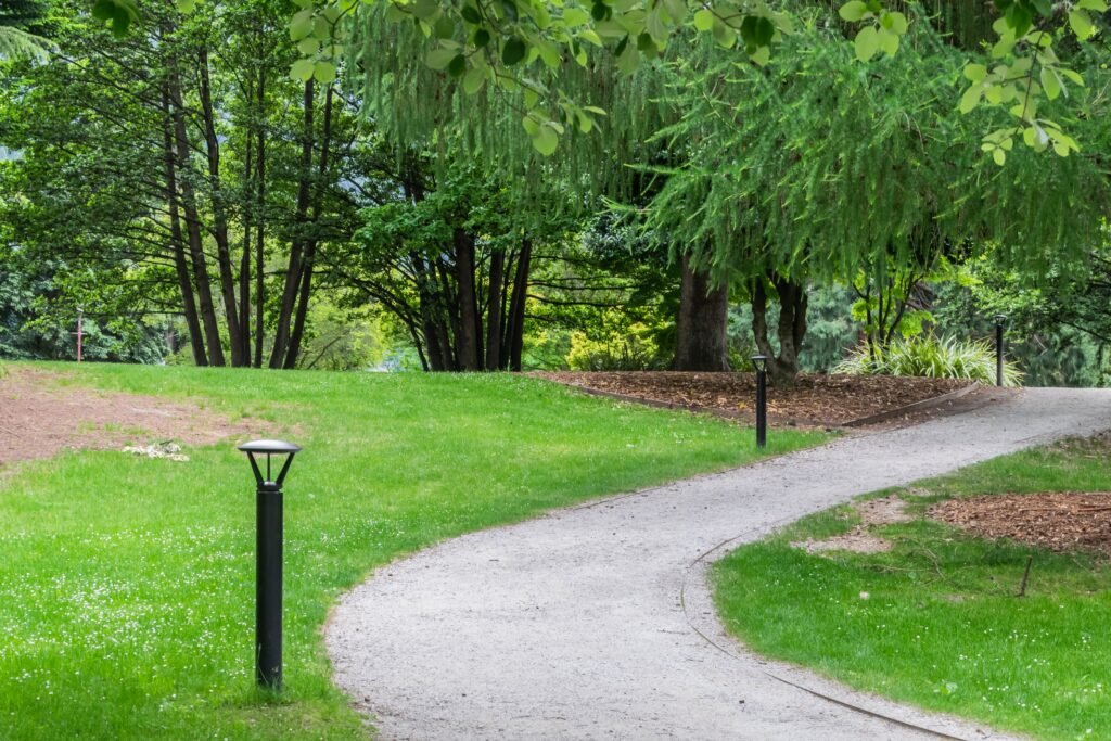
Marine Parade now has a raised concrete path, new access points and an accessible public toilet. Queenstown Gardens begins directly beside the lakefront rather than across a detached road corridor. Destination Queenstown lists the Gardens loop at 3.1 kilometers and about one hour. The loop is wheelchair accessible, although a few access points are steeper.
Skyline Is Close, but the Approach Still Climbs
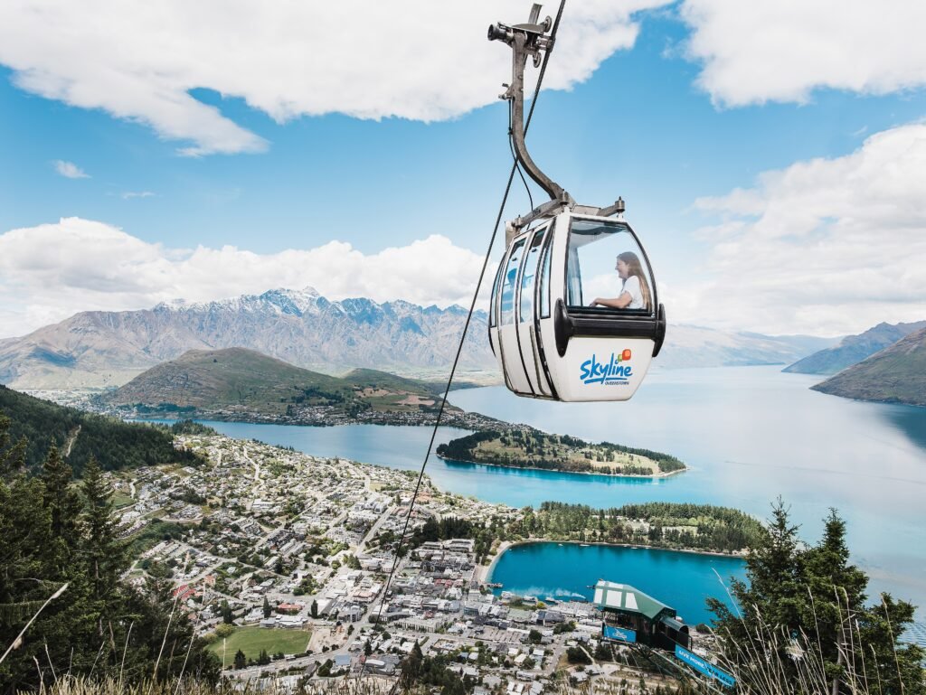
Skyline Queenstown sits on Brecon Street, only a short walk from the town centre. The important distinction is vertical effort. Brecon Street rises before the Gondola base, and the alternative Tiki Trail climbs more than 400 meters from that base. The Gondola then carries passengers uphill, but it is an attraction ride rather than a pedestrian connection. Its convenience does not reduce the climb required to reach the base.
Where to Stay for the Easiest Walking
A town-centre or immediate lakefront base minimizes daily mileage because the Mall, wharf, Gardens and Brecon Street all sit nearby. Fernhill changes the equation. Destination Queenstown places it 2.8 kilometers from central Queenstown and within roughly a 30-minute walk. It also sits on Route 1, which matters because the return from town includes real elevation. Frankton Road accommodation is similarly better judged by bus access than by map proximity alone.
Useful Queenstown Walking Times
| Walk | Typical time or distance |
|---|---|
| Queenstown Mall to Steamer Wharf | About 5 minutes; practical central planning estimate |
| Queenstown Mall to Skyline Gondola base | Roughly 8–12 minutes; short but uphill via Brecon Street |
| Queenstown Bay / Marine Parade to Queenstown Gardens | A few minutes on the continuous lakefront connection |
| Queenstown Gardens loop | About 1 hour; 3.1 km return |
| Central Queenstown to Fernhill | Within about 30 minutes; Fernhill is 2.8 km from central Queenstown |
| Queenstown Gardens to Frankton | A long recreational walk rather than an efficient central connection; check current Frankton Track conditions before setting out. |
| Queenstown Hill Time Walk | 2–3 hours; 5.4 km return with about 500 m of climbing from Belfast Terrace |
The short central figures are practical planning estimates rather than guaranteed walking times. Hills and route changes can make elapsed time longer than distance suggests.
A 2-Day Walking Route
Day 1: Mall, Lakefront and Queenstown Gardens
Walking route
Day 1 — Queenstown Mall, lakefront and Queenstown Gardens
- Queenstown Mall
- Beach Street
- Steamer Wharf
- Queenstown Bay Beach
- Queenstown Gardens
- Queenstown Ice Arena
Begin at Queenstown Mall and walk toward Beach Street instead of zigzagging through the center. Continue to Steamer Wharf, then follow the lakefront past Queenstown Bay and Marine Parade. Enter Queenstown Gardens from the lakefront and continue along the principal peninsula paths toward the southern side. This keeps the day inside the strongest pedestrian chain and avoids unnecessary transport.
Day 2: Queenstown Hill Trailhead and the Skyline Approach
Walking route
Day 2 — Queenstown Hill trailhead, Brecon Street and Skyline base
- Queenstown Mall
- Stanley Street Bus Hub
- Queenstown Hill Time Walk Trailhead
- Brecon Street
- Kiwi Park
- Skyline Queenstown Gondola Base
Use the second day to experience the terrain without turning the city route into a major hike. Start near Queenstown Mall and Stanley Street, then climb toward the Belfast Terrace trailhead. Treat that point as a decision stop rather than automatically committing to the summit. Continue across to Brecon Street and finish at the Skyline Gondola base. The full Queenstown Hill walk adds 5.4 kilometers, about 500 meters of climbing and two to three hours, so it belongs as an optional extension.
Frankton and Fernhill Are Separate Walking Decisions
Frankton is not part of the central sightseeing core even though a lakeside path connects it to Queenstown. The Frankton Arm route is long enough to function as a recreational walk rather than an efficient connection from central Queenstown. Route 1 is the practical choice for most visitors heading between central Queenstown, Frankton Road, Frankton and the airport.
Fernhill sits closer, but the elevation matters. A stay there can still work well without a car because Route 1 serves the hillside accommodation corridor. Walking down to town is more appealing than treating every return as an effortless stroll. The bus adds convenience without making Fernhill geographically central.
When Orbus Is Worth Using
Route 1 is the most useful public bus for a first visit. It links Fernhill, the town centre, Frankton Road, Frankton and Queenstown Airport, with frequent service through much of the day and continued evening operation.
Queenstown buses accept Bee Card or cash rather than ordinary contactless bank-card payment. Check current fares before travel, especially for airport journeys or if you expect to use the bus several times.
Arriving at Queenstown Airport Without a Car
Queenstown Airport has one of the easier public-transport arrivals for a small resort city. Orbus stops are immediately outside the terminal and Route 1 runs directly into central Queenstown. Published timetable examples take about 20 minutes from the airport to Stanley Street Bus Hub under normal running. Steamer Wharf follows one stop later. The final leg is usually a short walk from the central bus stop to accommodation.
Walking Limitations and Practical Tips
The center can feel crowded when tour departures, dining periods and major visitor flows overlap, even where surfaces are good. Steep streets also make short map distances deceptive. Queenstown Gardens is broadly accessible, but some approaches are steeper. The Frankton Arm route includes a short Battery Hill rise and shared-use sections.
Infrastructure work can occasionally alter the Frankton Track and require roadside or other signed detours. Check current trail notices before attempting the full lakeside route between Queenstown and Frankton.
When a Car Helps
A private car adds little to a weekend focused on Queenstown Mall, the lakefront, Gardens and Skyline. Public buses already cover Frankton, Fernhill and the airport. A car becomes more useful for dispersed regional trips such as Glenorchy, ski fields, winery stops or other rural destinations. Arrowtown and regional excursions can also be reached by other transport, but none of those journeys make central Queenstown more walkable.
Seasonal Walking Conditions
Queenstown’s alpine setting can produce cold mornings and fast weather changes in any shoulder season. Winter brings shorter days and colder surfaces, while summer increases sun exposure on open trails. Check the forecast before committing to Queenstown Hill or another exposed walk.
Bottom Line
Build a first Queenstown weekend around the Mall, Beach Street, Steamer Wharf, Marine Parade, Gardens and Brecon Street. Use Orbus when lodging or plans move uphill to Fernhill or outward toward Frankton and the airport. Keep Queenstown Hill as an optional terrain challenge, not a routine city connection. That approach preserves the compact strengths of the center without pretending the surrounding hills and outer clusters are equally easy on foot.