
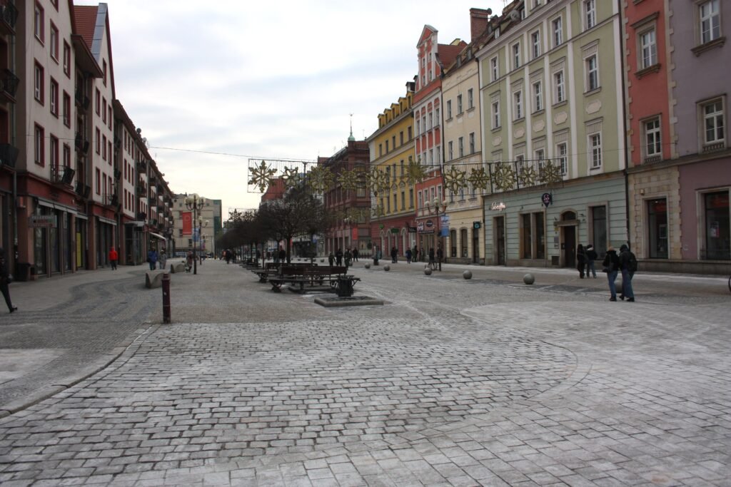
Wrocław’s visitor core works as a chain of plazas, university streets, islands, and cathedral approaches rather than one old town. Rynek anchors that chain, with Plac Solny and the Four Denominations District immediately to the west and south. North and east, short bridge crossings continue through the university quarter, Wyspa Piasek, Ostrów Tumski, and the river boulevards. Panorama Racławicka and the National Museum remain within the same central walking day. The pattern changes farther east, where Centennial Hall, the Japanese Garden, and Wrocław Zoo form a separate cluster. That split favors long central walks and selective tram use.
Why Wrocław Works Well on Foot
The strongest walking geography begins south of the Old Town at Wrocław Główny. Rynek is only about 15–20 minutes away on foot. From there, Plac Solny, the Four Denominations District, university streets, Wyspa Piasek, and Ostrów Tumski form a compact chain. The Odra’s branches do not break that chain because bridges appear at useful intervals. Most Piaskowy and Most Tumski make the island sequence feel continuous rather than remote.
Pedestrian quality is strongest around Rynek and the main central promenades. Private vehicle access inside Rynek is highly restricted, while Świdnicka has a long pedestrian-priority section. The city also identifies Oławska–Rynek–Ruska as a heavily used walking axis. Conditions become less uniform on bridge approaches and tram-running streets. Expect stone paving, tracks, mixed bicycle movement, narrower footways, and occasional vehicle access beyond the most pedestrianized blocks.
Where the Walking Core Ends
Panorama Racławicka and the National Museum still belong to the central walking network. Both sit naturally beyond Ostrów Tumski or the riverside boulevards. Hydropolis is a reasonable secondary extension, but it adds distance and works better when energy allows. Centennial Hall, the Japanese Garden, and Wrocław Zoo are different. They form a genuine eastern cluster, so a tram ride preserves time and makes the second day more efficient.
Best Areas to Stay for Walking
Rynek and the surrounding Old Town provide the easiest base for a first visit. The Four Denominations District is nearly as convenient, with quick access to Plac Solny and western central streets. University-edge stays work well for Ostrów Tumski and the islands. Hotels near Wrocław Główny simplify rail arrival, although they add a short walk to Rynek. A property marketed as central can still sit outside this strongest pedestrian chain, so check its actual position before booking.
Useful Walking Times
Wrocław Główny to Rynek: about 15–20 minutes. The route crosses busy central streets and tram interfaces before reaching the pedestrian core.
Rynek to the University of Wrocław: about 7–10 minutes through compact Old Town streets.
Rynek to Ostrów Tumski: about 15–20 minutes through the university area and island bridges. Historic paving can slow the final approach.
Ostrów Tumski to Panorama Racławicka: about 10–15 minutes via the eastern riverfront and bridge approaches.
Rynek to Hydropolis: roughly 25–30 minutes for most visitors. Treat it as an extension rather than a central stop.
These are practical planning estimates rather than guaranteed walking times. Crowds, tram crossings, museum entrances and temporary works can change actual times.
A 2-Day Walking Route
These routes keep the compact core and eastern cluster separate. The first route traces the central walking chain from the station to the riverside museums. On the second day, take a tram to Hala Stulecia before starting the mapped walk.
Day 1: Station, Rynek, Islands and Riverside Museums
Walking route
Day 1: Station, Rynek, Islands and Riverside Museums
- Wrocław Główny
- Opera Wrocławska
- White Stork Synagogue, Wrocław
- Plac Solny, Wrocław
- Rynek, Wrocław
- Wrocław Town Hall
- University of Wrocław Museum
- Wyspa Piasek, Wrocław
- Most Tumski, Wrocław
- Cathedral of St. John the Baptist, Wrocław
- National Museum in Wrocław
- Panorama Racławicka
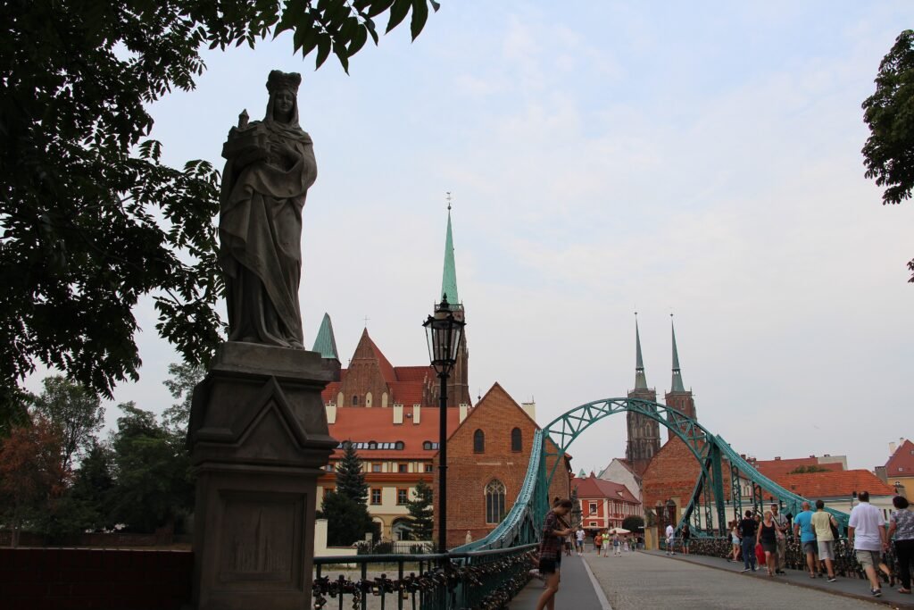
Start at Wrocław Główny and walk north toward Opera Wrocławska. Turn west into the Four Denominations District for the White Stork Synagogue, then continue to Plac Solny and Rynek. From the Town Hall, head north to the University of Wrocław Museum. Continue through Wyspa Piasek and cross Most Tumski into Ostrów Tumski. Finish by walking east toward the National Museum and Panorama Racławicka. The sequence minimizes backtracking and uses the bridges as part of the central route rather than treating them as barriers.
Day 2: Centennial Hall, Japanese Garden and Zoo
Walking route
Day 2: Centennial Hall, Japanese Garden and Zoo
- Centennial Hall, Wrocław
- Four Domes Pavilion, Wrocław
- Pergola, Wrocław
- Japanese Garden, Wrocław
- Wrocław Zoo
- Afrykarium, Wrocław
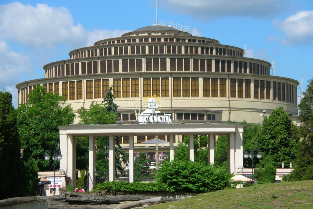
Take a tram from the center to Hala Stulecia before beginning the mapped walk. That transit segment is separate from the walking mileage. Explore Centennial Hall and the Four Domes Pavilion, then continue through the Pergola area to the Japanese Garden. Finish at Wrocław Zoo and Afrykarium. These attractions sit close together once reached, making the eastern cluster far more efficient than walking there from Rynek.
Using Trams and Buses
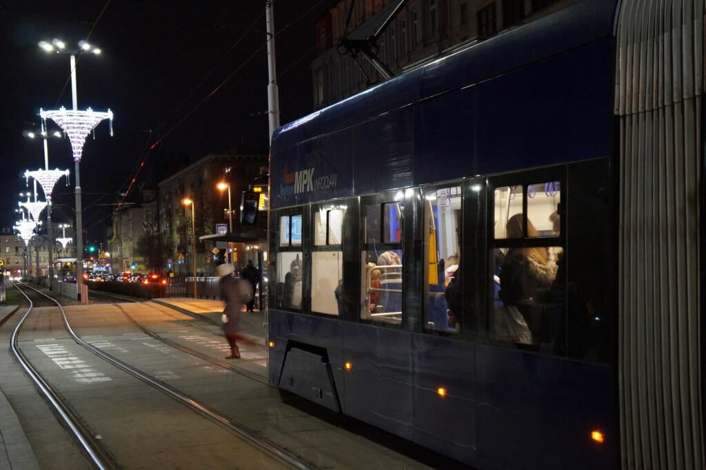
Trams are most useful for Wrocław Główny, longer cross-city journeys and the eastern visitor cluster around Centennial Hall, the Japanese Garden and the zoo. Central sightseeing around Rynek, the university quarter and Ostrów Tumski usually remains easier on foot. Check current MPK routes when planning an outer trip.
Tickets are available through machines and digital payment options, with time-based products useful for journeys involving transfers. Purchase and validation rules can change, so check current MPK ticket information before travel.
Arriving Without a Car
Wrocław Airport has public bus connections toward the city center and main railway station, including daytime and late services. Journey times and route patterns vary with traffic and timetable changes, so check current airport and MPK information before travel.
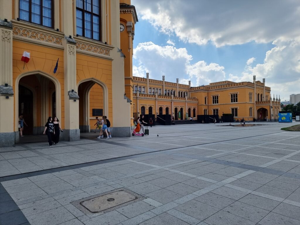
Rail arrival is much more central. Wrocław Główny sits within walking distance of Rynek and connects the city with major Polish destinations as well as selected international services. Check current rail timetables for your travel date.
When a Car Helps
A private car is unnecessary for the standard two-day city itinerary. It becomes more useful for regional excursions or rural combinations beyond Wrocław’s urban transport network. Świdnica, Książ Castle, Lower Silesian spa towns and mountain areas are better treated as separate regional excursions rather than part of the central Wrocław weekend.
Walking Limitations and Practical Tips
Historic stone and cobbled surfaces can be tiring over a long day, especially around older lanes and bridge approaches. Tram tracks demand attention at crossings, and some bridges combine pedestrians with vehicles, trams, or bicycles. The Four Denominations District is close to Rynek but includes narrower streets and more mixed access than the main square. Visitors with limited mobility should allow extra time for surface changes and river embankment access.
Temporary street, bridge or station-area works can occasionally change the easiest walking or tram route. Check current city and MPK notices shortly before travel when construction affects your planned itinerary.
Seasonal Comfort
Summer heat can make the exposed eastern cluster feel longer, while winter darkness reduces comfortable sightseeing time. Rain, snow or ice can make historic paving and bridge approaches more slippery. These conditions change walking comfort rather than the distances and connections between Wrocław’s main sights.
Bottom Line
Wrocław is at its best when visitors walk the central chain and use trams selectively. Rynek, university streets, river islands, Ostrów Tumski, and the central museums fit naturally into one pedestrian network. The main compromise is geographic rather than infrastructural: Centennial Hall and the zoo sit beyond that core. With a central base and one well-chosen tram ride, a car adds little to a first weekend.